Under the Red Sky: WeatherTiger's Hurricane Watch for May 15th
Taking pre-season stock of the Tropics for an already storm-addled Florida.
Welcome back to WeatherTiger’s Hurricane Watch! With the 2024 season beginning in a few weeks, I’m checking in to debunk rumors of pre-season tropical activity ahead of the release of WeatherTiger’s Hurricane Season Outlook on May 22. Paid supporters already have early access to our real-time seasonal activity and U.S. hurricane landfall risk models.
If you like what you read, consider signing up for WeatherTiger’s comprehensive coverage of what looks to be an active 2024 hurricane season. Paid subscriptions include Florida-focused daily tropical briefings like this one each weekday and a whole slew of other exclusive content.
Florida tropical threat synopsis: No tropical concerns over the next 7-10 days. Most of Florida and the Southeast U.S. will be wetter than average this week due to frontal disturbances, with the exception of persistently dry, hot conditions in South Florida.
Mood music:
Almanac: Today is Wednesday, May 15th… the 2024 hurricane season officially starts in 17 days and ends in 200 days. In terms of total storm energy, the season is 0.1% complete as a whole, 0.1% complete for the continental U.S., and 0.2% complete for Florida. There are no historical U.S. landfalls on this date.
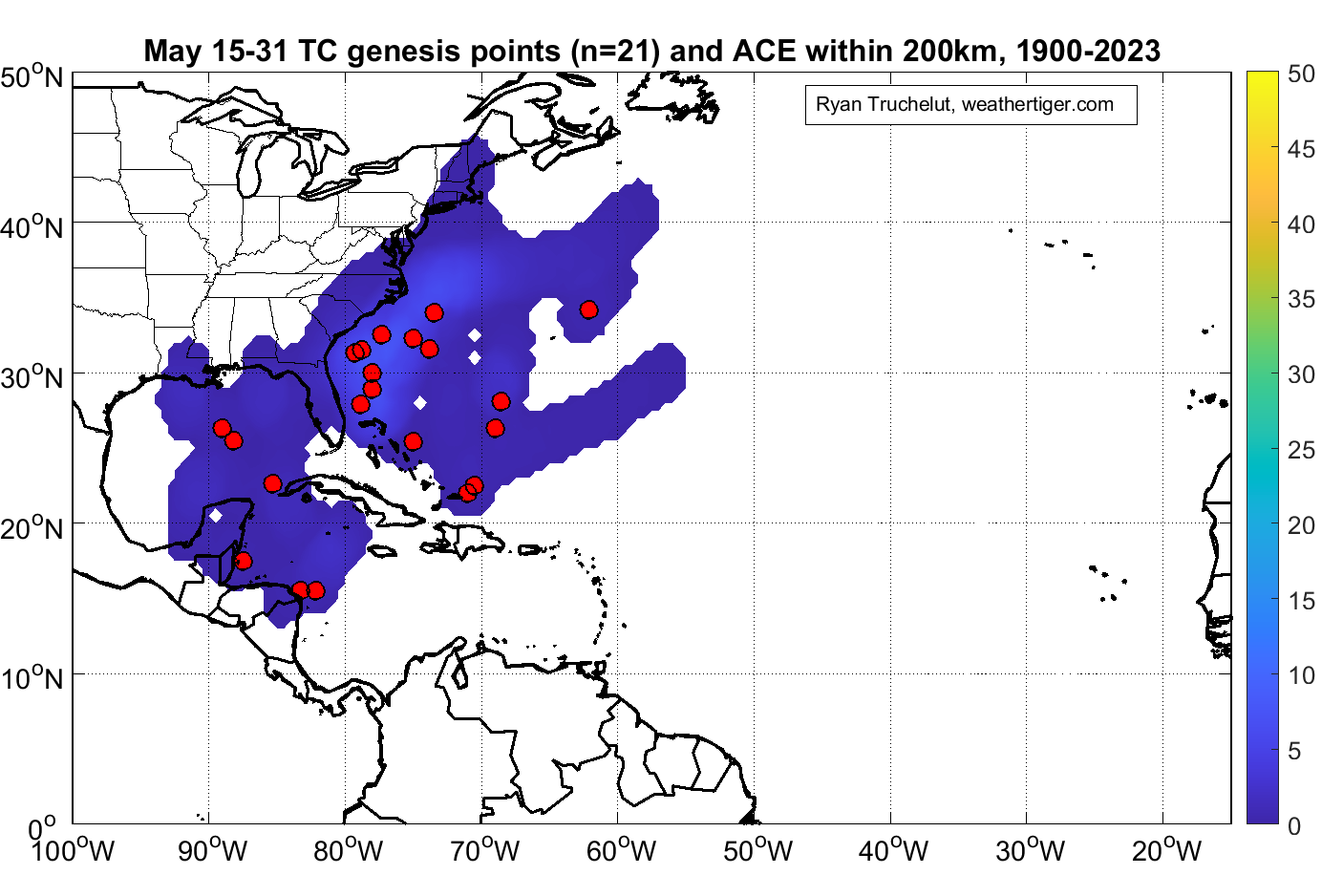
The most common area for development in the second half of May is east of Florida and south of the Carolinas, where a named storm forms once every 5 to 10 years or so. However, pre-season development has been more common in recent decades. U.S. landfalls are rare in May, but the eastern Gulf Coast and Carolinas have seen a handful of tropical storm impacts, mostly rainmakers.
Active Storms: None.
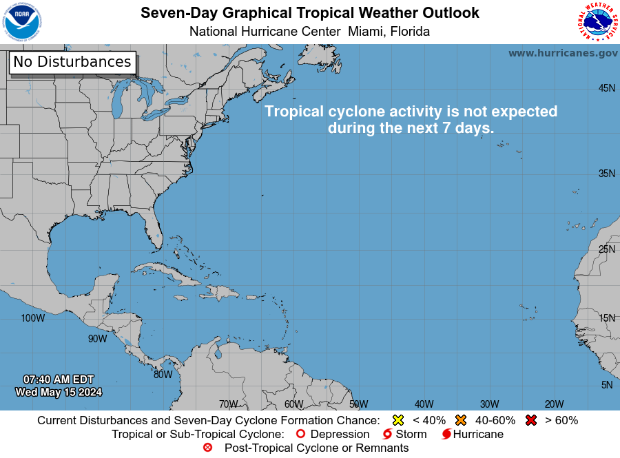
Current disturbances in NHC outlook, with 2-/7-day NHC development odds: Despite the official start of the hurricane season remaining June 1st, the National Hurricane Center begins issuing six-hourly Tropical Weather Outlooks for the Atlantic, Caribbean, and Gulf of Mexico on May 15. Thankfully, the NHC’s initial outlook this morning for the next seven days sees no storm threats on the horizon.
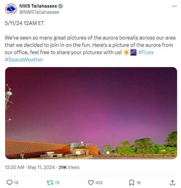
Elsewhere: It’s been a wild spring in the Florida skies without any help from the Tropics. On the heels of significant flash flooding in April, last Friday brought a massive outbreak of severe weather to North and Central Florida. Coincidentally, this was followed on the same night by the most widespread aurora display since at least 1989 courtesy of Sunspot Region 3664, the Ragin’ 3664th. I’m not an expert in ominous portents, but is it a bad sign when twin EF-2s tornadoes rip a swath of destruction through your hometown and then the sky turns blood red that night? It seems bad.
These vibes have fed ominous chatter about an early start to hurricane season, especially with portions of the Caribbean and Tropical Atlantic already warmer now than they are on average at their hottest in September. The good news is there is no indication of any kind of tropical threat to Florida or anywhere else over the next couple of weeks. The active severe weather pattern across the Southeast has been driven by a dip in the jet stream over the eastern U.S., linked to a negative state of the North Atlantic Oscillation. The NAO is expected to remain negative for another 10-15 days. Most of the eleven May named storms to form in the Atlantic Basin since 2007 have developed following a flip from negative to positive NAO conditions, so pre-season tropical mischief is unlikely unless the jet stream changes faster than expected.
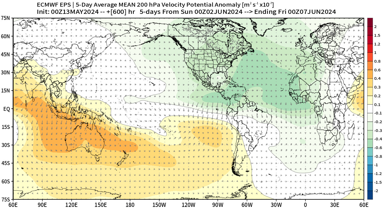
In another three weeks, there is some indication a convection-enhancing upper-atmospheric wave may cross the Gulf and Caribbean. Thus, the first half of June is a realistic timeframe to watch for early season development, especially as named storms are more historically common in June versus May. However, in the short and medium term, there is nothing of concern in the Atlantic Basin.
Next report: WeatherTiger’s outlook for the 2024 hurricane season will be released Wednesday, May 22nd. (Paid supporters, you can already get a live sneak peak at our seasonal model output here.) Daily weekday briefings for supporters will resume Monday, June 3rd, with the first weekly column of the season coming out June 5th for both free and paid subscribers. In the meantime, attempt to dodge any further tornadoes, floods, solar flares, or Boeing 737 MAX doors, and keep watching the skies.


