Hurricane Beryl Forecast for June 28th
Hurricane Beryl puts the Windward Islands on alert for a potential Category 3 hurricane hit on Monday.
This post is outdated. Click here to read our new forecast as of 5 p.m. Friday.
Florida tropical threat synopsis: The Tropics are extraordinarily busy for late June, but there are still no threats to Florida or the continental U.S. over the next 7 days.
Mood music:
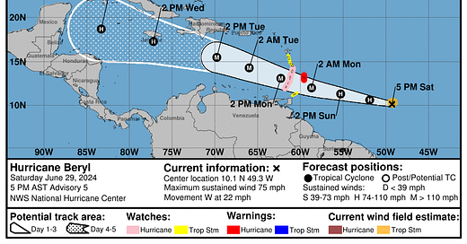
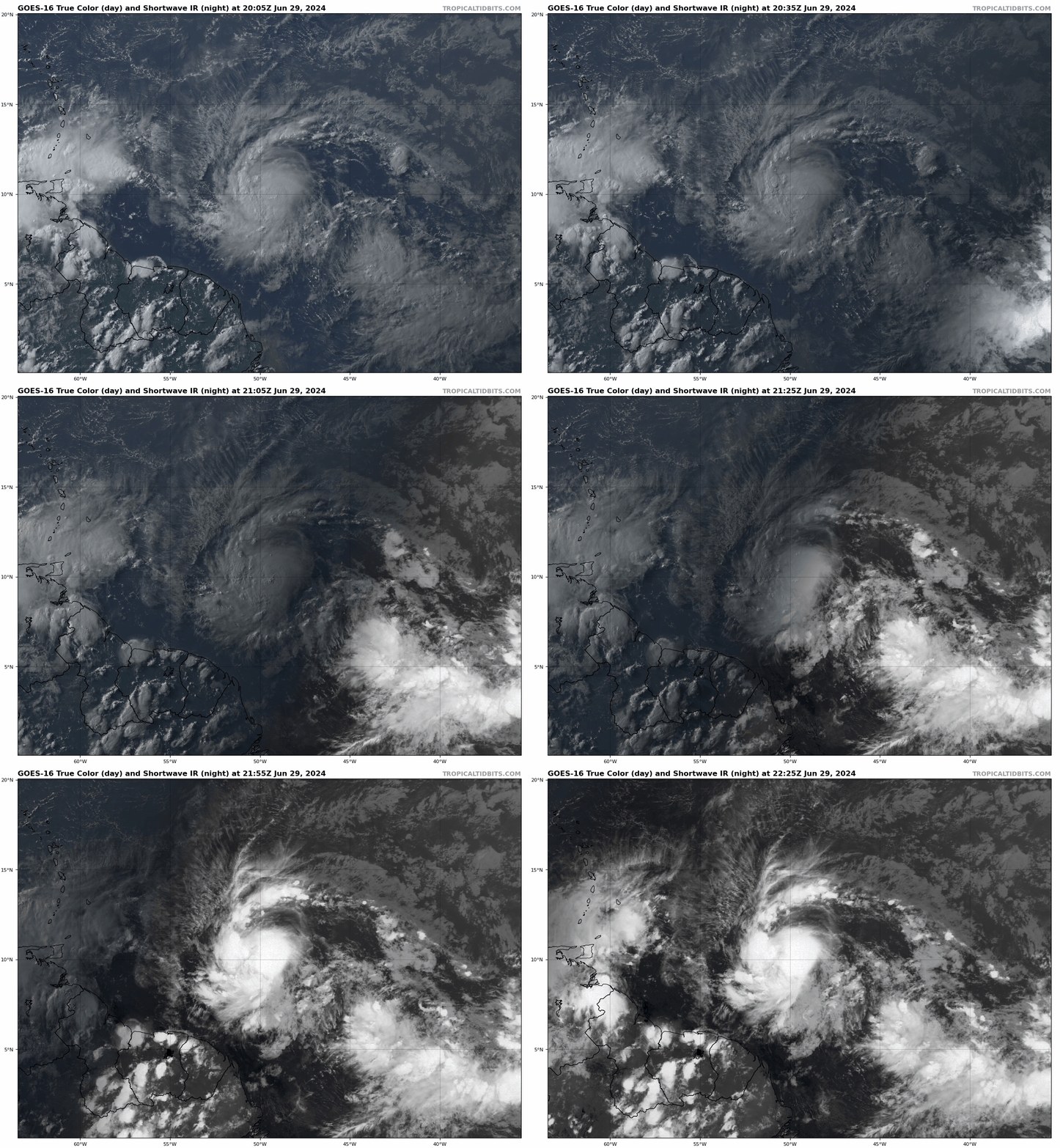
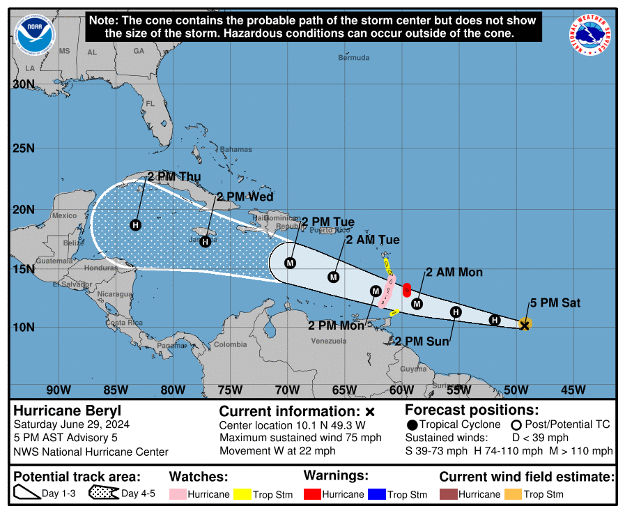
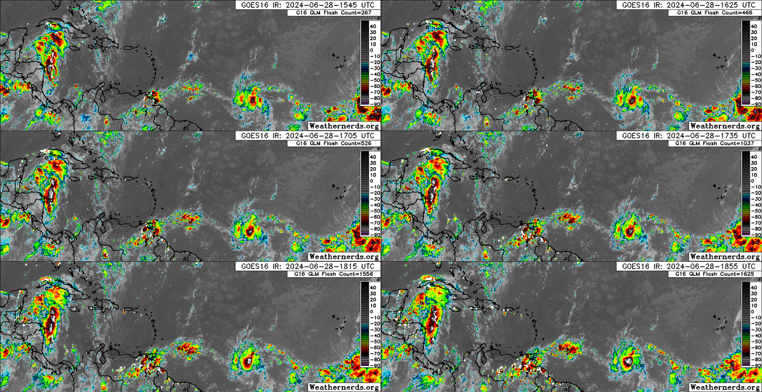
Active storms: Hurricane Beryl is about 600 miles east of Trinidad as of Saturday evening, with maximum sustained winds of around 75 mph. Beryl is moving west at about 20 mph, and is likely to continue to move west over the weekend, bending a bit more to the west-northwest with time as it is steered by a strong subtropical high to its north. By early Monday, Beryl will be on final approach to the southern Lesser Antilles, where Hurricane Watches are in effect. A Hurricane Warning is up for Barbados as of 5 p.m. on Saturday
Those watches and warnings are a good indication that the system will be moving through an unusually favorable environment, particularly on Sunday and Monday. Water temperatures in this region are already warmer than they typically would be in September, mid-level humidity is ample, and wind shear will be a favorable 10 knots or so. Additionally, an upper-level anticyclone above Beryl will allow outflow to spread out away from the storm in multiple directions, as shown on the GFS Ensembles below. This is all a recipe for intensification, whether it’s June or not. (The Taylor Swift wall calendar at WeatherTiger World HQ still says it is, but I’m not so sure.)

The NHC intensity forecast is calling for Beryl to reach Category 3 hurricane strength by the time it crosses south of Barbados mid-day Monday. Despite the untimely threat, the islands south of Martinique need to be getting ready for the possibility of serious and destructive wind, surge, and rain impacts on Monday. The Leeward Islands and Puerto Rico will likely see minimal impacts limited to high seas, occasional squalls, and a trade wind surge Monday into Tuesday.
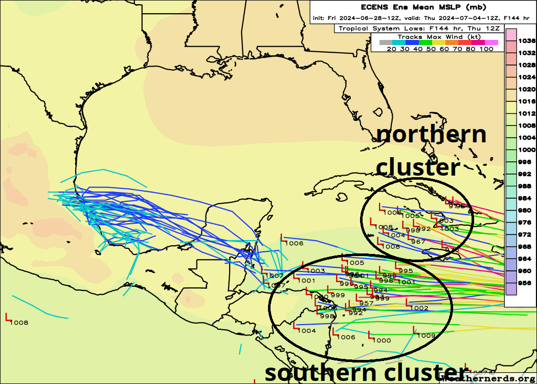
Once Beryl crosses into the Caribbean, environmental conditions are likely to become more hostile. Low-level trade winds should accelerate, causing Beryl to experience some sneaky mid-level shearing that models often have trouble getting a handle on. Intensity guidance in the central Caribbean has been too bullish with similar systems (Elsa ‘21, Bonnie ‘22, Bret ‘23); at the very least, this should cause strengthening to end by the time it gets past 65W, and some weakening is probable into the mid-week. That bullish bias in the Caribbean has also split the ensemble guidance into a more realistic southern cluster and a less realistic northern cluster, as shown above.
The official NHC track weights the southern cluster a bit more heavily, and my long-range forecast thoughts also favor a brisk west-northwestward track through the Caribbean over the next 5-7 days that eventually reaches Nicaragua or the Yucatan peninsula late next week. All models agree on strong mid-level ridging over the U.S. Gulf Coast for the next 7 days, and there remains no credible indication of a U.S. threat down the road from Beryl. Still, I’ll keep watching in case anything changes, as we don’t have much climatological precedent to go on, and that ridge may wane a bit heading into the following weekend.
Overall: crazy stuff. Get those hurricane preps going now in the Windwards.
Disturbances in the NHC tropical weather outlook:
Invest 94L may need a new publicist, because it’s not getting much attention despite generating quite a bit of deep convection along a sharp low-level wind shift in the northwestern Caribbean this afternoon. The wave will cross the Yucatan overnight and looks poised to make a run at organizing into a depression in the Bay of Campeche over the weekend. NHC is still at a 30% chance of development, which feels a bit low given 94L’s appearance and modeling today. In any case, all rain and other impacts should stay south of Texas.
Finally, the NHC has given the requisite 20% 7-day chance of development tag to the tropical wave east of TD 2, currently between 25-30W. Convection with this wave is scattered but disorganized, and any development is at least 3 days down the road. However, particularly if Beryl doesn’t excessively intensify, this wave will move into a favorable upper-level outflow regime early next week east of the Lesser Antilles, and has development potential then. Amazingly, a fair number of GFS and Euro Ensemble members show this as a second tropical storm crossing the Windward Islands in just three days, with this one targeting Wednesday for potential impacts. Once again, this system is likely to have modest impacts on Puerto Rico or the northern Leeward Islands, with a higher risk of tropical storm conditions south of Dominica. Environmental conditions will likely be less favorable for strengthening once this system enters the Caribbean, but it’s worth keeping an eye on in the Greater Antilles and Central America.
Elsewhere: No.
Next update: Daily update Monday morning.




Thanks for the complementary B-Boys track.