Tropical Storm Beryl Forecast Discussion for July 5th
Beryl will enter the Gulf soon, and risks of a hurricane landfall are increasing in south Texas.
U.S. tropical threat synopsis: Beryl will move into the western Gulf on Friday and near south Texas late this weekend, bringing significant wind, rain and surge impacts. Following Beryl, there are no tropical threats to Florida or elsewhere in the next week.
Almanac: It’s Friday, July 5th… day 35 of the 2024 hurricane season, 148 days to go. By total storm energy, the season is 2.9%, 8.5%, and 7.6% complete for the Atlantic, continental U.S., and Florida, respectively.
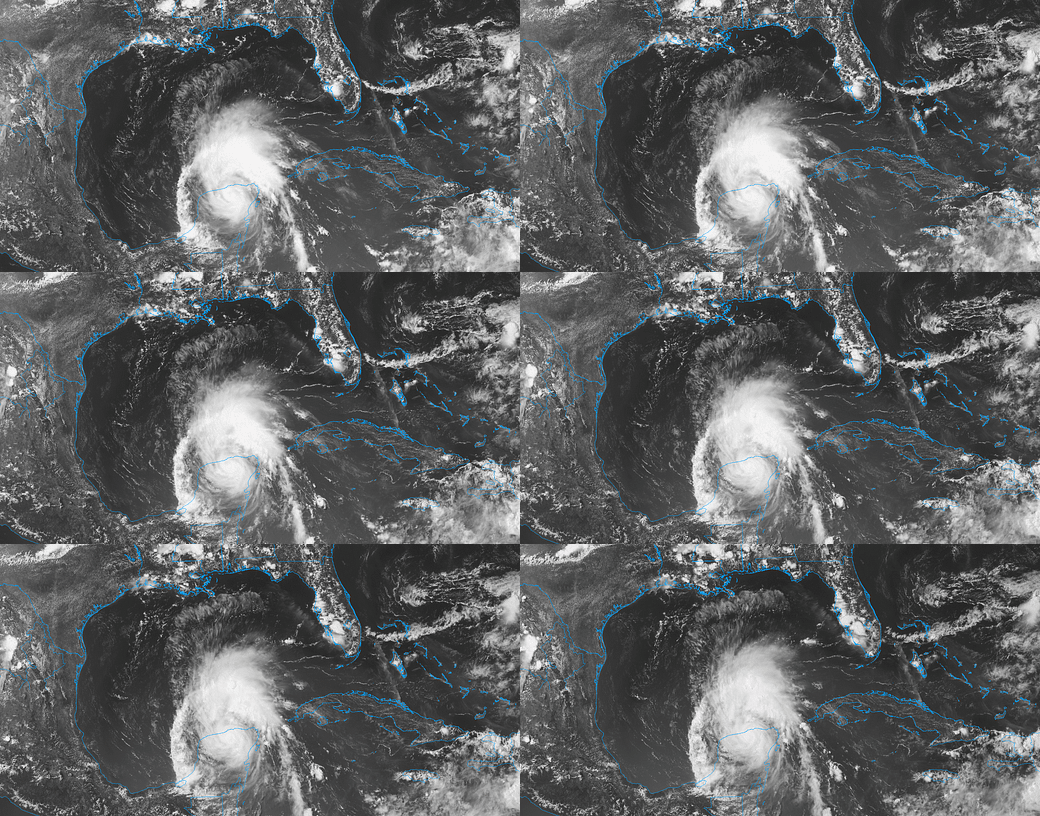
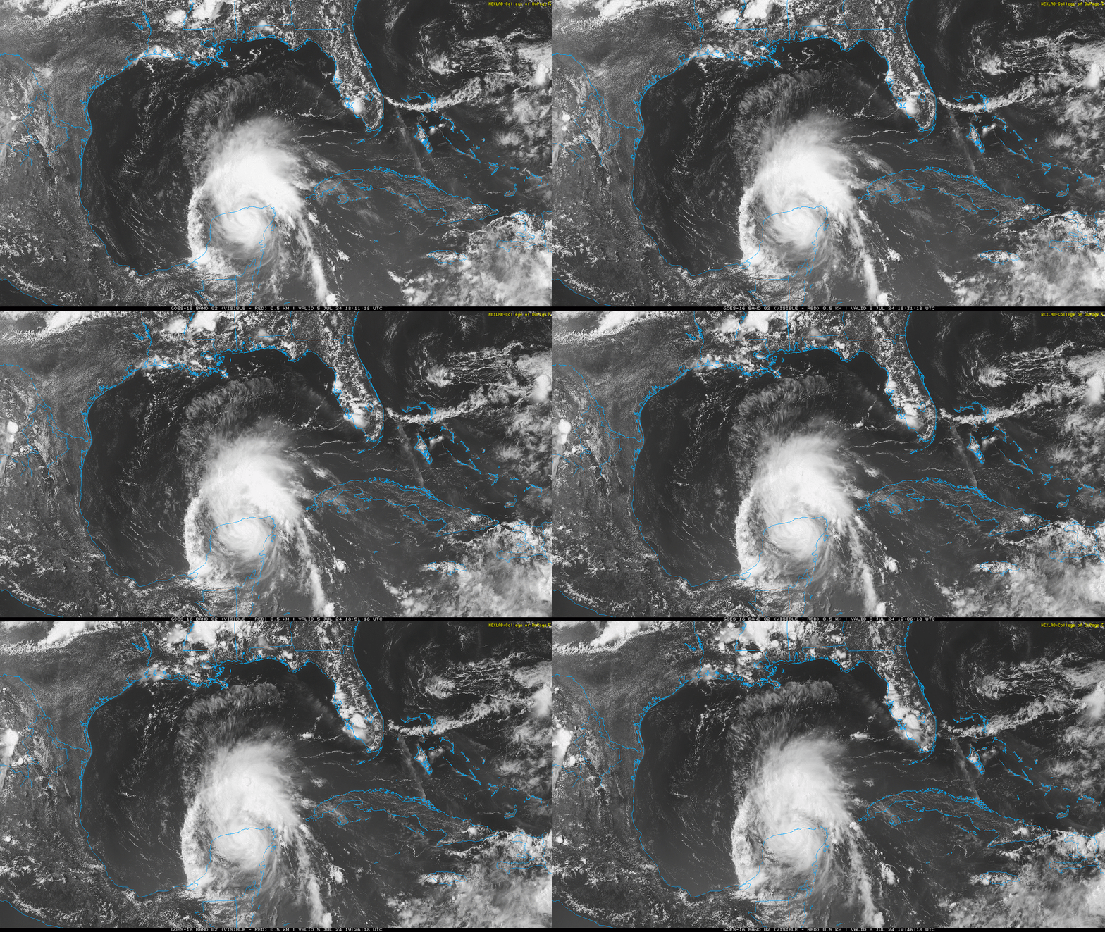
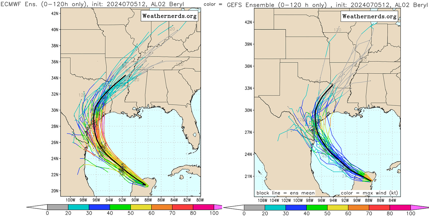
Active storms: Beryl has been a remarkably resilient honey badger of a hurricane. As a result of maintaining a higher-than-expected intensity, Beryl’s track forecast across the Gulf of Mexico has shifted north over the last couple of days. This morning, Beryl made landfall near Tulum, Mexico, as a Category 2 hurricane; as of the 2 p.m. Friday NHC advisory, Tropical Storm Beryl has temporarily weakened while inland over the Yucatan peninsula, and now has maximum sustained winds of 70 mph, moving west-northwest at 15 mph. Per Cancun radar, Beryl’s center will move into the Gulf of Mexico this evening.
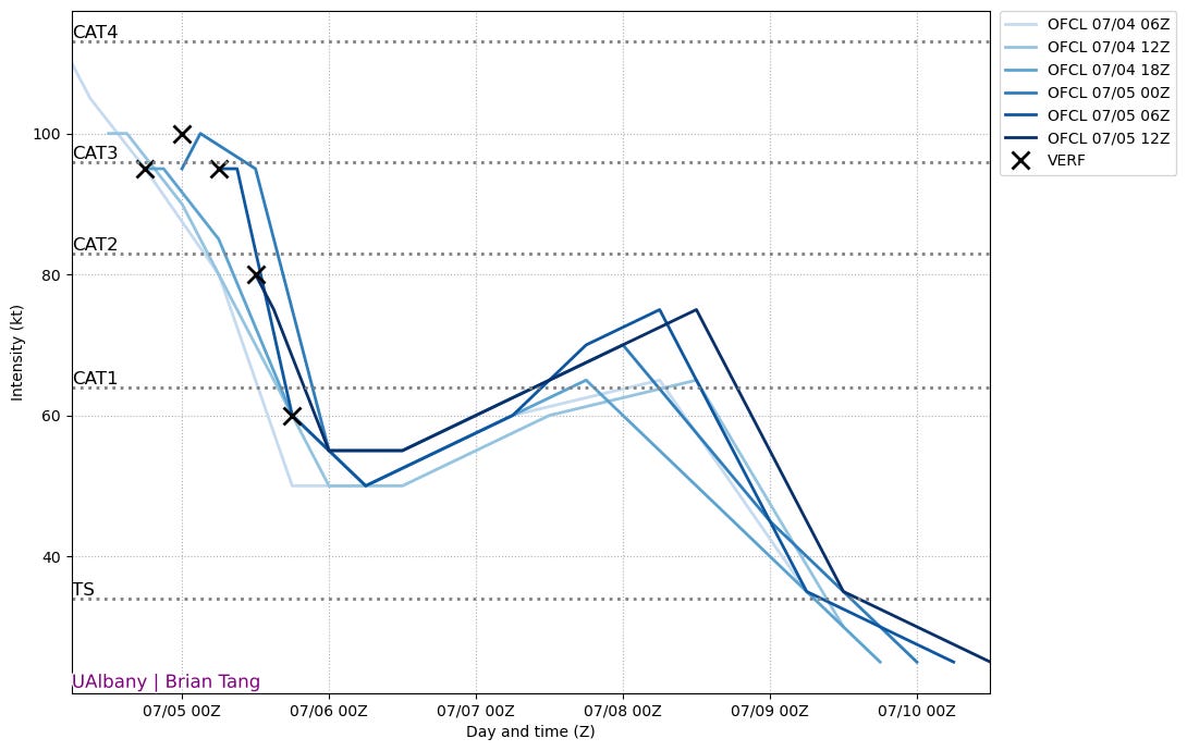
While deep convection has waned as the storm crosses the Yucatan, overall the system’s circulation does not appear unduly disrupted, either from land interaction or the 25-30 knots of shear Beryl has withstood in the last several days. Upon entry into the Gulf, shear will diminish to a less hostile 10-15 knots, and the outflow regime appears quite favorable, particularly towards landfall when an approaching upper-level trough will provide excellent ventilation for Beryl’s deep convection. Currently, the NHC official forecast brings Beryl back to hurricane intensity on Sunday and brings a Category 1 into south Texas Monday morning. Depending on how Beryl’s track plays out, this may be somewhat conservative.
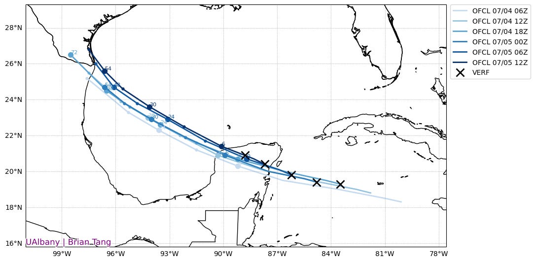
There are two key changes to Beryl’s track forecast since Wednesday. First, model guidance has consistently hinted that the more Beryl maintained its strength in the teeth of unfavorable shear, the further north it might track into the Gulf. With Beryl remaining a major hurricane for most of its improbably journey across the Caribbean, it has consistently ridden the northern edge of the ensemble envelope for the last two days, a trend that continues today. Additionally, the trough over the Central U.S. has edged toward eroding the western flank of Gulf Coast ridging more quickly this weekend. Putting these two things together, Beryl is now expected to turn north near or just before reaching the western Gulf Coast on Sunday. As such, the NHC’s landfall expectations have shifted out of northern Mexico into south Texas, with the additional time over water likely delaying landfall until Monday. The likely range of landfall locations extends from the U.S.-Mexico border north to Matagorda Bay. As always, impacts will extend far from the landfall point, especially to the east.
This is a worrisome trend for several reasons. Obviously, a north trend increases surge, wind, and rain impacts on more populated areas of southern and coastal Texas. Additionally, the longer Beryl delays landfall, the more favorable the upper-level wind and thermodynamic environment become for the storm. Waters near coastal Texas are in the mid and upper 80s, as opposed to the lower and mid 80s near the Mexican Gulf Coast and the rest of the west-central Gulf. Some of the hurricane models are hinting at rapid strengthening during final approach to the coast on late Sunday and early Monday, and given that hurricane models have performed fairly well and Beryl is a scrappy street survivor, this possibility must be taken seriously. Landfall as a Category 1 or 2 storm is most likely, but there is at least a slight chance of Beryl clipping back into the major hurricane range on Monday.
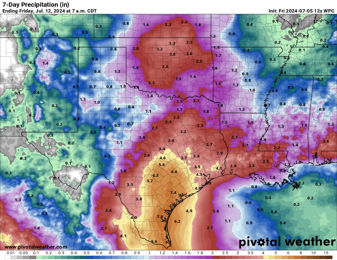
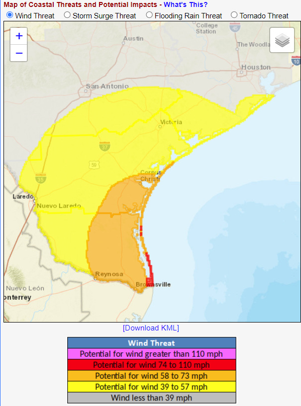
Given the narrow angle of approach to the coast, there is potential for further changes in track, and all interests in coastal Texas (including eastern Texas) should be following the storm carefully. With Alberto recently creating 2-4’ of surge along much of the Texas coast as a tropical storm many hundreds of miles distant underscoring the risks, dangerous surge of at least several feet above normal high water is probable across much of the western U.S. Gulf Coast, with higher localized values near and east of the landfall point. Fairly slow motion as Beryl moves north and then northeast through Texas on Monday and Tuesday also highlights the potential for significant flash flooding in southern and southeastern Texas, where a first guess at general rain totals is 4-8”. The wind threat is dependent on whether Beryl makes a final lunge at major hurricane intensity prior to landfall; the wind risk is far more limited for a steady-state Category 1 hurricane versus a strengthening low-end Category 3. It is too early to put a fine point on where the coastal wind threat will be greatest, other than to note that there is potential for significant but localized structural wind damage along southern and central Texas coast on Monday.
Time well tell how Beryl’s final act, but if there’s one lesson to be learned from the last week, it’s not to bet against this tenacious and unusual storm. All interests in coastal and southern Texas should be preparing for the first U.S. hurricane landfall of the 2024 season.
Other disturbances in the NHC tropical weather outlook: None.
Elsewhere: No activity of note. The former Invest 96L is a cluster of showers in the central Caribbean with no further prospects of development.
Next update: Updates this weekend as necessary, next full forecast on Monday.



"Beryl has been a remarkably resilient honey badger of a hurricane." This made me giggle. Who remembers Stoffel, the tenacious escapee?
What a week! Thanks for your reports.