
Storms and Rumors of Storms: Hurricane Watch Column for Sept. 20th
A potential Gulf Coast hurricane threat lurks next week. Here's what we can say about it now and what we can't.
WeatherTiger’s Hurricane Watch is a reader-supported publication. Paid subscribers get Florida-focused daily tropical briefings, plus coverage of every U.S. hurricane threat, our exclusive real-time seasonal forecast model, and the ability to comment and ask questions.
From church basements to fun run starting lines to medical receptionists’ desks, The People have been asking me one question this September:
“Where are the hurricanes?”
Unfortunately, there is some chance that question has a more obvious answer in the next week or two. While any speculative threat to the U.S. Gulf Coast is still a ways off, the probable development of a tropical system in the northwestern Caribbean or southern Gulf in the upcoming week is something that areas from Florida to Louisiana should watch.
If you’re asking where the hurricanes are, the call is coming from inside the house. While this season continues to run far below expectations in terms of overall tropical activity, it’s also had a knack for meting out its limited activity near and over land. In the last 10 days, the Gulf Coast picked up hurricane landfall #3 of 2024 from Category 2 Francine, and North Carolina saw significant flooding from an unnamed but impactful storm. A typical hurricane season has one to two U.S. hurricane landfalls. Only a quarter tally three or more.
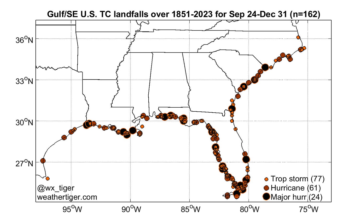
As the normal peak season development area between Africa and the Lesser Antilles continues to struggle and East Atlantic storms beyond mid-September are unlikely to threaten land, our focus nearing October shifts back towards the Caribbean and Gulf. The historical record of landfalls occurring in the final week of September and later shows a tilt away from the western Gulf and East Coasts and towards threats to the Central and Eastern Gulf Coast, often originating in the Caribbean.
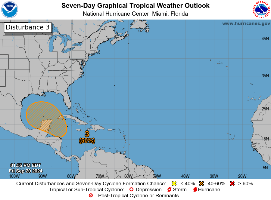
And it’s precisely there where model-fueled rumors are swirling about a possible hurricane threat next week. In fact, there have been far more rumors swirling than actual atmospheric swirling, as a trackable tropical disturbance is only just emerging from deep convection in the southern Caribbean. While rumors are running well ahead of reality, there is a potential U.S. threat, though not an imminent one. Let’s assess what can be said now to varying degrees of forecast confidence:
High confidence: A “Central American Gyre” will develop by early next week
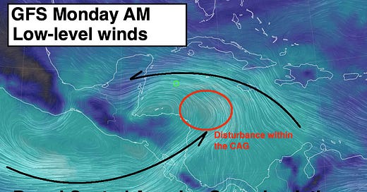
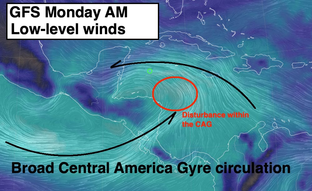
A Central American Gyre, or CAG, is large area of low pressure that often develops this time of year over, well, Central America. Westerly winds on the Pacific side of Central America and easterly winds in the Caribbean come together to trigger thunderstorms, which with time can focus the broad cyclonic turning of the CAG into an organized tropical storm. This is a common development pathway in the latter third of hurricane season.
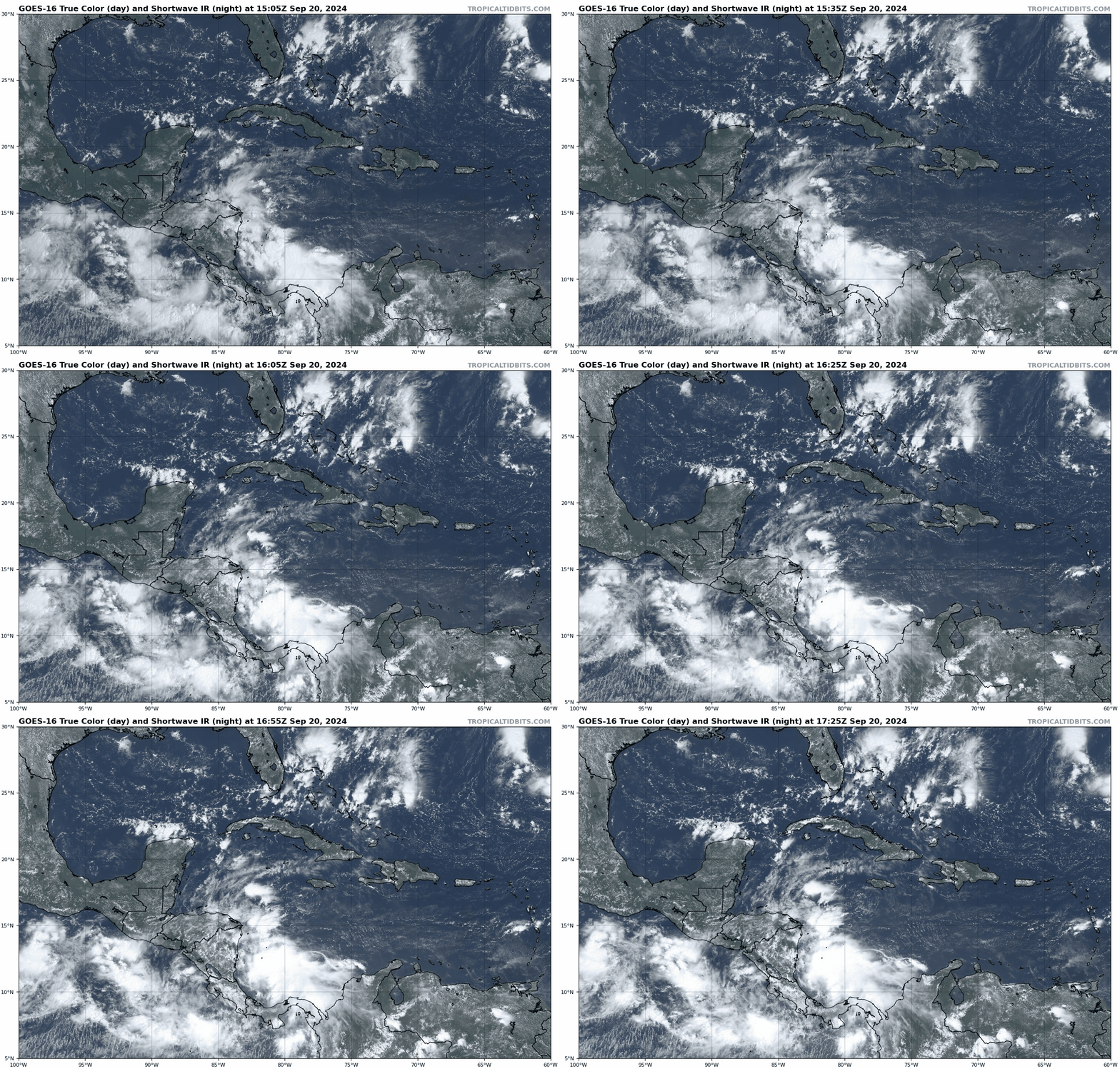
Over the next few days, a strong and somewhat early CAG is expected to come together. We’re already seeing the low-level wind precursors to a CAG, and deep but disorganized convection is on the upswing. With all models locked in on this scenario, we know to a pretty high degree of confidence that a CAG will be in place next week, setting up a generally favorable pattern for a tropical storm to develop.
Medium confidence: When and where a storm may develop
It’s relatively easy to predict that a CAG will form, but much harder to pinpoint when and where a tropical storm may develop within the expansive circulation of the CAG. This is especially true when the CAG hasn’t developed and there’s not yet satellite and observational data to scrutinize. However, with impressive convection starting to fire in the southern and western Caribbean, the tentative model consensus for a tropical depression to form Tuesday or Wednesday near the Yucatan peninsula seems like a reasonable first guess.
One complicating wrinkle is the possibility another tropical system develops from the CAG in the Eastern Pacific, prior to or alongside the Caribbean disturbance. If that were to occur, its influence would swing our proto-storm farther west over land, giving it less time in the western Caribbean. That might delay development until it reaches the southern Gulf of Mexico later next week.
Medium confidence: Shorter-term steering currents and storm environment
Predicting the jet stream and upper-level winds is something that models generally do better than handling tricky convective processes. Looking out three to seven days to when a storm may be trying to organize in the southern Gulf or western Caribbean, guidance suggests an upper-level wind pattern in which wind shear is modest and the “exhaust” from deep thunderstorm activity is spreading away from the developing system. If the disturbance can avoid moving over land, the environment looks favorable for intensification—especially given near-record ocean heat content in the Gulf and Caribbean.
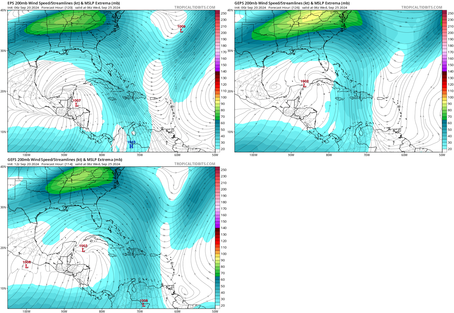
In terms of the steering winds aloft that would guide a developing storm, by the middle of next week models agree on a dip in the jet stream over the east-central U.S. imparting a northward steering influence, while a ridge of high pressure over Florida or the western Atlantic imparts a westward component. Together, that suggests an initial northwestward movement of the disturbance, perhaps at a measured pace, with the possibility of faster motion late next week if the trough influence is dominant.
Low confidence: The track and strength of a possible storm
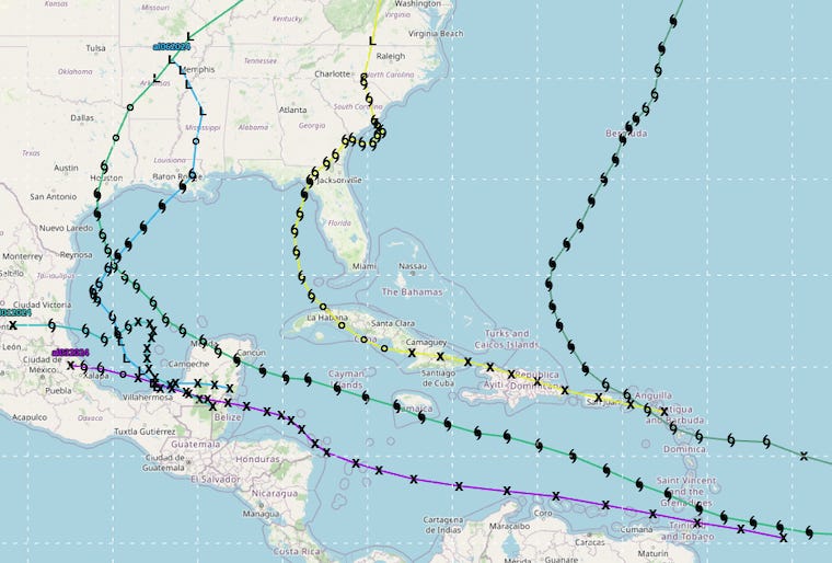
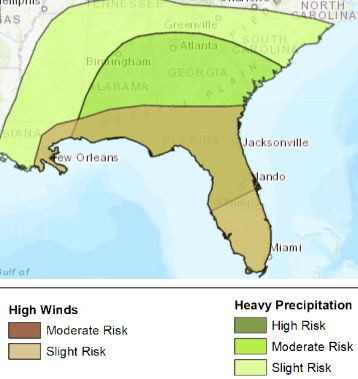
Forecasting what will actually happen with the track and intensity of a potential storm involves multiplying the formation location, steering, land interaction, and upper-level environment uncertainties together. Models will continue jumping around run-to-run for this reason, so don’t fixate on any specific outcome at this point. In general, the possibilities range from a faster launch towards the Gulf Coast towards the end of next week, to a slower burn in the southwestern Gulf, to limited or no development. The week 2 weather hazard product from the Climate Prediction Center highlights heavy precipitation and high wind risks across the eastern and central Gulf Coast and inland between the 27th and 29th. Time will tell.
In short, the balance between storms and rumors of storms remains tilted towards chatter for the time being. A Gulf Coast hurricane threat around a week out (or more) is plausible given what forecasters know with some confidence, but far from certain. If nothing else, it’s a good reminder to review your hurricane kits and plans, even if nothing happens. The historical high season for Florida hurricane landfalls continues until late October, so like taking political mailers directly to the recycle bin without reading them, monitoring the Tropics is something you have to do each day in September and October. Quit sharing the 312-hour GFS, but keep watching the skies.




Your clever writing style is always a fun read, even when it seems to point to a potential calamity. “The call is coming from inside the house” cracked me up.
Thank you for another great week of reports!
Way overdue thank you for your analysis and constant communication, Doc. Invaluable information!