Eight Isn't Enough: Hurricane Watch for September 16th
Potential Tropical Cyclone 8 will bring rain and wind to the Carolinas through tomorrow, but may not snag a name.
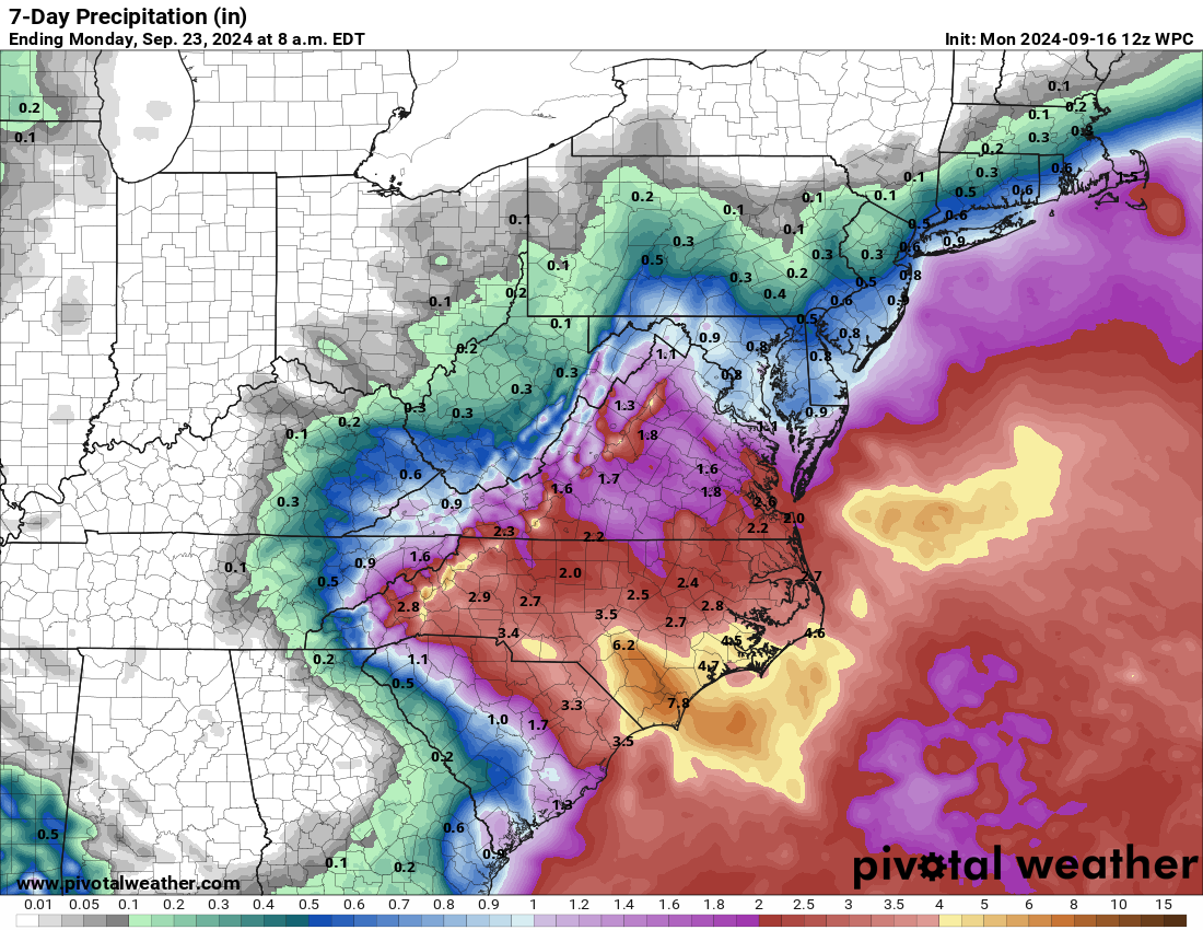
Florida and continental U.S. tropical threat synopsis: Potential Tropical Cyclone 8 is spreading heavy rainfall and some gusty winds to the South and North Carolina coasts, which will continue for another 12 to 24 hours before the storm moves inland and north. Florida should keep an eye on the Caribbean next week.
Almanac: It’s Monday, September 16th… day 108 of the 2024 hurricane season, 75 days to go. By total storm energy, the season is 56.8%, 66.2%, and 54.4% complete for the Atlantic, continental U.S., and Florida, respectively.
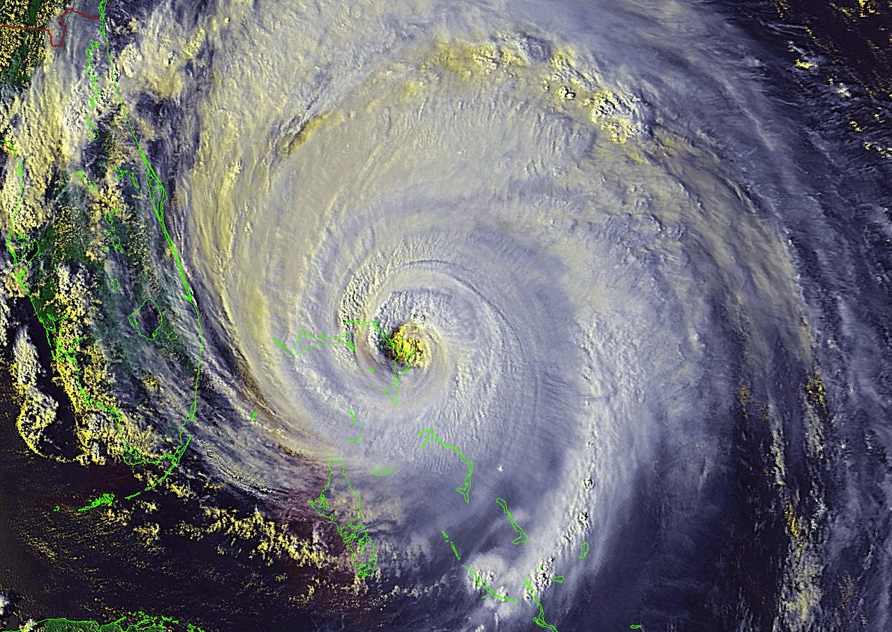
While the Carolinas are seeing some inclement quasi-tropical weather today, it is nothing compared to 25 years ago today, when Category 2 Hurricane Floyd made landfall near Cape Fear, NC. Floyd, which terrified Florida’s East Coast a few days earlier with the prospect of a Category 4 landfall, went on to cause massive flooding from eastern South Carolina into coastal New England, with totals up to 24”. It was also the largest peacetime evacuation in U.S. history to that point, setting over 3.5 million people in motion.
Active storms:
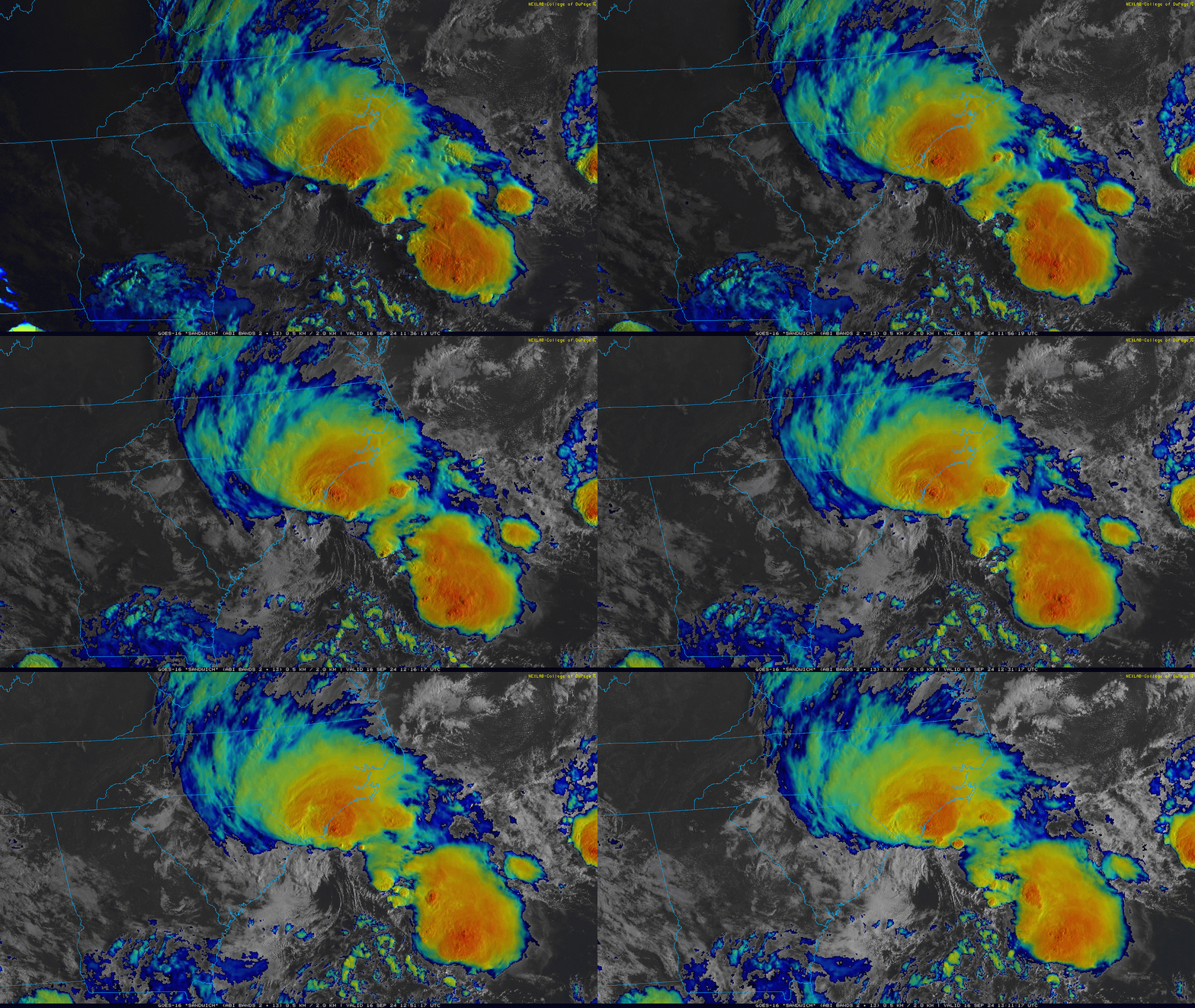
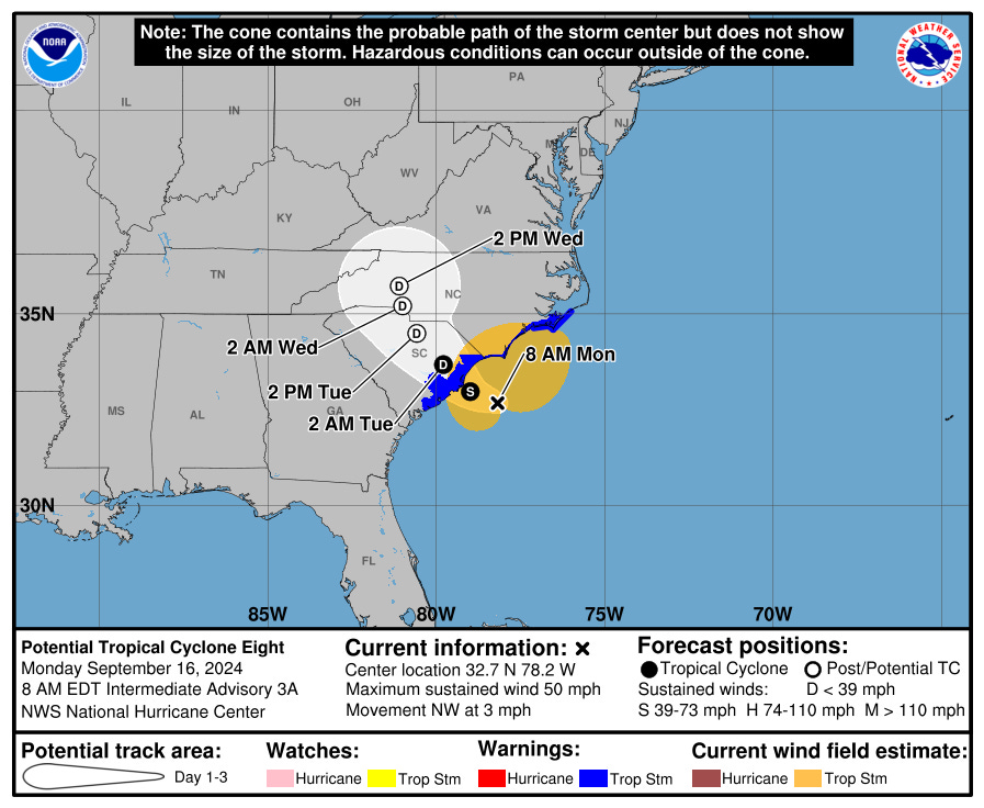
Speaking of the Carolinas, the threat du jour arises not from the moribund Deep Tropics, but rather mid-latitude weather systems taking on some tropical characteristics. Potential Tropical Cyclone 8 was designated last night in order to issue Tropical Storm Warnings for portions of the NC/SC coastline and inland areas of eastern South Carolina, which remain in effect this morning as PTC8 spirals about 100 miles east of Charleston with 50 mph sustained winds in the heavy convection to the center’s north.
PTC 8 is moving slowly northwest this morning, and should reach land near the NC/SC border in the next 12-24 hours. Heavy rain is already onshore in southeastern North Carolina and eastern South Carolina, where storm totals of 4-8” are expected, bringing flash flood risks to Wilmington on the 25th anniversary of Floyd’s flooding. In fact, a Flash Flood Warning is currently in effect in Wilmington as of 9 a.m. ET; in general, try to stay off the roads in the coastal Carolinas today. Top wind gusts from Myrtle Beach into the southern Outer Banks so far have generally been in the 35-55 mph range, with similar intermittent gusts continuing through this evening. PTC8 should be moving north at a better clip inland tomorrow, spreading rains into mid-week to the eastern mid-Atlantic.
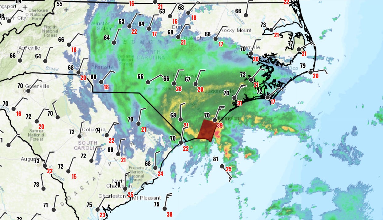
Winds, gusts, and radar for PTC8 as of 9:30 a.m. Monday. Flash Flood Warning in red. Click here for latest warnings from NWS Wilmington. If you’re wondering why this is still a “potential tropical cyclone” rather than a subtropical or tropical storm, the answer is that PTC 8 still has a couple of fronts connected to the center of circulation. As seen above, that center is also removed to the south of the deep convection. PTC 8 still may claim the name of Helene today before moving inland, but as of right now, its structure isn’t cleanly tropical enough to earn the title. Either way, that distinction doesn’t change the impacts on land, which are in line with what we’d look for from a moderate tropical storm.
Tropical Depression Gordon is busy epitomizing the fecklessness of the eastern Tropical Atlantic in 2024, poofing out occasional convection east of a low-level swirl. Gordon is hanging on by a thread as a classifiable tropical cyclone, and could well dissipate in the next day or two. If Gordon survives shear in the next three days, it (or a successor low) may strengthen again as it moves north into the open Central Atlantic by the end of the week. It continues to be no threat to land.
Disturbances in the NHC tropical weather outlook: None.
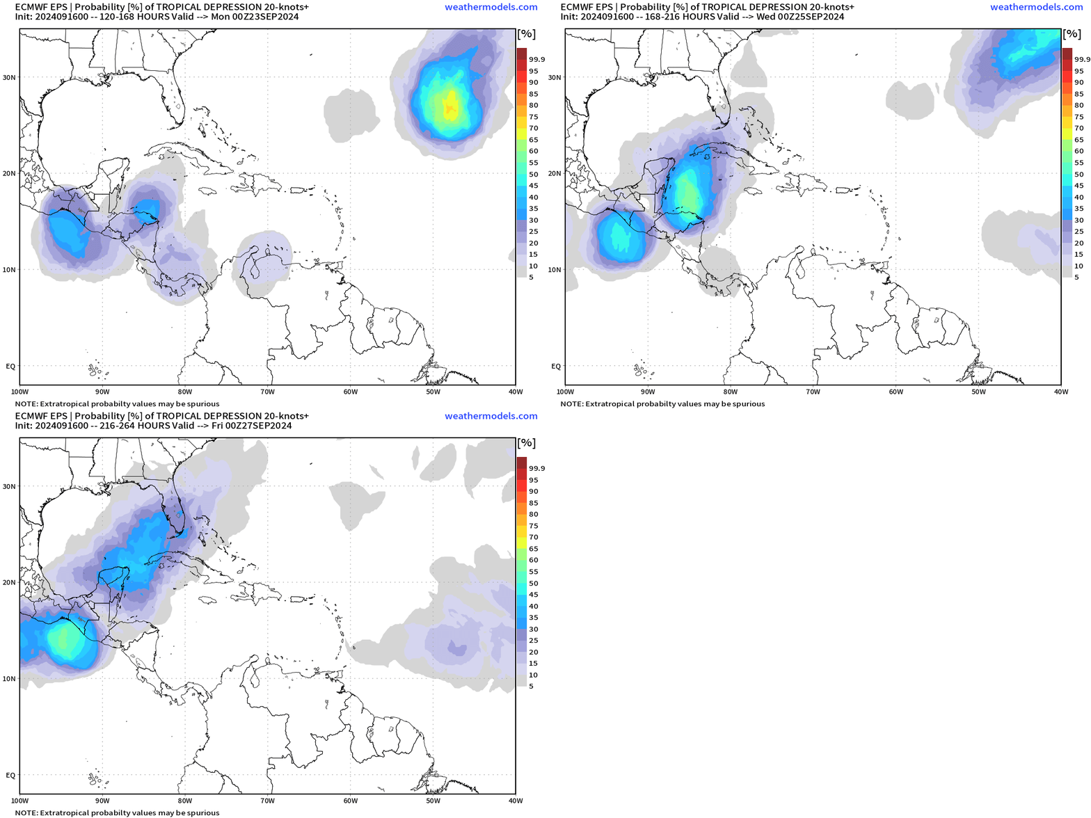
Elsewhere: Finally, the next area to pay attention is the western Caribbean, where most models or their ensembles are now suggesting the potential for a piece of a Central America Gyre to spin up into an organized tropical system in 6-10+ days. There’s nothing to look at in the Caribbean today, so how realistic this threat is remains tough to assess.
For now, the fact there is model support for development across multiple runs and types of models, moving forward in time is interesting and makes the area worth monitoring. If something were to form, lingering troughing over the U.S. East Coast would draw the system generally north, though when and where an actual disturbance were to form will dictate whether or not this setup poses an eventual U.S. landfall risk. Time and patience will tell.
Next update: Daily bulletin tomorrow morning.


glad to have your insights...got our 6...