El Gordo y La Flaca: Tropical Storm Alberto Update and Weekly Column for June 19th
Tropical Storm Alberto has developed in the Gulf of Mexico and another disturbance will spread rain to Florida over the next few days.
WeatherTiger’s Hurricane Watch is a reader-supported publication. Paid subscribers get Florida-focused daily tropical briefings, plus weekly columns, full coverage of every hurricane threat, our exclusive real-time seasonal forecast model, and the ability to comment and ask questions for $49.99 per year.
One is expansive, the other petite; one is messy, the other is neat. We’ve got an odd couple situation in the Tropics in the third week of hurricane season, with the first named storm of 2024 lumbering across the western Gulf and a featherweight disturbance set to approach Florida from the east. And like all venerable intellectual property, this classic set-up may well reboot into an immediate sequel early next week.
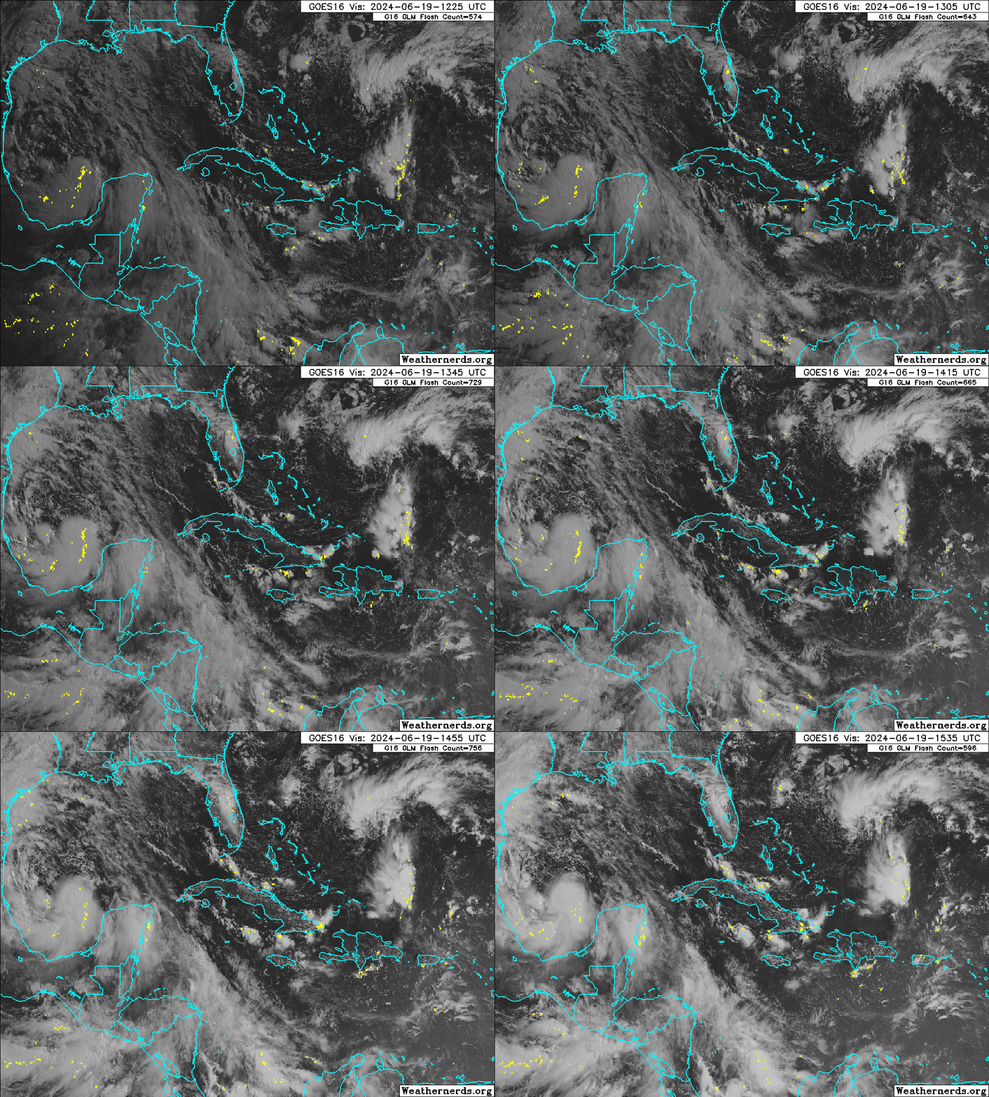
First things first: with its thunderstorm activity sprawling across the western half of the Gulf of Mexico, much of Central America, and a chunk of the Eastern Pacific, newly designated Tropical Storm Alberto is living large as it angles westward on a path towards northern Mexico. Alberto has slowly consolidated this week from a broad gyre of cyclonic rotation that sometimes forms over Central America early or late in the hurricane season, logically known as a Central American Gyre (CAG).
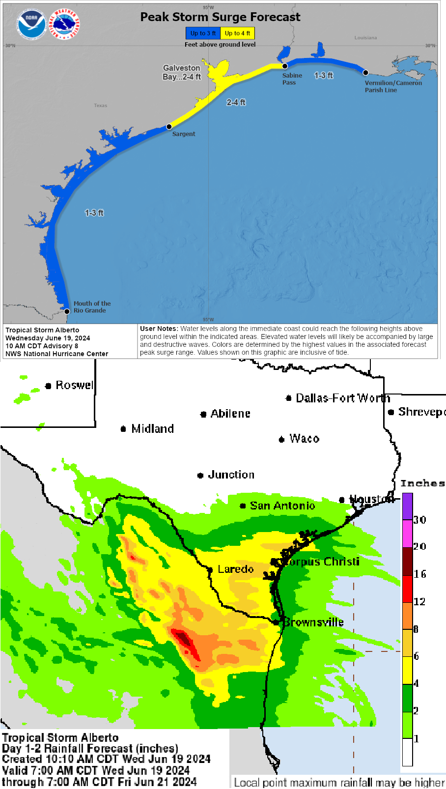
While this gyre has lent Alberto its outsized attitude, the larger the disturbance, the slower the rate of strengthening. So, while Alberto is generating low-end tropical-storm-force gusts hundreds of miles north of its center, only modest additional intensification from its maximum winds of 40 mph as of 11 a.m. Wednesday is likely prior to landfall early Thursday. Tropical Storm Warnings are in effect for South Texas and northern Mexico, and a few of feet of coastal storm surge will also continue in these areas for the next day or two.
The primary impact of Alberto will be flash flooding. Storm totals of 4-8” are probable in the southern Rio Grande Valley, which may well cause localized flash floods, particularly in urban areas. South Texas is in a drought, so there will be some benefit to the region as well. Rains taper by Friday as Alberto clips westward through Mexico, guided by a powerful ridge of high pressure to its north.
This week’s jet stream pattern over the eastern United States has more ridges than Ruffles, so look for high pressure to also be the dominant influence on a diminutive disturbance several hundred miles east of Florida. Thunderstorm activity with this small area of low pressure remains limited due to a nearby dry airmass, and it probably won’t organize further prior to reaching Florida. However, a slim chance of last-minute development while crossing the Gulf Stream can’t be ruled out, as unlike large storms, the intensity of small systems takes the elevator up (or down).
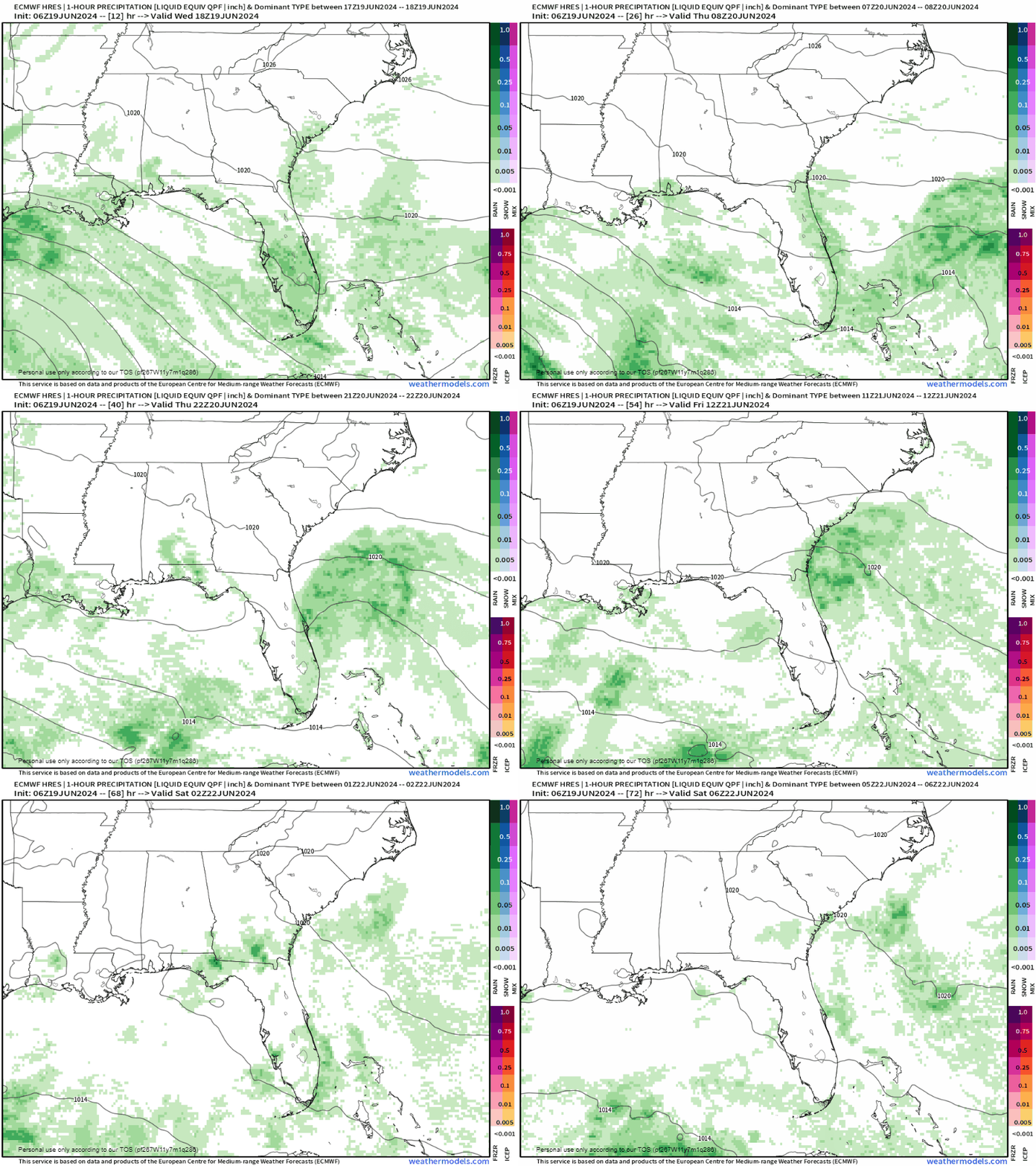
Even if a depression or minimal tropical storm briefly forms, impacts on Florida would be little different than a typical day in June. Expect enhanced rain chances along Florida’s Atlantic coast and into North Florida on Thursday and Friday, and continued breezy conditions into the weekend, but that’s about it. In all likelihood, the only necessary watch or warning is a Clickbait Watch for the usual suspects on social media hyping this modest feature beyond what it is.
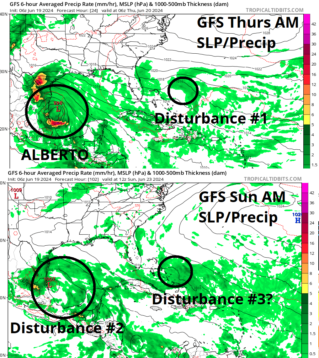
Climatologically, those two features should be plenty for late June. However, unlike twenty years ago when Spiderman rebooted a few times per decade, today Spiderman reboots literally thousands of times per film, thus a tropical instant replay is in the works. The CAG that never ends is expected to spit another disturbance into the southern Gulf of Mexico almost as soon as Alberto moves ashore, and models suggest this broad area of rotation may slowly become a tropical depression over the weekend.
The early read on track and impacts of this disturbance is that it might copy Alberto, though perhaps be somewhat weaker, with a general path towards Mexico and rains extending north into Texas through early next week. Weirdly, this system may also be accompanied by its own small disturbance east of Florida, though indications are that will probably remain offshore, with an even lower chance of any tropical development than during round one.
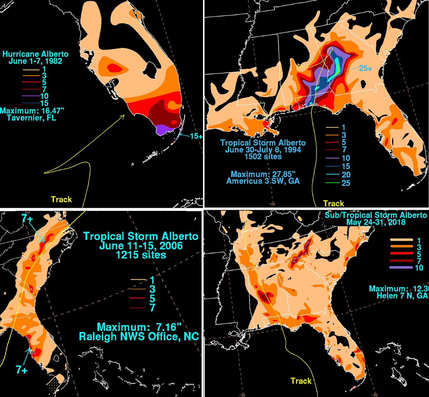
A final synchronicity worth mentioning: do you get déjà vu hearing about Alberto? If so, that’s because it isn’t the name’s first trip through the content mines. This is the eighth iteration of a moniker that first hit the NHC list in 1982 and has repeated every six years since then. Oddly, an Alberto has impacted Florida each dozen years starting in 1982, including tropical storm landfalls in 1994, 2006, and 2018. So, while Alberto V08’s path into the western Gulf fits that pattern, if history rhymes Floridians might want to set a Google Calendar reminder now to expect heavy rain in June 2030.
In the meantime, we’ve got our pair of comedically mismatched tropical dyads to monitor this week, whether they are spreading precipitation by day to Florida and the Gulf Coast or working together by night to solve crimes in a CBS spin-off provisionally titled NHC: Miami. As David Caruso might say if smugglers were trafficking contraband through Miami International Airport inside the tail engine of an L-1011, [puts on Ray-Bans] keep watching the skies.


