
Five Alive: Potential Tropical Cyclone 5 Update and Tropical Outlook for August 12th
Potential Tropical Cyclone Five will be a mid-week rainmaker for the Leeward Islands and Puerto Rico, but is not a threat to the continental U.S.
Florida and continental U.S. tropical threat synopsis: Potential Tropical Cyclone 5 will remain well east of Florida and the Southeast U.S. coast over the upcoming week as it strengthens to a hurricane, with no CONUS impacts other than high waves.
Almanac: It’s Monday, August 12th… day 73 of the 2024 hurricane season, 110 days to go. By total storm energy, the season is 10.6%, 23.1%, and 14.9% complete for the Atlantic, continental U.S., and Florida, respectively. Twenty years ago today, Tropical Storm Bonnie, packing modest 45 mph winds, became the first of two storms to make landfall in Florida on consecutive days. The second one was worse.
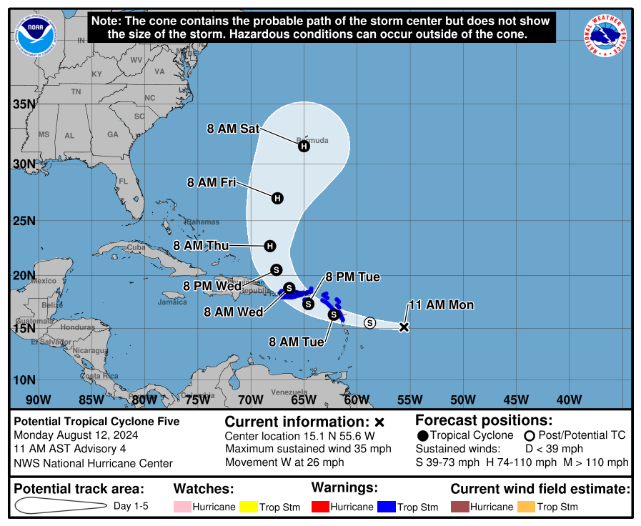
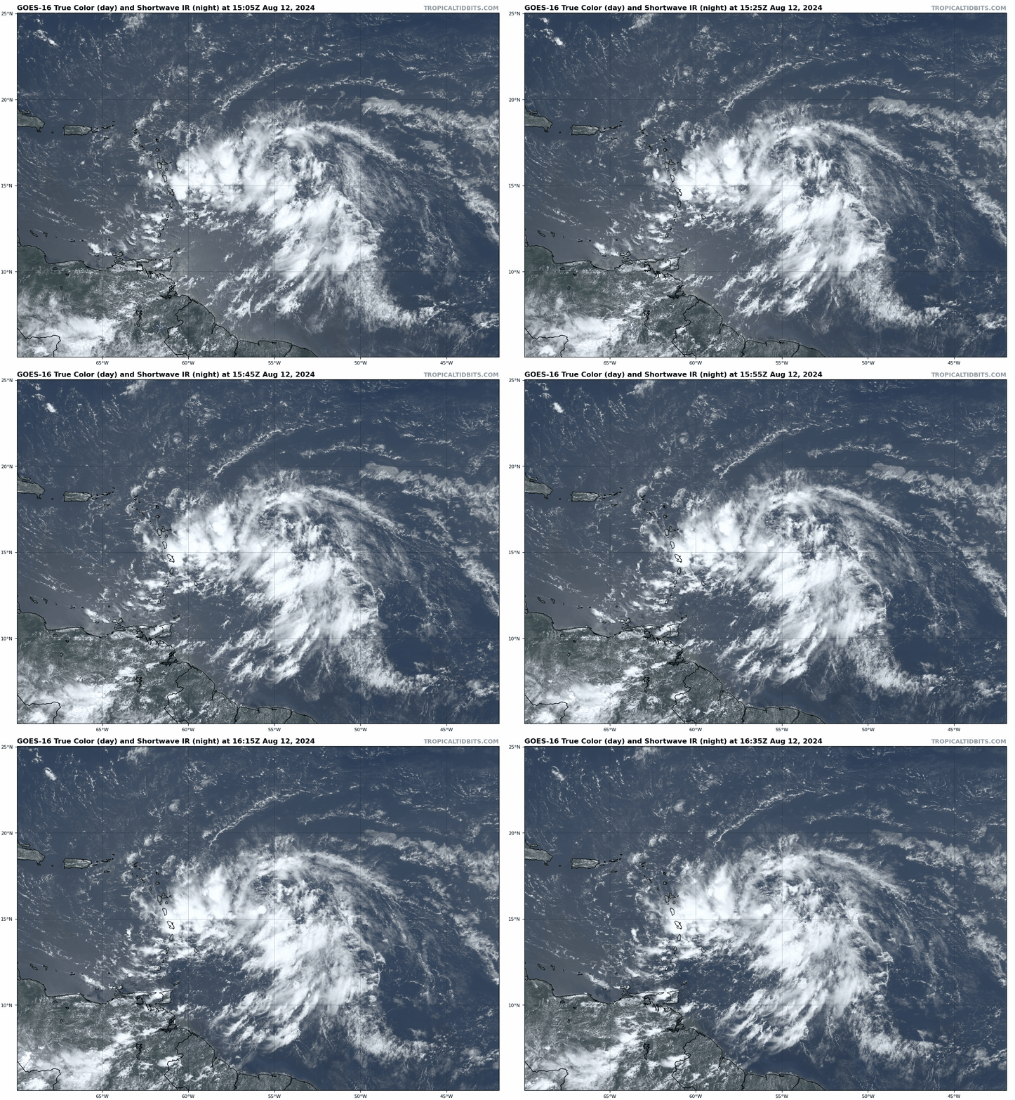
Active storms: The National Hurricane Center started issuing advisories on Potential Tropical Cyclone Five yesterday afternoon, which is now located about 700 miles east-southeast of San Juan as of 11 a.m. Monday morning. PTC 5 is expected to become Tropical Storm Ernesto by tomorrow morning as it moves west-northwest towards the Leeward Islands. A Tropical Storm Warning is now in effect for all of Puerto Rico and the northern Lesser Antilles.
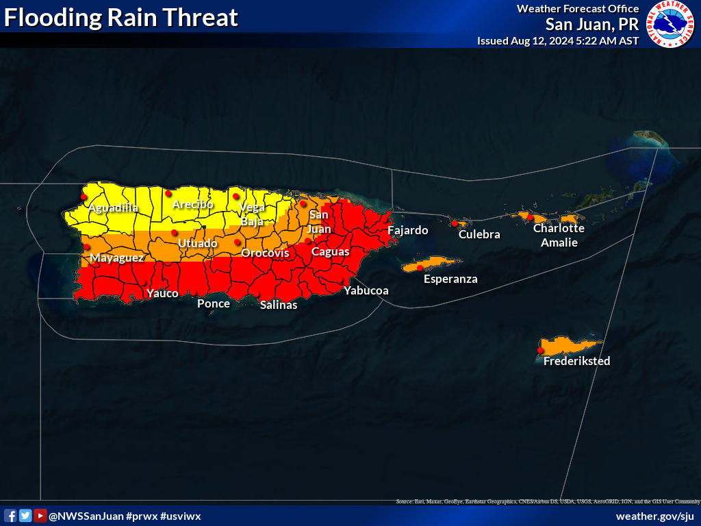
PTC 5/Ernesto will make its closest approach to Puerto Rico early Wednesday, most likely as a mid-range tropical storm. The favored track scenario is a path traveling northwestward over Puerto Rico, which would keep most of the island on the less windy half of the storm. With PTC 5/Ernesto expected to pass over or near Puerto Rico before it develops a well-organized core, wind and surge impacts on the island are not likely to be severe, generally lower-end tropical-storm-force wind gusts associated with rainbands. Heavy rainfall is expected to be the most widespread hazard, with 6-10” storm totals through Friday for southern and eastern Puerto Rico. The region at greatest risk of flooding and mudslides is this area, most acutely in southeastern Puerto Rico where the last month has been wet. North-central Puerto Rico, including San Juan, is likely to see storm totals of more like 4-6”, which may lead to local urban flooding issues as well. Northwestern PR in the rain shadow of the central mountains is likely to be driest, seeing on the order of 2-4” of total rainfall.
PTC 5/Ernesto will turn north late Wednesday and Thursday as it moves away from Puerto Rico, and should become a powerful hurricane later in the week as it moves in the general direction of Bermuda— likely 2024’s first major (Cat 3+) hurricane. With the system developing east of the islands and troughing hanging tough over the eastern U.S. for the next 10 days, this storm will not be a threat to the continental U.S. coastline. (Look for some high East Coast wave action arriving this weekend, so be careful in the surf.) Keep an eye on it in Maritime Canada, where a strong post-tropical storm is possible in 7-8 days.
Disturbances in the NHC tropical weather outlook: None.
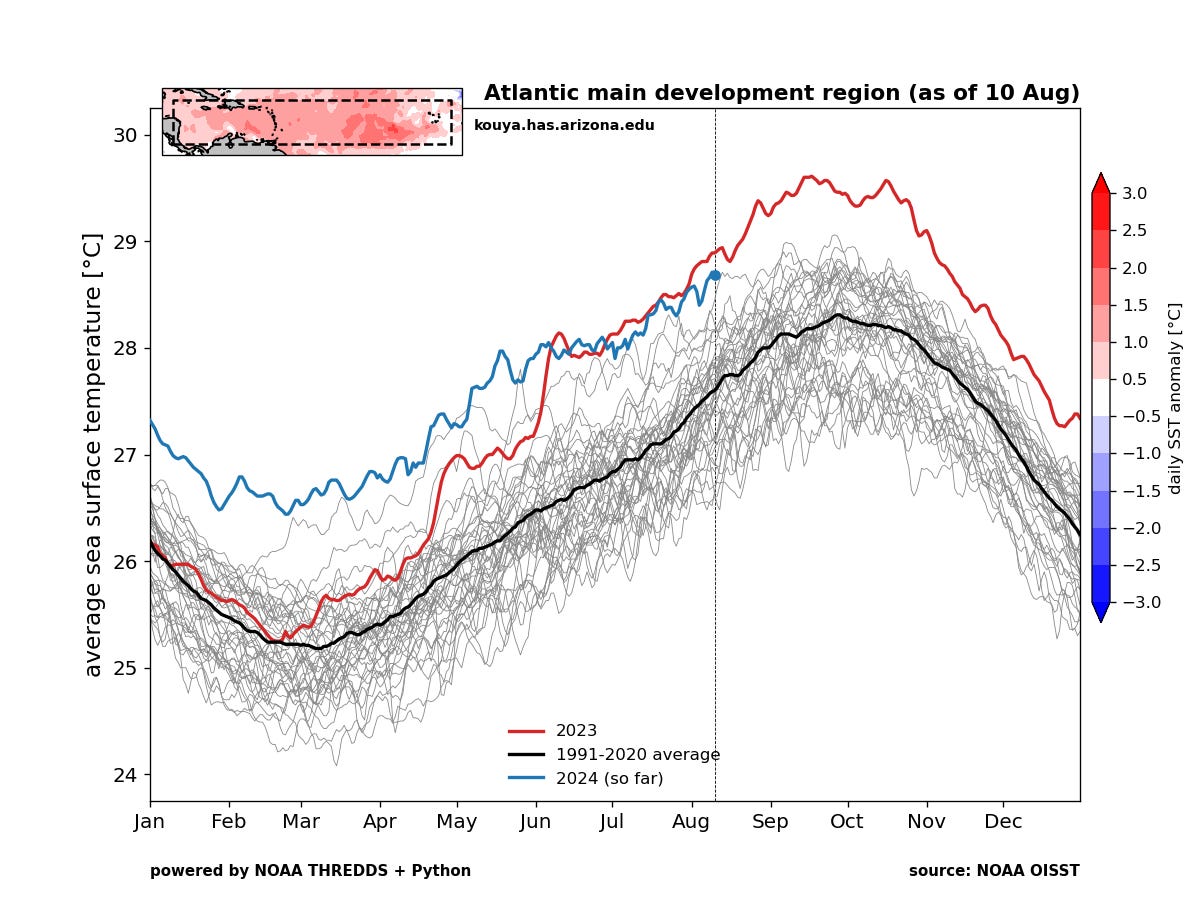
Elsewhere: There remains no specific signal for any tropical waves to PTC 5’s east to develop over the next week. However, with a low-shear regime developing over the Main Development Region, much warmer than Tropical Atlantic average sea surface temperatures, and global patterns of rising air in the Tropics favoring moist, high-amplitude tropical waves beyond mid-month, I would expect that additional prospects for tropical development will start to present themselves in the medium term. I’ll keep you posted. In the meantime, enjoy the respite from tropical threats to the continental U.S.
Next update: Tomorrow morning.




You shouldn't be so coy about Charley---some of us remember the date every year beginning a few days ahead.