End the Fred?: WeatherTiger's Quick Update on Fred and Grace for August 14th
Fred and Grace are struggling, but remain threats to Florida.
WeatherTiger’s Hurricane Watch will be issuing daily forecasts for Fred and Grace for the duration of the threat(s) to Florida. If you enjoy our work and are not already a supporter, please consider signing up for our paid subscription service to receive a daily threat briefing each weekday, or sharing this blog with your friends and family.
A quick Saturday update on Fred and Grace. We all have lives, so this will be pithy. Look for a longer update tomorrow once the smoke (hopefully) clears on some of the current organizational messiness of both systems.
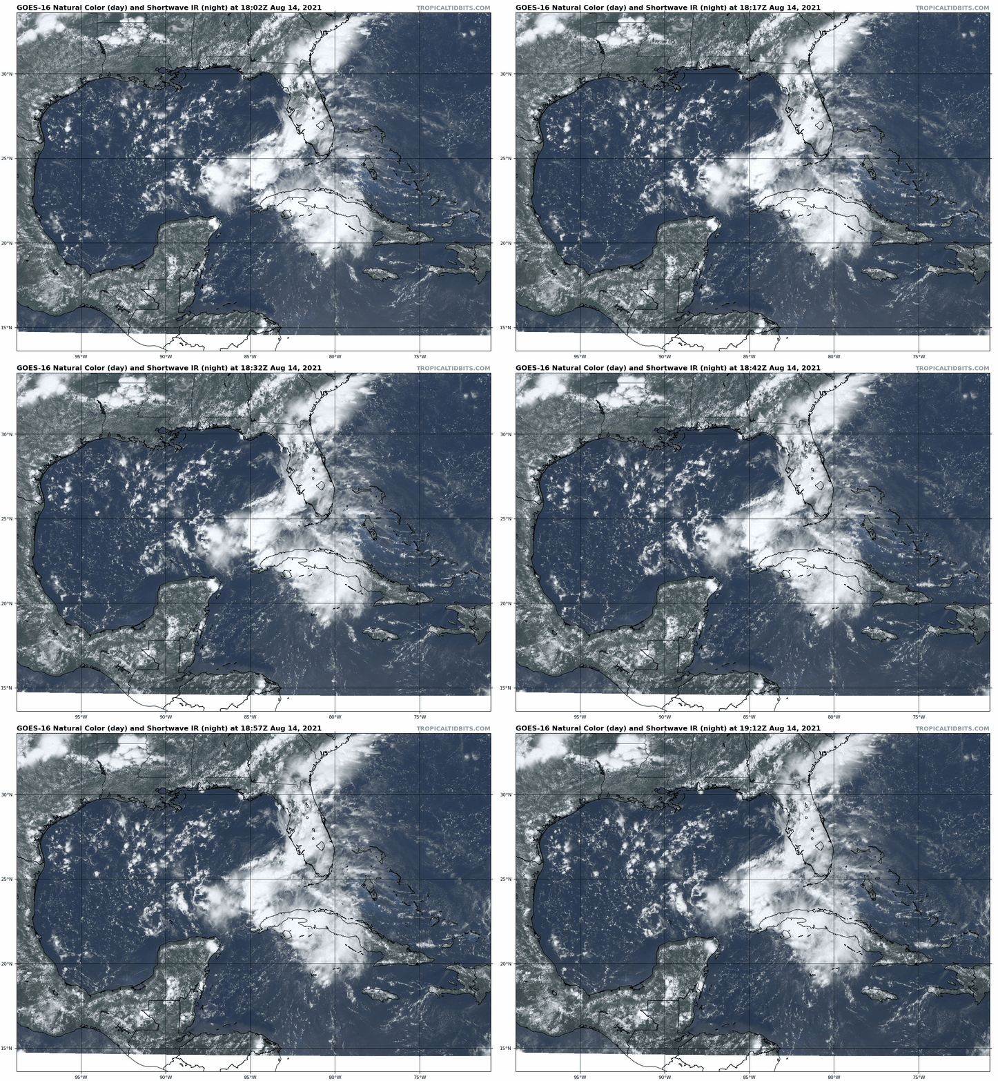
Tropical… something… Fred: The NHC has downgraded former TS/TD Fred to the mere “Remnants of Fred” as of the 11 a.m. advisory. This is due to the system no longer having a closed circulation (winds from all compass points) as a result of excessive time over Cuba. Currently, these remnants are generating extensive but disorganized convection over the Southeast Gulf as this mess angles northwest away from Cuba, and Fred is also indirectly triggering copious thunderstorms over the Florida peninsula this afternoon.
Nevertheless, the NHC is be continuing to issue advisories on Fred. This might seem a little confusing, but with the expectation of Fred regaining tropical storm intensity over the next 36 hours as it tracks north-northwest across the eastern Gulf, it makes sense so any necessary watches or warnings for the Gulf Coast can be issued in a timely manner.
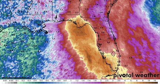
With a diminished Fred slipping further west than it would have been if it was more organized, the general track is now likely to see Fred reach the western Florida Panhandle or Alabama coast sometime later on Monday, possibly still as a weak or mid-range tropical storm. As center reformations could certainly change that, the forecast is highly uncertain. Ultimately, redevelopment or not, Fred remains likely to be a 2-5” rainmaker for west central Florida, the Panhandle, eastern Alabama, and western Georgia.
Odds of any significant wind or surge impacts on the Big Bend or Apalachee Bay have dropped due to Fred’s struggles, but coastal tropical storm force winds in the western Panhandle remain a possibility.
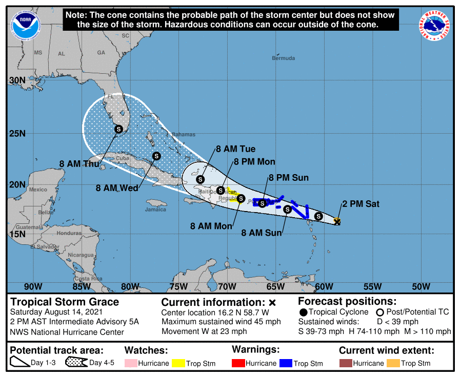
Tropical Storm Grace: TS Grace is on approach to the northern Lesser Antilles this afternoon, with maximum sustained winds of around 45 mph as it moves westward at around 23 mph. Satellite imagery would seem to indicate a developing system, with ample deep convection near the apparent center.
However, aircraft reconnaissance data this afternoon shows Grace is highly disorganized under the hood, and may not even currently have a closed circulation, either. At the same time, models are starting to become more bullish on Grace’s intensity in the Bahamas, western Caribbean, or Gulf.
So, Grace is a real conundrum this afternoon. It may be in the process of disintegrating, or may be reorganizing further south that models and the NHC forecast suggest. The mountains of Hispaniola, Puerto Rico, and eastern Cuba loom as a potential great leveler. The NHC forecast track splits the difference between the various bullish and bearish scenarios on the table, bringing a mid-range tropical storm near South Florida in five days. Overall, forecasters need another day with this one to get a better handle on storm structure, and for models to catch up to reality, before projections can be made with any kind of confidence.
Next update: Daily updates on Fred and Grace will continue tomorrow afternoon.

