WeatherTiger Hurricane Milton Update for October 6th
Florida faces a high-end surge, rain, and wind threat from strengthening Milton.
This post is outdated! Click below for the latest forecast.
This update has been sent to all subscribers. You may share it freely. Paid supporters will receive an exclusive morning briefing by 7:30 a.m. tomorrow about the latest overnight developments with Milton.
The hits keep coming: less than two weeks after Helene, Milton will strike the peninsular Florida Gulf Coast as a powerful hurricane. Despite uncertainty about exactly how Milton plays out, but there is high confidence that destructive surge is coming to Southwest Florida on Wednesday, with the potential for the worst surge in more than 100 years in the Tampa Bay area. Widespread wind and rain impacts are also coming to northeast, central, and south Florida.
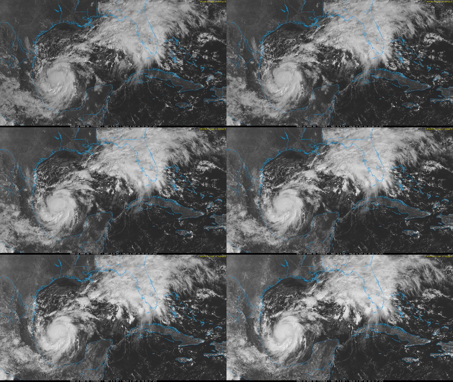
As of 2 p.m. Sunday morning, Hurricane Milton’s sustained winds are 80 mph, as determined by a NOAA Hurricane Hunter plane. This flight also found Milton’s minimum pressure to be about 10 millibars lower than expected, an ominous signal that the storm is coming together quickly. An eyewall is in the process of forming this afternoon, and rapid intensification is likely in the next 48 hours. As usual, we don’t know exactly how high that strengthening cycle will loft maximum winds. Embedded in a low-shear, high-moisture environment and crossing record-warm Gulf waters still in the upper 80s, the NHC is predicting Milton to become a major hurricane by late Monday. Time plus Gulf is, as always, a dangerous combination.
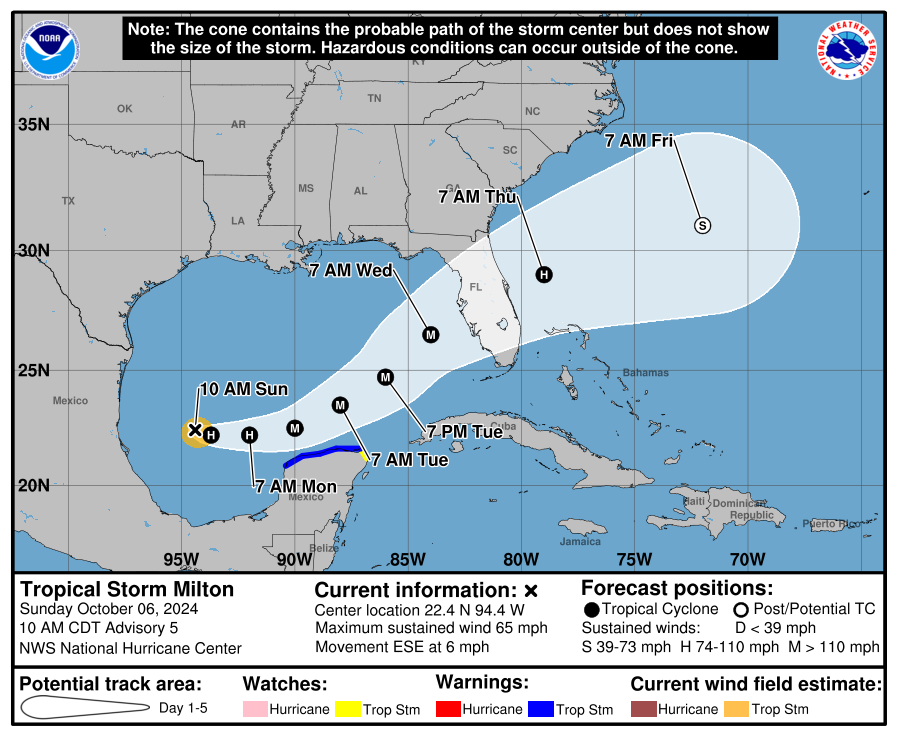
Milton is drifting east today and will continue moving a little south of due east through Tuesday, when it will pass just north of the Yucatan peninsula. That is a very unusual direction of movement for a strong Gulf hurricane, one reason there remain few if any apt historical comparisons to Milton. Later on Tuesday and into Wednesday as Milton approaches Florida, it will accelerate east-northeast or northeast as it feels combined northward nudges from a U.S. East Coast trough and a ridge of high pressure over the Caribbean. However, Milton will not hook north towards the Panhandle, as a west-to-east-oriented subtropical jet over the Southeastern U.S. will keep the hurricane hustling eastward midweek, even as it gains latitude crossing the southeastern Gulf.
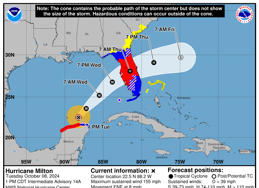
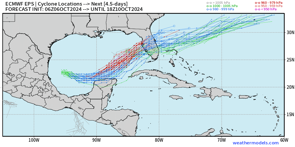
Therefore, Milton is expected to make landfall somewhere between the Nature Coast and Marco Island, most likely on Wednesday. Models are nudging a bit back to the south on Sunday after jogging north yesterday, and it is simply early too pick a landfall point within this range. The most recent NHC track is basically Sarasota to Melbourne, which really means that if you are in the Tampa Bay metro area, Bradenton, Sarasota, Venice, Cape Coral, Fort Myers, Naples, or anywhere in west-central and southwest Florida, we do not know whether the center of Milton will pass north, south, or over you.
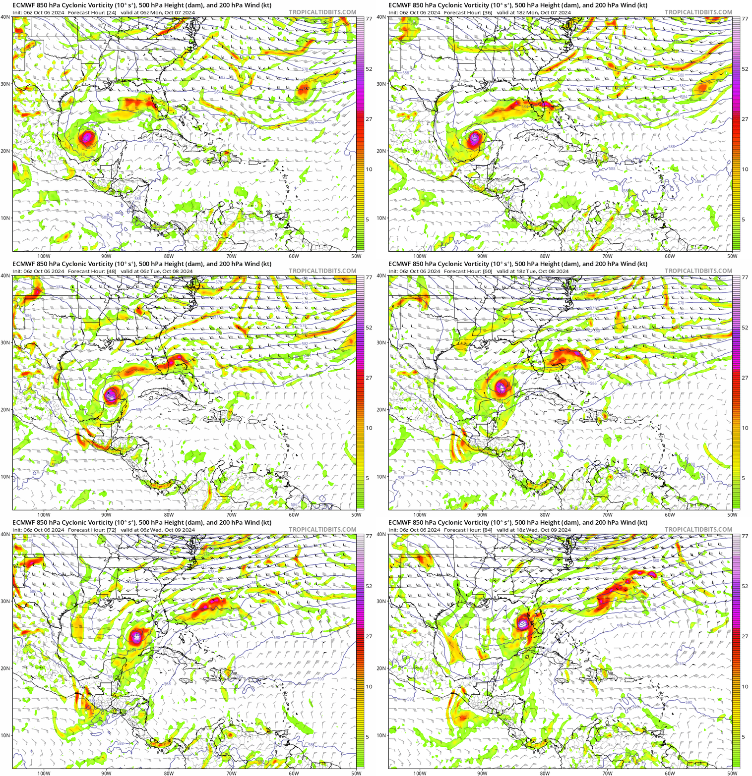
Focusing on the exact forecast track is the wrong way to look at a storm like Milton, because impacts are going to be widespread throughout the Florida peninsula no matter what. At this range, the primary focus for residents of the peninsular Gulf Coast should be on Milton’s surge threat. There is high confidence that Milton will be a powerful major hurricane on Tuesday in the south central Gulf; as Milton angles northeast towards Florida later on Tuesday into Wednesday, it’s likely going to encounter enough stronger vertical wind shear and dry air to cause its maximum sustained winds to plateau or potentially even decline a bit prior to landfall.
However, these potential fluctuations in maximum sustained winds before landfall do not translate in any way to diminished surge threat. Milton will be a ferocious storm over the southeastern Gulf, building up a life-threatening wall of water over days that will be inbound to the Florida Gulf Coast, no matter what wind-based category Milton is labeled with at landfall.
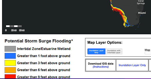
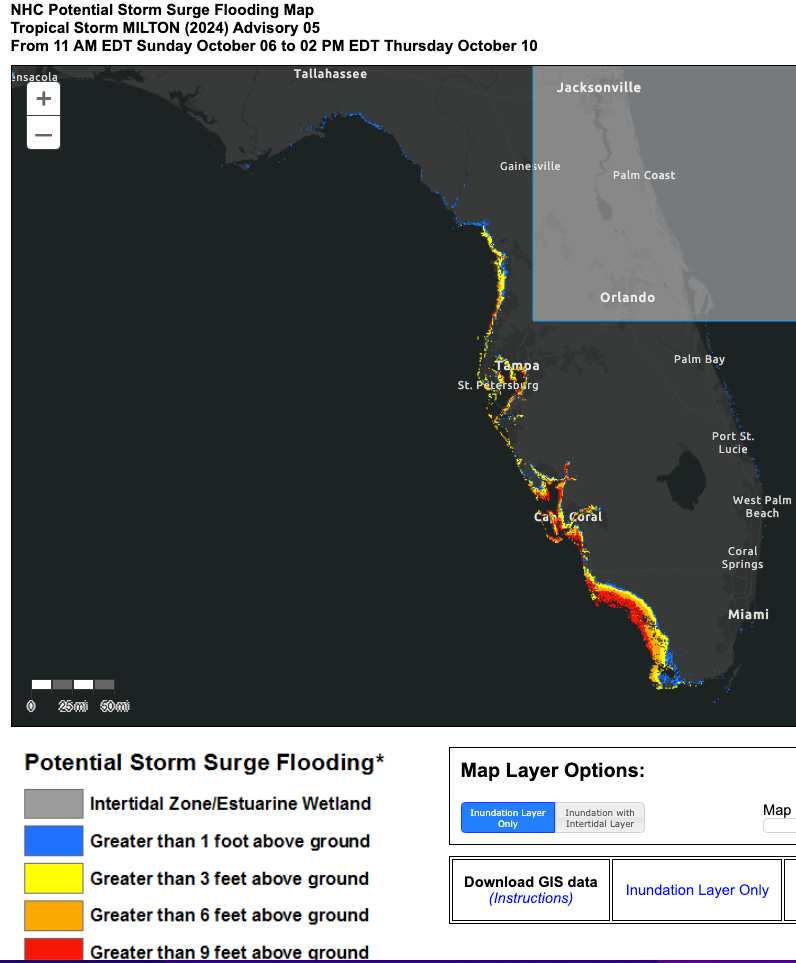
The first official surge forecast ranges from the NHC show this widespread threat. In the meantime, if you’re in Southwest Florida, you need to know that destructive surge is likely to occur on Wednesday. There are better and worse scenarios, but a wallop is coming, greatest in whoever gets the southeastern eyewall. Still, as we know from very recent experience, a hurricane passing well to Southwest Florida’s north or east results in dangerous surge. If you are in a coastal flood zone, prepare now to leave when your local emergency manager calls for an evacuation.
In the Tampa Bay region and west-central Florida, the there is more uncertainty about whether or not life-threatening surge will occur, but the potential of what could happen is historically bad. As in Ian and Irma, if the center of the hurricane passes south and east of Tampa Bay, primarily offshore winds will mean limited or no surge. However, if Milton were to pass near or north of Tampa Bay, primarily onshore winds could drive surge above Helene’s heights and into the 10’+ realm not seen in the area since 1848 and 1921.
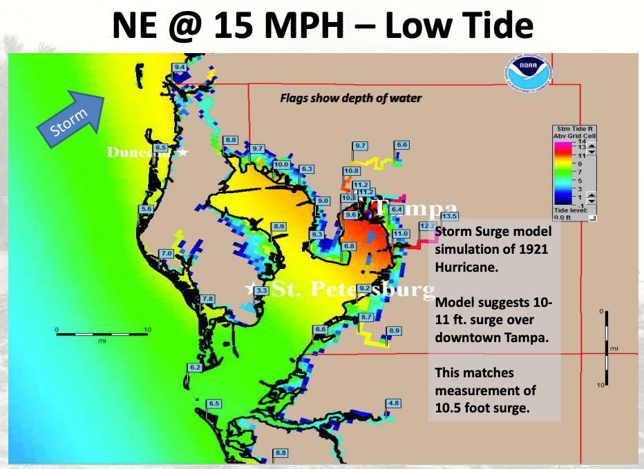
The best thing I can say now is that Tampa Bay residents simply have to prepare for Milton as if the worst case will occur, and hope that it doesn’t. The probability of severe surge is high enough, and the consequences of not evacuating low-lying areas dire enough, that you just can’t afford to roll the dice on getting lucky again. Again, west-central Florida sadly has very, very recent reference points for the consequences of not heeding local authorities. If your flood zone is told to evacuate, get inland. Figure out what you’d do if the word comes down today.
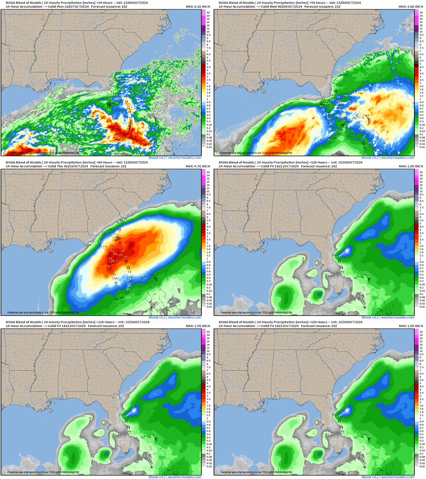
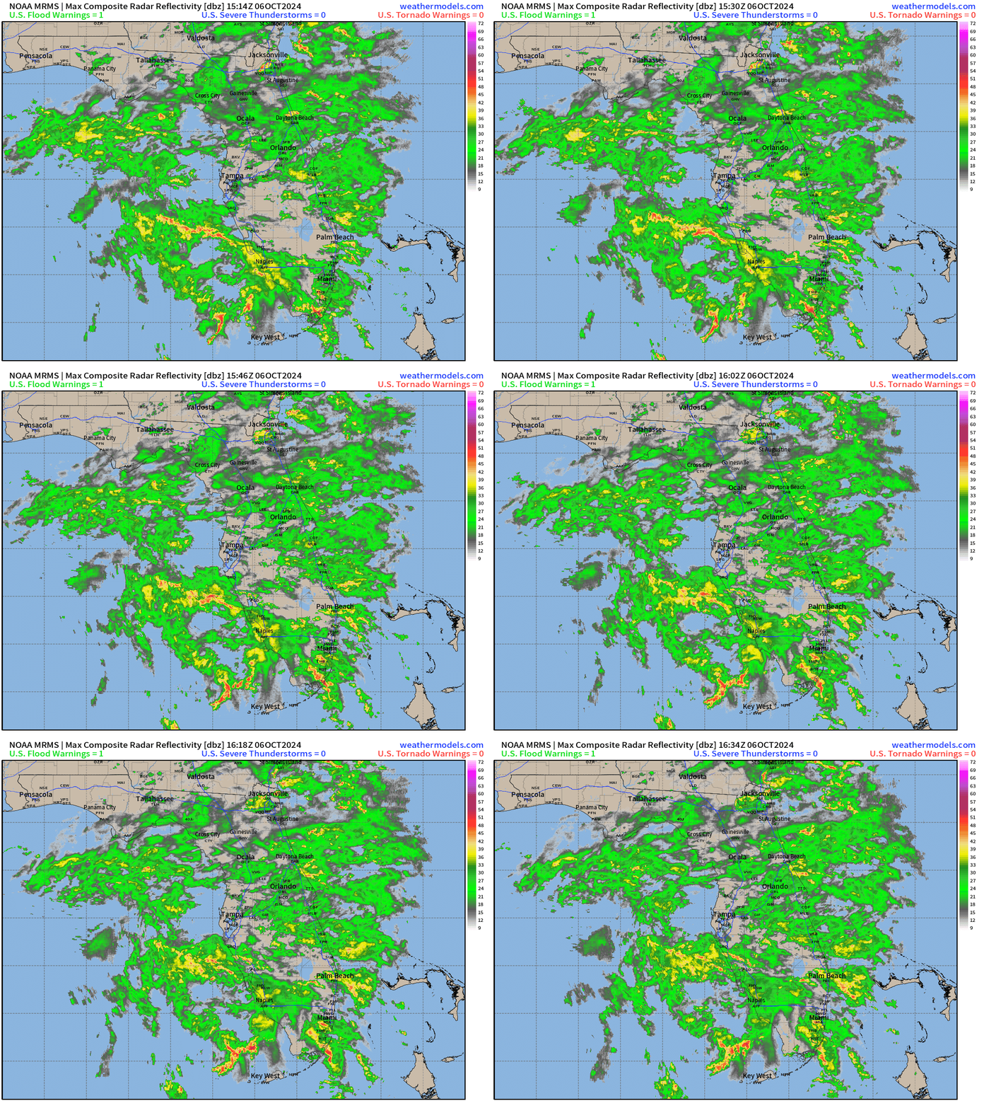
Another major impact of Milton that is not sensitive to exactly how the forecast plays out is the heavy rain threat to the entire Florida peninsula, which starts now and continues through midweek. I’ve been highlighting excessive rainfall risks to South and Central Florida as likely to begin this weekend no matter what, and right on cue, widespread storms are spreading over the peninsula today. This rainfall is only indirectly associated with Milton, but precipitation will nevertheless tally anywhere from 2-5”+ south of a line from roughly Cedar Key to Jacksonville before the storm arrives, with the highest risks of early week flash flooding in South Florida.
With dry air potentially punching into Milton’s southern half on Wednesday as it makes landfall, the highest risks of excessive rainfall with the hurricane itself will most likely be in Central or Northeast Florida, even if landfall is farther south. Once again, recent experience teaches us that we need to take the threat of hurricane-related flooding every bit as seriously as surge and wind, so be monitoring the situation closely in low-lying and freshwater flood-prone areas of the Orlando, Tampa, and even Jacksonville metro areas. The northwestern cutoff of the heavy rain threat will fall across the Big Bend, and the central and western Panhandle should be mostly dry.
Coastal and inland wind impacts are also a potential major issue for Central and South Florida, albeit the one with the lowest forecast confidence at this point. Due to interaction with a subtropical jet streak as it nears and crosses Florida, Milton’s top winds may be on the downswing just prior to landfall on Wednesday, though likely at the cost of smearing tropical-storm-force and hurricane-force wind gusts over a large area. As highlighted by the NHC forecast discussion, the complicated jet dynamics in play may well result a stronger “weak” (in this case, north/west) side of Milton than one might expect, even if the storm were to drop a category or two from its Category 3 or 4 peak intensity. Take any estimates of potential wind impacts for specific locations from Milton with big grains of salt at this point, but residents of coastal areas from the Nature Coast south, plus the entire inland Florida peninsula should do what you can now to prepare your property for high winds, particularly in areas already brutalized just two weeks ago by Helene.
Bottom line is nothing good is going on with Milton today, and I continue to hate that this is happening so, so much. We’re facing a compounded threat with few precedents in hurricane history, as only 1926, 1950, 2004, and 2005 saw two Category 3 or higher landfalls in Florida. Whether or not 2024 joins that list is immaterial to the near-certainty that Helene and Milton are likely to go down as one of the most devastating one-two statewide punches of all time.
We’re all exhausted already. You are, I am. That’s reality, and I know that. Unfortunately, it’s also reality that we have to react, prepare, and if necessary, evacuate, because the surge, rain, and wind threat from Milton requires our last full measures to protect life and property. I’ll be keeping you posted with updates through the storm, which too, shall pass. Keep watching the skies.



![[Image of Rainfall Potential] [Image of Rainfall Potential]](https://substackcdn.com/image/fetch/w_1456,c_limit,f_auto,q_auto:good,fl_lossy/https%3A%2F%2Fsubstack-post-media.s3.amazonaws.com%2Fpublic%2Fimages%2F4317c037-7d6d-4e43-9f62-c67150535e89_892x716.gif)
![[Image of WPC Flash Flooding/Excessive Rainfall Outlook] [Image of WPC Flash Flooding/Excessive Rainfall Outlook]](https://substackcdn.com/image/fetch/w_1456,c_limit,f_auto,q_auto:good,fl_lossy/https%3A%2F%2Fsubstack-post-media.s3.amazonaws.com%2Fpublic%2Fimages%2Fb2da3764-b39a-486b-9998-c9230583db05_893x746.gif)
Got a dozen storm panels up this morning before running out of energy. I have kind of been prepping for this since we bought our house in 2004. We are at SRQ lever so flood should not be a problem, but as Betsy taught a 26-year-old version of me you never know how it will work out. Thank you again for working on this weekend after all you have been through.
A hearty thanks from Palm Bay. Starting on the shutters shortly. Been a while around here since we had to do this. BTW, we've had 2+ inches rain since 8am and still coming down. Mother Nature's pre-soaking I guess...
Again, thank you for all you do for us. It is greatly appreciated.