Major Hurricane Beryl Forecast and Tropical Update for July 1st
Category 4 Hurricane Beryl plows through the Windward Islands and will menace the Caribbean this week, but risks to the U.S. are minimal.
This post is outdated. Click here to read our new forecast as of 5 p.m. Friday.
U.S. tropical threat synopsis: There are no tropical threats to Florida or the eastern Gulf Coast in the next 7 days. The western Gulf Coast should monitor Beryl, though any direct impacts in the U.S. remain very unlikely.
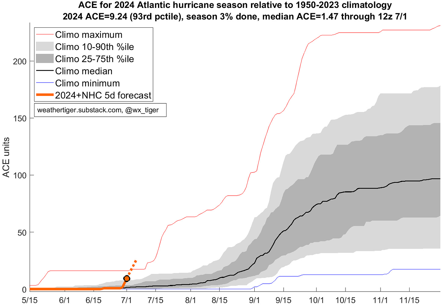
Almanac: It’s Monday, July 1st… day 32 of the 2024 hurricane season, 151 days to go. By total storm energy, the season is 2.5%, 8%, and 7% complete for the Atlantic, continental U.S., and Florida, respectively.
Beryl’s exceptional intensity now puts 2024 well ahead of normal in terms of seasonal hurricane activity. Adding in Beryl’s expected strength this week, 2024 looks to leap into the lead as the most activity hurricane season to date for early July since 1950.
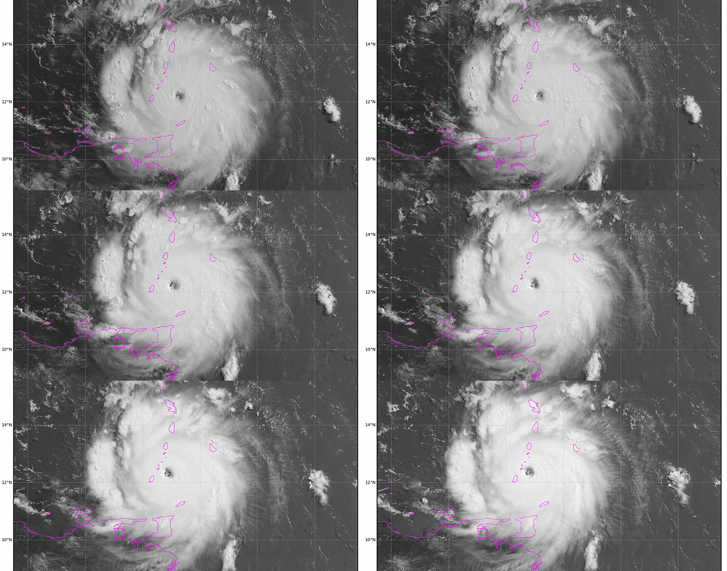
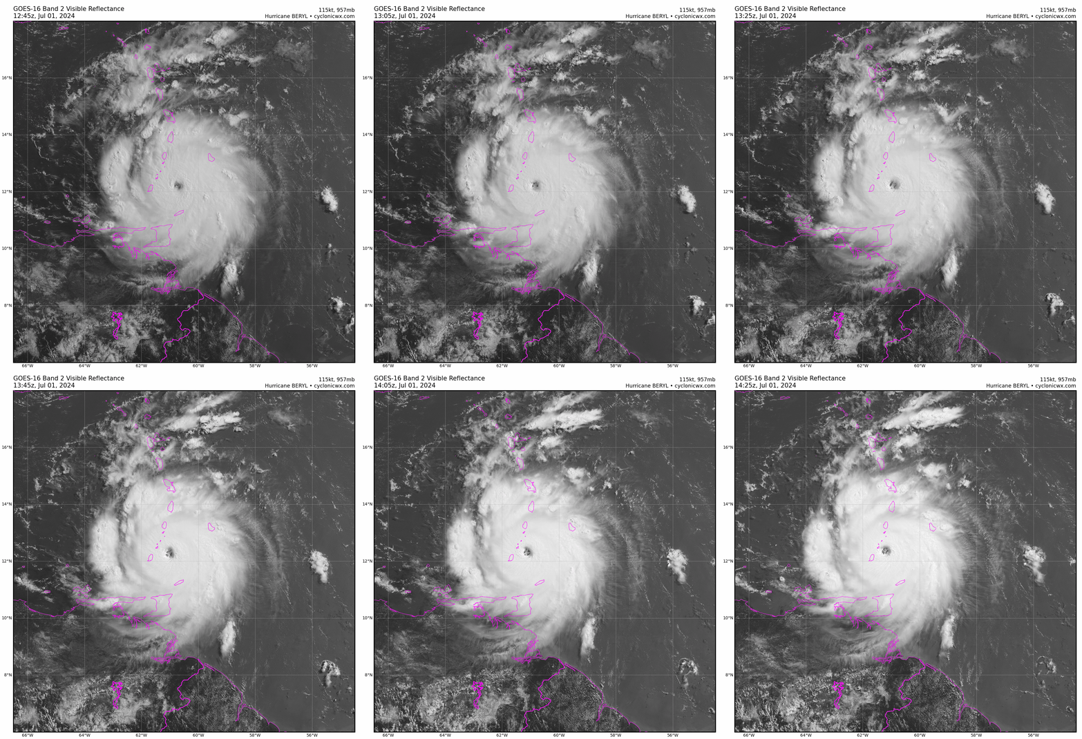
Active storms: As of the 11 a.m. Monday NHC advisory, Hurricane Beryl is a Category 4 storm with maximum sustained winds of 150 mph, currently about 30 miles northeast of Grenada, moving west-northwest at about 20 mph. (Click here for the latest NHC forecast information.) Unfortunately, Beryl successfully completed an eyewall replacement cycle overnight, and after a dip in peak winds accompanying that cycle, is strengthening yet again. Recon winds are rising and pressures are falling on each plane pass through the center, and radar/satellite appearance is symmetrical with eyewall mesovorticies clearly evident. The eyewall will track between Grenada and Saint Vincent over the next few hours, and unfortunately damage is likely to be what you’d expect from a powerful Category 4 hurricane. The windfield also has expanded due to the eyewall replacement cycle, and sustained tropical-storm-force winds extend north to Saint Lucia and Barbados, which recorded a 69 mph gust this morning.

There’s not much in the way of historical precedent for this. Major hurricanes are not common in the Windward Islands at any time of year, and unknown in early July. The last Category 3 storm to cross south of Saint Lucia was Ivan in 2004. In general, the southern Lesser Antilles see fewer intense storms than the Leeward Islands, which continue to be in line for just some intermittent showers from Beryl. Bottom line, Beryl would be a historically impressive and destructive storm no matter when it occurred; that it is happening on July 1 is anomalous by another order of magnitude.

Conditions in the Windward Islands should begin to improve this evening, when Beryl will cross into the eastern Caribbean and will probably have peaked out in intensity. As mentioned last week, environmental conditions as Beryl moves west-northwest across the central Caribbean are less favorable, with 30-35 knot steering winds out of the east near the surface and light winds from the east aloft. This speed shear will weaken Beryl, though weakening from a Cat 4 initial intensity means Beryl should remain a dangerous hurricane as it moves west-northwest through the Caribbean over the next 2-3 days. NHC and model tracks have continued to edge a bit farther south over the last 24 hours. Beryl will probably pass far enough south of Jamaica on Wednesday to avoid major wind damage there, but it will be a close call.
The good news, if any, is that robust U.S. Gulf Coast ridging will keep steering currents in the western Caribbean flowing from east-to-west on Thursday, Friday, and Saturday, with no hint of the northward component that would be needed to draw Beryl up into the central Gulf. Instead, Beryl is likely to plow due west starting Thursday and reach the Yucatan peninsula on Friday. Shear continues to look challenging in the western Caribbean, so while Beryl is likely to remain a hurricane, it probably will be a Category 1 or 2 storm by the time it gets to Mexico or Belize.

After crossing the Yucatan, Beryl’s track could bend a little more WNW again as it responds to a weakness in the western flank of the Gulf Coast ridge that will develop by next weekend. Models are trending towards a faster weakening of the ridge, which may allow Beryl to gain enough latitude to reach the southwestern Gulf of Mexico by Sunday. Given the southward track trends prior to that point, it is very unlikely even given a weaker ridge that Beryl could move far enough north to have direct impacts on Texas, but it can’t yet be entirely ruled out. If there is a Gulf landfall, the Mexican Gulf Coast is far more likely to take the brunt, and Beryl may well never get into the Gulf at all. Overall, the western Gulf Coast should keep an eye on Beryl, but there is really no cause for concern for any U.S. interests unless things change dramatically.
The other named system in the Atlantic Basin this morning is blink-and-you’ll-miss-it Tropical Depression Chris, which briefly attained minimal tropical storm status overnight and moved west into the Mexican Gulf Coast south of Veracruz. Chris will dissipate today over the highlands of central Mexico, spreading heavy rains as it does. There are no U.S. impacts here, but squeezing a third tropical storm into June does tie the record for most named storm formations ever during the month.
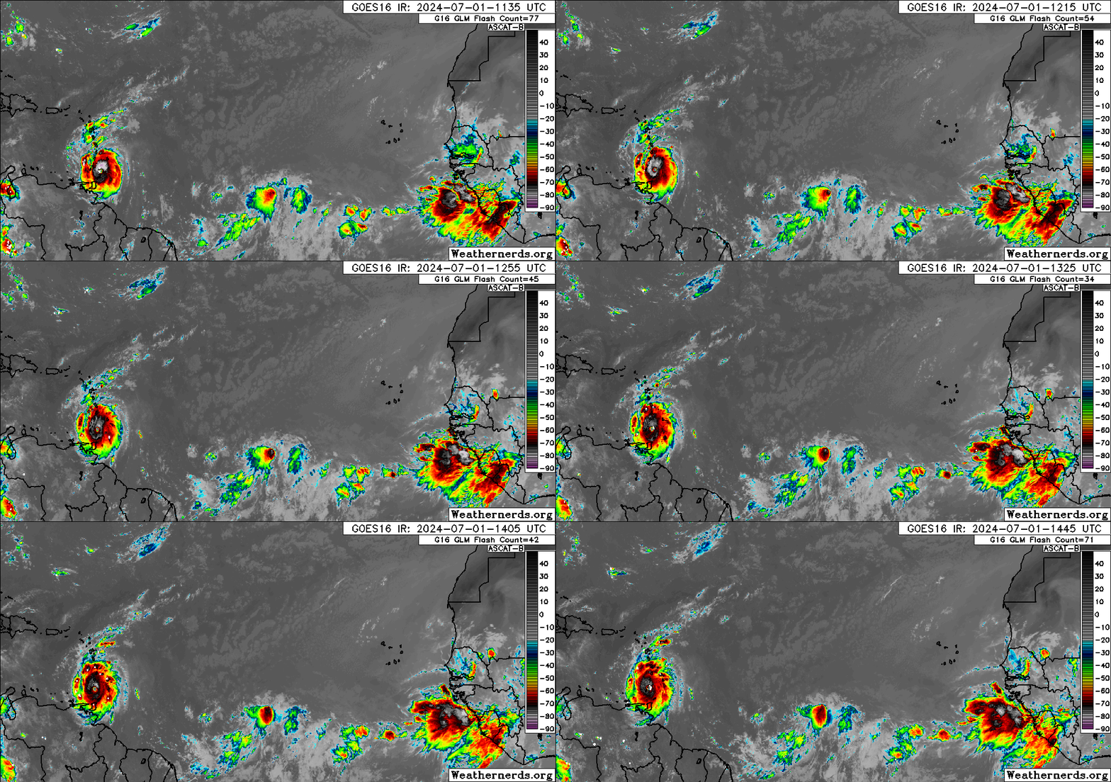
Other disturbances in the NHC tropical weather outlook: In addition to Beryl, there has also been some chatter about Invest 96L, the tropical wave to Beryl’s east, about 1200 miles away from the Lesser Antilles. NHC is giving 96L a 30% chance of development over the next two days and a 60% chance over the next week, which is down slightly from 40/70 over the weekend. As I mentioned last week, 96L had a better chance of development if Beryl didn’t “excessively intensify”… which is exactly what it did. Effectively, 96L will be breathing in Beryl’s exhaust this week, and models are backing off on its development potential prior to reaching the islands as the outflow environment it moves through becomes less favorable. Enhanced showers and brisk trade winds are expected across the Lesser Antilles on Wednesday, but the odds of a significant storm in the islands are thankfully falling.
Down the road, it’s worth keeping half an eye on 96L, as its fate is not clear-cut. The environment as the wave crosses the Caribbean appears fairly hostile in the wake of Beryl, so development will be unlikely late this week as the wave spreads moisture to the Greater Antilles and continues west-northwest. However, with Beryl slowing down late week, Beryl’s circulation might bump 96L a little further north, and the aforementioned weakness in the ridge could theoretically draw the wave further north into the northwest Caribbean or southern Gulf. If there is anything coherent left of 96L at that point, it could have a shot at organizing there in 6-8 days or more. Models are not enthusiastic about 96L’s development prospects and overall U.S. risks remain very low, but it’s a scenario that can’t be ruled out yet. I’ll keep watching it.
Elsewhere: Nothing worth mentioning.
Next update: Daily update Tuesday morning.


Wake up call! Beryl went from tropical depression to major hurricane in 48 hours. Recalibrating time-to-get-out-of-Dodge, Daytona, Destin, Delray Beach, Dade City, Dania. Gone, apparently, is the watch the grass grow and cake rise 3-4 day window of slowness. Whole new ballgame!