Invest 97L Update for September 22nd
Invest 97L is likely to become a hurricane in the Gulf of Mexico and reach the eastern Gulf Coast late this week.
Tropical threat synopsis: A tropical disturbance is coming together in the western Caribbean, and a hurricane landfall on the eastern or east-central Gulf Coast between Thursday and Saturday is probable.
Today’s update will be short, because I’ve been working on storm preps and dealing with other complications1. But like life, Invest 97L comes at you fast. So here we go.
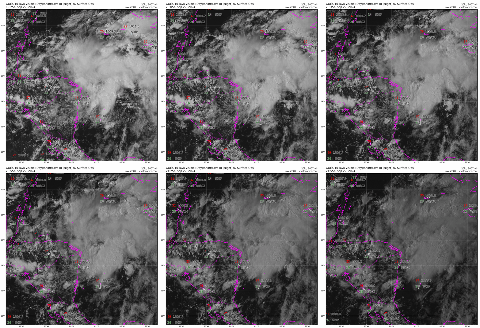
In the last 24 hours, the western Caribbean tropical disturbance I’ve been anticipating all week (and some of the previous week) has developed on the faster side of the range of possibilities laid out in Friday’s column and in the model guidance. While this disturbance is not organized enough to be termed a tropical depression or storm yet, it has been tagged “Invest 97L” by the NHC, a designation that triggers the allocation of additional observational and model resources to tracking the system. The NHC also gives 97L an 80% chance of development in the 2 p.m. Tropical Weather Outlook.
While 97L doesn’t have a well-defined circulation center, it has deep convection east of a proto-center near the Caribbean coast of Nicaragua. This turning will lift north away from land in the next day, and there’s little stopping it from continuing to organize during that time. On Friday, I was targeting Tuesday or Wednesday for a depression to develop, but now tomorrow or Tuesday looks more probable.
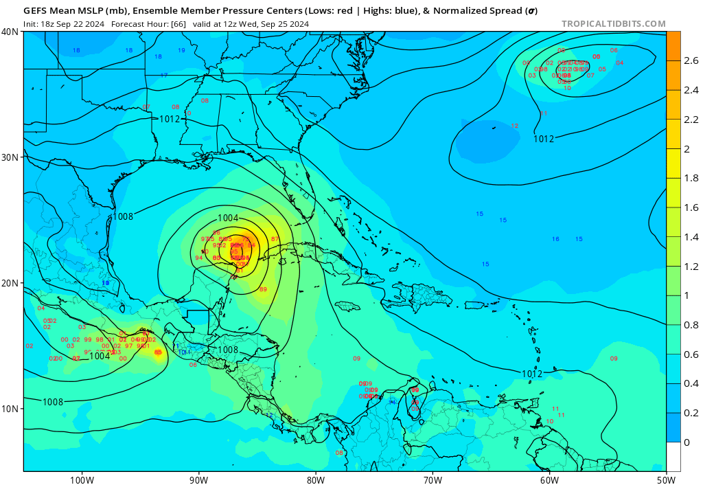
The shorter timeline for development and the likelihood that the center will not move over the Yucatan (or do so only briefly) as it swings northwest on Tuesday nudges intensity expectations upward. It takes time for a tropical cyclone to put together a convective core, but 97L is giving itself a head start on that process. There’s no NHC forecast yet, but model guidance and the favorable upper-level and oceanic environment argue for a hurricane entering the southern Gulf on or prior to late Wednesday, especially if the system becomes a depression tomorrow.
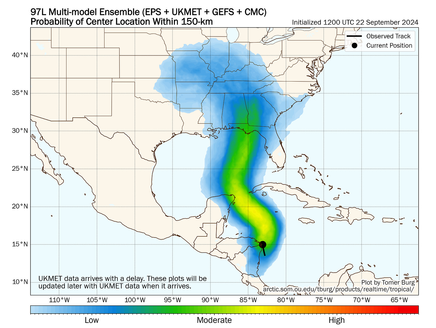
On Thursday and Friday, a cut-off upper-level low over the Lower Mississippi Valley will sweep the storm north towards the east-central Gulf Coast, and models have come into much better agreement in the last day on a landfall between Mobile and Tampa, with the nexus of highest risk squarely on North Florida. That range will narrow once a clear circulation center emerges in the next day. Landfall timing is likely late Thursday or Friday.
The huge question here is how much strengthening will occur prior to landfall. At this point, before a true center develops, I’m really only comfortable saying a hurricane is more likely than not, and that there is potential for a major hurricane. If the upper-level cutoff low is a little farther away from the storm, the shearing and outflow remain generally favorable for strengthening to landfall; if they are closer, stronger shearing might cap intensity in its last day over water. Those details are beyond what can be predicted at this range, but suffice to say there’s wind and rain coming to the eastern Gulf Coast late this week, especially as the storm will be quite large.
In short, Invest 97L has “the look” of a disturbance that is coming together fast. A major hurricane landfall is a possibility that everyone in the Alabama and Florida Gulf Coasts needs to be thinking about and preparing for now even if somewhat better outcomes remain a realistic possibility.
Next report: A complete forecast will be out early tomorrow afternoon.
My wife is undergoing surgery on Tuesday, so my schedule is somewhat uncertain this week. I apologize in advance if forecasts are late or email responses are delayed.


Thanks all. Erica is touched by everyone's nice notes and concern. It's outpatient surgery to put some pins in her hand to repair a broken bone, so hopefully it goes smoothly and we're back home right away on Tuesday. (And hopefully the power stays on through recovery.)
Hoping all goes well for your wife, and a speedy recovery