Category 5 Hurricane Milton Forecast for October 7th
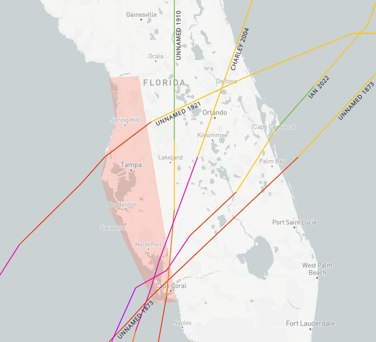
Category 5 Milton poses the greatest surge threat to west-central Florida since 1921.
This post is outdated! Click below for our newest impacts forecast for Florida:
WeatherTiger’s Hurricane Watch is a reader-supported publication. Paid subscribers get daily tropical bulletins, weekly columns, full coverage of every hurricane threat, the ability to comment on posts and ask questions, and more. Paid supporters also receive a subscriber-exclusive morning forecast briefing daily at 7:30 a.m. through the threat from Milton.
Edited 9:45 pm: An evening video forecast can be viewed at the bottom of this page.
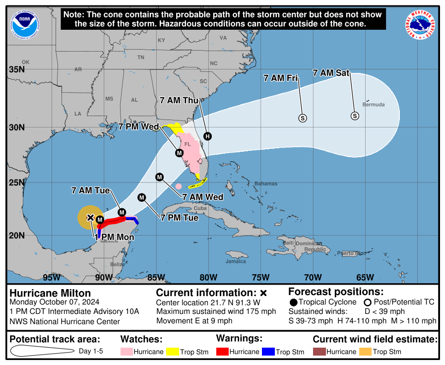
Rewriting the record books today and set to rearrange the Florida coast in a few days, Milton has strengthened in the Gulf in a way that no hurricane has in recorded history. Milton’s two-day transformation into a Category 5 sharpens an already extreme surge, wind, and rain threat to the Florida peninsula, including Tampa Bay. Hurricane and Storm Surge Watches are now up for much of the Florida peninsula.
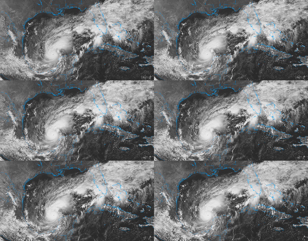
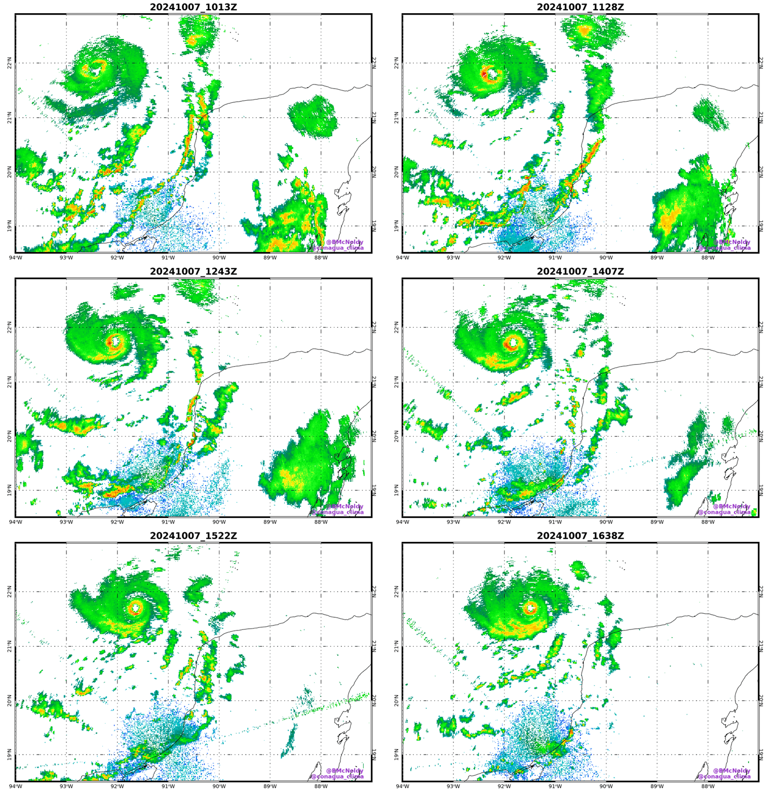
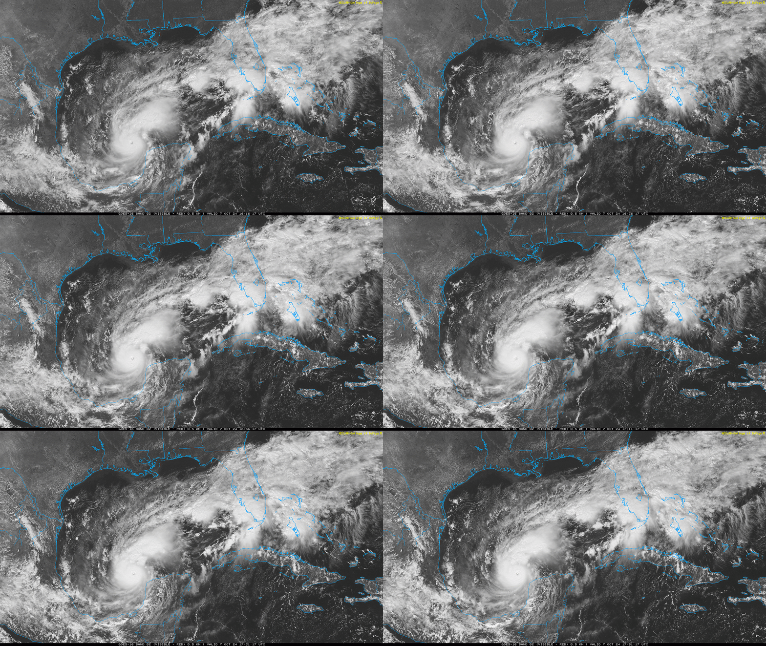
As of 2 p.m. Monday afternoon, Milton is located about 700 miles west-southwest of Tampa. Hurricane Hunter aircraft investigating the storm today have borne witness to an intensification streak with only a handful of recorded parallels anywhere in the world, as maximum sustained winds rose from Category 2 strength early Monday morning to a Category 5 by noon. Aircraft observations currently support sustained winds of an astonishing 175 mph, and pressure is still dropping like a rock. Milton should remain a Category 5 hurricane through Tuesday and may attempt to break records for strongest Atlantic hurricane ever. Given the clear, tiny eye, continuous eyewall lightning, and fearful symmetry of the central convection, it is plausible.
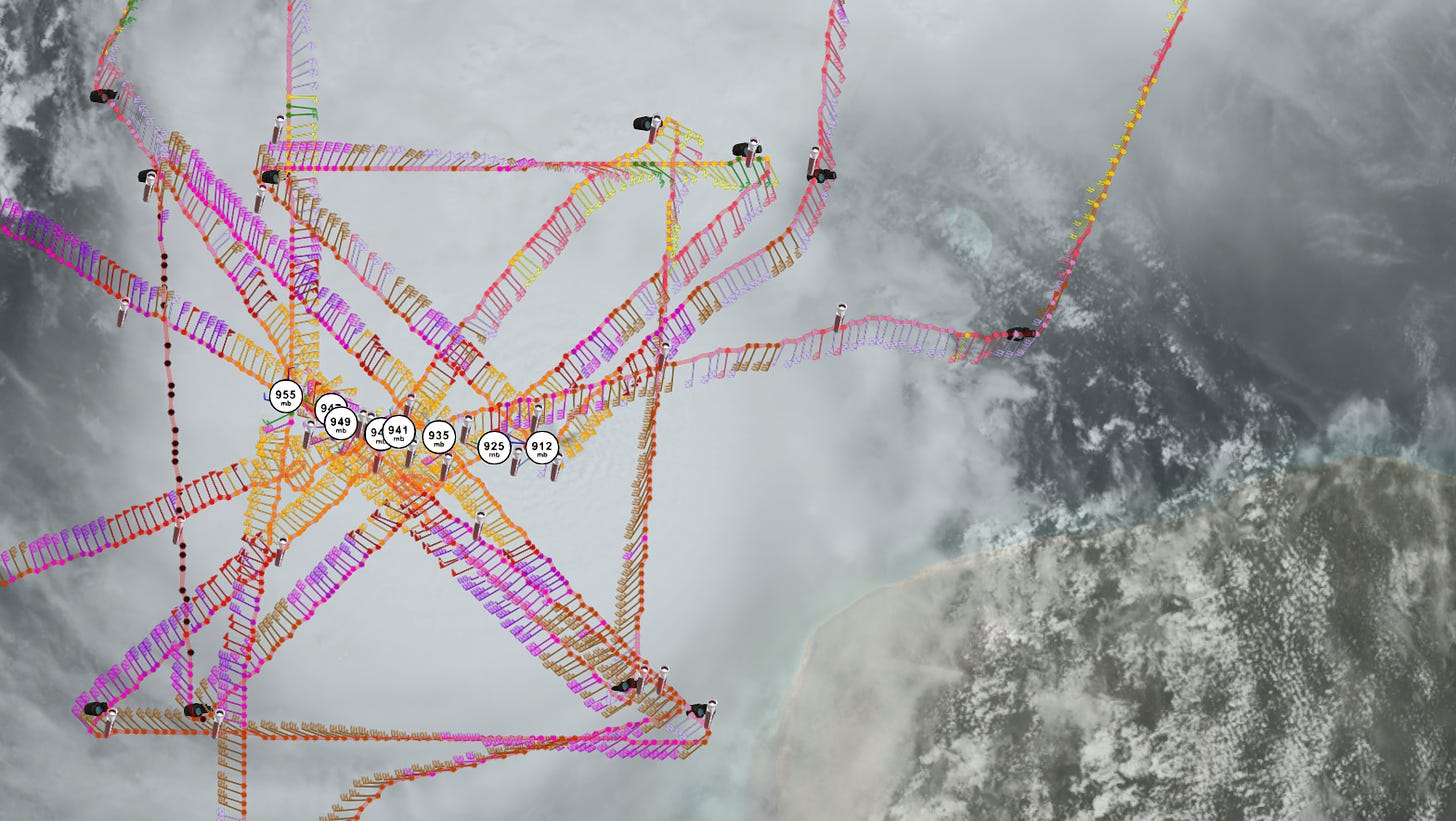
The words “Category 5 hurricane” alone should let you know that the threat to Florida is truly exceptional, particularly as the NHC forecast track continues to target west-central Florida. This region between Venice and Crystal River does not have the living memory of a direct impact from a major hurricane. In the last day, Milton has already strengthened more quickly than all but two Atlantic hurricanes in history, and joins Michael as the only other October Category 5 ever in the Gulf of Mexico. In just over two days’ time, it has also equalled or exceeded Wilma’s record sprint in 2005 from a tropical depression to a Category 5.
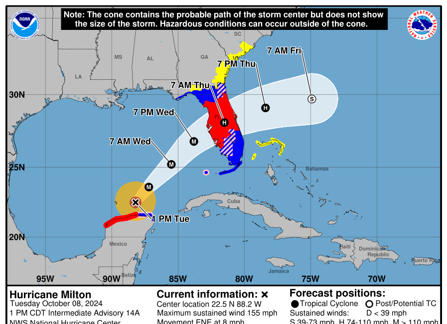
So, this is not a garden-variety late-season hurricane threat to Florida’s Gulf Coast. While Milton’s phantasmagoric strengthening further raises the stakes of an already grim impacts forecast for Florida, the overall track forecast remains little changed from the weekend. Milton is still expected to move due east through Tuesday afternoon, when it should pass just north of the Yucatan peninsula. Milton deviating south and actually scraping or moving over the Yucatan is a slight possibility, one that would throw Florida a modicum of lifeline by weakening the storm while it remains in a favorable environment. I wouldn’t count on it, though.
Late Tuesday, Milton will turn more northeast as it enters a channel of steering winds aloft between western Caribbean high pressure and a strong trough of upper-level low pressure over the U.S. East Coast, then turn back more east-northeast late Wednesday and early Thursday as it gets swept up by a west-to-east streak of strong winds in the jet stream. Exactly when and how sharply those turns happen will dictate where Milton reaches the coast.
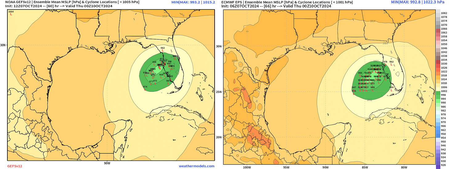
It’s not possible to know this far out exactly where landfall will occur. The NHC track is centered on the Tampa Bay region, but could shift as far north as the central Nature Coast or as far south as the Fort Myers area. (Panhandle readers, I understand your skittishness, but you will not be directly targeted by Milton. Peripheral rains will reach into the eastern Big Bend.) Within the Nature Coast-Tampa Bay-Southwest Florida range, we don’t know whether the center will go north, south, or over you.
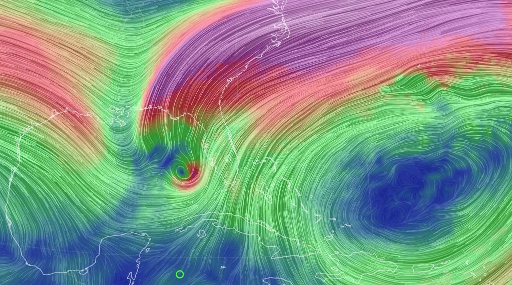
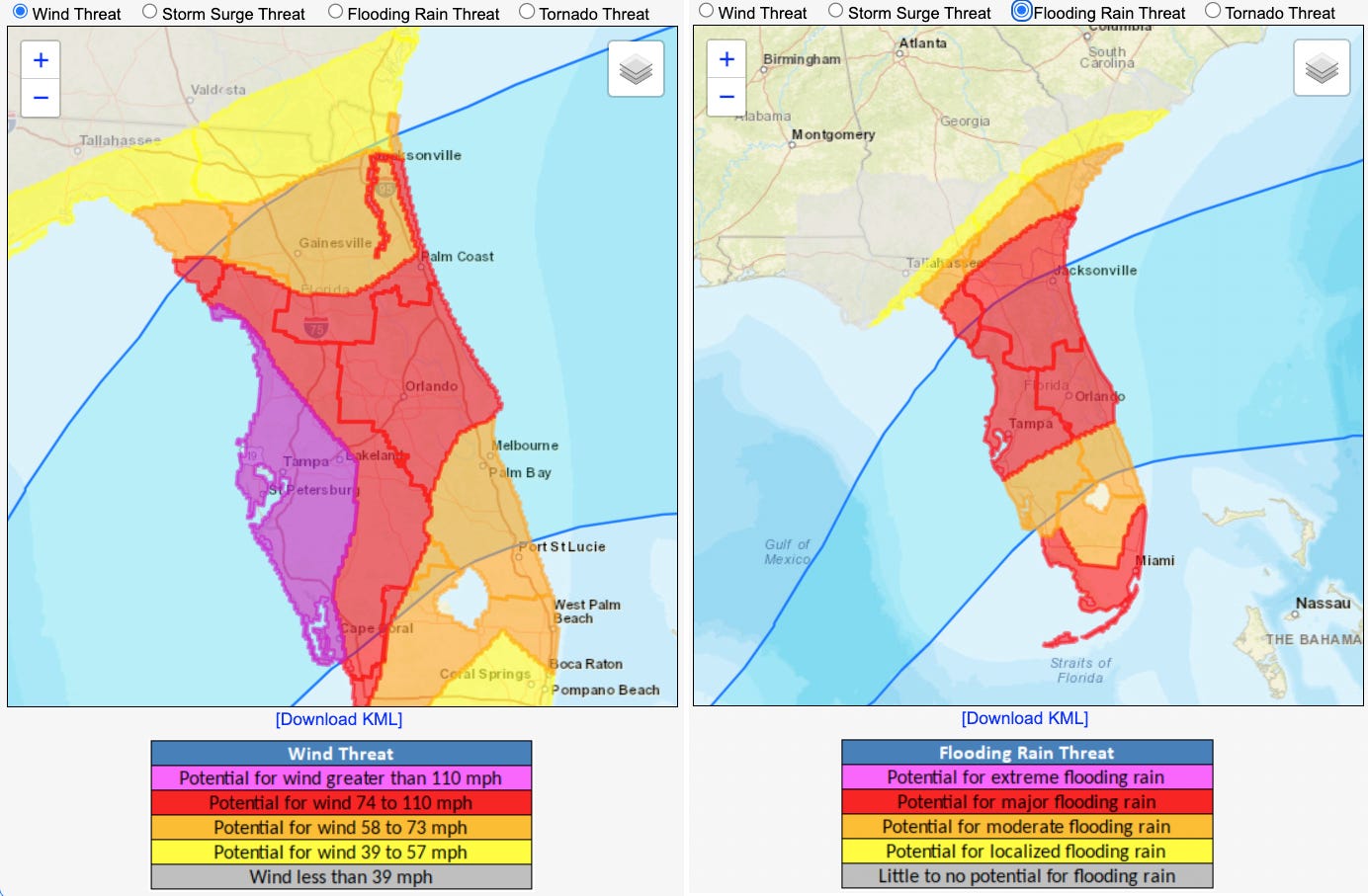
And that means that Central and Southwest Florida need to prepare for the worst. While Milton may well shed a category or two from its maximum sustained winds by late Wednesday as landfall approaches, the shearing influence of the jet streak will also cause the currently diminutive hurricane to expand. I do not expect the hurricane to “weaken” prior to landfall on Wednesday evening, rather to exchange some of its highest maximum winds in order to expand the size of the windfield. Milton won’t be as gargantuan as Helene, but the NHC forecasts hurricane-force winds to extend over an 80-mile swath of the Gulf and tropical-storm-force winds over a 350 mile-wide area immediately prior to Milton reaching Florida, which is larger than an average storm.
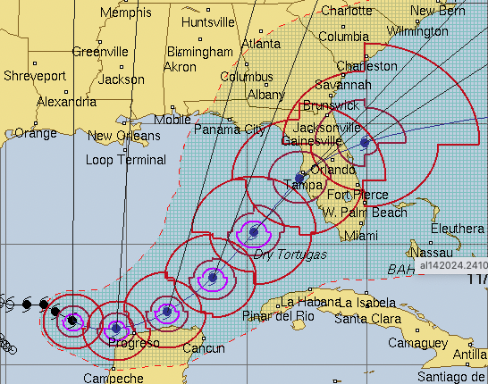
My point is that once you have a Category 5 hurricane, the amount of energy in flux in the atmosphere is so exorbitant that changes in peak windspeed don’t matter to surge impacts. We know Milton will push a wall of water across the southeastern Gulf of Mexico that is certain to slam into the west coast of the Florida peninsula by late Wednesday. Slight shifts in track will make a huge difference in wind and surge outcomes for individual locations that can’t be predicted two days out, but someone is getting the wall. Areas that are north of where the center makes landfall are at risk of destructive winds and flooding rainfall, but the primarily offshore (east-to-west) winds during the peak of the storm will mean limited or no surge, like when Ian or Irma pushed water out of Tampa Bay while passing to the south and east.
It’s the areas along and south of where Milton comes in, especially the areas north of Charlotte Harbor and within 30 to 50 miles of where landfall occurs, that will see onshore winds and storm surge equal to or worse than anything seen in over 100 years. (For Charlotte Harbor south to Marco Island, severe and life-threatening surge of 5-10’ is likely, though that would not exceed Ian’s devastating heights.)
Hard as it is to believe, Tampa Bay and vicinity faces a surge threat beyond Helene’s carnage, itself the worst since 1921. Peak surge values of 5-8’ occurred in the Bay Area in Helene, and the initial NHC reasonable worst case values from Milton are 8-12’+ from Anclote Key to roughly Englewood. Think about the water that poured across coastal Pinellas County and the rest of the west-central Florida barrier islands in Helene, then add another person’s height of water on top of that. Is that something you want to be in the way of? In hurricanes, wind can destroy, but water kills. We just watched this movie. The sequel is worse, as sequels are.
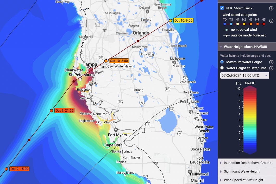
With the model consensus and NHC forecast straddling Pinellas and Hillsborough Counties, hoping that the forecast shifts enough south of Tampa Bay (or Bradenton, or Sarasota) to spare it is not a plan. The only positive I can see to Milton’s incredible strengthening is that a Category 5 hurricane provides the best possible argument and strongest possible motivation to residents of the west-central and southwest Florida coast to heed the evacuation guidance of your local emergency managers.
If you get an order, you need to leave. It’s as simple as that. The cavalry is not coming for you in the eyewall of a major hurricane when you’re in 7 feet of water and pinned to the wall by a fridge, or trying frantically to ax a hole in the darkness of your attic because because surge has reached the second story of buildings, as it did in Tampa’s 1921 hurricane. It happened then. It could happen again this week, or worse.
Think carefully about the last two weeks. Think about your neighbors’ experiences in Helene. Learn from the tragic stories from Fort Myers Beach in Ian. Look with your own eyes at the world around you. Follow your evacuation orders and save your life. If you’re not in an evacuation zone, you don’t need to leave, but it still might make sense to in west-central and Southwest Florida given your personal circumstances and tolerance for life without power.
This forecast has been focused on contextualizing the surge risks to west-central and Southwest Florida, because it’s that exceptional threat that people need to react to right now to protect life and property. Of course, widespread hurricane-force wind gusts across the Florida peninsula, flash-flooding rainfall, and even the possibility of significant Atlantic-side surge north of Cape Canaveral are also severe potential impacts of Milton. I’ll be specifically discussing the surge, wind, and rain impacts for Florida in a forecast video later this evening. In the meantime, today and tomorrow are your days to prepare and if necessary leave west-central and Southwest Florida.
You have two days to make the right choice. Keep watching the skies.
***Monday evening video forecast***


![[Image of cumulative wind history] [Image of cumulative wind history]](https://substackcdn.com/image/fetch/w_1456,c_limit,f_auto,q_auto:good,fl_progressive:steep/https%3A%2F%2Fsubstack-post-media.s3.amazonaws.com%2Fpublic%2Fimages%2F39224aae-c66f-4009-93e0-9f85c95d72a2_897x736.png)
Hi. Live in Punta Gorda. Evacuating tomorrow. Can you please address the actual definition of storm surge level? Everything I look at at from NHC references storm surge above mean sea level but then other graphics refer to feet above ground level. Clarification please. Thanks
Thank you, thank you…a million times…thank you. God bless you for providing such excellent reports, as usual. Over here in Martin we’re going just a little bit crazy because of the unknown factor. I’m putting up the shutters; I don’t trust this thing.