Category 5 Hurricane Beryl Forecast for July 2nd
Beryl is the strongest July hurricane ever. Jamaica, the Yucatan peninsula, and western Gulf Coast should be watching carefully.
This post is outdated. Click here to read our new forecast as of 5 p.m. Friday.
U.S. tropical threat synopsis: Beryl remains no threat to Florida or the eastern Gulf Coast. Odds of have ticked higher since yesterday of possible impacts on the western Gulf Coast; Texas as well as Mexico should be monitoring the progress of Beryl.
Almanac: It’s Tuesday, July 2nd… day 33 of the 2024 hurricane season, 152 days to go. By total storm energy, the season is 2.6%, 8.2%, and 7.3% complete for the Atlantic, continental U.S., and Florida, respectively.
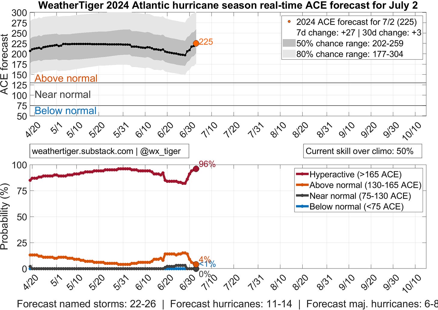
After a brief dip, WeatherTiger’s real-time seasonal ACE outlook has bounced right back to the top of its range as it incorporates observed and forecast ACE from Beryl. The current most likely outcome for the season is about 225 ACE, or about the same as 1995, 2004, or 2017, and significantly trailing only 2005 in the modern era.
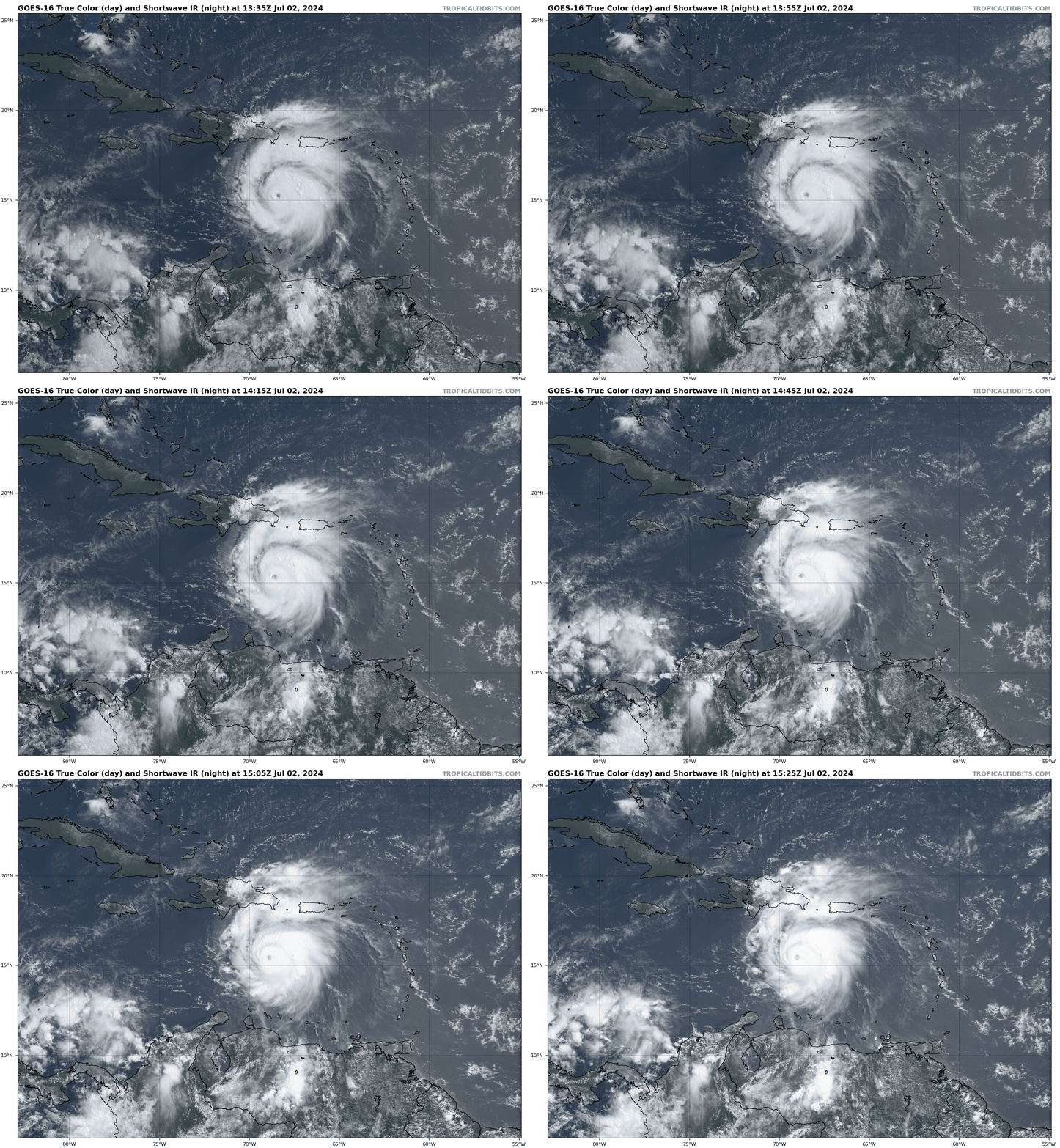
Active storms: As of the 11 a.m. Tuesday NHC advisory, Hurricane Beryl is still a Category 5 hurricane with maximum sustained winds of 160 mph, about 500 miles east-southeast of Jamaica, moving west-northwest at 22 mph. Overnight, Beryl reached Category 5 strength earlier than any hurricane in Atlantic history; it also peaked in intensity higher than any Atlantic July hurricane on record. Truth be told, that maximum wind of 165 mph may even be a bit conservative given some of the dropsonde and tail Doppler radar data from Hurricane Hunters, so we’ll see if that gets revised higher post-season. In any case, Beryl’s head-spinning intensification in the last 36 hours ranks with the all-time heavy hitters of the Caribbean for any time of year, much less early summer.
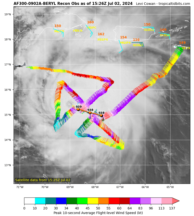
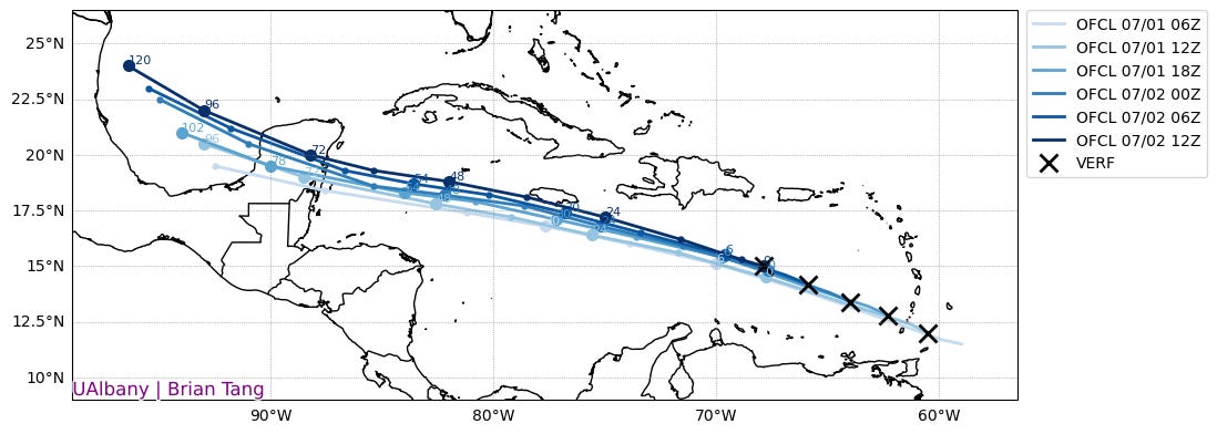
Recent recon passes this morning are finding increasing shear finally starting to do some work against the formidable hurricane, with slightly rising pressures and the eyewall no longer completely closed. Beryl has peaked, will likely shed a couple of categories in the next 24-36 hours as it moves through a region of stronger low-level trade winds and possibly undergoes another eyewall replacement cycle. With Beryl strengthening far more than models predicted, it has jogged more towards the northwest, which has shifted the track much closer to Jamaica than it was yesterday. Beryl is likely to scrape the mountainous coast of Jamaica tomorrow afternoon, which may or may not disrupt the hurricane’s circulation and lead to further weakening.
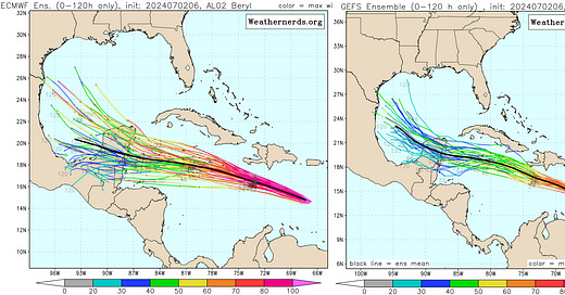
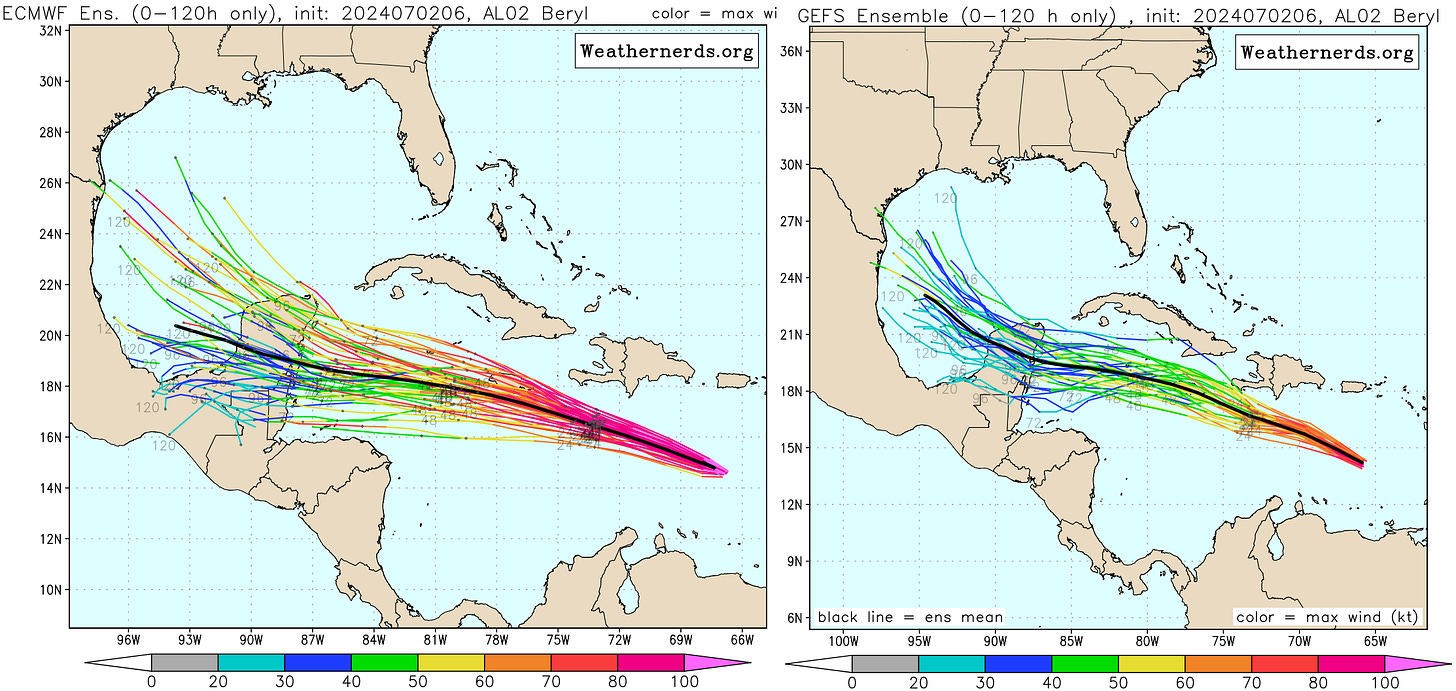
That leads to two potential scenarios down the road. If Beryl is weaker, faster, or more damaged by land interaction, it will likely move westward across the western Caribbean and Yucatan, then continue W/WNW through Central America or the far southern Gulf as a broader and disrupted system. If Beryl moves more north or doesn’t weaken as much passing Jamaica, the steering flow a deeper Beryl would “feel” would likely have more of a northward component in the western Caribbean. This would mean a higher (Cat 1-3) potential landfall intensity on Friday in the Yucatan, likely followed by a WNW/NW track into the west-central Gulf this weekend.
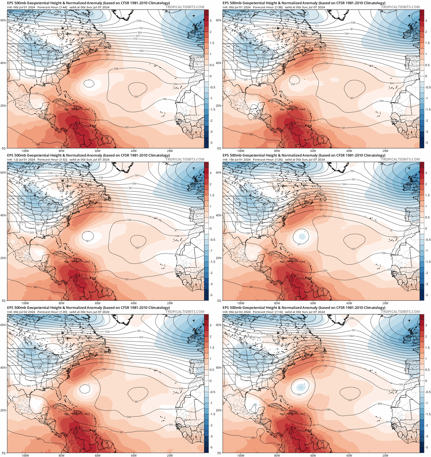
Since yesterday, global models have continued trending towards a faster weakening of the western flank of Gulf Coast ridging and deeper troughing developing in the U.S. Plains over the weekend. If Beryl is far enough north entering the Gulf, it is increasingly plausible that it could be picked up by this trough and turned towards the northern Mexico or even Texas coastline on Sunday or Monday. Overall, I still think a track towards the western U.S. Gulf Coast is less likely than not, given the multiple land and shear obstacles in Beryl’s path over the next 96 hours. Still, the potential is there for a hurricane landfall somewhere on the western Gulf Coast, be it Mexico or Texas. We should start to get a clearer picture of the odds tomorrow evening once Beryl is past Jamaica, and we see how it is coping with 30 knots of shear. Meanwhile, stay tuned; as we’ve seen, nothing can be taken for granted with Beryl.
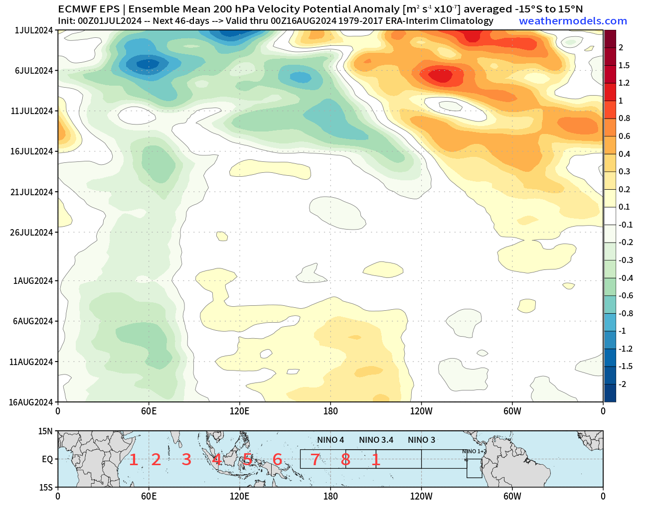
Other disturbances in the NHC tropical weather outlook: Invest 96L is generating modest convection about 600 miles east of the Lesser Antilles. The NHC has a 20% chance of development in the next 2 days before 96L reaches the islands, and a 30% chance over the next 7 days as the wave continues west-northwest into the Caribbean. Beryl’s extreme intensification is likely responsible for the downtrend in 96L’s development odds, as all that rising air has to come down somewhere. Between Beryl’s exhaust and the descending branch of an MJO/Kelvin wave (oranges/reds on the plot below) reaching the Tropical Atlantic, 96L is likely to continue to struggle. That’s very good news as the last thing the Windward Islands need is another wind event.
Given these factors, ensemble support is quite limited for any development from 96L over the next 5 days. It is still worth keeping an eye on the wave when it reaches the western Caribbean late in the weekend, particularly if Beryl is weaker or gets out of the way relatively quickly. But as of now, there is no indication that 96L is a concern.
Elsewhere: No activity. As shown above, the Atlantic should be relatively calm for a few weeks in the wake of Beryl as those unfavorable upper-level winds pass over the Basin.
Next update: Weekly column out tomorrow.

