98° and Rising: Hurricane Watch Weekly Column for July 18th
TS Don swirls in the open ocean as marine heat squeezes Florida like a 19' python.
WeatherTiger’s Hurricane Watch is a reader-supported publication. Paid subscribers get Florida-focused tropical briefings each weekday, plus weekly columns, full coverage of every hurricane threat, our exclusive real-time seasonal forecast model, and the ability to comment and ask questions for $49.99 per year.
On average, the third week of July is the hottest of the year in much of Florida. This is a distinction without meaning in a state where mid-May through late September are indistinguishably miserable, but it may provide some comfort to know that suffering ahead roughly equals suffering behind.
As I often say, there are three kinds of summer and “fall” weather in Florida: hot and wet, hotter and dry, and a third kind that shall not be named. The good news this week is that while we are roasting like Kenny Rogers, at least the dreaded third kind of weather is not a concern at the midpoint of meteorological summer. Thankfully, the Tropics are free of hurricane threats to the continental U.S. or any landmass.
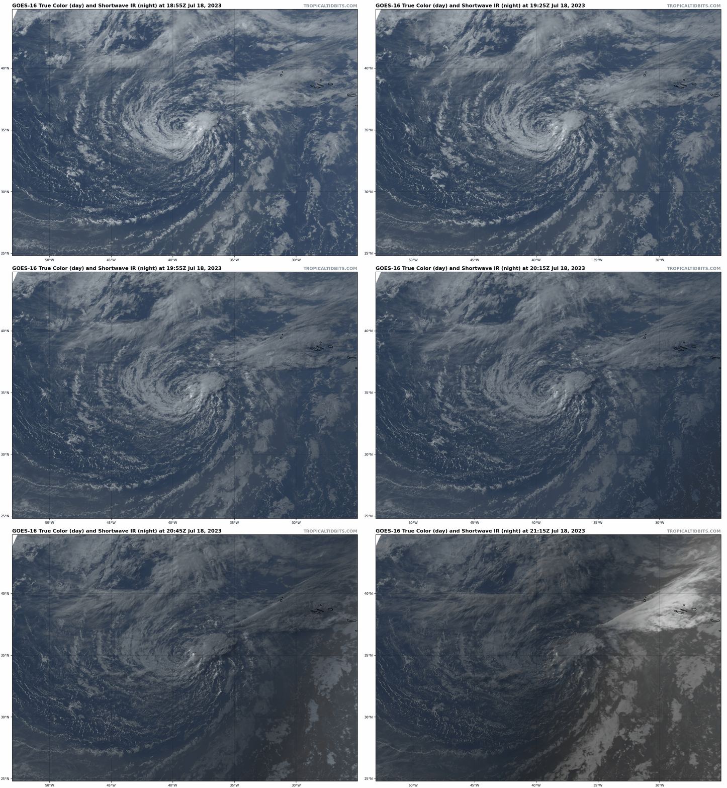
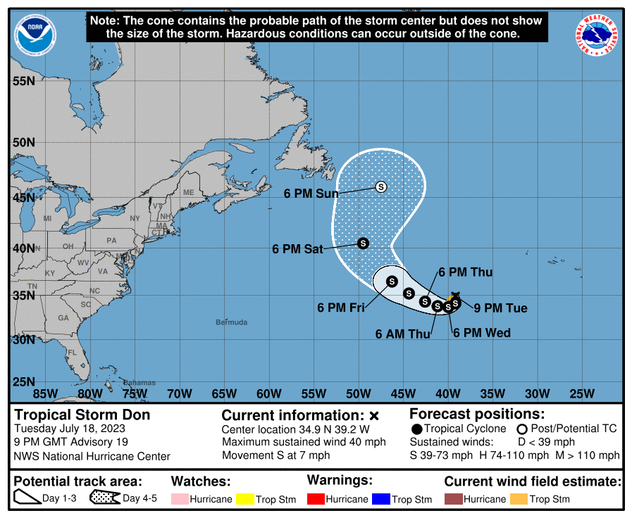
The only named storm out there is Tropical Storm Don, a weak system that has been flitting between depression and minimal tropical storm status this week in the open Atlantic between Bermuda and the Azores. This peripatetic storm may strengthen a bit over the next few days as it completes a loop, but tepid waters should limit intensification until it accelerates north and merges with a front over the weekend. Overall, Don is no threat to anyone, and the right move is to ignore it until goes away.
Elsewhere, tropical development is not expected over the next week. A dry and dusty airmass dominates the eastern Atlantic, unfavorable wind shear rules the western Atlantic and Caribbean, and there’s an especially harsh realm where both overlap in the central Tropical Atlantic. A tropical wave in the eastern Atlantic will swim upstream against these factors over the next eight to ten days and may eventually reach the Gulf or western Caribbean late next week. However, any development, even at long range, is unlikely.
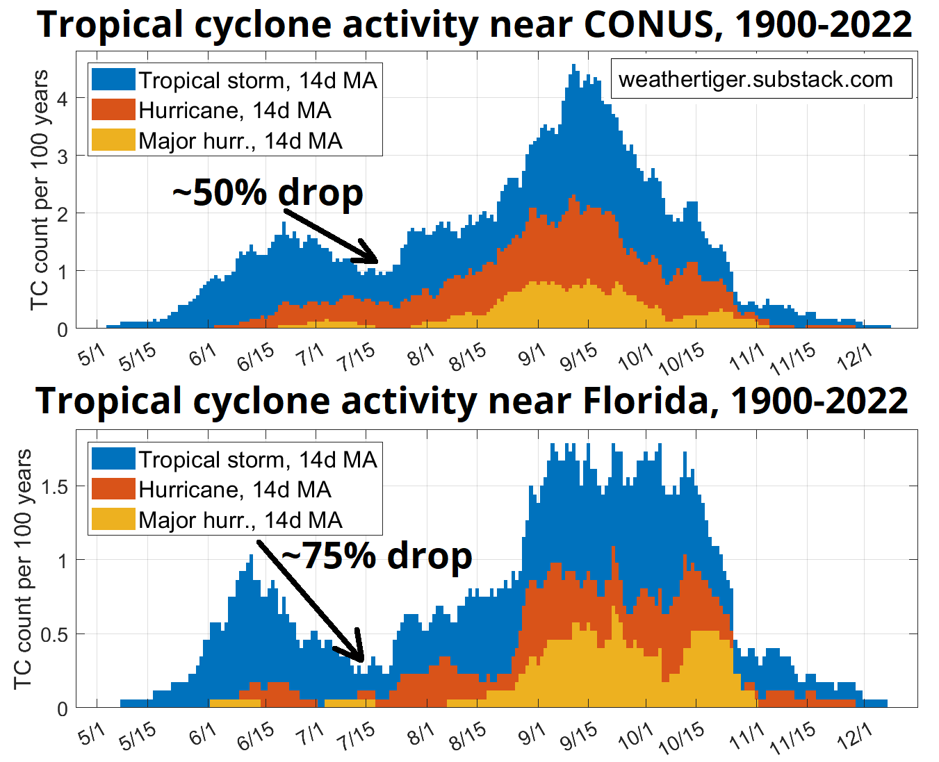
This quiet is normal, as the third week of July also marks the mid-summer nadir of historical U.S. landfall frequency. Storm impacts get a little less uncommon heading into early August, and the risk of a major hurricane really ramps up starting in mid-August.
There’s also not a lot to be gleaned from the relatively busy season so far, with 2023’s five storms producing more Accumulated Cyclone Energy to date than about 85% of seasons since 1950. There is no relationship between either Atlantic hurricane activity or U.S. landfalls occurring before August 1st and how busy the rest of the year is. The correlation coefficients are, quite literally, zero.
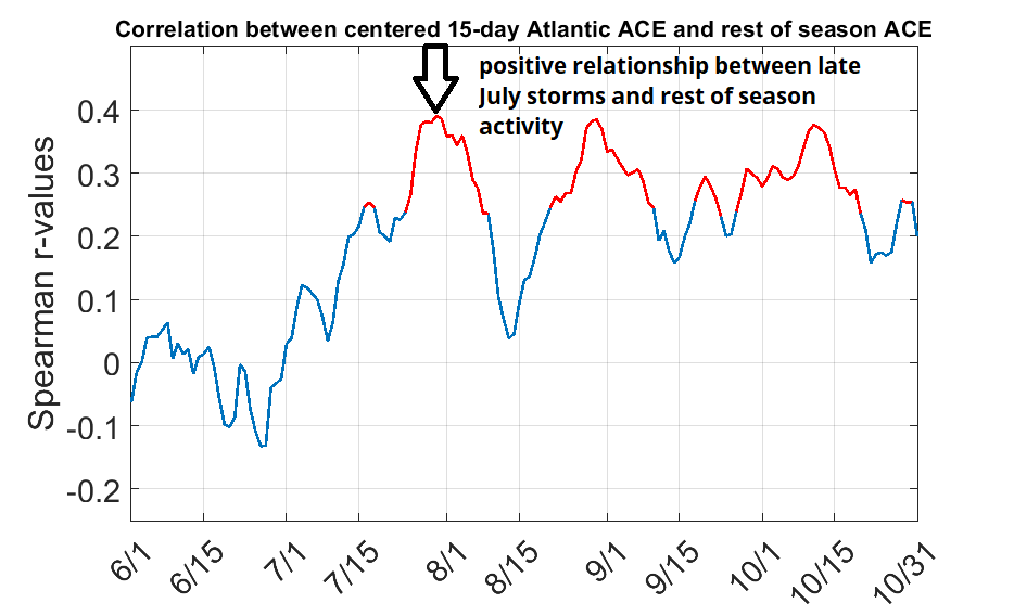
One caveat: there is some indication that a busy late July increases the chance of an active peak season, as favorable upper-level winds now can presage a supportive pattern for development in September. So, if the Atlantic can stay quiet for another few weeks, that would be cautiously encouraging.
And let’s face it, we need a win. While Florida has not seen type 3 weather, this summer has vacillated between unusually wet and hot conditions, both marinated in a mesquite wildfire smoke reduction. Particularly odd has been the lack of easterly trade winds in the southern peninsula, which have Southwest Florida arid and smoldering. This cause of this is persistent troughing along the East Coast, which has kept early season tropical systems well away from U.S. shores, but also trapped South Florida in a meteorological DMZ between the Tropics’ east-to-west winds and mid-latitudes’ west-to-east winds.
As a result of these weak winds, water temperatures near South Florida have soared to deranged heights, running 5 to 10° above normal. Afternoon SSTs have regularly reached the lower-to-mid 90s, with a max at Garfield Bight in the Everglades of a pore-clearing 98.1° on July 12. Note that if the temperature of your Garfield Bight exceeds 98°, go directly to urgent care as you require immediate antibiotics.
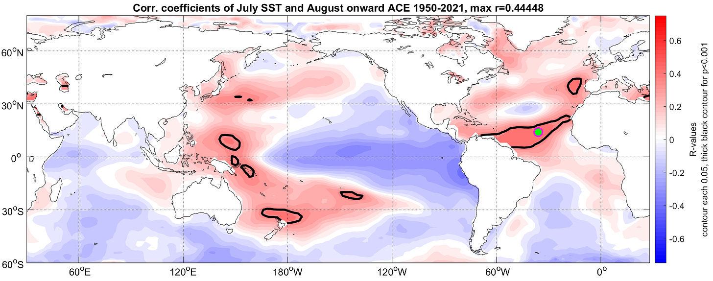
Still, while these record water temperatures are alarming and do contribute to a feedback cycle of weather misery, the eastern Gulf and Florida’s coastal waters are mostly shallow and water temperatures can pivot on a dime. This means that even excessive near-shore July SSTs have little historical bearing on how busy the hurricane season ahead will be. Far more important are water temperatures in the eastern Atlantic, as I’ll discuss in WeatherTiger’s updated seasonal outlook in two weeks. (Next week, look for a tour of the various eras of Atlantic hurricane history1.)
So, while America’s Bathtub is bathtubbing to an unprecedented degree and causing David Lee Roth levels of heat craziness, at least that doesn’t necessarily mean that landfalling hurricanes are waiting in the wings. There is sunshine after the rain, so keep watching the skies.
Meet me at midnight.


