What's in a Name?: WeatherTiger's Hurricane Watch for June 3rd
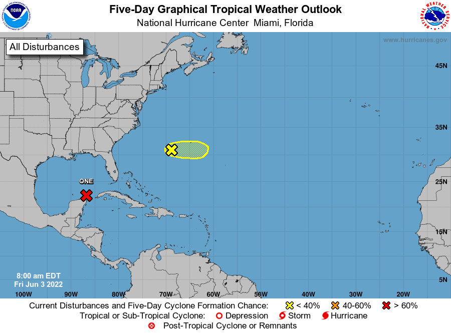
Potential Tropical Cyclone 1 is on approach to South Florida with heavy rain in tow.
If you are not already a supporter and would like continued comprehensive coverage of the 2022 hurricane season, please consider signing up for a paid subscription. You’ll get Florida-focused daily tropical briefings like this one each weekday, plus weekly columns, full coverage of every U.S. hurricane threat, our exclusive real-time seasonal forecast, and the ability to comment and ask questions, all for $7.99 per month.
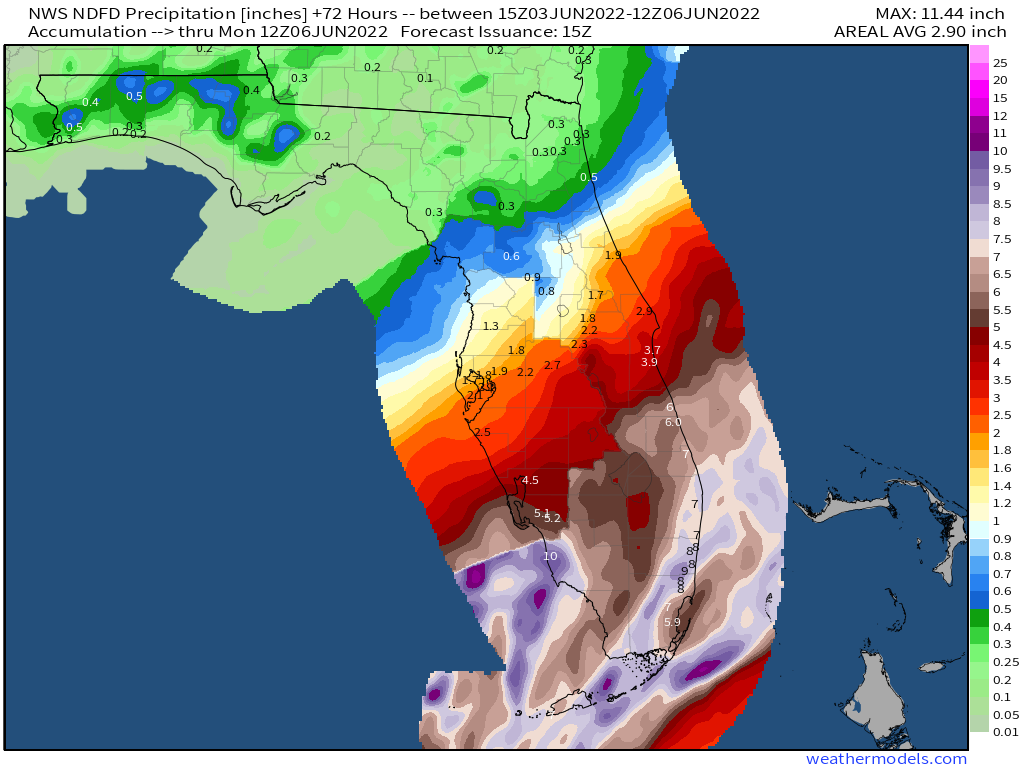
Florida tropical threat synopsis: Potential Tropical Cyclone 1, likely to be Tropical Storm Alex, will cross South Florida on Saturday. Watch for flash flooding potential south of Lake Okeechobee, especially in urban South Florida where 4-8” is likely.
Almanac: It’s Friday, June 3rd… day 3 of the 2022 hurricane season, with just 180 days to go. By total storm energy, the season is 0.8% complete as a whole, 0.9% complete for the continental U.S., and 0.7% complete for Florida. The only historical landfall on this date was an unnamed tropical storm that crossed the NC Outer Banks in 1963.
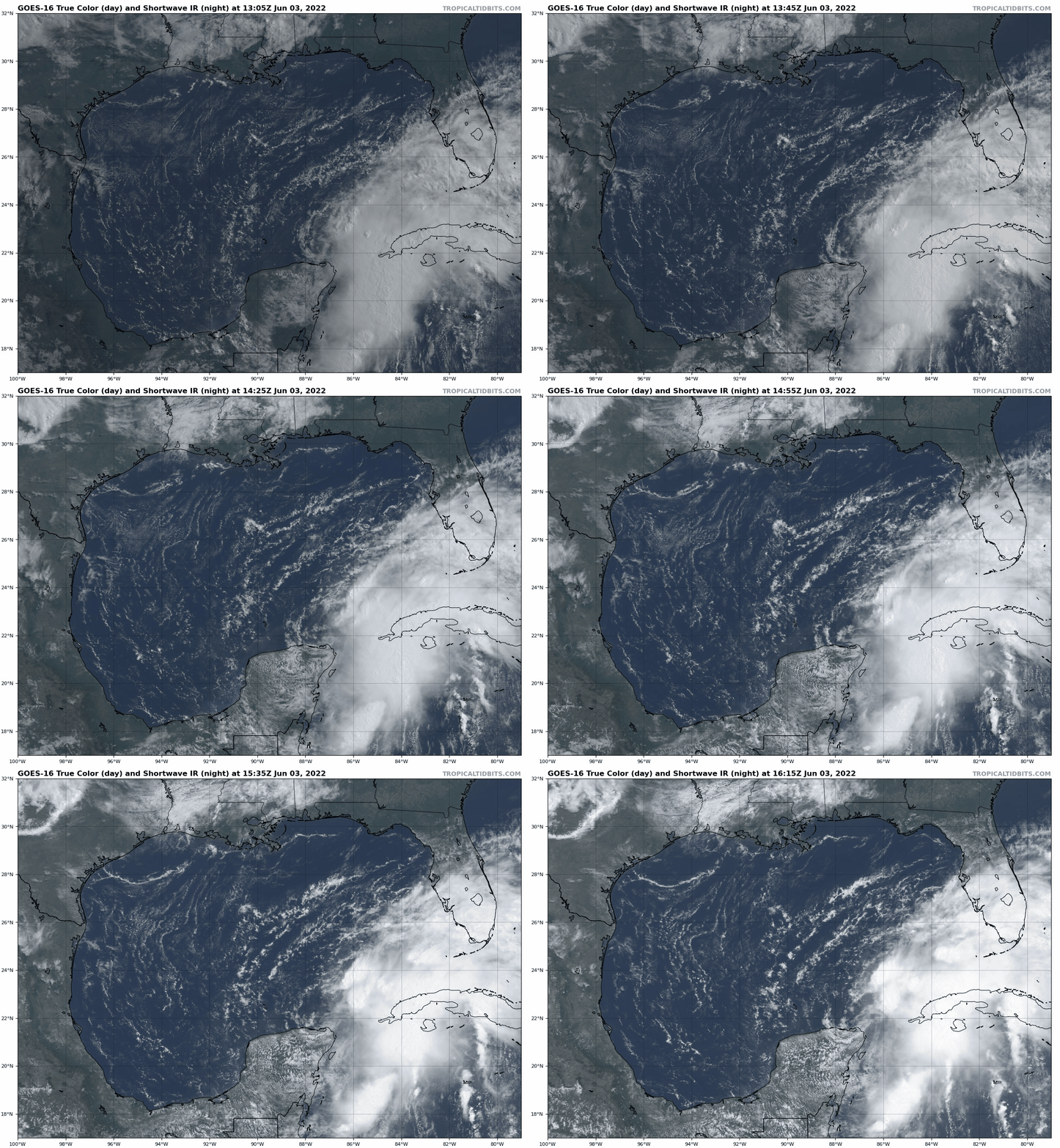
Active Storms: Potential Tropical Cyclone 1 is on the brink of becoming Tropical Storm Alex as of early Friday afternoon, with just a slight increase in organization needed for the system to receive a name. Whatever it is called, however, rainfall impacts on Florida are underway and will continue over the next two days.
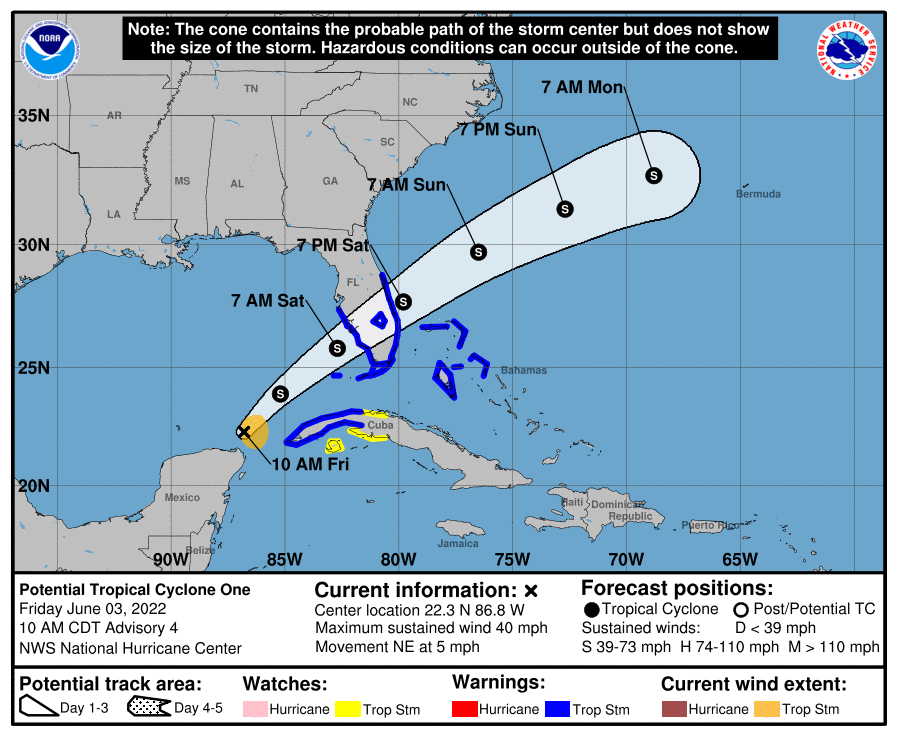
After meandering the far southern Gulf for the last 24 hours, the system is now beginning to track northeast towards Florida at 5 to 10 mph and will do so into Saturday, plus or minus possible reformations of the surface circulation. Sustained winds are around 40 mph in squalls east of the center. As expected, westerly wind shear of 30 to 40 knots is displacing all inclement weather well into the eastern half of the storm, and also means that only incremental strengthening is possible before the system reaches the Southwest Florida coast early Saturday.

The “potential tropical cyclone” designation allows the National Hurricane Center to issue advisories and warnings before a system is formally named. Thus, Tropical Storm Warnings wrap around the southern half of the Florida peninsula from just south of Tampa Bay to Cape Canaveral, including the Keys. Intermittent coastal wind gusts of 40 to 50 mph are likely in this area from the overnight hours into Saturday afternoon, with occasional inland gusts into this range in squalls.
Storm surge of 1-2’ above normal high water is expected from roughly Port Charlotte to the Keys. There is also a risk of fast-developing tornadoes in bands south and east of the track, so keep means of receiving emergency weather warnings on hand in South Florida tonight and tomorrow.
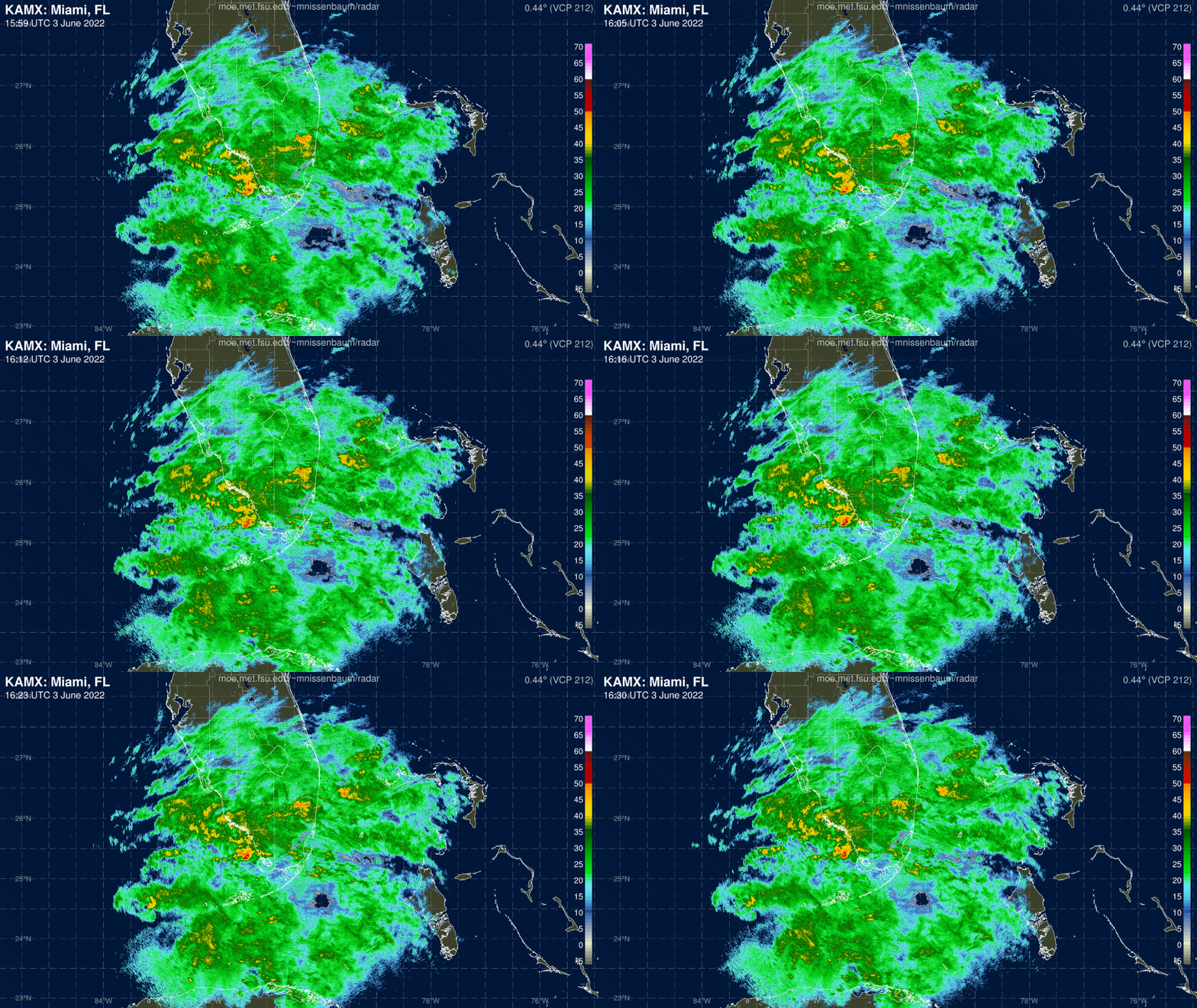
The most significant impact continues to be excessive rainfall and flash flooding potential in the southern third of Florida. Steady, moderate precip has begun for the southern peninsula and will continue with interspersed tropical downpours through mid-day Saturday in southwest Florida and Saturday afternoon in metro South Florida. Expected rainfall totals are steady since yesterday at 4-8” (locally 10”) south of Lake Okeechobee, and a patchier 2-4” north from there into Central Florida.
Such accumulations mean a moderate risk of flash flooding in South Florida and a slight risk in south Central Florida from late Friday into Saturday, and Flood Watches are in place for the Space Coast and south. Again, particularly if you are in a low-lying or flood-prone area in this region, have a way of getting real-time weather warnings and a plan to activate if you receive a Flood Warning.
Overall, Florida will go on the board for 2022 with a typically wet and messy early-season tropical storm landfall this weekend. Keep aware of the tornado and especially flood risks south of I-4.
Other disturbances in NHC outlook, with 2-/5-day NHC development odds:
Invest 92L (10/10%): A small low south of Bermuda has popped a few thunderstorms near a weak surface center this morning, but shear means it is unlikely to organize further as it moves east away from land.
Elsewhere: Nothing of note.
Next report: Barring any unexpected changes to the forecast, I’ll have a wrap-up of PTC 1/Alex on Monday. You can follow WeatherTiger on Twitter or Facebook for short updates as the storm slogs ashore.


