WeatherTiger's Tropical Storm Sara Update for November 14th
TS Sara is likely to spend most of its time near or over land, probably limiting eventual Florida impacts to increased rain chances.
Florida and continental U.S. tropical threat synopsis: Tropical Storm Sara will move near or over Central America through the weekend, which diminishes risks of non-rainfall impacts to Florida next week.
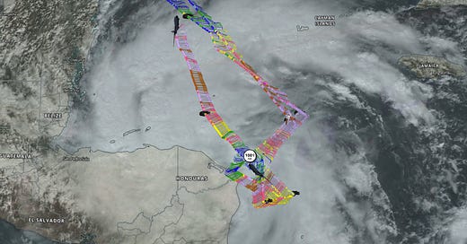
Almanac: It’s Thursday, November 14th… day 166 of the 2024 hurricane season, 17 days to go. By total storm energy, the season is 96.9%, 99.4%, and 98.8% complete for the Atlantic, continental U.S., and Florida, respectively.
With Rafael just carrying the 2024 season past the 159.6 ACE unit threshold NOAA uses to define a hyperactive hurricane season, it remains to be seen if newly-formed Sara will carry us much further into that territory. If the season ended today, it would have been more active than about 85% of years since 1950.
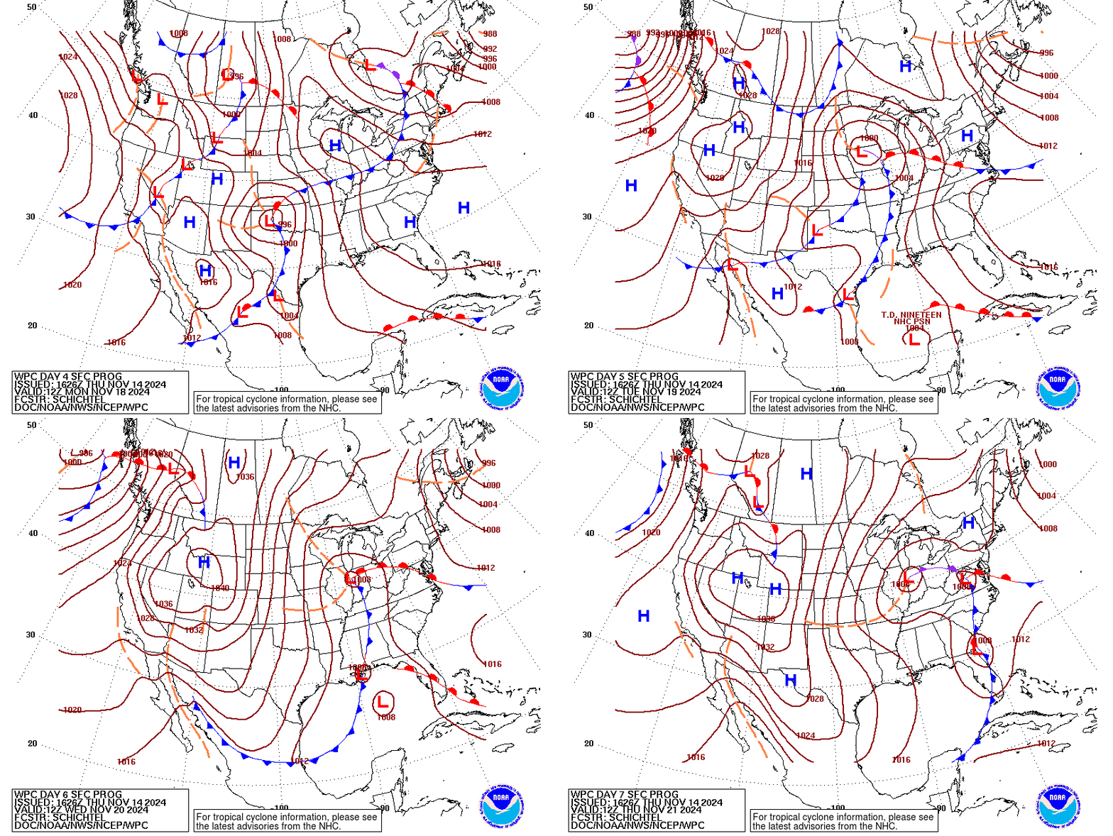
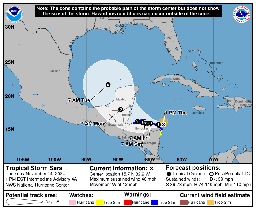
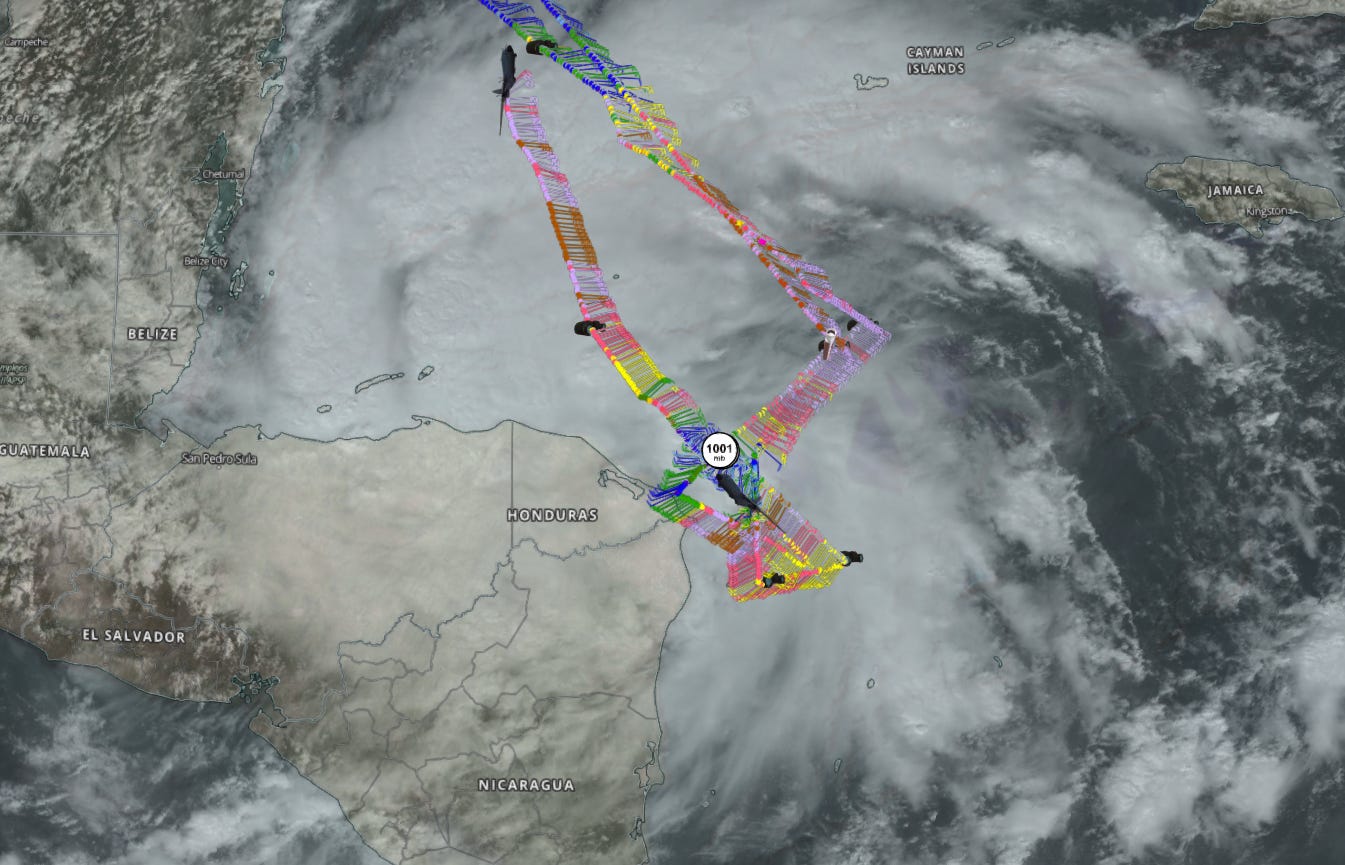
Active storms: The good news is that Tropical Storm Sara is significantly less likely to run up the ACE score than it looked to be just 24 hours ago. Sara is currently located just east of northeastern Honduras, with sustained winds around 40 mph. An Air Force Hurricane Hunter investigating the storm has found the center to be quite close to the coast and still moving west at around 10 mph, and it looks likely that Sara will begin scraping the northern coast of Honduras tonight.
With the surface circulation of Sara developing farther south than most models suggested and a slightly stronger ridge to its north pushing it west more quickly, the storm is clearly following the favored scenario I laid out yesterday, in which Sara spends much or most of the next four days over or very near land as it stalls or drifts westward. This is a huge relief for Florida, as ample separation from Central America could have resulted in a strong hurricane, given the favorable shear, moisture, and SST environment. Of course, all those factors are moot if the center of circulation is over or very close to land.
In the short term, an on- or near-shore path means major heavy rainfall concerns for Honduras, particularly in the north-central mountains where 15” or more is possible. While Sara is not expected to strengthen above moderate tropical storm intensity through the weekend, persistent heavy rainfall as those mountains wring out tropical moisture is expected to cause mudslides and flash flooding in a region where Hurricane Eta caused devastating floods four years ago. After several days of meandering along the northern coast of Honduras, northwest movement is likely to pick up again on Sunday into Monday, and Sara will then cross the Yucatan. Rain totals should be more manageable in Belize and Mexico.
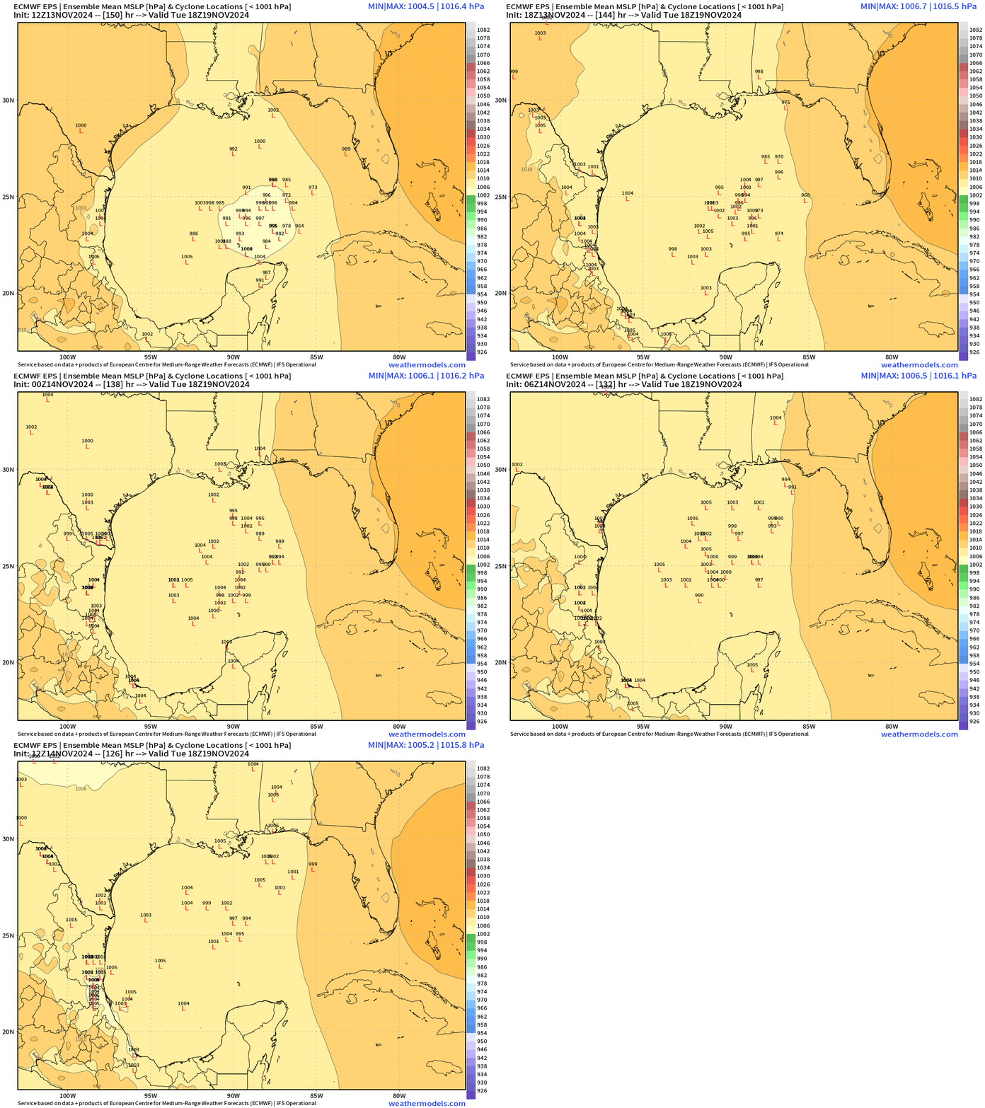
This westward and southward shift means Sara will also spend quite a bit of time over the Yucatan peninsula, so whatever makes it into the southern Gulf on late Monday or early Tuesday is likely to be quite broad and more of a surge of moisture than anything else. What’s left of Sara will sweep northeast across the Gulf on Tuesday ahead of a front, reaching Florida by Wednesday. At this point, there’s little to no chance of the high-end scenario that some models were showing earlier this week of a strong hurricane targeting South Florida.
Sara could hang on as a tropical storm, or more likely be a frontal wave or non-tropical low as it races towards North or Central Florida midweek, but almost certainly its main impact will be needed rainfall, potentially accompanied by severe weather ahead of the front. I’ll keep watching Sara in case the situation changes again, but as of now, the risks to the state have lessened considerably since yesterday.
Disturbances in the NHC tropical weather outlook: None.
Elsewhere: Nothing else of note.
And finally, mood music:
Next update: Tomorrow, early afternoon.



![[Image of rainfall potential] [Image of rainfall potential]](https://substackcdn.com/image/fetch/w_1456,c_limit,f_auto,q_auto:good,fl_progressive:steep/https%3A%2F%2Fsubstack-post-media.s3.amazonaws.com%2Fpublic%2Fimages%2Fce1fae1a-b3ae-4232-a89a-780f223497de_2064x1384.png)
Doc, mood music is so fitting...maybe even Hall and Oates' "Sara Smile" if even better news in a few days! Thanks so much for these updates.
Dr. Ryan,
I thought you'd like to know that in today's paper (11/14), the Sarasota Herald Tribune published your article from yesterday and included an image labeled "Exclusive Accuweather Forecast Tropical Eye Path" which shows Sarah's path curving into South Florida as a Cat 2 Hurricane by Wednesday 2PM. That's a clearly inaccurate image that totally misrepresents what you said yesterday (and today) only for the purpose of scaring people. Were I you, I would object to Sarasota Herald Tribune for misrepresentation of your article!