WeatherTiger's Tropical Storm Sara Update for November 15th
Sara is no longer a hurricane threat to Florida, though its remnants will likely contribute to midweek thunderstorms across the state.
WeatherTiger’s Hurricane Watch is a reader-supported publication. Paid subscribers get Florida-focused daily tropical briefings, plus coverage of every U.S. hurricane threat, our exclusive real-time seasonal forecast model, and the ability to comment and ask questions.
Florida and continental U.S. tropical threat synopsis: Tropical Storm Sara is expected to merge with a cold front next week, enhancing mid-week thunderstorm activity driven by a cold front. Severe weather is possible late Tuesday into Wednesday in Florida and elsewhere in the Southeastern U.S.
As it turns out, no, we don’t have to go through all of this again.
Tropical Storm Sara has developed on schedule in the western Caribbean and will tussle with Central America through the weekend, preventing further strengthening. Hurricane landfall risks for the Gulf Coast have subsided, with Sara’s leftover moisture simply enhancing Florida’s thunderstorm threat from a potent cold front in the middle of next week.
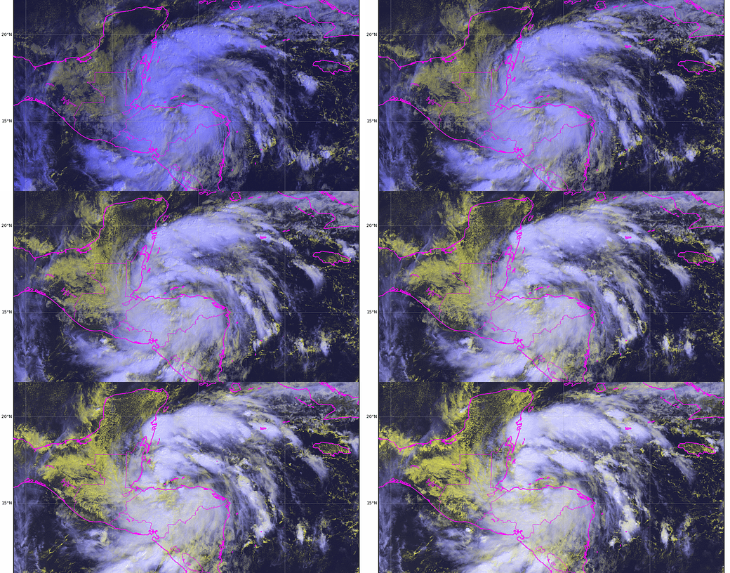
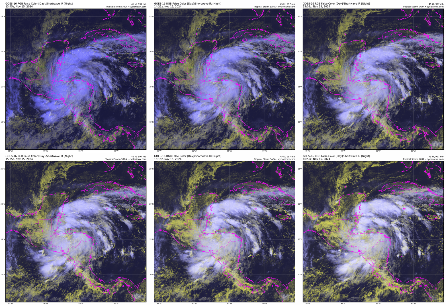
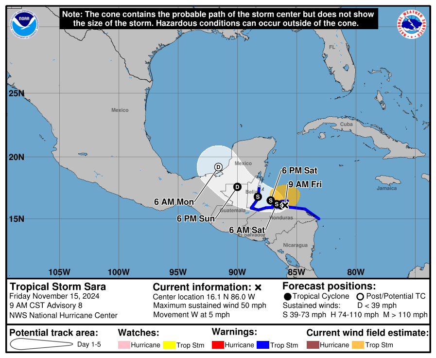
Sara is currently located near the northern coast of Honduras, with sustained winds of around 50 mph. As expected, its forward motion has slowed to a crawl as steering currents weaken. Sara will resume moving west-northwest this weekend, taking it over the Yucatan peninsula, and its center of circulation will thus remain continuously over or very close to land through Monday. That means any additional intensification in the next few days should be minimal.
That land interaction is a disaster in the making for Central America, where severe flooding is already ongoing in Honduras and an additional 10-20” or more of rain is probable through Monday. Central America is taking a heavy hit for Florida; Sara’s structure is impressive for a storm interacting with land, and if it was centered two hundred miles east-northeast of where it is, Sara likely would be intensifying into a powerful hurricane right now.
But it isn’t. Now that Sara’s low-level circulation center has formed, there is less uncertainty in the forecast going forward. With the tropical storm developing on the western side of the broad incipient gyre and interacting with mountainous landmasses through early next week, don’t look for much to be left of Sara when it emerges into the southwestern Gulf of Mexico on Monday. The NHC is calling for Sara to be a dissipating remnant low at that point.
If Sara was going to track east of the Yucatan peninsula, it would have found favorable conditions for maintaining hurricane strength in the southeastern Gulf early next week: low wind shear, ample mid-level moisture, and abnormally warm ocean temperatures. Mashed up against the approaching cold front northwest of the Yucatan however, what’s left of Sara will instead be highly sheared, so significant re-strengthening in the Gulf is unlikely.
It’s not totally impossible that Sara could hang on to its name as it races northeast across the Gulf on Tuesday, particularly if it ticks a bit further east or gets a little stronger than anticipated before reaching Belize. More likely, Sara’s remnants will no longer have their own distinct circulation, with its residual rotation and tropical moisture merging with a strong front moving east across the Gulf Coast and Deep South on Tuesday.
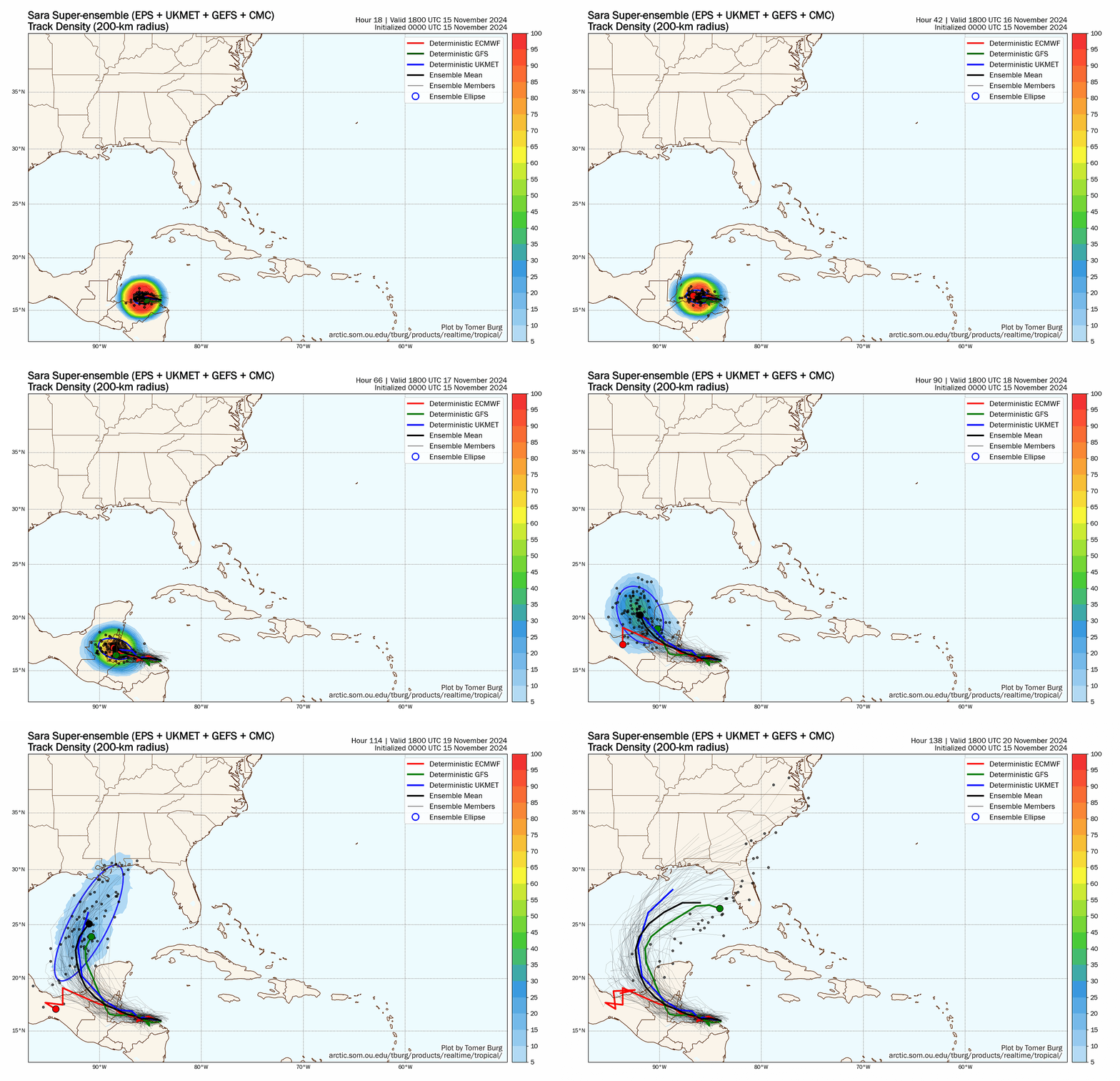
This is definitely a case where looking at the “spaghetti” is misleading. The handful of models and ensemble members that continue to have Sara as a trackable, distinct entity into the middle of next week plot a path towards North or Central Florida, but the clear consensus of guidance has Sara dissipating as a tropical cyclone on Monday over Mexico. Don’t let pasta lead you astray. Meteorology’s messy reality is more complicated than colorful dots and lines on a map.
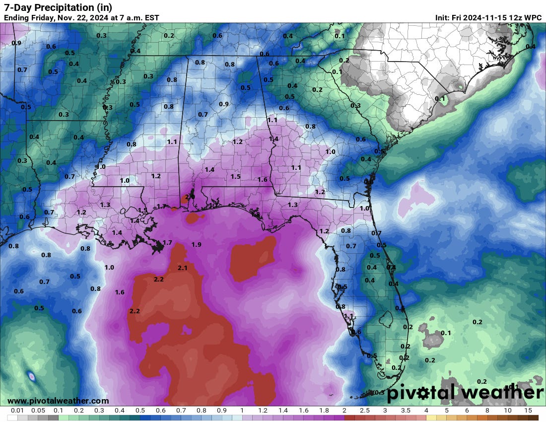
Instead, Sara’s leftovers will juice thunderstorm activity along the cold front. Look for a line of heavy rain and storms to move east across the Panhandle late Tuesday or early Wednesday, and continue to advance south and east across the Florida peninsula during the day on Wednesday. It is too early to get into specifics, but embedded severe thunderstorms are a concern, particularly the risk of gusty winds along the convective line. Rain totals in the Panhandle may be a helpful 1” or more, probably a little lower than that for the peninsula.
It will also be quite windy across Florida and the Southeast in the wake of the cold front on Thursday, as a waylaid infusion of fall pours across the state. This cool, dry airmass will plunge south across the Gulf and into the Northwestern Caribbean by late next week, which will finally put an end to any further risk of tropical activity threatening the continental U.S. this year.
And so, with that, I’ve run out of excuses to not take my patio furniture out of the garage, where it’s been since before Helene. (Purportedly out of foresight, actually out of laziness.) Unless the prognosis for Sara changes dramatically over the next few days, this column is a season wrap on WeatherTiger’s coverage of the myriad hurricane threats of 2024. I’ll be back at the end of the month with a year-in-review discussing all the tropical punishment doled out in this exhausting year. In the meantime, enjoy the heretofore unknown weather phenomenon known as “seasons,” and keep watching the skies.
Next update: Updates on Sara or its remnants will continue each weekday for paid supporters through at least Wednesday.



![[Image of rainfall potential] [Image of rainfall potential]](https://substackcdn.com/image/fetch/w_1456,c_limit,f_auto,q_auto:good,fl_progressive:steep/https%3A%2F%2Fsubstack-post-media.s3.amazonaws.com%2Fpublic%2Fimages%2Fefe875a0-2222-4132-8849-f8af0d3ec11c_3235x2234.png)
Hey Doc if I lived near Tallahassee I’d be happy to come over and help you with the patio gear. But Naples is a bit too far away. Thanks for staying on top of things this season. Hopefully next year you can give us more mood music and less storm prognostication.
Thank you for your daily updates this season. It was reassuring to know we had a source of information that wasn't hyped or exaggerated. Have a restful off-season and looking forward to hopefully a quieter season for 2025.