Twin Peaks: Hurricane Lee Update for September 11th
On the peak date of hurricane season, Major Hurricane Lee is growing increasingly likely to have impacts on eastern New England next weekend.
Enjoy this sample of WeatherTiger’s daily tropical bulletins, just one of the benefits of being a paid supporter of the Hurricane Watch. Sign up here to receive these forecasts each weekday.
Florida tropical threat synopsis: Hurricane Lee will pass over 600 miles east of Florida in 2 or 3 days. There will be no wind or rain impacts on the state, but heavy surf and beach erosion will persist along the East Coast this week. No other threats to Florida this week.
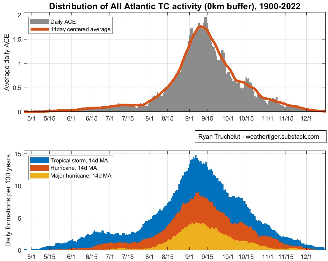
Almanac: It’s Monday, September 11th… day 102 of the 2023 hurricane season, 81 days to go. By total storm energy, the season is 47.5%, 58.3%, and 49.7% complete for the Atlantic, continental U.S., and Florida, respectively.
There are several ways to define the “peak” of hurricane season— in terms of total Accumulated Cyclone Energy (ACE), U.S. ACE, and Florida ACE, the season is 50% done on September 12, 6, and 11, respectively. In general, in both landfall and overall terms, the week from September 7-13 has the highest overall level of activity of the year. Climatologically, today is as good a day as any to note being halfway done with hurricane season, so we will.
Active Storms:
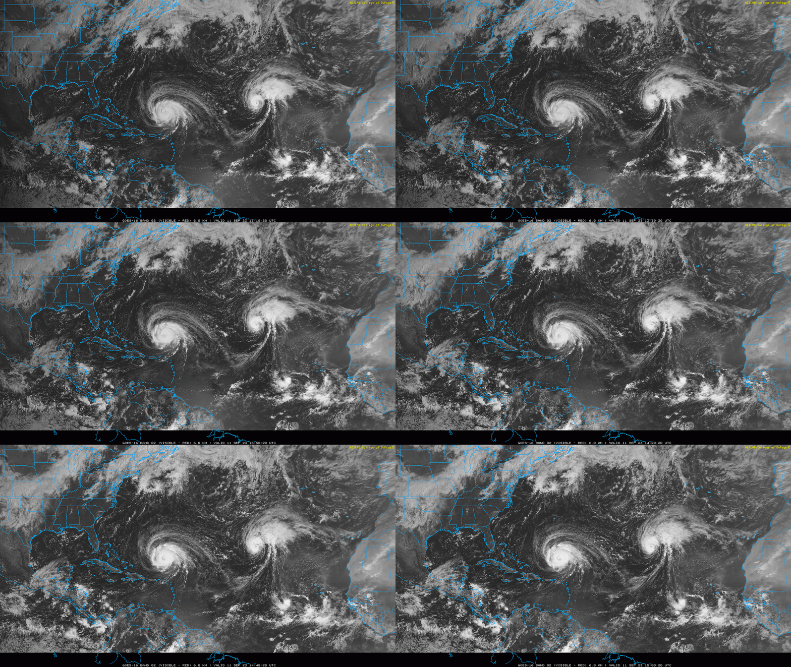
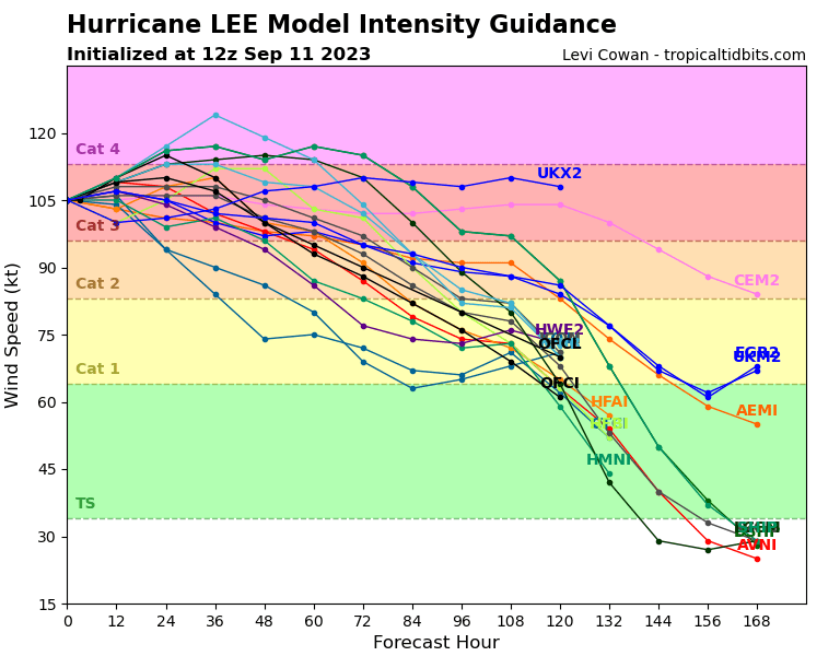
Hurricane Lee has been vacillating in intensity over the weekend, falling from a Category 5 on Friday to a 2 on Saturday due to shear, and rebounding to a Category 3 hurricane yesterday. Today, reconnaissance aircraft are indicating a clear double wind max, twin peaks that are likely indicative of an eyewall replacement cycle underway. This should bring down the maximum sustained winds in the near future, though at the cost of continuing to expand the size of the hurricane. Lee may make one more push for Category 4 status tomorrow, as shown in the 11 a.m. NHC forecast, before sustained winds decline and the storm continues to grow on its path north.
As expected, Lee has started to slow in anticipation of that mid-week turn north. There is no change to the forecast through Friday, with Lee turning north to the east of 70W. Lee continues to pose no risk to Florida of any wind or rain impacts. High seas of 5-10' and strong rip currents will cause beach erosion issues along Florida’s Atlantic coast into the weekend. Lee will pass west of Bermuda on Thursday and Friday as it tracks due north, but tropical-storm-force winds are likely there as gales will extend 250 miles away from the center or more.
As Lee accelerates north into the weekend, a complex interaction between an existing front offshore New England, high-latitude ridging in the North Atlantic, and an approaching trough over the Great Lakes will determine whether Lee tracks north-northwest, due north, or north-northeast on final approach to eastern New England or Atlantic Canada. As of this morning’s model runs, the likely orientation of the stalled front and the process of Lee becoming an extra-tropical storm is tilting odds towards less eastward motion north of 40N. Particularly given that rain and wind impacts may extend 300-400 miles west of the center next weekend, chances are increasing that eastern New England (Maine, Rhode Island, Eastern Massachusetts, New Hampshire) will see impacts from Lee. New Brunswick and Nova Scotia are also very likely to see rain and wind, with much lower odds of significant impacts in western New England or the mid-Atlantic.
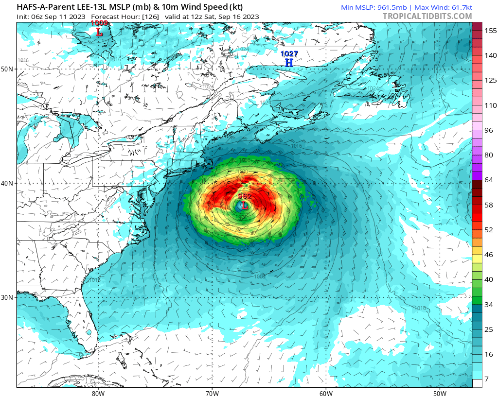
HAFS-A showing Lee with tropical-storm-force wind radii (green) of 300 miles on Saturday morning, but maximum winds of barely hurricane force. There is still quite a bit of time left for the track of Lee to shift before it may approach eastern New England, and these shifts will determine how far west Lee’s rain and wind get. But keep in mind that landfall point won’t be particularly important due to the massive size of Lee in 5-7 days, and the fact there won’t be much of a tropical core left by “landfall.” Bottom line, Lee is increasingly likely to have impacts on the far northeastern U.S. Saturday and Sunday. Stay tuned.
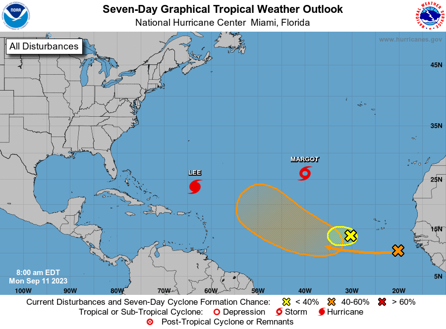
Tropical Storm Margot is almost a hurricane this morning as it pivots north into the open Atlantic. Margot is likely to become an hurricane in the next 36 hours, and will stall out over the subtropical Atlantic in 3-4 days. The hurricane will likely meander far from landmasses into next week, but is no threat to anyone.
Other disturbances in NHC outlook, with 2-/7-day NHC development odds:
Invest 97L (eastern Tropical Atlantic): A tropical wave that briefly showed some signs of organization over the weekend has diminished this morning. NHC has a 10% chance of short-term development, but 97L will not amount to anything on its own.
Far eastern Tropical Atlantic: Another wave just emerging from West Africa today isn’t much to behold, but does have a large area of low-level turning and will likely fold what’s left of 97L into itself in 2-3 days. Shear and moisture parameters look favorable for slow development of a tropical depression in the Main Development Region in 4-7 days. The northern Lesser Antilles should keep an eye on this one for a possible threat in the middle of next week.
Elsewhere: No other features of note in the Atlantic today.
Next report: Weekly column out tomorrow afternoon.
Also, tomorrow evening at 7 pm, I will be presenting a webinar on WeatherTiger’s expectations for the rest of hurricane season via the American Meteorological Society. Registration is free and the link is below:
https://us06web.zoom.us/webinar/register/6316940222215/WN_yhHWMnmZR5uajTGJuLX3Aw#/registration
Hope to see you there! Originally I was supposed to do this on the evening of August 29th, but I turned out to be a little preoccupied that night.



Just FYI, the Barron River in Everglades City is 93.4 F just now.