Tropical Storm Francine Update for September 9th
Francine has formed in the Gulf, and a mid-week hurricane landfall in Louisiana is likely.
WeatherTiger’s Hurricane Watch is a reader-supported publication. Paid subscribers get Florida-focused daily tropical bulletins, plus weekly columns, full coverage of every hurricane threat, our real-time seasonal forecast, and the ability to comment on posts. Paid supporters will receive an exclusive morning forecast tomorrow with overnight developments on Debby.
Florida and continental U.S. tropical threat synopsis: Francine will bring heavy rainfall, plus surge and wind impacts this week to the western and central Gulf Coast. It will likely reach Louisiana as a hurricane by early Thursday. Impacts in Florida will be limited to outer rainbands. There are no other U.S. tropical threats on the map.
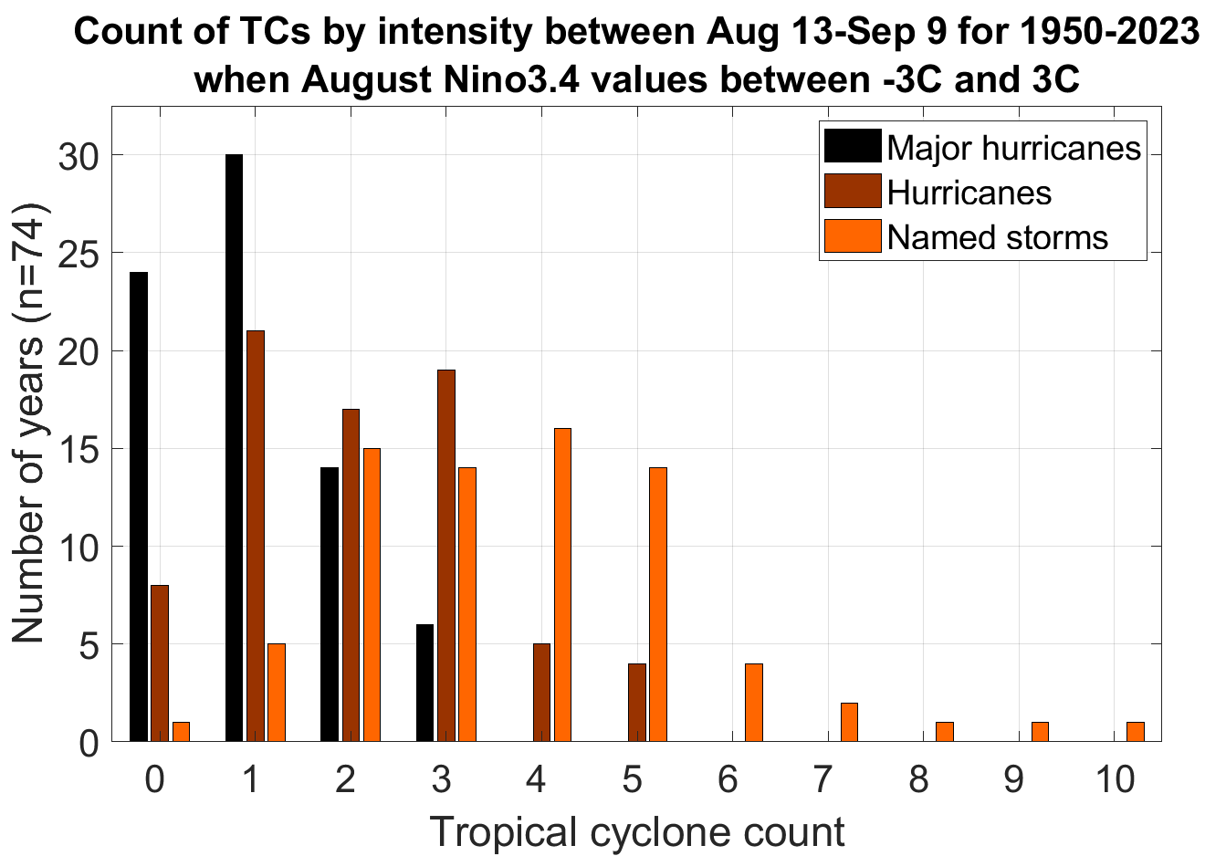
Almanac: It’s Monday, September 9th… day 101 of the 2024 hurricane season, 82 days to go. By total storm energy, the season is 43.5%, 54.4%, and 43.3% complete for the Atlantic, continental U.S., and Florida, respectively. Francine is the first named storm to develop since Ernesto on 8/12. Only one other hurricane season (1968) saw no storms develop between 8/13 and 12z on 9/9; typically, this period sees 3-5 named storms, 2-3 hurricanes, and 1-2 major hurricanes.
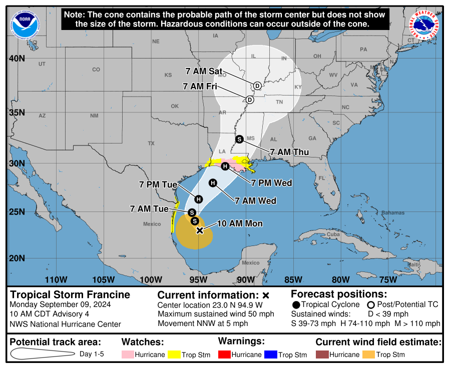
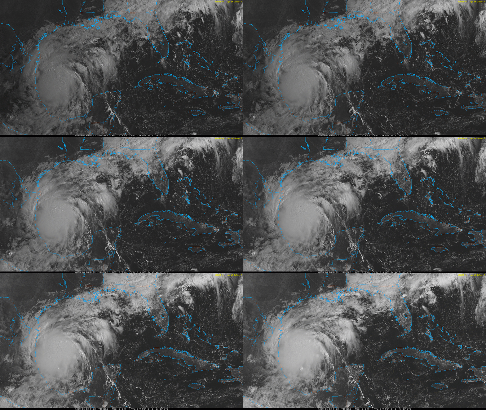
Active storms: Tropical Storm Francine has developed in the western Gulf of Mexico, upgraded from Potential Tropical Cyclone 6 based on morning reconnaissance data showing a well-defined circulation has formed about 450 miles south of Houston. Francine is the combination of two disturbances (one frontal and one a tropical wave) which have just finished blending, so movement is a little uncertain, but the best guess is a north-northwest drift at about 5 mph. Maximum sustained winds are already 50 mph, and Hurricane and Storm Surge Watches are up for coastal Louisiana.
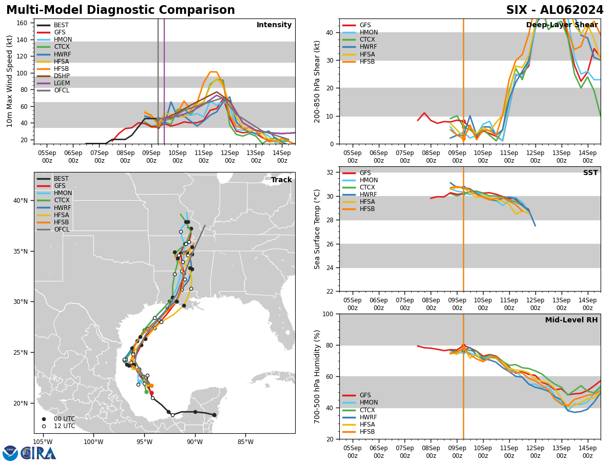
Francine is generating very deep convection near its new circulation center, which came together faster than the models (and I) anticipated. With water temperatures in the 85-88F range, low shear, and plenty of moisture to work with for the next 36 hours, continued strengthening is expected through early Wednesday. This intensification may be rapid (i.e. a 30 knot increase in 24 hours) tomorrow, as indicated by statistical guidance and several of our best hurricane models. Right now, the NHC is calling for Francine to be a hurricane by late Tuesday and make landfall near its top intensity (85 mph) late Wednesday.
However, a peak at category 2 intensity would not be at all surprising, and even topping out as a major isn’t completely out of the question. With a west-to-east strong subtropical jet across the Deep South, wind shear will increase as Francine nears the Gulf Coast. This should at least lead to a plateau in intensity in its last 12 hours over water, and might cause some weakening before reaching shore, as most models show.

Francine will initially be steered north around a ridge of high-pressure over the eastern Gulf, but will turn more northeastward tomorrow as it feels the influence of the mid-latitude westerly winds associated with a dip in the jet stream over the eastern U.S. Northeastward movement should continue on Wednesday, bringing Francine into Louisiana overnight Wednesday into Thursday. The primary uncertainty with track was where the combined center of the storm would form, which per recon appears to be a little further east that most models suggested. This would argue for a track on the east side of model envelope, with a landfall somewhere in the swamps south of Lafayette to Morgan City. Look for guidance to tighten up today with improved organization of Francine’s low-level circulation.
I’ll talk more about impacts in the next update, but track will add up to a lot of rain (4-8” more) for an area of the western Gulf Coast that has already seen quite a bit in the last week. For that reason, flash flood potential is a major concern in much of Louisiana and southern Mississippi. With Francine being a large storm and moving fairly quickly at landfall, the potential for damaging wind gusts, even inland, is also a concern in Louisiana, including Lafayette, Baton Rouge, and potentially New Orleans. Surge will also be an issue in southeastern and south-central Louisiana, and possibly even further east. Bottom line is the west-central Gulf Coast should be preparing for the high likelihood of the third U.S. hurricane landfall of 2024 in the next couple of days. I’ll have a full rundown on expected impacts tomorrow.
Disturbances in the NHC tropical weather outlook:
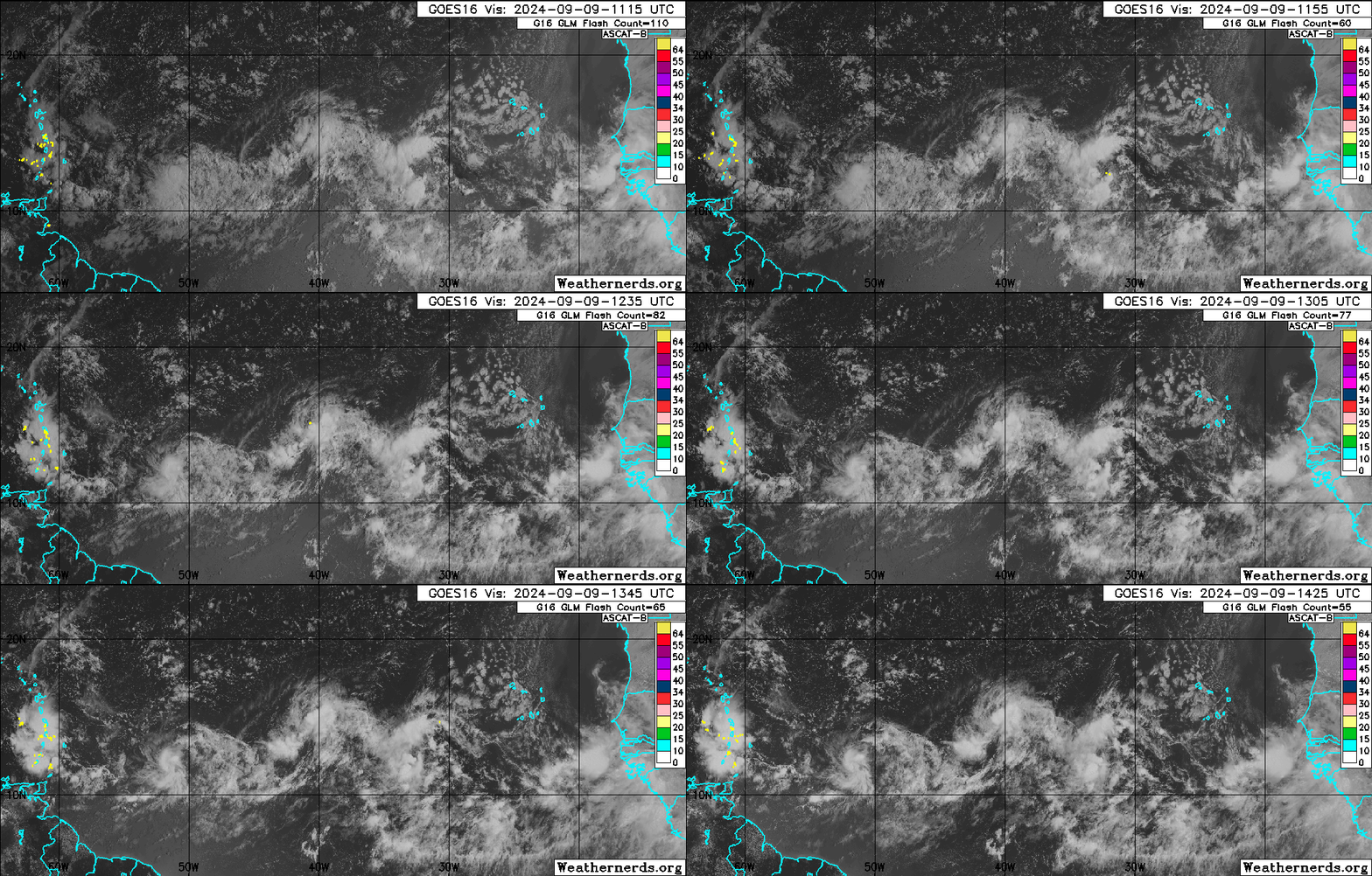
Invest 92L, a tropical wave in the central Tropical Atlantic along 40-45W, has been generating decent convection near a possible low-level circulation over the weekend. The NHC is giving 92L a 60% chance of two-day development, but little additional chance of organizing at longer range if it doesn’t develop in the near future. The reason for that is, as ever in 2024, quite a bit of nearby dry air in the mid levels. If 92L can seal off some core convection by Wednesday, it has a chance of proceeding slowly west-northwest in the general direction of the northern Lesser Antilles as a named storm; if not, it’s likely to remain a wave. This system would likely move north of the Windwards if it develops, but it’s worth keeping half an eye on for the islands until the longer-term evolution of this wave is a higher confidence forecast.
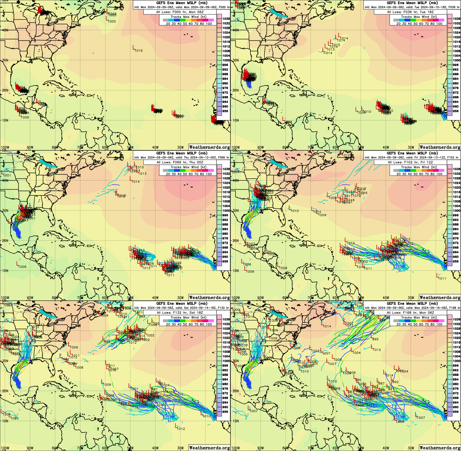
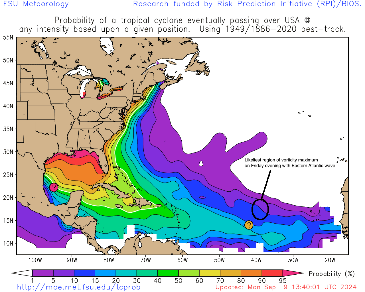
Another tropical wave in the eastern Tropical Atlantic is being given a 60% chance of seven-day development this morning. In reality, this is the joint development chance for both a weak low between 30-35W currently, and a large tropical wave now moving off the African coast, which most models suggest will roll up the smaller disturbance on Thursday. The combined system may take its time developing, but something will probably form from it eventually due to lower-than-average shear and less bone-dry airmass surrounding the wave. There’s quite a bit of model support in the 6-10 day period for a storm forming, possibly a strong one, but with the wave’s core rotation likely to pass 40W between 15N and 20N later this week, it is likely too far north, too early to be a threat to the continental U.S or even the Antilles. This is particularly true given the expectation of central Atlantic troughing early next week. However, the breakdown of the monsoon trough into more discrete disturbances is messy, so changes to the early read aren’t impossible.
Elsewhere: No other short- or medium-range development threats on the map today. There are hints in the models that a broad low may take shape off the Southeast coast along same old stalled front sometime next week, but this is at least 7 days off and dependent on how Francine plays out.
Next update: Next daily bulletin tomorrow morning.


![[Image of Rainfall Potential] [Image of Rainfall Potential]](https://substackcdn.com/image/fetch/w_1456,c_limit,f_auto,q_auto:good,fl_lossy/https%3A%2F%2Fsubstack-post-media.s3.amazonaws.com%2Fpublic%2Fimages%2F984d086f-2fba-4a7e-88fd-178b806061c5_892x716.gif)
