Tropical Storm Francine Impacts Forecast for September 10th
TS Francine will likely become a hurricane before reaching Louisiana on Wednesday. Here's the latest on the surge, wind, rain, and tornado impacts from Texas to Florida.
WeatherTiger’s Hurricane Watch is a reader-supported publication. Paid subscribers get daily tropical bulletins, plus weekly columns, full coverage of every hurricane threat, our real-time seasonal forecast, and the ability to comment on posts. Paid supporters will receive an exclusive morning forecast tomorrow with the latest overnight developments on Francine.
The 2024 hurricane season is on the verge of going six-for-six in terms of named storms impacting land, with Tropical Storm Francine poised to make landfall on Wednesday in south-central Louisiana. Francine will bring surge, rain, and wind impacts to the central Gulf Coast, as well as some outer rainbands east into the Florida Panhandle.
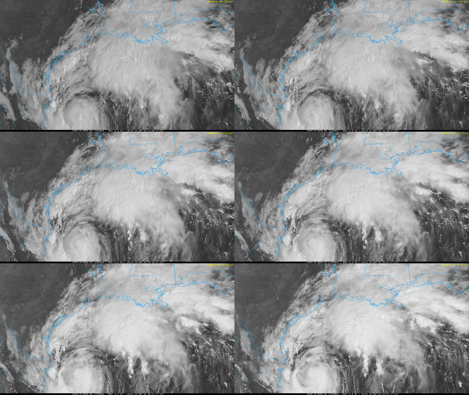
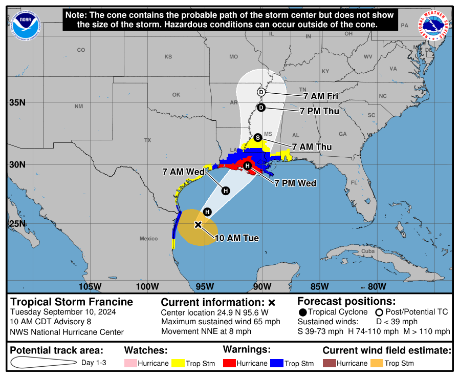
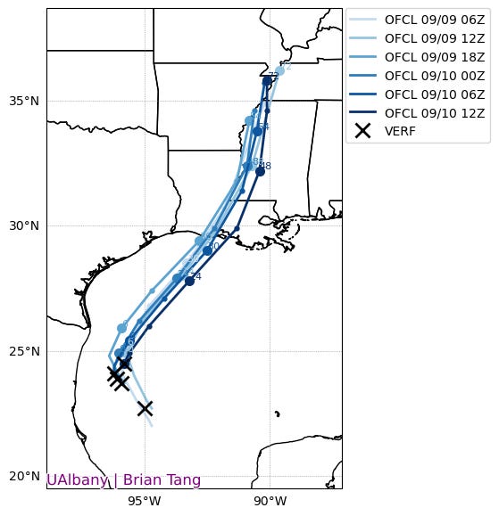
Tropical Storm Francine is currently located over the west-central Gulf of Mexico, with associated rainfall already reaching Louisiana. As of the 10 a.m. CT Tuesday advisory, Francine is located about 500 miles southwest of New Orleans, with sustained winds of around 65 mph. The storm is moving north-northeast at about 8 mph, and Francine will accelerate northeast in the next 12 to 24 hours.
With the storm moving a bit less north and west than expected in the last couple of days, the NHC track has edged east from the initial forecast, and may shift a bit more in that direction yet. However, major changes to the forecast track are not expected, and Francine will likely make landfall in the bayous south of Lafayette to Houma on Wednesday afternoon. Hurricane and Storm Surge Warnings are up for almost all of the Louisiana coastline, with an inland Hurricane Warning for Lafayette. There is a Tropical Storm Warning in effect for Baton Rouge and New Orleans, with the center passing over or just west of Louisiana’s major cities overnight into early Thursday.
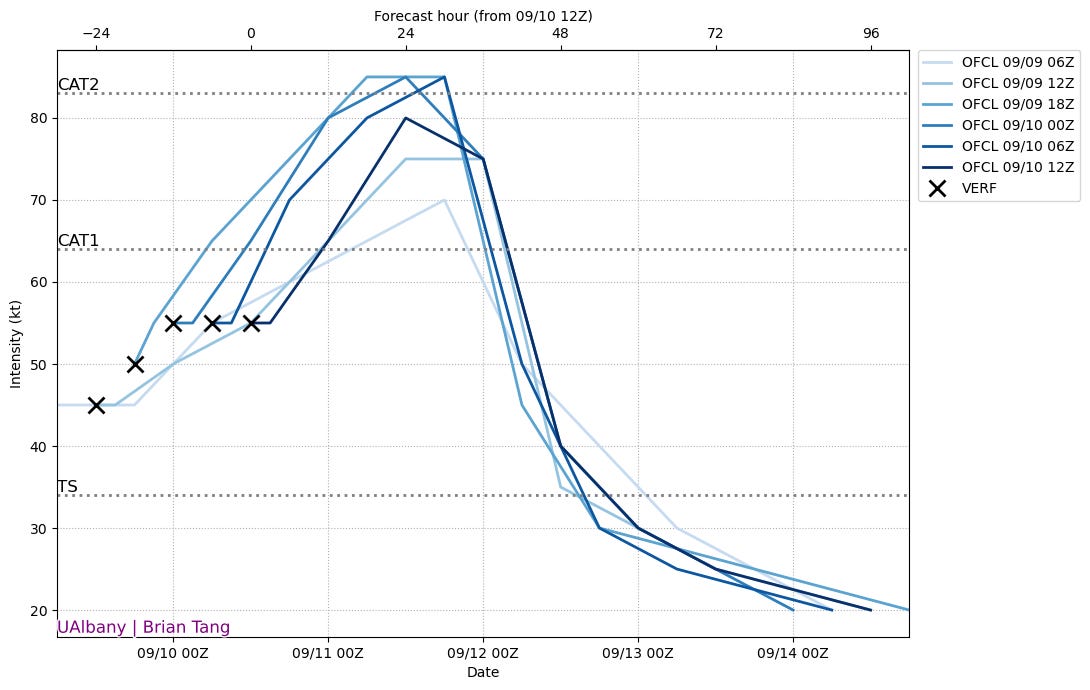
The intensity forecast currently calls for Francine to be a category 1 hurricane when it makes landfall on Wednesday. Francine has remained a strong tropical storm over the last day as it dealt with dry air intrusions, but a well-defined core is forming and conditions should become more supportive of intensification through Wednesday morning as it starts to move northeast and is a favorable distance from a Southeastern U.S. streak in the subtropical jet stream. Wind shear will increase as Francine gets too close to those strong upper-level westerly winds right before landfall, so look for landfall intensity to plateau at category 1 strength, though a category 2 is not out of the question.
With Francine’s track and intensity forecast firming up, let’s take a look at how the four main types of weather threats from a hurricane (wind, surge, tornadoes, and flooding rainfall) are likely to play out.
Storm Surge
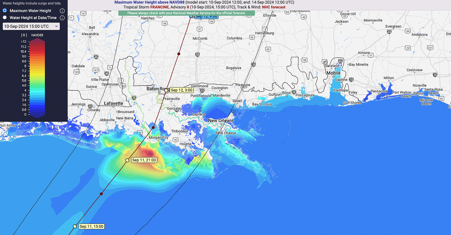
As of 10 a.m. CT on Tuesday, Storm Surge Warnings are in effect from the Texas-Louisiana border to the Mississippi-Alabama line, including Lake Pontchartrain, with a Storm Surge Watch up for Mobile Bay. The storm surge will be more muted west of the center in southwestern Louisiana, and likely the highest in southeastern Louisiana, particularly the Morgan City and Houma areas. The boundary between land and Gulf is muddy in Louisiana, but these coastal areas are expected to see anywhere from 5-10’ of surge.
Eastern Louisiana, Lake Pontchartrain, Mobile Bay, and as far east as Pensacola will see a couple of feet of surge from Francine due to an extended period of onshore winds. As always, if you live in a flood zone, heed evacuation guidance from your county’s local emergency management office.
Wind
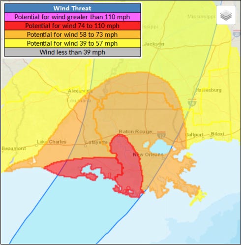
With Francine flexing to a probable Category 1 intensity prior to landfall, wind impacts in southern Louisiana will be locally significant in the areas that receive the hurricane’s eyewall, and still damaging outside of that area. Shear will likely tilt the strongest winds into Francine’s northeastern eyewall, so hurricane-force top wind gusts are most probable from Lafayette to Houma and south Wednesday afternoon.
Francine’s speed of forward motion is expected to increase as it makes landfall, so New Orleans and Baton Rouge should prepare for moderate to strong tropical-storm-force wind gusts of 50 to 65 mph peaking Wednesday evening, particularly if the track ticks east. The western half of Francine will see notably weaker gusts than the eastern half, so wind impacts should be modest in Lake Charles and inland western Louisiana. Coastal areas from Gulfport to Pensacola may see wind gusts up to 40 mph out of the south in intermittent squalls Wednesday into early Thursday.
Rainfall
The central and western Gulf coast have already seen quite a bit of rainfall in the past week, with accumulations of 5-10” in south-central and southeastern Louisiana. Francine’s sprawling structure means more heavy rainfall is on the way on the next 48 hours, with another 4-8” expected in the areas of eastern Louisiana and southern Mississippi that have already been drenched. This will lead to a serious risk of flash flooding in these areas on Wednesday and early Thursday, including the New Orleans metro.
With Francine moving at a decent clip, rainfall totals from northwest from the western Florida Panhandle and up the Lower Mississippi Valley are likely to be more on the order of 2-4”, which may also cause localized flood issues. Rains will clear southern Louisiana by Thursday morning, with remnant rains pushing into the Lower Midwest and bands lingering over North Florida and the eastern Southeast through Friday.
Tornadoes
Finally, there is a low-end tornado threat from Francine along and east of the center’s track. On Wednesday, look for the highest risk of tornadoes along the coast from eastern Louisiana into the western Florida Panhandle. A slight chance of tornadoes continues on Thursday across Alabama and North Florida (including Tallahassee), associated with outer band thunderstorm lines that will push through these areas periodically between Wednesday and Friday.
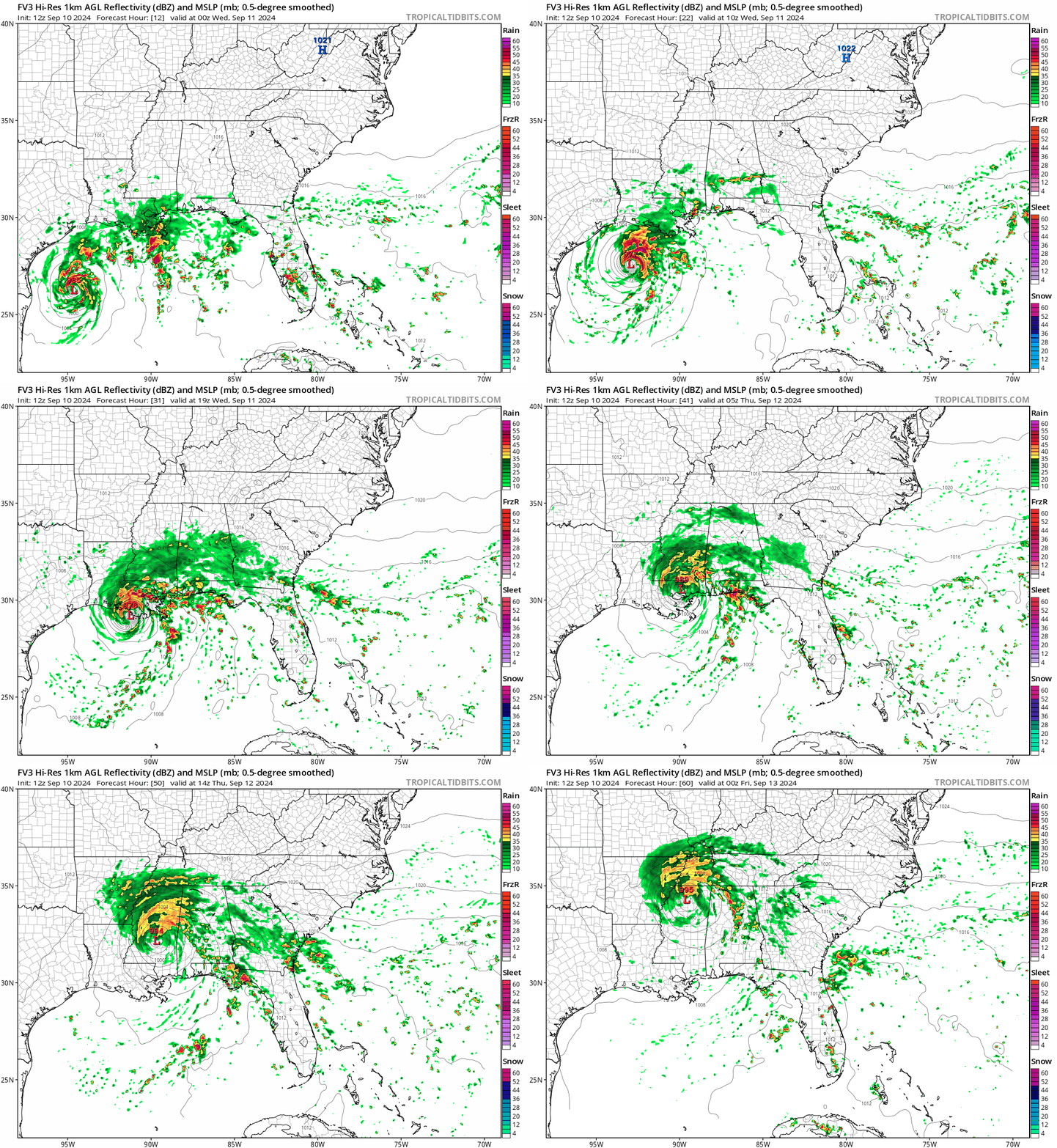
Overall, Tropical Storm Francine will pack a punch as it likely becomes the third U.S. hurricane landfall of the 2024 hurricane season on Wednesday, though not a wallop nearly on par with recent Louisiana major hurricanes like Laura, Zeta, or Ida.
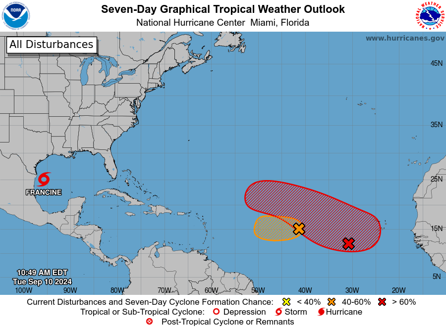
Elsewhere, I’m happy to say that there are no other short- or medium-term tropical threats to the continental U.S. over the next 7 days, though there is at least one disturbance likely to develop into a named storm by the middle of next week. That tropical wave is just emerging from the African coast and should develop over time, as the Cape Verde region finally less a little less inconducive to development. This system may become a strong storm down the road while meandering over the open Atlantic, but it is likely too far north to be a threat to the continental U.S or even the Lesser Antilles. Another tropical wave further west will peter out in a couple of days, snuffed by dry air.
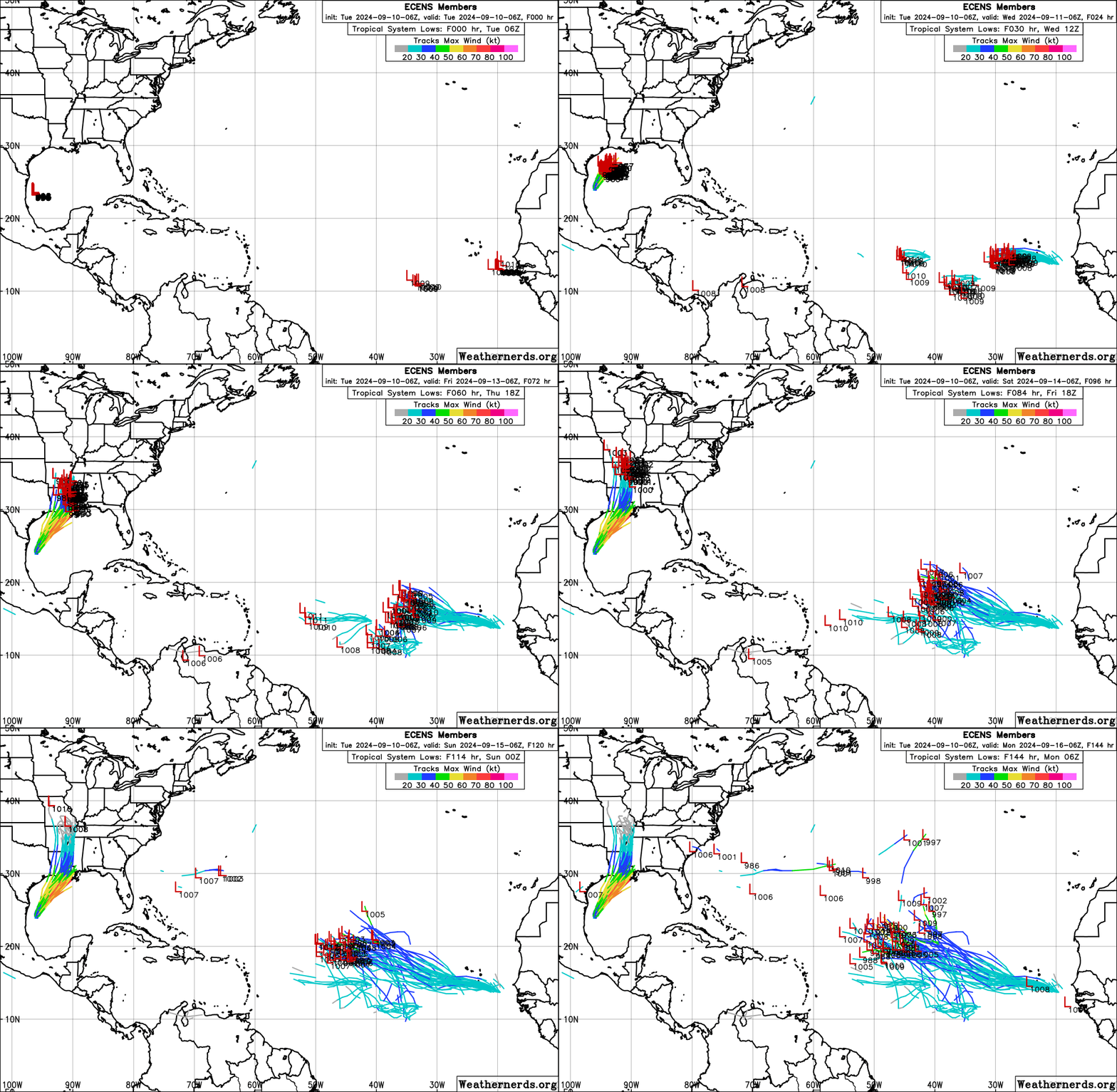
The only region to keep half an eye on as a possible longer range tropical (or subtropical) influence is east of the Southeast coast, where some models are hinting a broad low may take shape along a stalled front early next week. If it develops, it’s not clear if it would go out-to-sea or loop back towards land, but there’s no specific threat and plenty of time to keep watching the skies.
Next update: Update exclusively for paid subscribers tomorrow morning by 9 a.m.


![[Image of cumulative wind history] [Image of cumulative wind history]](https://substackcdn.com/image/fetch/w_1456,c_limit,f_auto,q_auto:good,fl_progressive:steep/https%3A%2F%2Fsubstack-post-media.s3.amazonaws.com%2Fpublic%2Fimages%2Fe8ddecc1-26ae-4dea-b45e-1b79e7f4551b_897x736.png)
![[Image of WPC Flash Flooding/Excessive Rainfall Outlook] [Image of WPC Flash Flooding/Excessive Rainfall Outlook]](https://substackcdn.com/image/fetch/w_1456,c_limit,f_auto,q_auto:good,fl_lossy/https%3A%2F%2Fsubstack-post-media.s3.amazonaws.com%2Fpublic%2Fimages%2F27906e7c-1d90-49e0-9f01-de64b73bb1d3_893x746.gif)
Air travel involvec
What is impact to SWFL ( Ft Myers area) later this week? Any insights?