Tropical Situationship: The Hurricane Watch for September 28th
It's complicated between Tropical Storms Philippe and Rina, which are spinning around each other east of the Lesser Antilles.
Florida tropical threat synopsis: No tropical threats to Florida in the next seven days.
Almanac: It’s Thursday, September 28th… day 119 of the 2023 hurricane season, 64 days to go. By total storm energy, the season is 73.1%, 79.9%, and 69% complete for the Atlantic, continental U.S., and Florida, respectively.
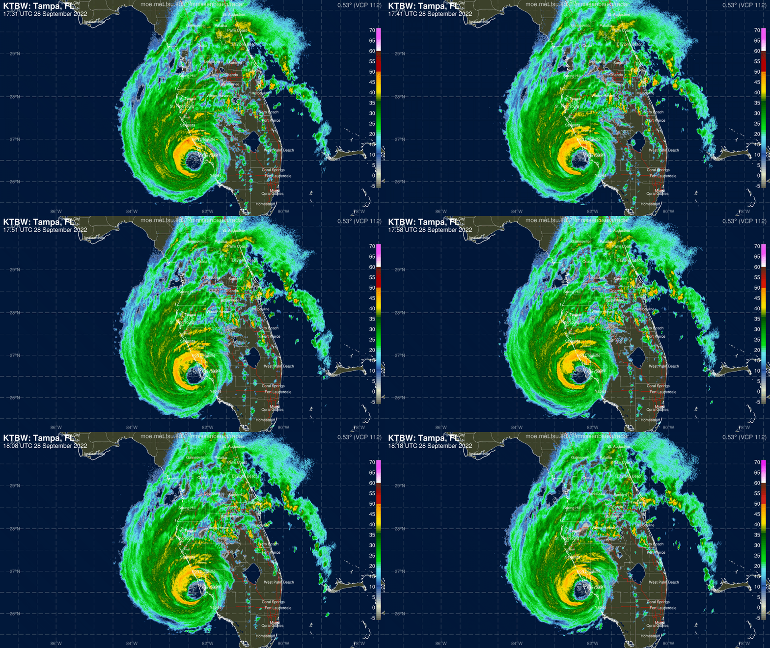
Today is the one-year anniversary of Hurricane Ian’s landfall in Charlotte Harbor as a Category 4 hurricane with 150 mph sustained winds, storm surge of up to 15’, and rain totals of up to 20”— adding up to the most expensive hurricane landfall in Florida history ($112 billion), and deadliest since 1935. If you have an itch to review the tape on Ian, WeatherTiger’s archived live blog from one year ago today is here.
Active Storms: Given their entanglement, it seems foolish to consider Tropical Storm Philippe and newly formed Tropical Storm Rina individually. Both Philippe and Rina are low-end tropical storms of comparable size, whose low-level centers of circulation (broad, in Philippe’s case) are now around 600 miles from one another. As such, they are now engaged in a Fujiwhara interaction, in which the individual storms begin rotating around a common center of circulation between the two. As shown in the diagram below, this interaction between two comparably sized/strengthed vortices deflects the western storm (Philippe) to the south, and the eastern storm (Rina) to the north. In practice, this means Philippe is moving little today, while Rina swings north-northwest at around 10 mph.
These kind of binary interactions between storms make for a very high uncertainty forecast. However, it is certain that Rina will not be a threat to land. Model outcomes for Philippe range from a scenario in which Philippe “wins” out over Rina and turns north as a stronger system, or an outcome in which a weaker/remnant low Philippe drifts west into the northern Lesser Antilles or Puerto Rico vicinity as a stronger Rina launches to the north. There continues to be no continental U.S. threat from Philippe in either case. If Philippe makes it farther west, it might be a rainmaker for Puerto Rico or the Virgin Islands, but even then impacts would likely be modest.
Overall, the most probable outcome given Philippe’s disorganization and the messy interaction with Rina over the next 2-4 days is that both storms remain fairly weak and both stay somewhat northeast of the Lesser Antilles and Puerto Rico. This is, however, a low confidence forecast, albeit (thankfully), one with low stakes. Stay tuned.
Other disturbances in NHC outlook, with 2-/7-day NHC development odds: None.
Elsewhere: Ensembles are trending towards a more progressive North American pattern in week 2, which means ridging will only be in place over the East Coast for 3-4 days before being replaced by East Coast troughing in 9-10 days. This means less time for any potential hybrid low to take shape south of the ridging, so risks of development east of Florida next week are waning.
Next report: Daily bulletin out tomorrow afternoon.


