


Tropical Depression 10 Update for August 26th
TD 10 is likely to become a hurricane in the Gulf of Mexico and reach Florida by Wednesday.
This post is now outdated! Click the image below for the newest Idalia forecast:

WeatherTiger’s Hurricane Watch is a reader-supported publication. Paid subscribers get Florida-focused daily tropical briefings, plus weekly columns, our exclusive real-time seasonal forecast model, and the ability to comment and ask questions for $49.99 per year.
Subscribers will also receive exclusive morning forecasts during Florida hurricane threats.
Florida tropical threat synopsis: Tropical Depression 10 has developed today in the northwestern Caribbean. A hurricane landfall in the Panhandle or Big Bend region between Tuesday afternoon and late Wednesday is increasingly likely.
Today’s update will be short, because this was the day I’d personally blocked out for storm prep. But life comes at you fast, so here we go. Tropical Depression 10, soon to be Idalia.
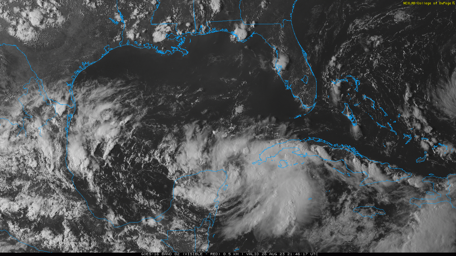
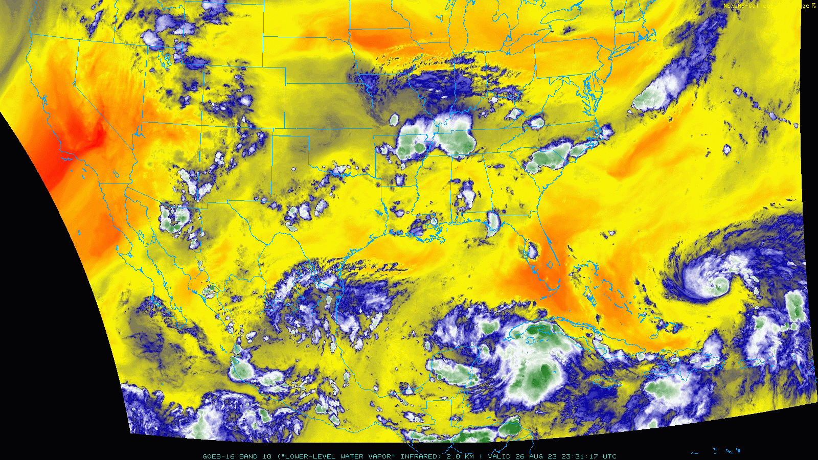
In the last 24 hours, the broad disturbance we’ve been following all week has consolidated into a single circulation faster than models and forecasters, including me, had anticipated. With ample convection close to the center, the NHC began issuing advisories on TD 10 at 5 p.m. this afternoon. Currently, sustained winds are 30 mph, and the depression isn’t moving. Here’s the initial NHC bid on track:

Little motion is expected over the next 36 hours, but crucially, the center is not expected to move over land in that time. If you recall yesterday’s forecast, the #1 key consideration was whether the low organized over water or over land. Well, question answered. TD 10 is going to have the next day and a half to improve structurally, over extremely warm waters, before starting north across the Gulf. It takes time for a tropical cyclone to put together a convective core, but unless it unexpectedly jukes over the Yucatan in the next day, the depression is giving itself a head start on that process.
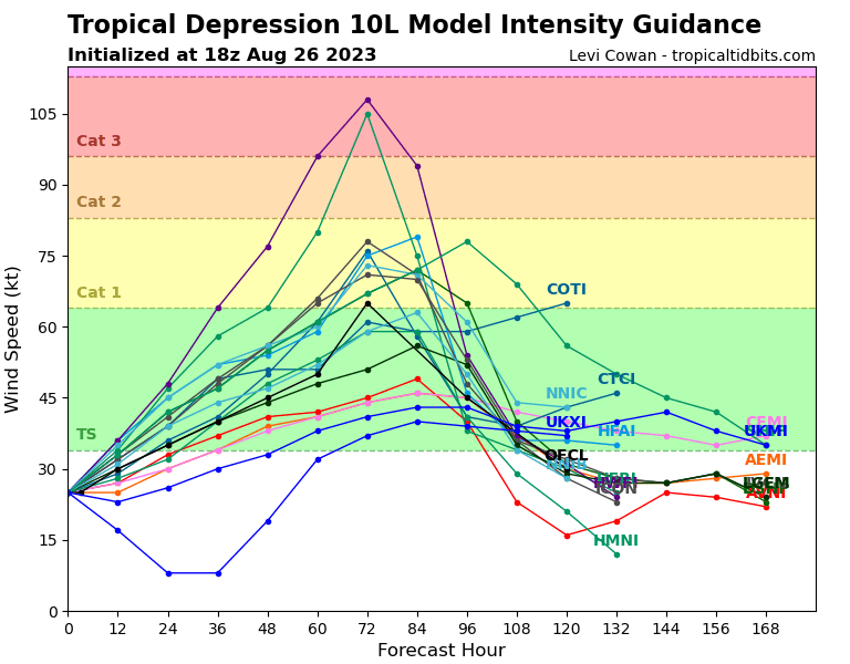
That means worrisome things for the intensity forecast. The initial NHC forecast has TD 10 as a minimal Category 1 hurricane in the east-central Gulf on Tuesday afternoon and reaching the coast in the eastern Panhandle by Wednesday morning. Overall, there’s a narrowing track possibilities, and landfall is most likely somewhere in the central Panhandle to Nature Coast range. Intensity is the real question— the NHC admits in the forecast discussion that there is higher than normal uncertainty in the 3-4 day timeframe. Frankly, the NHC intensity forecast is probably a little conservative at this stage until more data is in hand from recon.
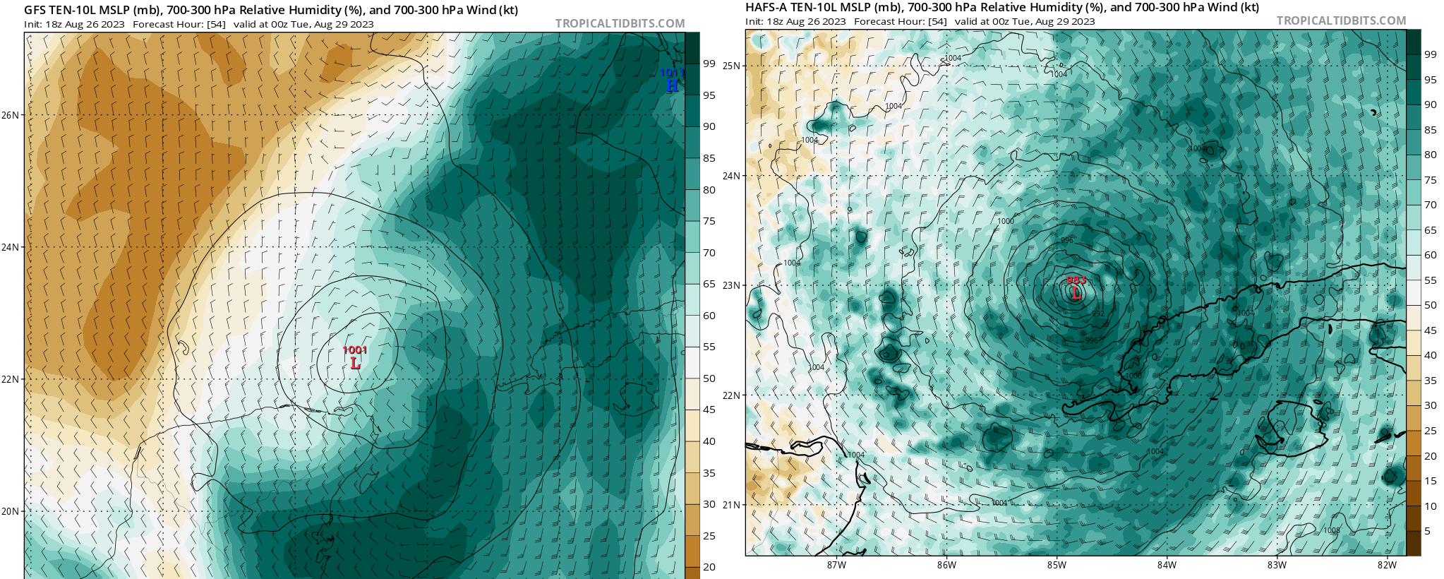
Models are split how much strengthening will occur. The hurricane-specific models more aggressive with Ten, and the global models are more reserved (though these are typically less skillful at intensity forecasting). Key question #2 from yesterday’s forecast remains very pertinent here, as the intensity differences seem driven by the global models pushing more dry air into Ten/Idalia’s core on Monday than the hurricane models do. There is quite a bit of dry air at the mid-levels lurking over the northern Gulf and Deep South, and the extent to which this airmass disrupts the core will be the difference between a tropical storm/low-end hurricane, and the potential for a major hurricane.
In short, the rapid development of TD 10 shifts the window of possibilities in the wrong direction, and major hurricane strength is now on the table. Everyone in the Panhandle, Big Bend, west-central Florida, and north-central Florida needs to be preparing now for a potential major hurricane, even as better outcomes remain a very realistic possibility.
Next report: Complete discussion out early tomorrow afternoon.
Over the years with situation like these my favorite comment is, Oy Vey, thanks for keeping us posted!
Insurance companies may have left Florida, but prayer hasn’t….