


Too Hot for TC: WeatherTiger's Weekly Column for June 15th
Heat keeps tropical activity at bay for the U.S. coast, but at what cost?

If you are not already a supporter, please consider signing up for a paid subscription. You’ll get Florida-focused daily tropical briefings each weekday, plus weekly columns like this one, full coverage of every U.S. hurricane threat, our exclusive real-time seasonal forecast, and the ability to comment and ask questions, all for just $7.99.
Like defending candy corn, the word “moist,” or the series finale of Lost, finding something positive to say about the brutal heat wave gripping Florida and the eastern U.S. is a provocative choice. We need a little controversy, so here’s an alternate perspective: without the heat, the U.S. Gulf Coast could well have been dealing with a tropical threat this week.
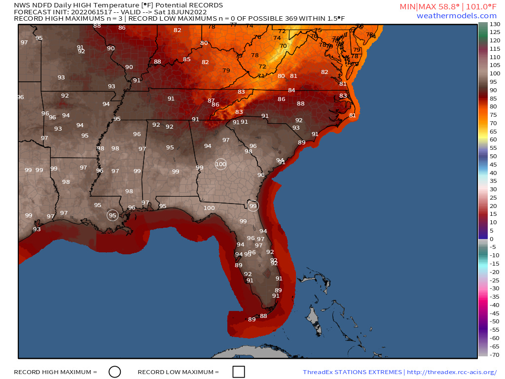
Florida’s weather between May and September is an exercise in poison picking, with the options limited to hot and wet, hotter and dry, and the wildcard influence of the Tropics. For the upcoming week to ten days, we will be squarely in the second camp. Thunderstorm coverage will be less than normal as high temperatures soar into the mid- and upper-90s. Spotty triple digit heat is even expected this weekend across North Florida and the Deep South. A more typically miserable pattern will probably resume sometime in the last week of June.
The culprit is a powerful ridge of high pressure aloft centered over the Southeastern U.S. The cores of ridges are defined by light winds and sinking air, which heats as it is compressed. Unfortunately, abundant sunlight also continues to evaporate moisture from bodies of water and soils as this occurs, adding up to a humid, stagnant airmass at the surface with high temperatures somewhere between the melting points of chocolate and tungsten.
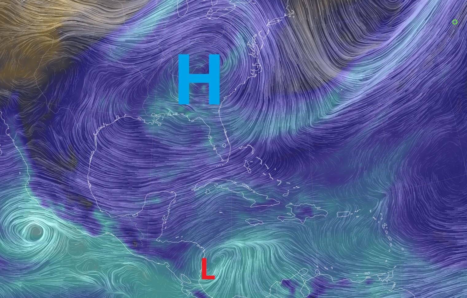
While this subsidence feels antithetical to human existence, it actually is antithetical to hurricane activity, at least within close proximity. Tropical cyclones require rising air to fuel their heat engines, so even disturbances are usually displaced hundreds of miles from the centers of subtropical ridges. Thus, today, all the intrigue in the Tropics is smooshed into the western Caribbean and Central America.
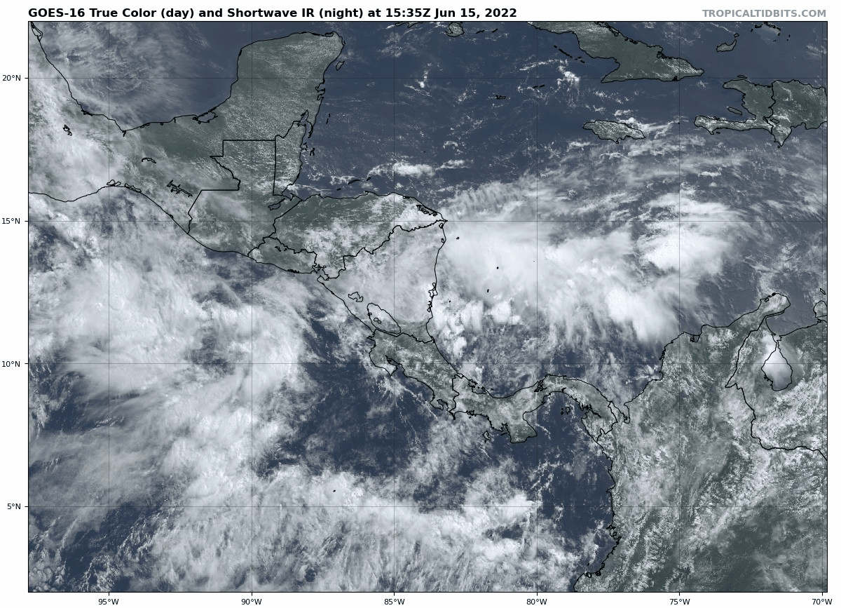
The key feature to watch over the next five days is Invest 93L, a small circulation just inland over eastern Nicaragua as of Wednesday afternoon. While 93L is still generating some organized convection, the center of rotation will remain over Central America for the next several days, making short-term development of a depression or storm unlikely.
Here’s where the ridge comes into play. As high-pressure systems produce clockwise circulations in the Northern Hemisphere, the mid-level wind currents south of Florida for the next week will run mostly east-to-west. This brisk steering flow will escort 93L westward across the far western Caribbean, Central America, and extreme southern Gulf into the weekend.
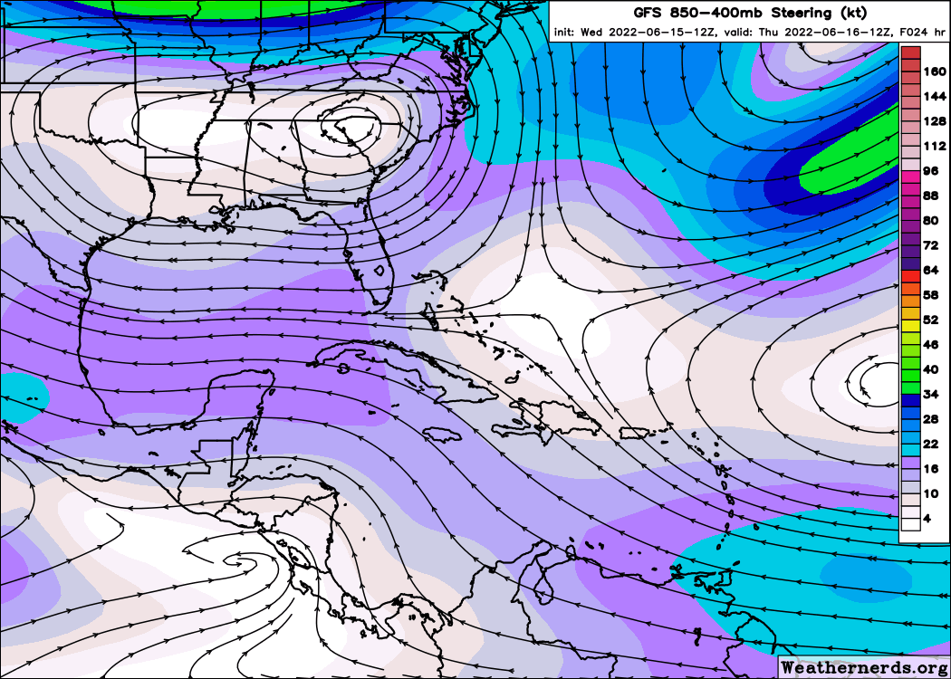
There may be an opportunity for short-lived development, particularly in the Bay of Campeche, if the disturbance can gain separation from land for any length of time. However, the ridge will suppress anything that develops well south of the U.S. Gulf Coast, so there are no tropical concerns for Florida from 93L or any other disturbance over the next week.
As longtime readers know, the risks of hurricane season come in three distinct chunks for Florida. The second and third peaks in early September and mid-October arise from storms developing in the Tropical Atlantic and western Caribbean, respectively, and together account for most of Florida’s major hurricane landfalls.
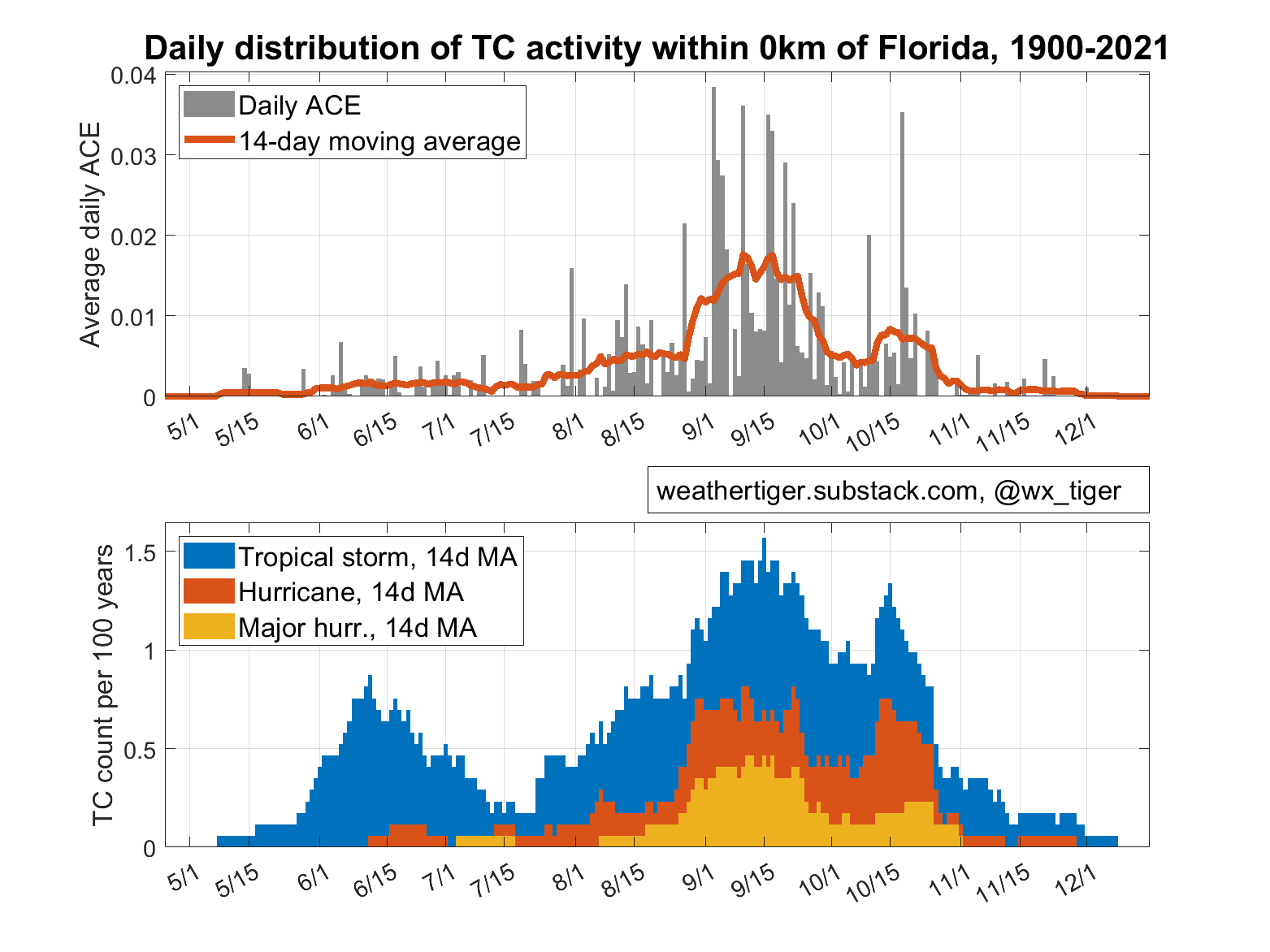
In contrast, the first peak in early and mid-June, known as the “Steinhatchee Season” for the strange attractive power of that Gulf Coast hamlet on early storms, is kind of the bun-warming lid on the George Foreman Grill that is hurricane season. While almost all June storms are weak, they generally develop in the southern Gulf or western Caribbean and depend on the south-to-north steering currents associated with eastern U.S. troughs to lift them towards Florida. With ridging in place over the Southeast into late June and no upper-level troughs in sight, Florida will likely escape Steinhatchee Season 2022 without a follow-up to PTC 1/Alex.
So, while Florida will dodge Tropical Storm Warnings for the near future, this comes at the price of widespread Nick Lachey Warnings, which are issued when high temperatures are expected to be 98° and rising. I recommend you stay inside and raise a cool beverage in honor of Dr. John Gorrie, inventor of air conditioning and patron saint of Floridaman and Floridawoman. Keep watching the skies.