Too Cool for School: Hurricane Watch for August 26th
The Tropics remain quiet, but it isn't because the Atlantic is cooling.
Florida and continental U.S. tropical threat synopsis: No tropical threats to Florida or the continental U.S. over the next week.
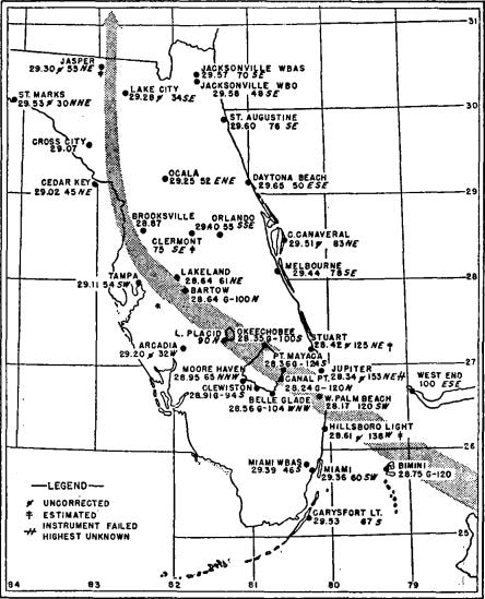
Almanac: It’s Monday, August 26th… day 87 of the 2024 hurricane season, 96 days to go. By total storm energy, the season is 20%, 32.9%, and 22.7% complete for the Atlantic, continental U.S., and Florida, respectively. This date is a busy one in hurricane history, including landfalls from Category 4 Hurricane Harvey in 2017, Category 3 Hurricane Andrew in 1992 (Louisiana second landfall), and one of the less-remembered Category 4 landfalls in Florida hurricane history: a 1949 storm that struck West Palm Beach and continued westward towards Lake Okeechobee. Elevated gusts in Martin County were unofficially clocked at 160 mph, with Palm Beach County also seeing severe damage in the southern eyewall with gusts to 155 mph. The chief of the Miami Weather Bureau called the so-called Delray Beach Hurricane “a real pumpernickel” and noted that the damage would have been much worse if it had struck more densely populated Broward and Dade Counties.
Active storms: None.
Disturbances in the NHC tropical weather outlook: None.
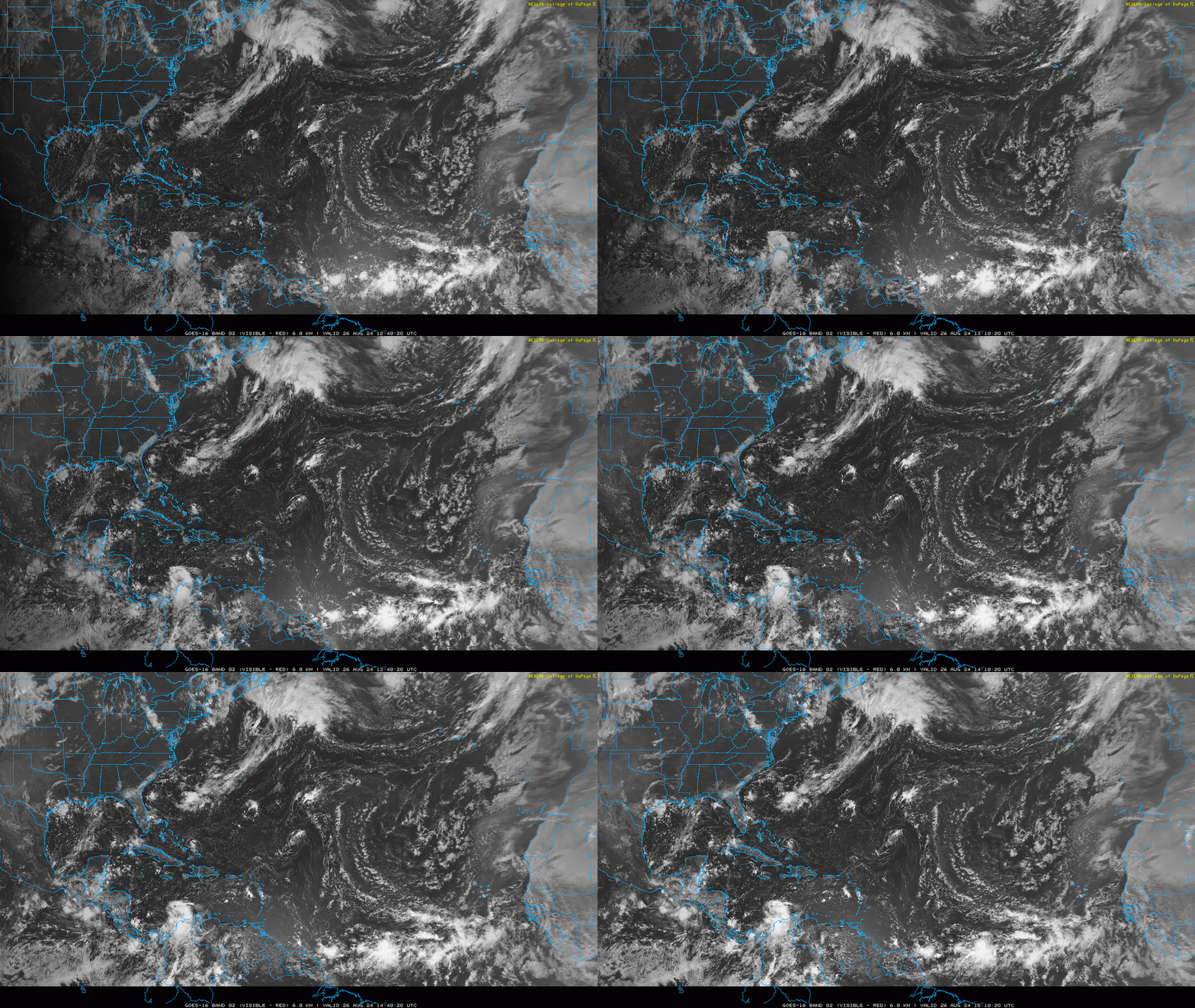
Elsewhere: The Atlantic remains quiet today, with development over the next five days remaining unlikely. As seen on visible satellite imagery above, there is little convection in the western half of the Basin, including the Gulf and Caribbean, and convection remains strung out and diffuse along a monsoon trough in the eastern Atlantic. However, there are finally some more realistic chances of development in the 6-10 day range as we head into the first week of September, though nothing certain or particularly concerning at this point.
There are two areas worth watching. Starting with the longer shot closer to home, a front is forecast to push into the Deep South late in the weekend, which will likely stall out along the Gulf Coast and off the Southeast Coast next week. This boundary may linger for much of the first week of September. While there is no specific threat and none of the major models are doing anything, a stalled front this region is a common mode of storm development. Time plus Gulf is never a good thing, so I’ll keep an eye on this region.
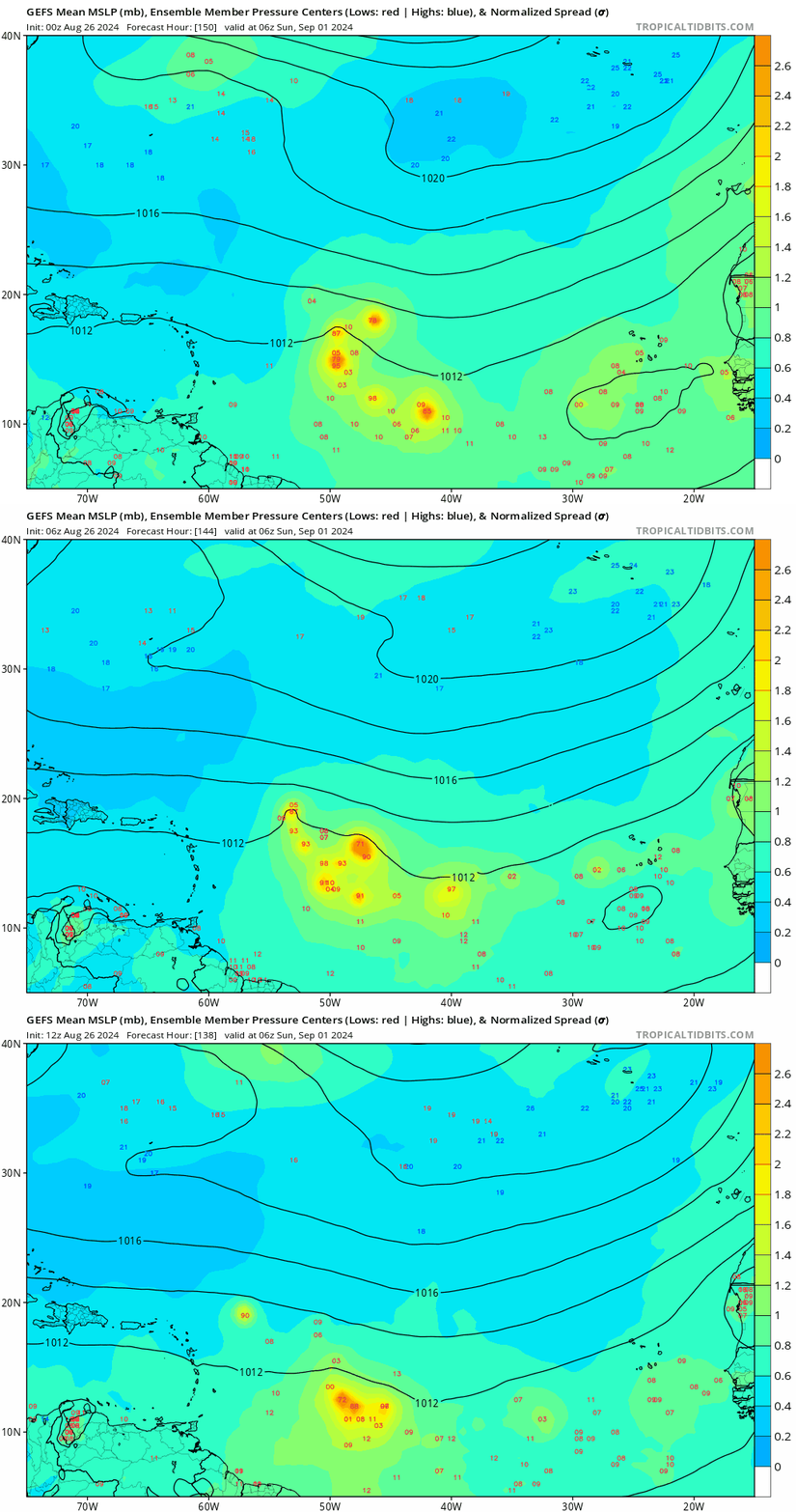
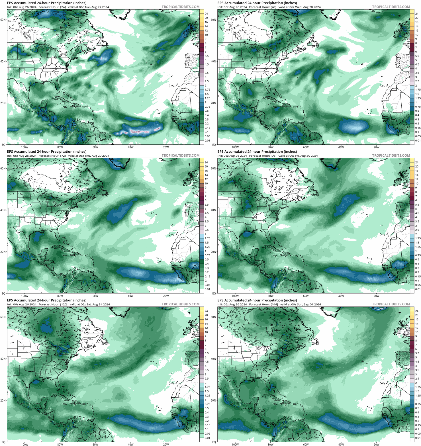
The other potential prospect for development is that a tropical wave just west of Senegal currently may finally cause the monsoon trough to break down into more concentrated blobs of low-level rotation late this week, and one of those blobs will develop into a tropical storm on its way towards the Lesser Antilles in 7-10 days. With convection and rotation in the eastern Atlantic still linear and chaotic, it’s tough to assess how realistic that specific outcome is, especially with the likelihood that dry air will be lingering to the north. However, there’s a pretty decent signal for this wave on both the GFS (above) and Euro Ensembles today, which is crawling towards the five-day time horizon when we’ll really sit up and take notice. Historically, it would be very odd if nothing developed east of the Lesser Antilles in the next two weeks.
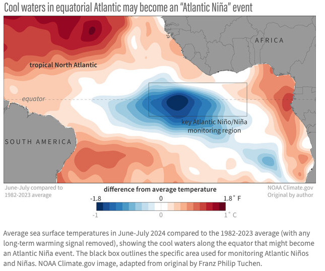
Even with a few areas to monitor, the Atlantic is still on the struggle bus relative to both climatology and (especially) 2024 expectations. I’ll be talking more about the reasons for that this week, but one reason that does not explain it is cool water in the Atlantic. The “rapidly cooling Atlantic” brainworm has really taken off as a meme over the past week, mutating from this NOAA blog post on 8/14 about a possible “Atlantic Nina” developing. Notably, the Atlantic Nino/Nina region is along the Equator south of Africa, well southeast of where storms form. While this small area cooled significantly in July, temps there have rebounded in August, and are pretty close to average. Impacts of Atlantic Nino/Nina on hurricane season are debatable, though there are indications of linkages to easterly wave amplitude.
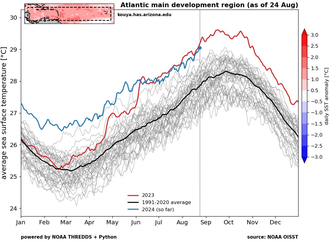
Despite misleading headlines, the part of the Tropical Atlantic where hurricanes form isn't cooling “mysteriously,” “rapidly,” or at all. As seen above, the Main Development Region continues to warm up, as usual for August, and remains tied for 2023 for all-time record anomalous warmth. This warmth also runs deep, meaning oceanic heat content in the MDR is near-record as well. Oceanic warmth is not enough to cause hurricanes to form when atmospheric factors are unfavorable, but there remains a huge reserve of energy to be tapped when winds change.
Next update: Daily bulletin tomorrow morning.



You know how it is being discussed that a ‘Category 6’ be added to the Saffir-Simpson scale? I would propose instead any plus-5 hurricane be called “a real pumpernickel” after that Miami meteorologist’s description of the Delray storm. That’s a goodie! 😅
Hi Doc, i always look to native Florida plants for signs (lots of seeds = storm)...noticed about 2 weeks ago my wild Florida citrus plants in pots, for the first time, both put up suckers around the trunk, as happens when the main trunk is sheared. Then driving by, I saw some mature Sycamores at L3-Harris parking lot doing the same. never seen that for years, either. no others yet, but the echo got my attention... the seed thing seemed to work somewhat in my 4 decades living in the pine/palmetto scrub. hope I am wrong about this... lb