Time of the Season: WeatherTiger's Hurricane Watch for June 2nd
Flash flooding potential is rising in South Florida from a likely tropical storm passage
A free preview of WeatherTiger’s daily briefing will continue into June. If you like what you read, please support us by signing up for our comprehensive coverage of the 2022 hurricane season. Premium subscribers get Florida-focused daily tropical briefings like this one each weekday, plus weekly columns, full coverage of every U.S. hurricane threat, and our real-time seasonal forecast, all for $7.99 per month.
Florida tropical threat synopsis: A low-end tropical storm is likely to cross South Florida over the weekend. Rain impacts remain the primary concern, and expected totals have nudged a little higher since yesterday’s forecast.
Almanac: It’s Thursday, June 2nd… day 2 of the 2022 hurricane season, with a mere 181 days to go. By total storm energy, the season is 0.7% complete as a whole, 0.9% complete for the continental U.S., and 0.7% complete for Florida. The lone historical landfall on this date was a weak tropical storm north of Jacksonville way back in 1873.
Active Storms: None.
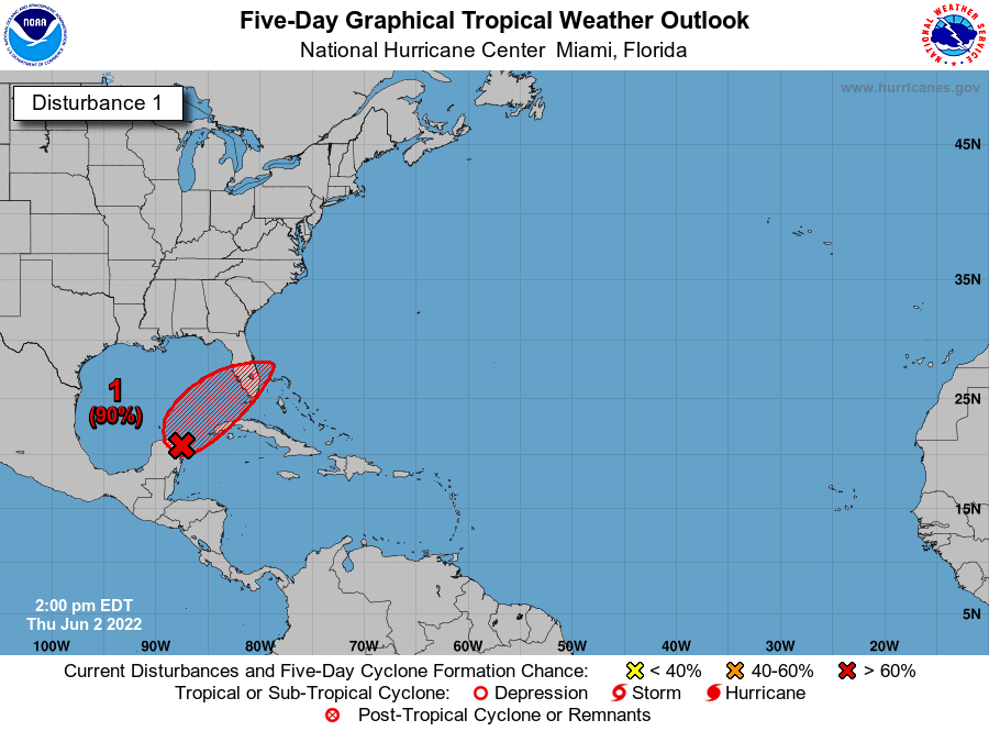
Current disturbances in NHC outlook, with 2-/5-day NHC development odds:
Invest 91L (80/80%): The tropical disturbance over the northwestern Caribbean is slowly getting better organized, and the likelihood is increasing that a low-end tropical storm will cross South Florida over the weekend. Rain impacts remain the primary concern from this system, with expected rainfall accumulations nudging a little higher since yesterday’s forecast.
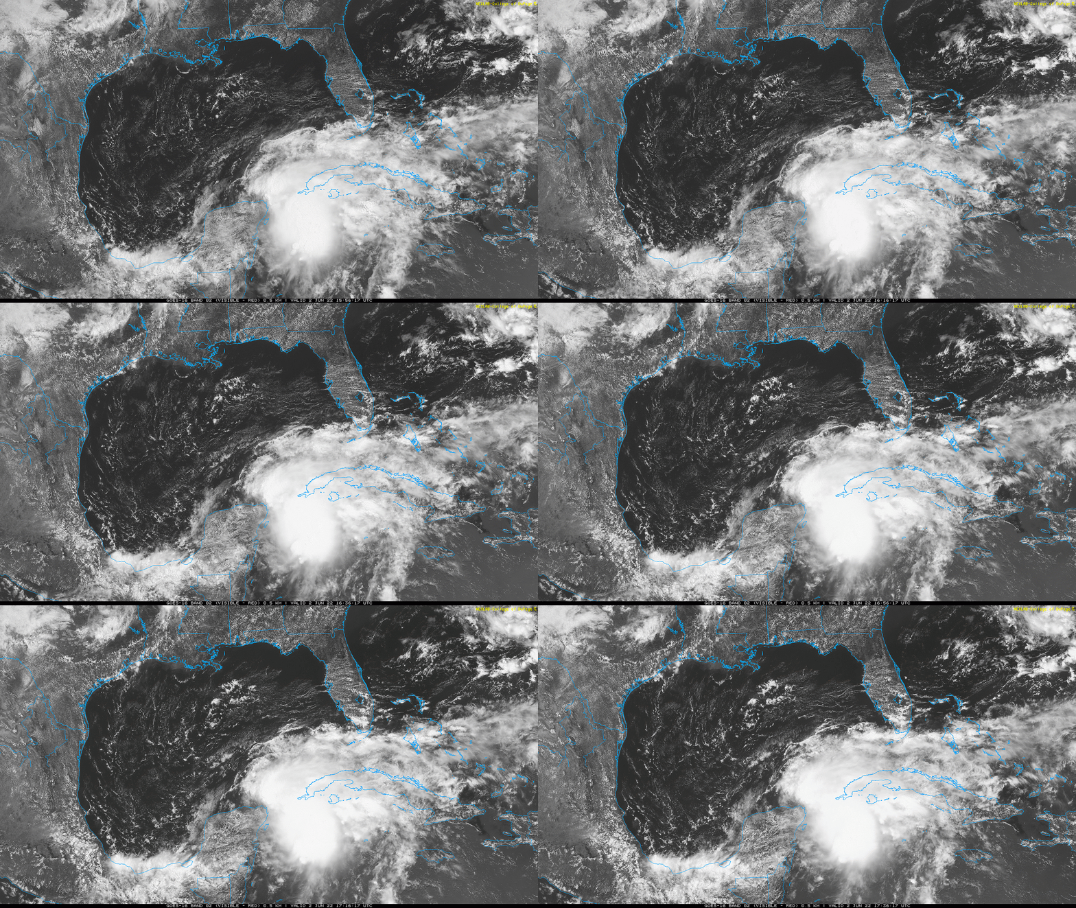
As of early Thursday afternoon, the disturbance’s center of circulation has consolidated over the northeast tip of the Yucatan peninsula. As expected, brisk westerly shear is displacing most convection east of the development, but a formidable cluster of heavy storms are located from the Florida Straits into the northwestern Caribbean. A reconnaissance aircraft is investigating this system, and based on numerous land reports of west winds at the surface, Tropical Depression 1 or Tropical Storm Alex should develop by early Friday morning. Tropical Storm Watches and Warnings will likely soon be hoisted for South Florida and the Keys as well.
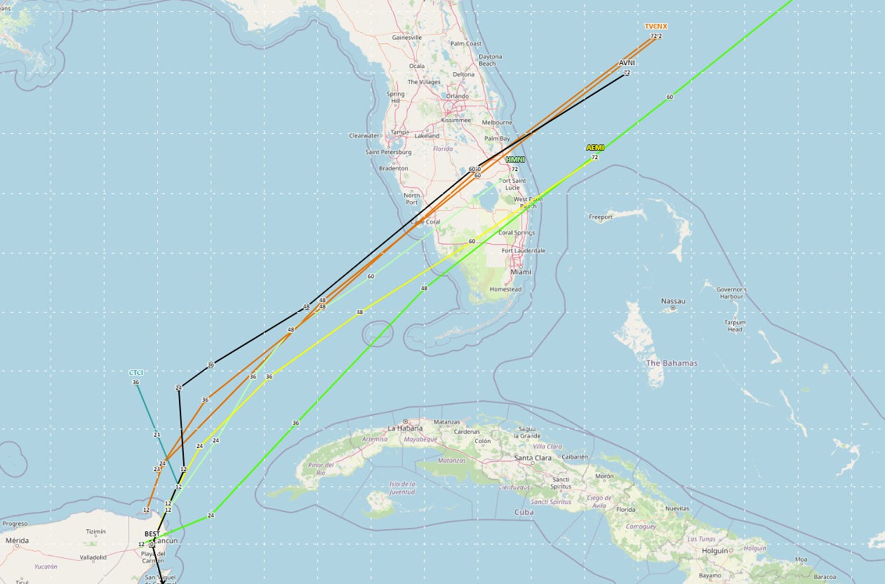
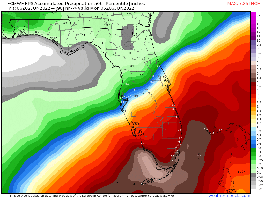
Changes to yesterday’s track and intensity forecast are minor. The storm will begin lifting north and then northeast across the southern Gulf on Friday, and accelerate northeast across the southern half of the Florida peninsula on Saturday. The probable point of contact with land is somewhere in the Fort Myers to Marco Island range as a low-end tropical storm, with the I-4 corridor roughly delineating the region of minimal or no impacts to the north from heavy rain to the south.
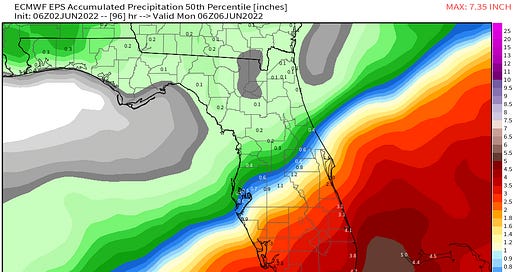
With model solutions coming in a bit more on the organized and further north range of yesterday’s possibilities, the most notable change to the forecast is an increased chance of widespread 4-8” rainfall totals south of a line from Fort Myers to West Palm Beach. The NWS has increased the odds of excessive rainfall late Friday and Saturday in this area, and at least localized flash flooding is a good possibility in urban South Florida. Storm totals between I-4 and Lake Okeechobee will vary, but are likely to land somewhere in the 1-4” range. The Keys and South Florida coasts should also brace for 1-2’ of possible surge and gusts out of the south of at least 40 to 50 mph, perhaps locally higher.
Overall, forecast confidence is increasing for a tropical storm strike on South Florida, which may well cause locally serious coastal and urban flood issues.
Elsewhere: Nothing of note.
Next report: Back with an impacts forecast for Florida tomorrow afternoon.

