


The Back Side of Water: WeatherTiger's Hurricane Watch for June 21st
Claudette exits stage right after depositing ample precipitation on the Southeast.

Each weekday, WeatherTiger’s Hurricane Watch brings you a pithy tropical briefing with that day’s hurricane history and current tropical activity. Paid subscribers receive these daily briefings and are able to comment and ask questions, as well as get our seasonal outlooks, analysis columns, daily forecasts and video discussions, and live landfall coverage. Free subscribers will receive our weekly forecast column and selected storm coverage. Get in touch at ryan@weathertiger.com with any questions.
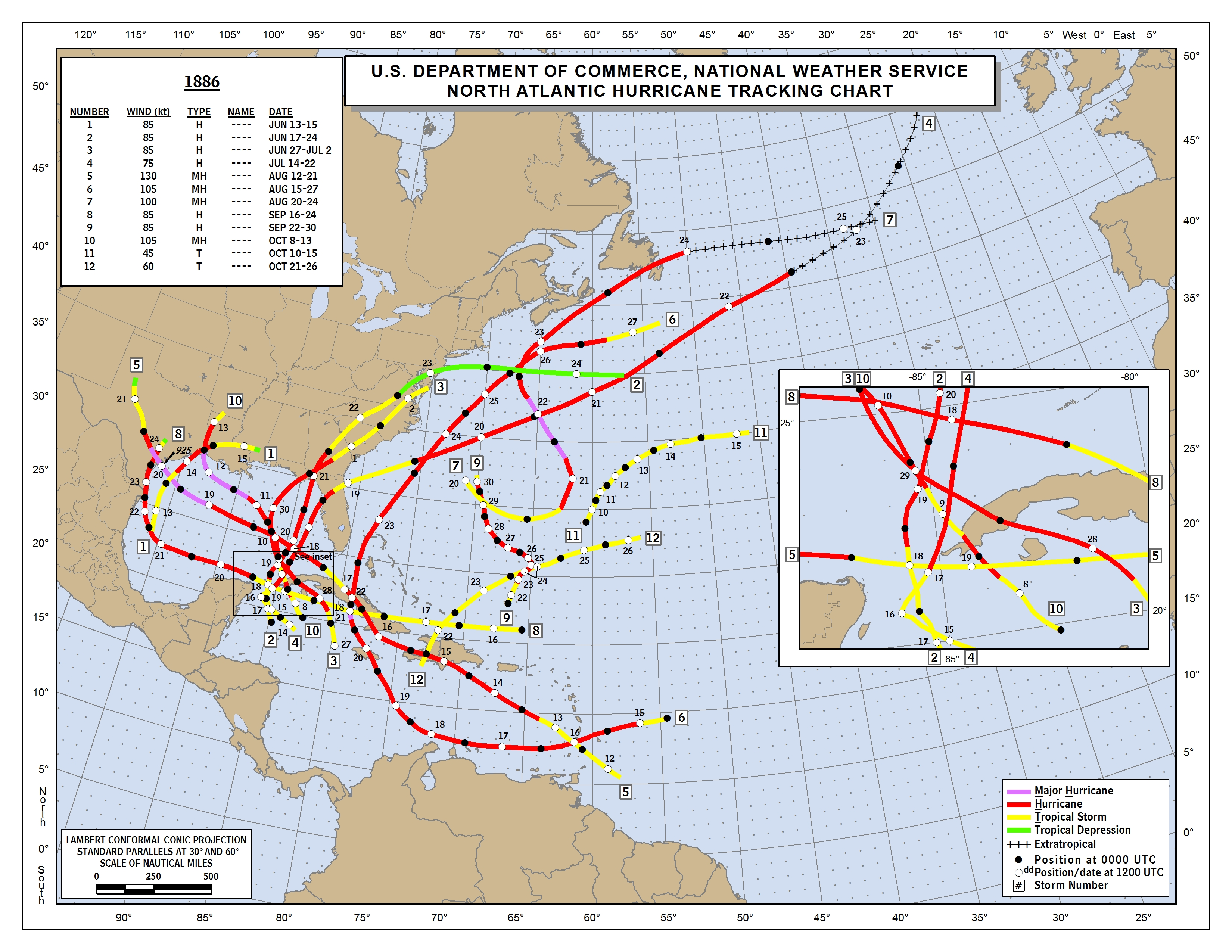
Almanac: Today is Monday, June 21st… day 21 of the 2021 hurricane season, 163 days to go. By total storm energy, the season is 1.8% complete as a whole, 5.0% complete for the continental U.S., and 6.3% complete for Florida. On this date in 1886, the first Florida hurricane landfall of the unprecedented 1886 early season onslaught struck on Apalachee Bay as a category 2. You can read more about that season here.
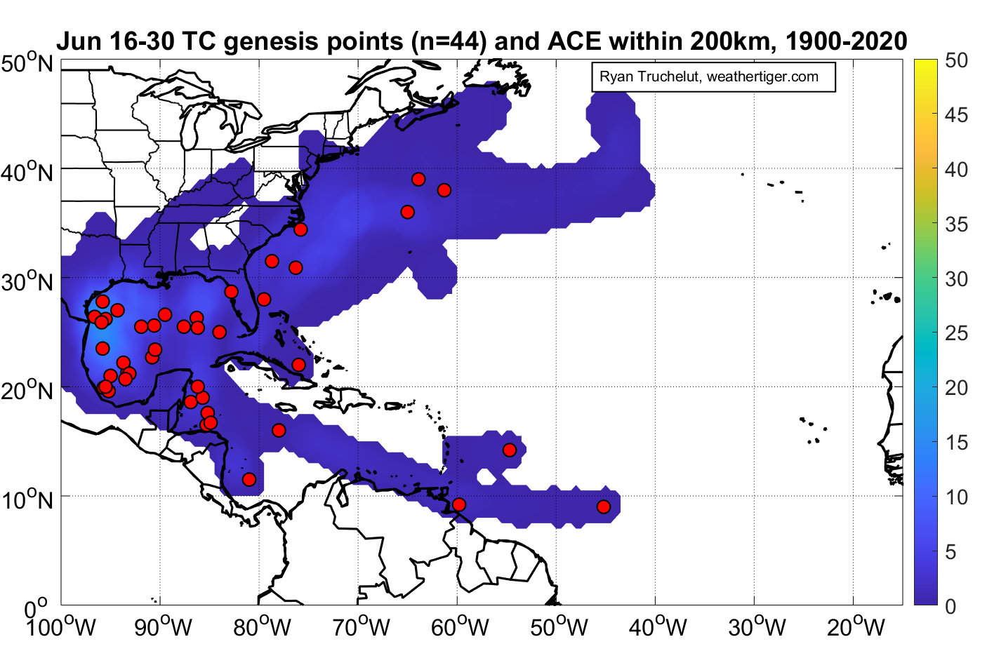
More typically, the second half of June features a focus of historical development on the Gulf and western Caribbean, with just a smattering of storms forming elsewhere.

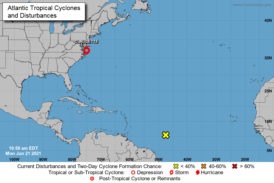
Active Storms: Tropical Storm Claudette intensified for a second time to a tropical storm while over land last night as it approached the Outer Banks of North Carolina, and is zipping northeast off the mid-Atlantic coast this afternoon as a minimal tropical storm. The current NHC forecast moves Claudette harmlessly into the open Atlantic as it transitions to a non-tropical low in the next 12-24 hours.
Claudette’s legacy, other than an affinity for land, is heavy rainfall over much of the central Gulf Coast and eastern portions of the Deep South. As shown below, general totals of 4-8” were observed from eastern Louisiana to the western Florida Panhandle, with 2-6” inland in Alabama and Georgia. Several destructive tornadoes also occurred in association with Claudette’s outer bands, along with localized flash flooding.

Current disturbances in NHC outlook:
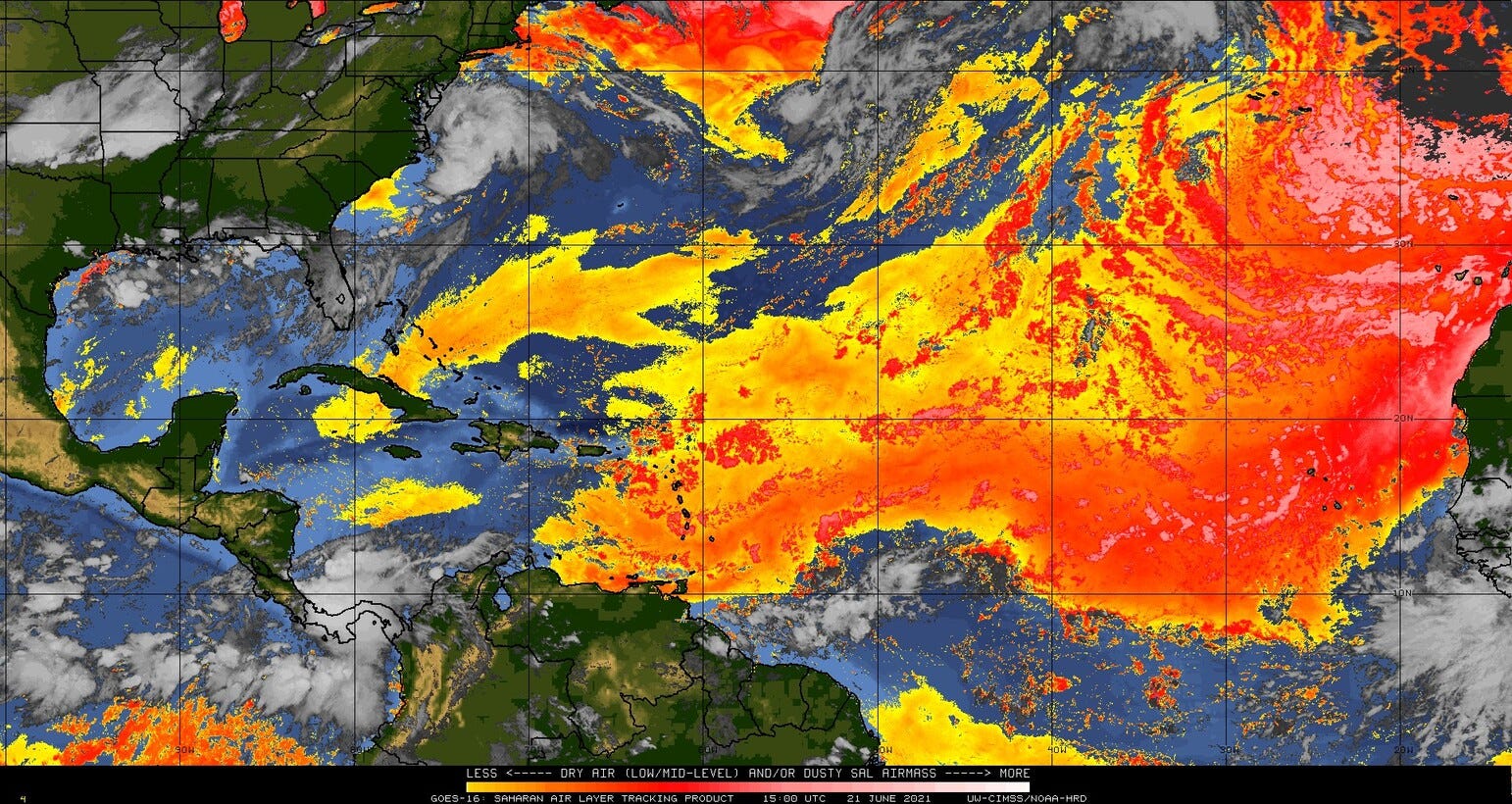
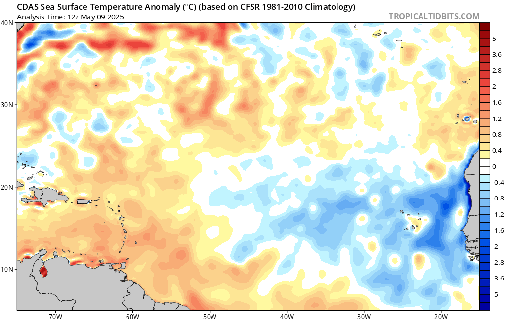
Central Tropical Atlantic (2-/5-day odds: 20/20%). A tropical wave along 10N approaching 50W is generating scattered convection in association with some turning in the low-level wind field this afternoon. Its organization is not currently impressive, and there is only a slight chance of brief development before the wave is sandwiched in a couple of days by eastern Caribbean shear and a dry, dusty African airmass just to its north (see below).
The wave axis will need to be monitored for potential development early next week as it may enter a more favorable environment in the western Caribbean, but it is not a short- or even medium-term concern at this point.
Elsewhere: Given unusually favorable upper-level winds promoting rising motion over the eastern Atlantic for the remainder of the month (greens and blues, below), there is some hint that waves emerging from the west African coast will need to be monitored for potential development towards the end of the month. This is despite climatology having no cases of eastern Atlantic tropical wave development in June (see top), and also SSTs that remain a little cooler than average in the Main Development Region. Overall, any MDR development in June is unlikely.

Next report: The next daily briefing will be issued by 3 p.m. tomorrow.