Sporting Chances: Hurricane Watch Weekly Column for July 31st
A tropical wave approaching Florida this weekend is a development threat, and may hang around the Southeast coast into next week.
WeatherTiger’s Hurricane Watch is a reader-supported publication. Paid subscribers get Florida-focused daily tropical briefings, plus weekly columns, full coverage of every hurricane threat, our exclusive real-time seasonal forecast model, and the ability to comment on posts.
Just as Americans care about swimming, pommel horse, and badminton for two weeks every four years, so too do predictable patterns shape tropical weather. Easterly waves roll off the African coast several days apart; upper-level winds often switch from favorable to unfavorable and back every two or three months; even the Atlantic itself seems to warm and cool on a multi-decadal cycle. This week, with Florida and the Southeast in the possible path of a tropical system, we’ll look at how those patterns are aligning to scaffold hurricane risks over the short, medium, and long terms.
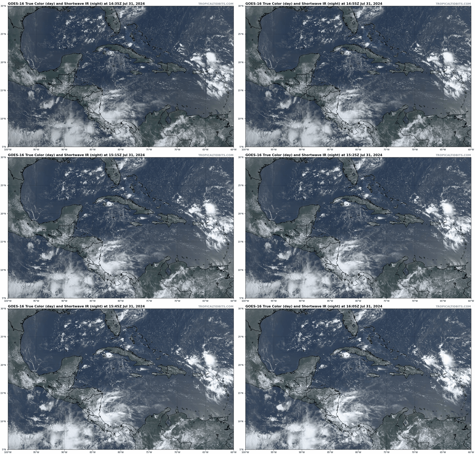
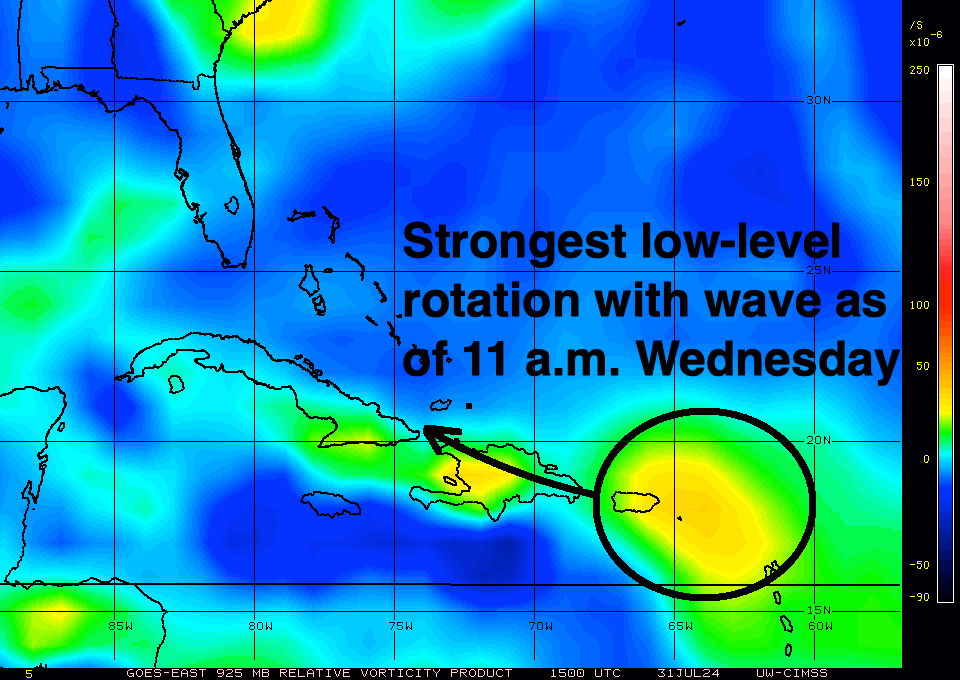
The immediate focus is on a sizable tropical wave near the eastern Greater Antilles. After a lonesome week of plowing westward through dry air and Saharan dust, the wave is finally beginning to generate respectable convection today within its broad area of cyclonic low-level winds. Large waves are hard to kill, but they also are slow to organize. Realistically, it’ll take until early Saturday for deep convection to potentially sculpt this scruffy wave into a tropical depression, by which time it will be over Cuba or the western Bahamas.
Given current trends, there’s a fair chance that “something” forms this weekend in the general vicinity of the Florida peninsula, though a wild card is how much the wave is disrupted by land interaction over the next few days. If the circulation can consolidate on the northern side of its expansive region of rotation, that would favor less disruption and faster organization; consolidating a little farther south means the developing center of circulation would contend with the mountains of Hispaniola and Cuba, delaying organization. As of mid-day Wednesday, the most concentrated low-level spin seems to be headed for the islands, though that could change.
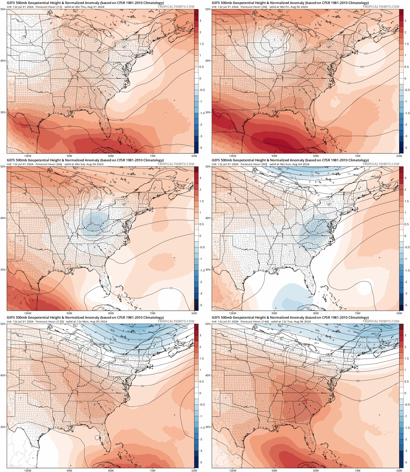
This matters because a depression or tropical storm that forms earlier, over the Bahamas, would likely connect with a dip in the jet stream over the eastern U.S., turn north, and remain east of Florida as it passes out to sea. Alternatively, if the wave stays disorganized, it would continue west-northwest into the eastern Gulf. Models suggest the eastern U.S. trough ships out and ridging redevelops over the Southeast next week, so if the disturbance gets into the Gulf, light steering currents mean it could meander for a while. With water temperatures in the eastern Gulf in the upper 80s and favorable outflow aloft, that would be something that we’d need to watch.
So: tricky forecast. In scenario 1, a faster-to-develop but sloppy tropical low moves north just east of (or over) the Florida peninsula this weekend, possibly scraping the Carolinas as it turns northeast after that. Whether or not this mess is named or numbered, impacts would be limited to elevated rain coverage across Florida and the coastal Southeast between Saturday and early next week. This outcome would be a shot over the bow heralding an active season to come, but not a serious concern in and of itself.
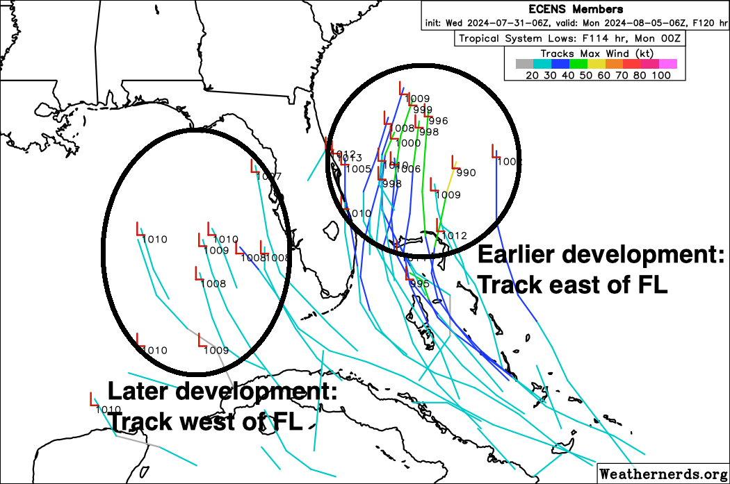
In scenario 2, a land-disrupted wave doesn’t develop by Saturday, just boosts rain chances in South and Central Florida as it crosses into the Gulf by the end of the weekend. The disturbance then festers over the eastern Gulf in a generally favorable environment through the middle of next week or beyond. There’s no guarantee anything would actually develop, and the wave’s large size and mountain-related discombobulation probably means that organization would be slow to occur, at least initially. Still, Gulf plus time isn’t a reassuring combination, and it’s unclear what the endgame of this situation is. Weak steering winds make for uncertain forecasts.
Overall, I wouldn’t be concerned— yet. While models have shifted a bit in the direction of scenario 2, today’s convection is also outperforming expectations, a point in scenario 1’s favor. Bottom line is the situation remains fluid until a trackable center of circulation emerges. All that can be said with confidence in the meantime is high rain coverage is probable in the Florida peninsula this weekend. Otherwise, it’ll take a few more days to sort out what may become of this messy wave, and the coastal Carolinas to the eastern Gulf Coast, including Florida, should monitor the situation.
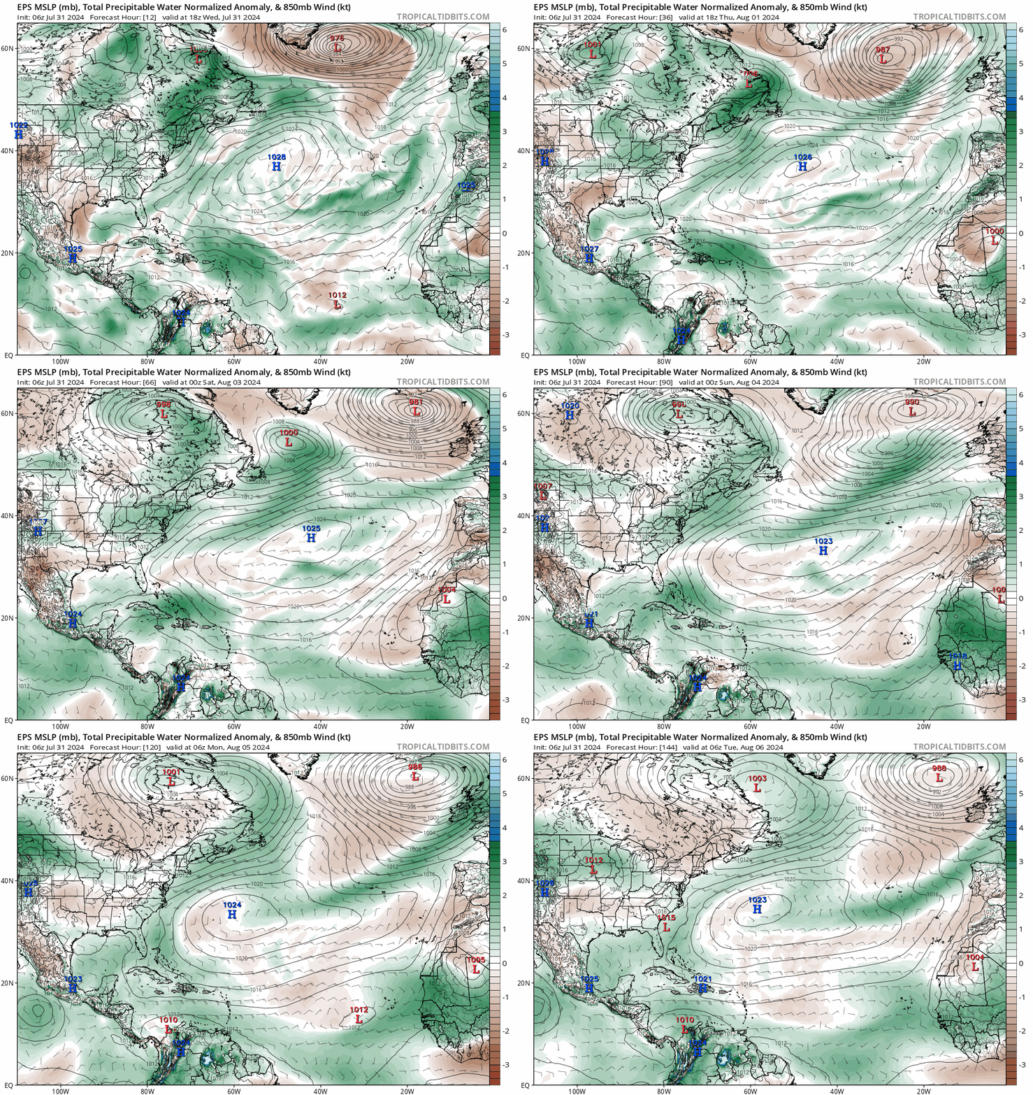
In contrast to the short-term forecast agita of being in a NHC area of prospective interest, the next week or two in the Tropics don’t look too alarming otherwise. Airmasses one to four miles up over the Tropical Atlantic look to remain drier than normal through mid-month, putting the kibosh on rapid development prospects for most tropical waves. Slow organization of waves in the western half of the Atlantic is possible, but it’ll likely continue to be an uphill battle in the medium term.
Unfortunately, conditions are likely to flip to favoring more tropical activity than normal in mid-August and afterwards, including the peak weeks of hurricane season in late August and September. While I’ll dig into my updated seasonal outlook once the current mishigas is off our desk, suffice to say that WeatherTiger continues to project a most likely outcome for the hurricane season ahead of around double the average tropical activity, our consistent prediction since March. Extremely warm waters across the Tropical and eastern Atlantic, weaker than average Main Development Region wind shear and low-level trade winds this summer, and a recent shift towards La Nina onset in the Pacific all support this forecast.
In short, keep your emotions in check regarding the wave that’s out there now, because like a fencer, BMX racer, or modern pentathlete, you’ll need to pace yourself to go the distance in 2024. Keep watching the skies.


TPS teacher planning begins tomorrow thru next week. The whole shebang begins 12th. Very interested to see what the Atlantic has in mind.