Reprieve, Reprieve: WeatherTiger's Weekly Column for September 2nd
Hurricane Larry is likely to head for no-mans-land while the U.S. gets a needed break.
WeatherTiger’s weekly Thursday column is provided free to all subscribers. To get our complete storm coverage, upgrade to premium for as little as $8 to get daily forecast briefings, in-depth forecasts and videos during Florida hurricane threats, live landfall coverage, expanded seasonal outlooks, and the ability to comment and ask questions. Click below to sign up below now, or to share the Hurricane Watch with your friends and family.
Florida threat synopsis (column starts below): Hurricane Larry remains no threat to Florida. A weak low has a slight chance of developing in the western or central Gulf and hooking north in a week or more, but risks to Florida of a significant storm remain minimal.
There are some forecasts that you don’t want to be right.
Not because forecasters “are wrong half the time” or don’t hate being wrong. We’re not, and we do. But simply because you know the consequence of a correct forecast will be unimaginable human suffering.
Last week’s grim prognosis for Hurricane Ida was such a forecast. Unfortunately, the NHC’s consistent predictions for a Category 3 or 4 storm to cross southeastern Louisiana were timely and accurate.
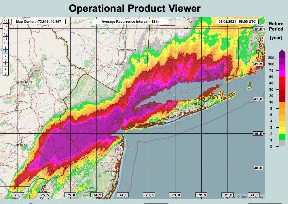
With the destruction along the Gulf Coast barely comprehended and unprecedented floodwaters still flowing in the northern mid-Atlantic and southern New England, the time for a full accounting of Ida’s legacy lies ahead. Still, as Ida’s maximum sustained winds at landfall are tied for fifth-strongest in the continental U.S. since 1851, and 200-year-old river records were topped in the northeast corridor, Ida is sure to be a top 10 all-time historical U.S. hurricane in terms of intensity, impacts, and damage.
The good news is that today’s tropical outlook is not the kind of forecast to wish against: Florida and the continental U.S. are unlikely to see any significant hurricane threats over the next five to seven days.
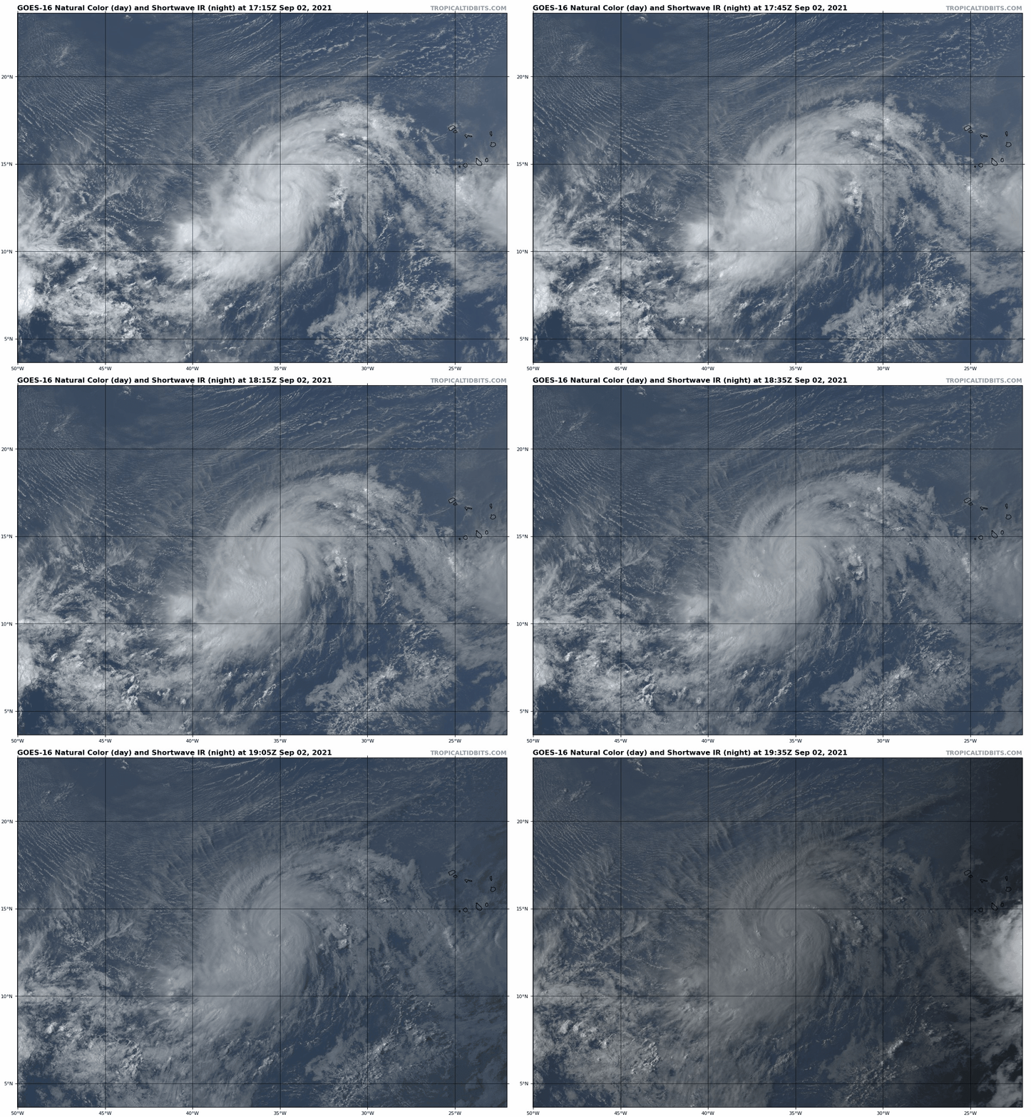
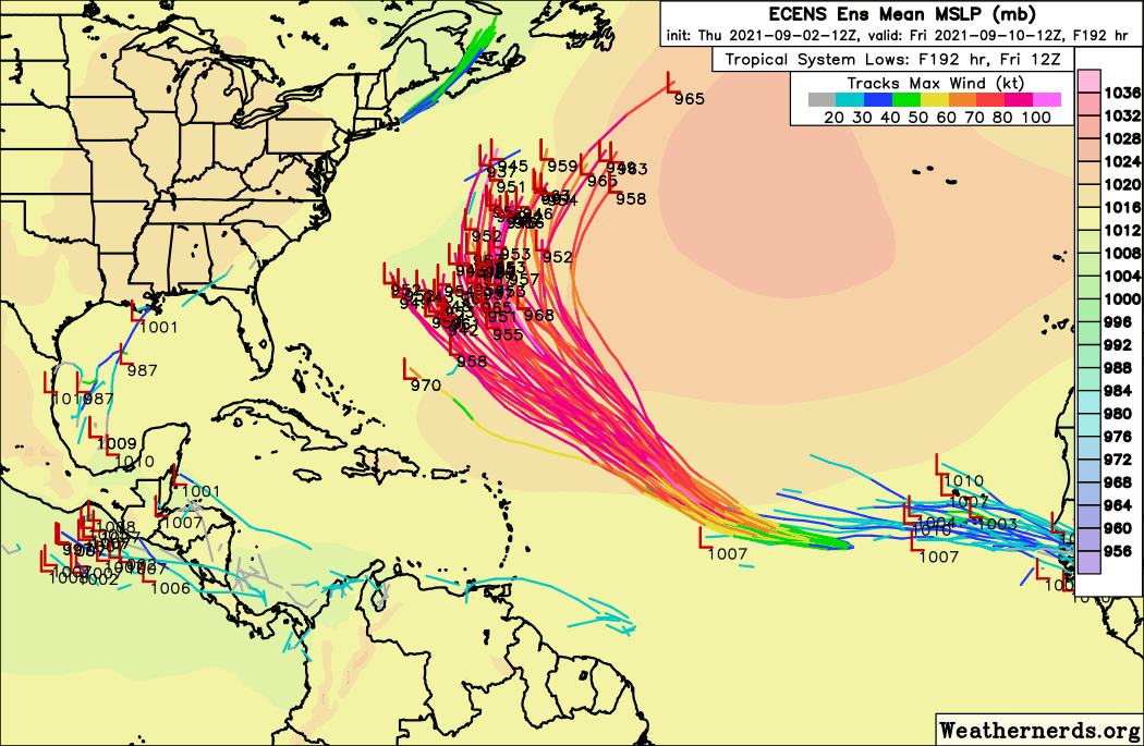
Hurricane Larry is looking pretty, pretty good in the eastern Tropical Atlantic, and is expected to become a major hurricane well east of where storms typically first attain Category 3 strength. Larry will continue west-northwest this weekend with a gradual turn to the northwest into the central Atlantic early next week, probably remaining a major hurricane as it does.
On this track, Larry eventually may be a serious concern for Bermuda, but it will have no impacts on Florida other than some nice swells from the east in about a week for the surfers. The mid-Atlantic and Northeast should keep half an eye on Larry, but even there any direct impacts are extremely unlikely.
And that’s especially great news, as the first two weeks of September are the busiest of the year for Florida hurricane activity, accounting for over a quarter of historical landfalling storm energy. If there is a strong ridge of high pressure near Bermuda, east-to-west steering winds can guide the powerful “long-tracking” Cape Verde hurricanes that are most common in September all the way across the Atlantic towards Florida. Think Irma, or for the classicists, the Great Miami Hurricane of 1926.
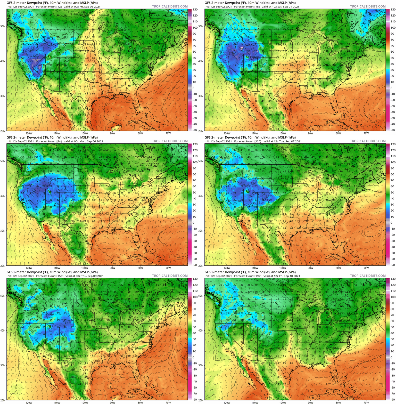
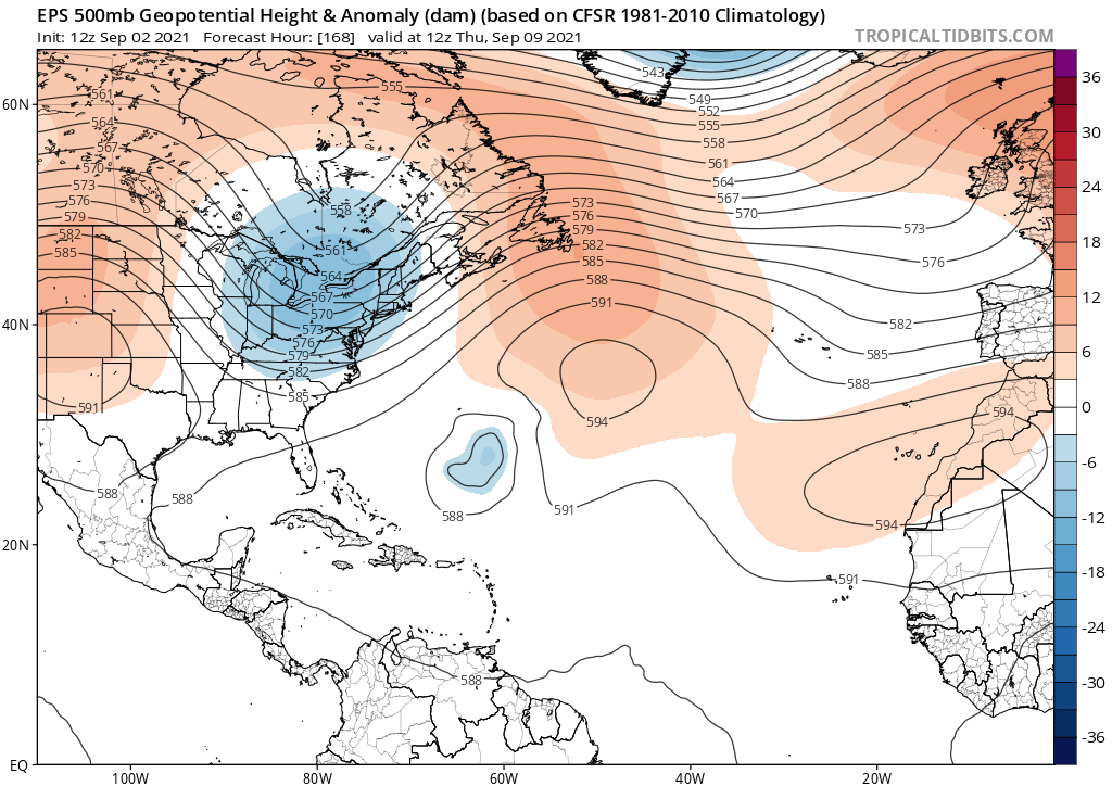
In contrast, Florida and the East Coast are protected from Larry by a fortuitous dip in the jet stream over the eastern third of the U.S., which is causing steering winds in the western Atlantic to run more south-to-north for the time being. Though this could change later in September, there is high confidence this trough will steer Larry out-to-sea this week well east of the U.S. coast.
Believe it or not, this eastern trough is also going to push a couple of early season cool fronts south across the Florida peninsula over the next 8 to 10 days. Don’t expect an outbreak of pumpkin spices, scarves, and decorative gourds, but there should be a noticeable change in Florida weather from oppressive to merely unpleasant this week. We’ll take what we can get.
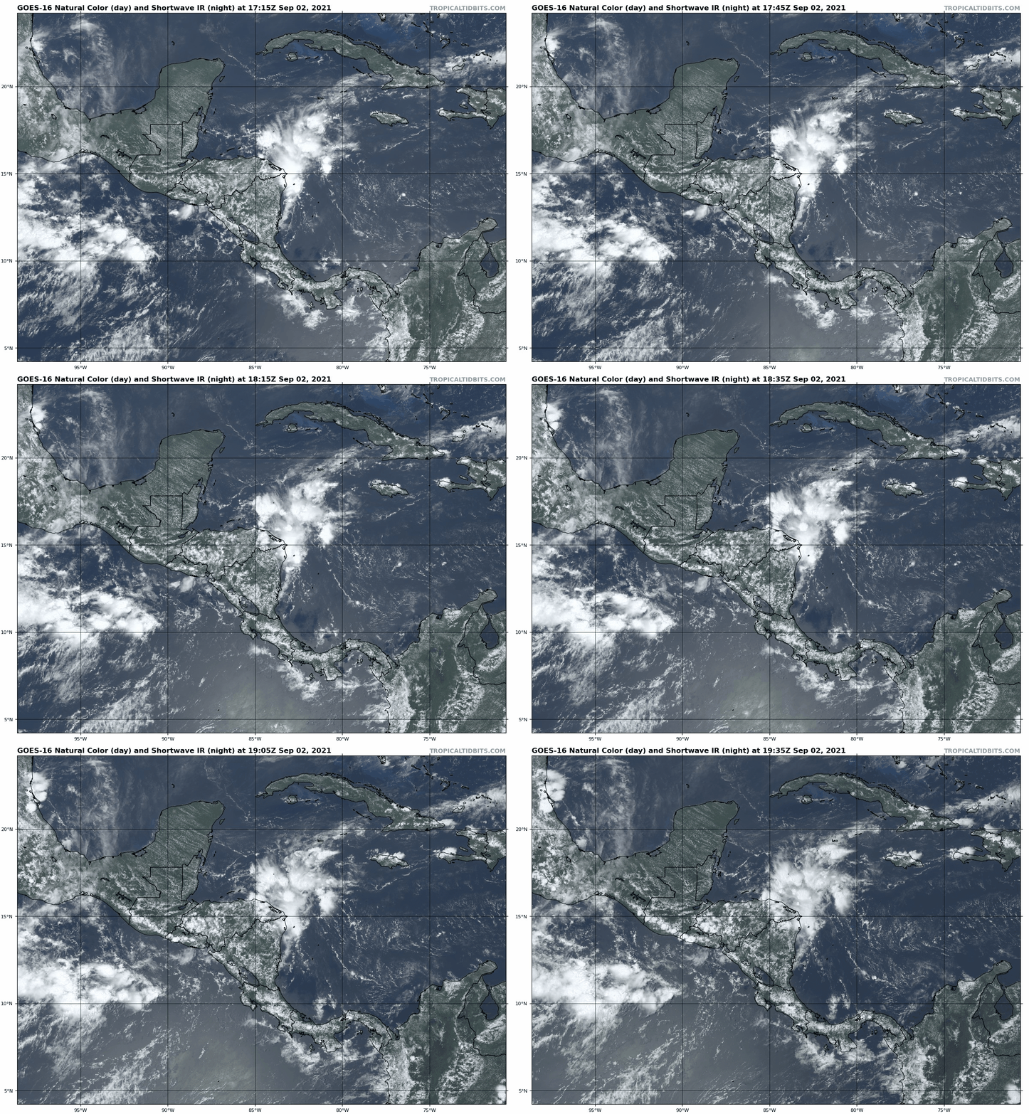
The only area to watch in the Tropics over the next week for any chance of eventual U.S. impacts is a weak area of low pressure located inland over Honduras and Nicaragua, Invest 91L. This low will bumble northwest over land for the next few days, but may re-emerge over the southwestern Gulf of Mexico early next week. There is a slight chance of organization in four to eight days, and it is plausible that the eastern U.S. troughing could put anything that develops on an eventual north or northeast heading.
However, the environment over the Gulf will be sheared and not especially favorable for strengthening, and there is also a good chance that 91L never disentangles itself from land in the first place. We’ll keep an eye on the southern Gulf as things can change quickly at this time of year, but overall concerns for any kind of significant storm for the Gulf Coast are thankfully low at this time.
Invest 91L does point out that eastern troughing is only a friend to Florida if the primary direction of approach for hurricane threats is from the east, which is usually but not always true in September. If a storm is initially to the south, like Hurricane Hermine on this day five years ago or Hurricane Earl in 1998, an eastern U.S. trough can Hoover it up and fling it toward towards the Gulf or Southeast Coasts.
Despite those examples, that type of storm is historically less common in early September. However, it becomes more predominant in late September and October as the Cape Verde long-tracker threat wanes. So, while we can unapologetically root for this week’s forecast as the eastern U.S. trough gives us a much-needed reprieve from hurricane threats, the persistence of such a pattern may spell trouble down the road. Keep watching the skies.
Next update: Paid subscribers will receive a daily briefing tomorrow.


