Born on the Bayou: WeatherTiger's Weekly Column for August 26th
Yet another very dangerous hurricane threat is developing for Louisiana.
WeatherTiger’s weekly Thursday column is provided free to all subscribers. To get our complete storm coverage, upgrade to premium for as little as $8 to get daily forecast briefings, in-depth forecasts and videos during Florida hurricane threats, live landfall coverage, expanded seasonal outlooks, and the ability to comment and ask questions. Click below to sign up below now, or to share the Hurricane Watch with your friends and family.
Florida threat synopsis (column starts below): Dangerous (future) Ida will pass well west of Florida this weekend, perhaps boosting rain chances in the Panhandle. Additional tropical development in the eastern Atlantic and potentially the Caribbean in six to ten days’ time will need to be watched by Florida-based interests, though there are not yet any specific threats to the state through the first week of September.
One of the traditions of the late, great Dr. Bill Gray—forefather of seasonal hurricane prediction and great-great-grand-doctoral advisor to the WeatherTiger—was ringing a bell on August 20th to mark the beginning of the most historically active six weeks of hurricane season.
It is one of my core beliefs that Florida deserves a more culturally specific version of this ceremony. Perhaps the ill winds of September could be dispelled by placing a chicken tender sub in the foam-flecked remnants of Kissimmee’s Xanadu: Home of the Future, dumping some bath salts into Biscayne Bay, or releasing unwanted exotic lizards into a pristine wildlife refuge. We’ll never know if we don’t try.
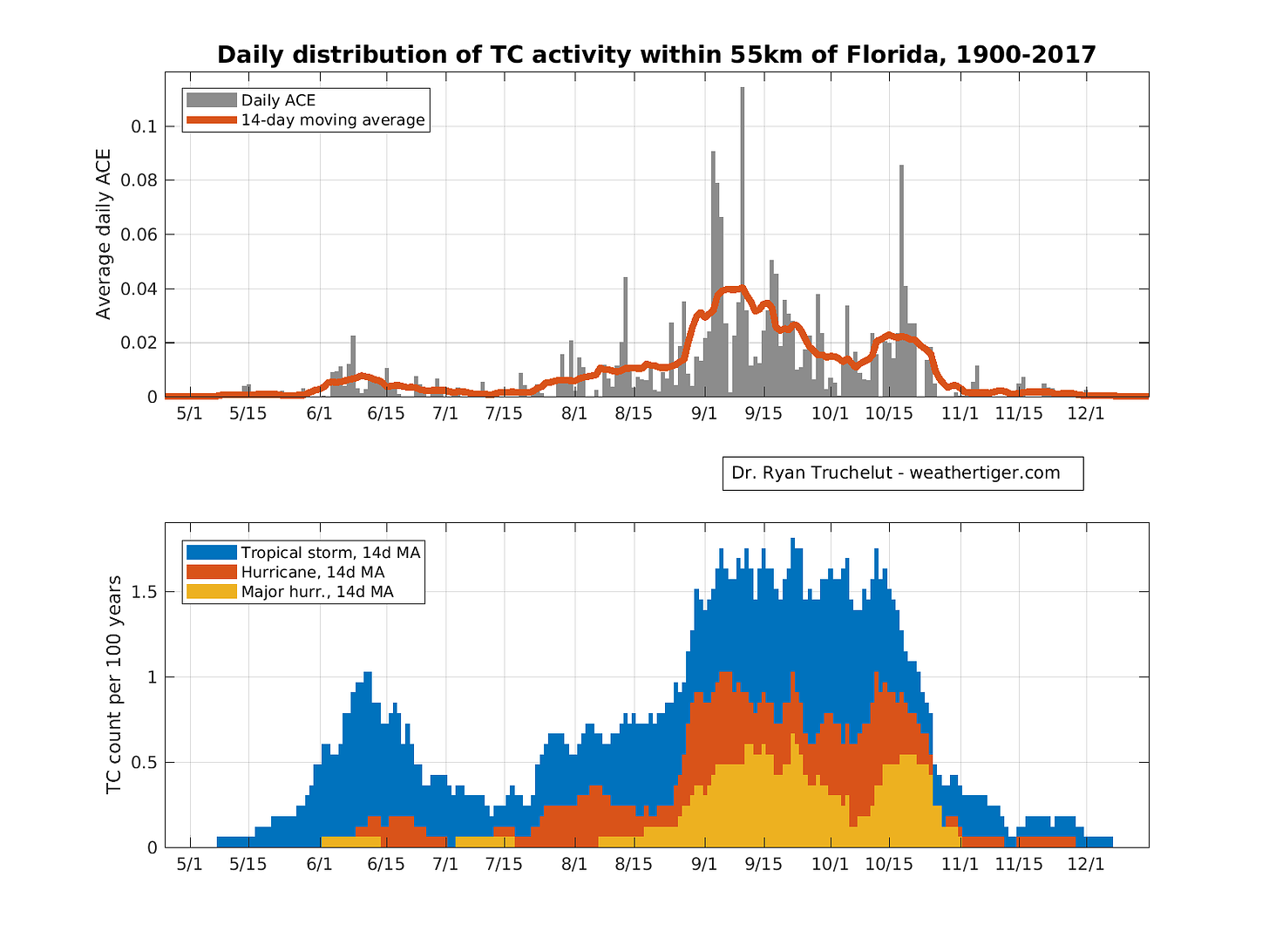
Whatever method of reflecting on peak hurricane season’s arrival best comports with your all-important freedoms, that peak is here: over 50% of Florida’s intensity-weighted storm impacts occur between now and September 30th.
Today, there are some potential long-term risks worth watching, but Florida should dodge the tropical onslaught of the next five to seven days. However, a brutal weekend is ahead for Louisiana.
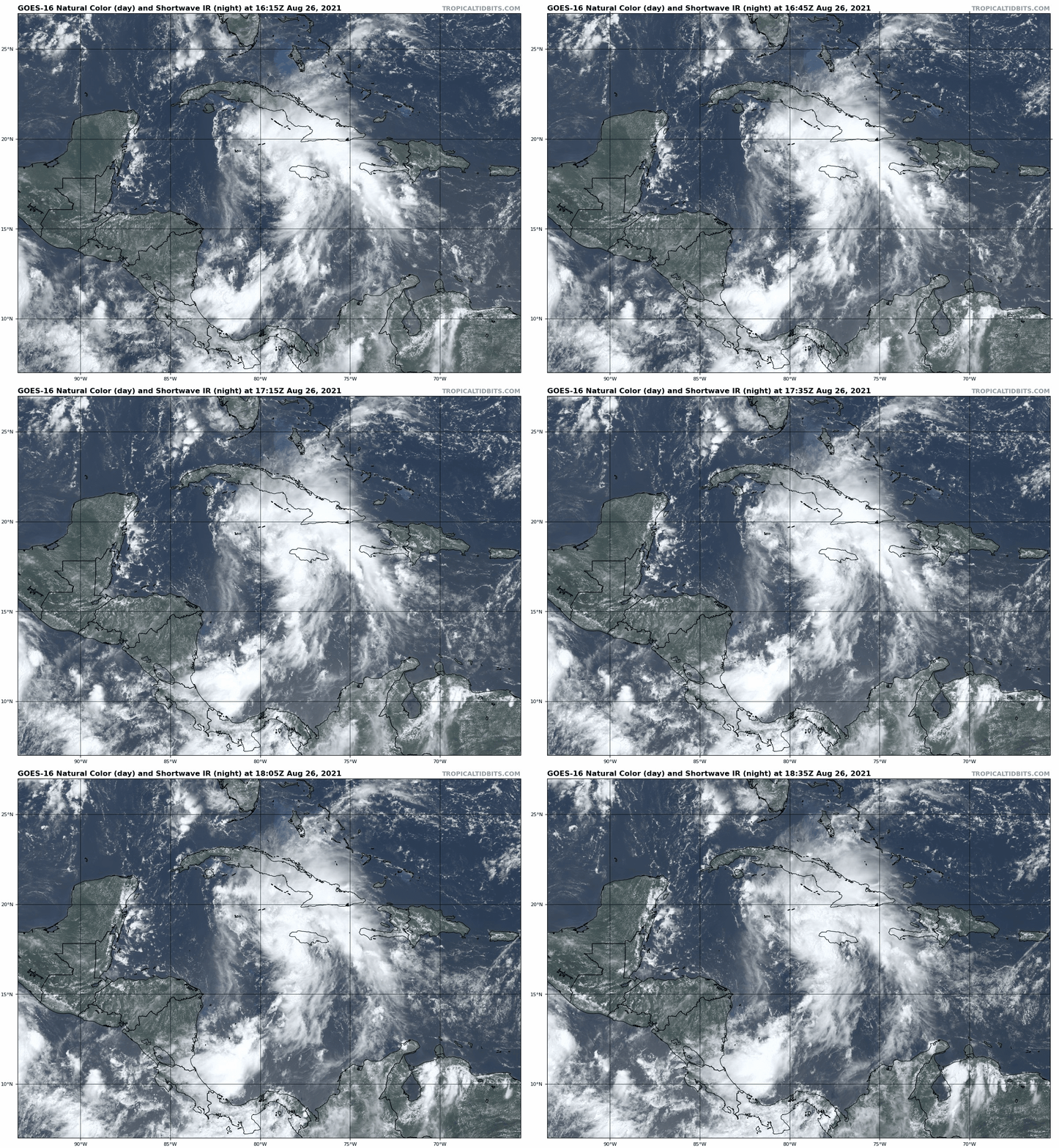
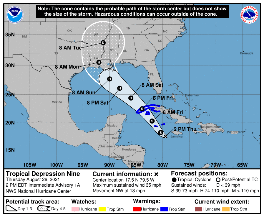
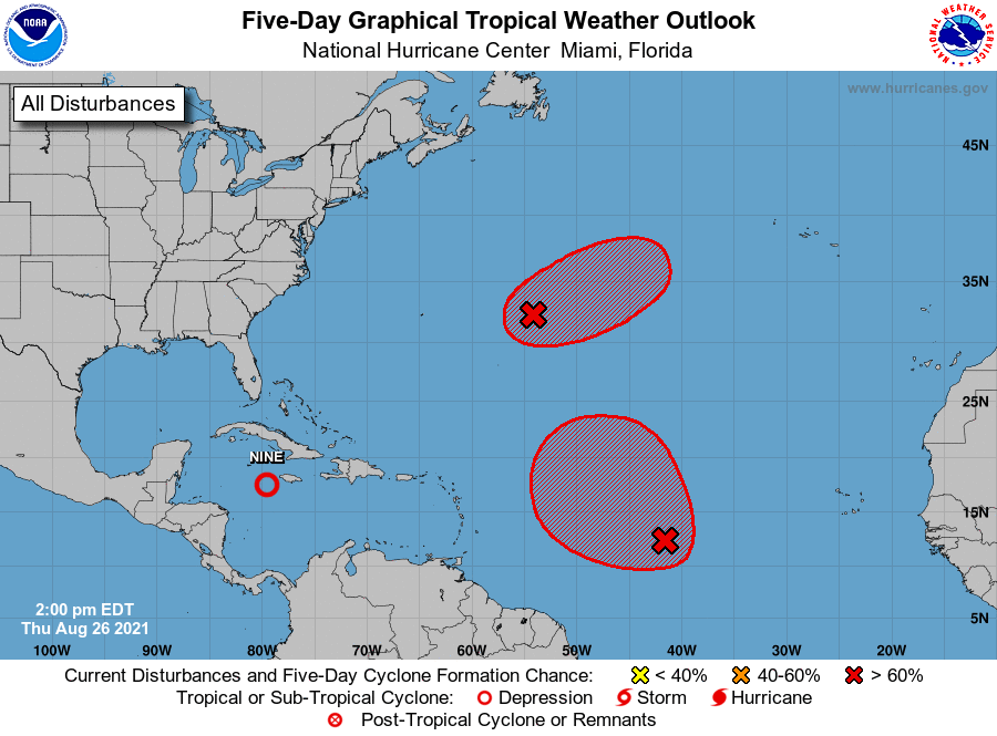
The key feature on the map is Tropical Depression Nine, which has developed in the Caribbean Sea south of Cuba and west of Jamaica. This system is organizing quickly as it moves northwest, and TD 9 is likely to strengthen to Hurricane Ida by Friday evening as it passes close to the western tip of Cuba.
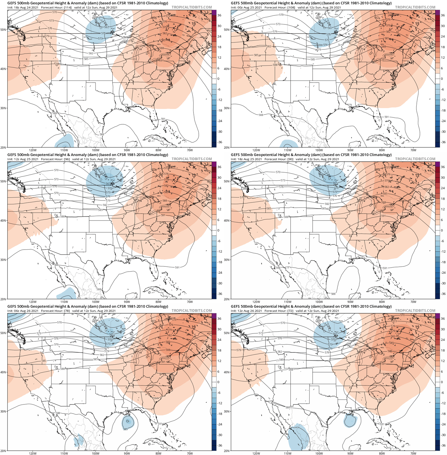
Ida will continue moving northwest across the Gulf of Mexico over the weekend, steered by a strong ridge of high pressure centered over Georgia and the Carolinas. On this track, Ida will likely near the Louisiana coast late Sunday or early Monday.
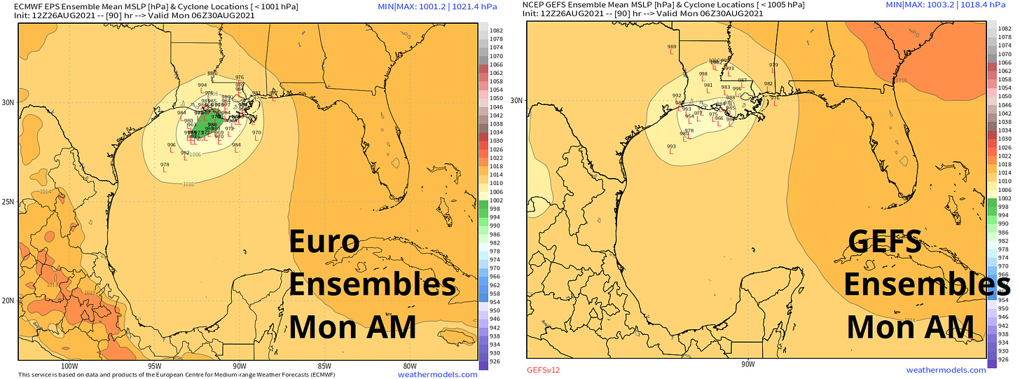
Over the last few days, computer model guidance for Ida has shifted east, but is now tightly clustered on an eventual landfall point somewhere between Houston and Gulfport. Understandably, this has caused some consternation that further shifts east are imminent that will put Florida in the line of fire.
The good news for Florida is that this model mayhem has been due to fuzzy math regarding exactly where a low-level circulation would form along TD 9’s axis of broad rotation, and not due to big changes in the location or strength of the steering high-pressure system (see 48-hour trend in Sunday ridge position above). In general, predicting where a circulation will form along a trough is a hard problem for which models have poor skill; picking where steering ridges will be is an easier problem for which models have more predictive power.
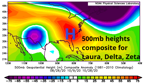
Thus, with a low-level circulation now developed along the northern extent of the wave and a steering environment much like that observed during 2020’s Louisiana hurricane strikes (above), model consensus and forecast confidence in a track towards the west-central Gulf Coast is improving. Some forecast changes are inevitable, but Florida can for the most part relax, as I do not expect significant moves in the predicted track of Ida in the next few days. Some enhanced rain chances are possible in the Panhandle.
But what a dangerous track that is for Louisiana. Ida’s expected path aligns nearly perfectly with an avenue of the warmest and deepest waters in the Atlantic, extending from the northwestern Caribbean into the north-central Gulf, including a passage over the Gulf’s notorious Loop Current. Sea surface temperatures on final approach to Louisiana are in the upper 80s, pushing 90° in spots. Coupling this extraordinary oceanic heat potential with abundant mid-level moisture and an outflow jet to the north of the storm over the weekend is a recipe for rapid intensification into landfall.
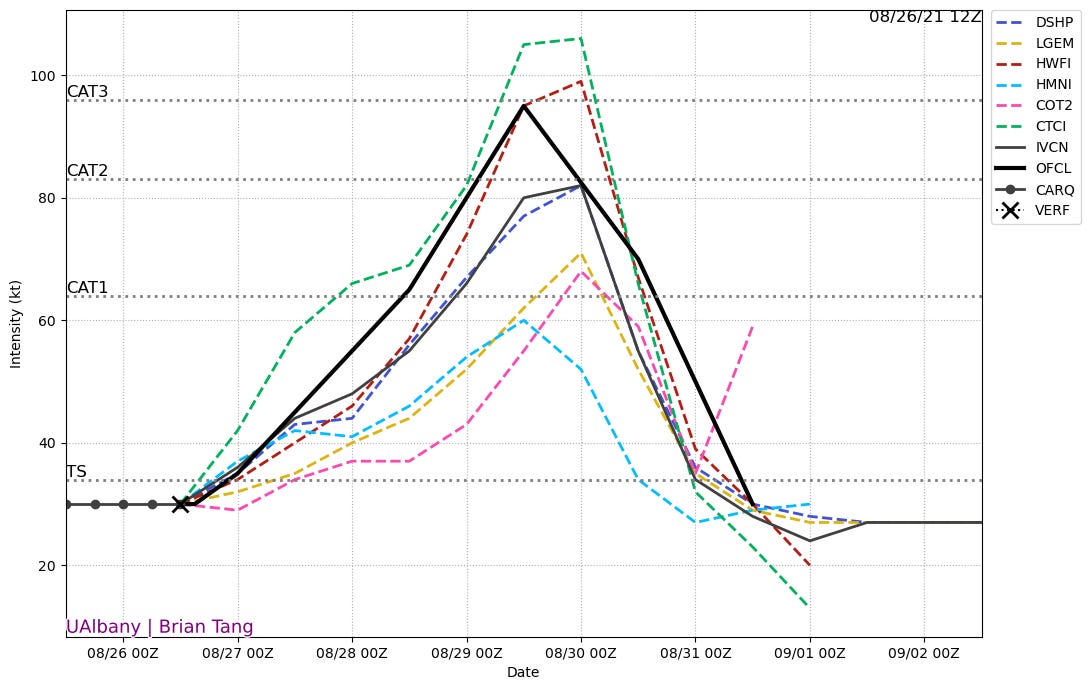
As of 2 p.m. Thursday, the NHC intensity forecast calls for a head-spinning 30 kt of intensification between Saturday and Sunday mornings, up to strong Category 2 intensity. Usually, early NHC advisories run conservative on intensity, but in recognition of this explosive environment, they’ve stopped being polite and gotten real: TD 9’s initial intensity forecast among the most aggressive the NHC has issued.
This forecast may yet be too low, and landfall at Category 3 or Category 4 intensity is a reasonable expectation. Time appears to be the only limit on rapid intensification processes in the Gulf, once engaged on Saturday, through landfall by early on Monday.
If you’re reading this from Louisiana, I regret to inform you that the time to start preparing for a major hurricane landfall is now. It is too early to know who will take the worst hit, but everyone in southern Louisiana needs to be taking a hard look, right now, at what you would do in a worst-case scenario. Ida is going to come at you faster than you think, and there won’t be much time to react. So start reacting.
Elsewhere, there are two other disturbances in the central Atlantic that have realistic chances of becoming tropical storms or hurricanes over the next three to five days, but neither is any threat to the continental U.S. The next names on the list are Julian and Kate.
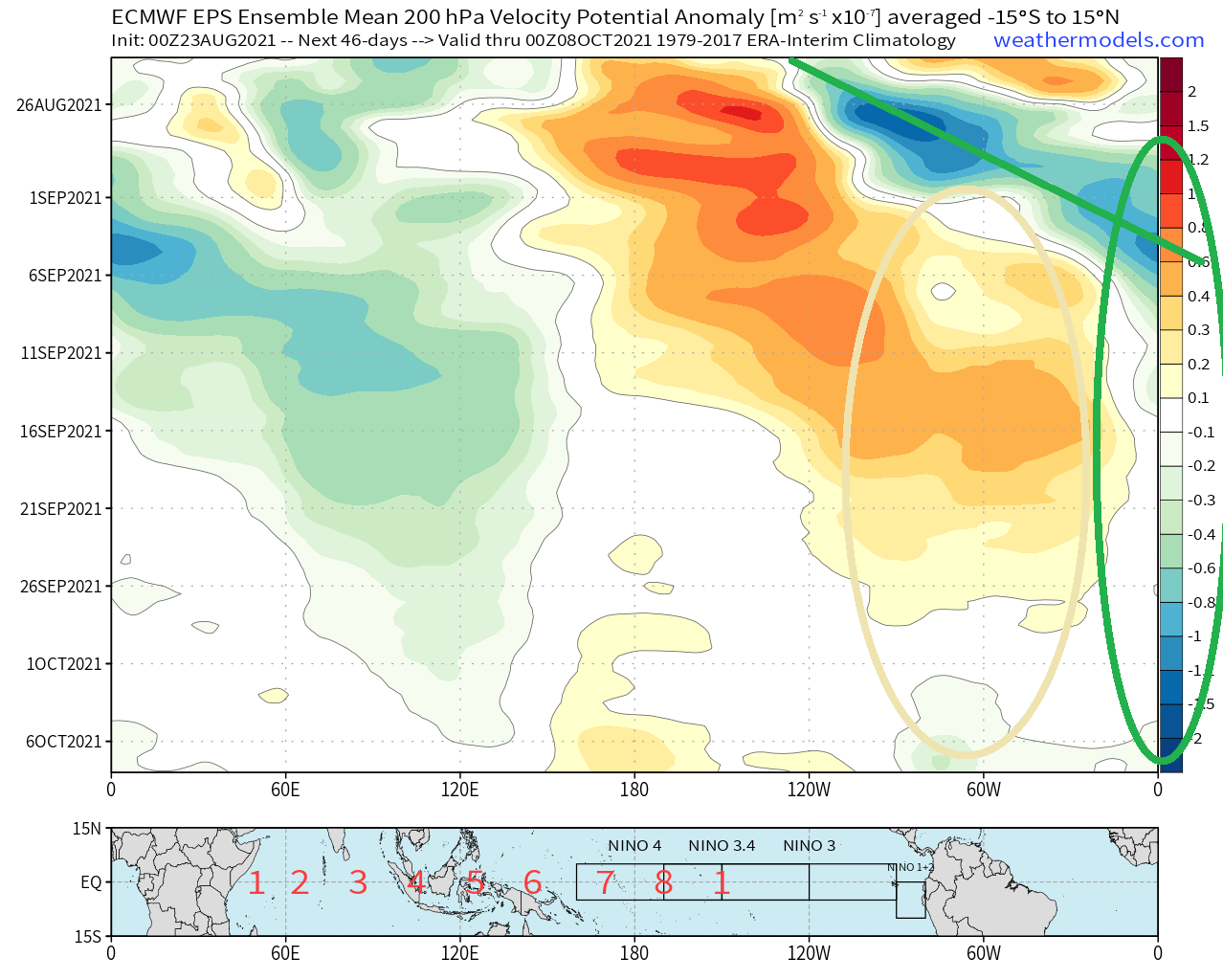
At longer range, a pulse of very favorable upper-level winds is poised to move over the Tropical Atlantic later this week and remain in place through at least the climatological peak of the season in mid-September. Expect additional tropical development in the eastern Atlantic and perhaps another round of trouble in the Caribbean in six to ten days’ time. All this activity will need to be watched for Florida’s interests, though there are not yet any specific threats to the state through the first week of September.
For now, the focus is on Ida, which has potential to be yet another devastating major hurricane hit for Louisiana, still very much in recovery after Hurricanes Laura, Delta, and Zeta. The peak season of hurricane season is here, and that bell can’t be un-rung. Stay safe and keep watching the skies.
Next update: Paid subscribers will receive a daily briefing tomorrow.


