Quick as Gaston: The Hurricane Watch for September 20th
Fiona goes major, Gaston develops, and the U.S. focus shifts to a threatening wave approaching the Caribbean.
If you are not already a supporter, please consider signing up for a free or paid subscription to WeatherTiger’s Hurricane Watch. Paid subscribers get Florida-focused tropical briefings each weekday, plus weekly columns, coverage of every U.S. hurricane threat, our exclusive real-time seasonal forecast model, and the ability to comment and ask questions, for $7.99/mo. or $49.99/yr. Free subscribers receive our weekly columns and storm coverage in your inbox.
Florida tropical threat synopsis: A wave approaching the eastern Caribbean today is a potential threat to Florida in 8-10 days.
Almanac: It’s Tuesday, September 20th… day 111 of the 2022 hurricane season, 72 days to go. By total storm energy, the season is 63.8%, 72.7%, and 63.5% complete for the Atlantic, continental U.S., and Florida, respectively.
With high hurricane activity in the next five days, the 2022 season is likely to be back to almost the median for ACE through 9/25 over 1950-2021. Busy times in the Tropics. I’m missing that slow start already.
Active Storms:
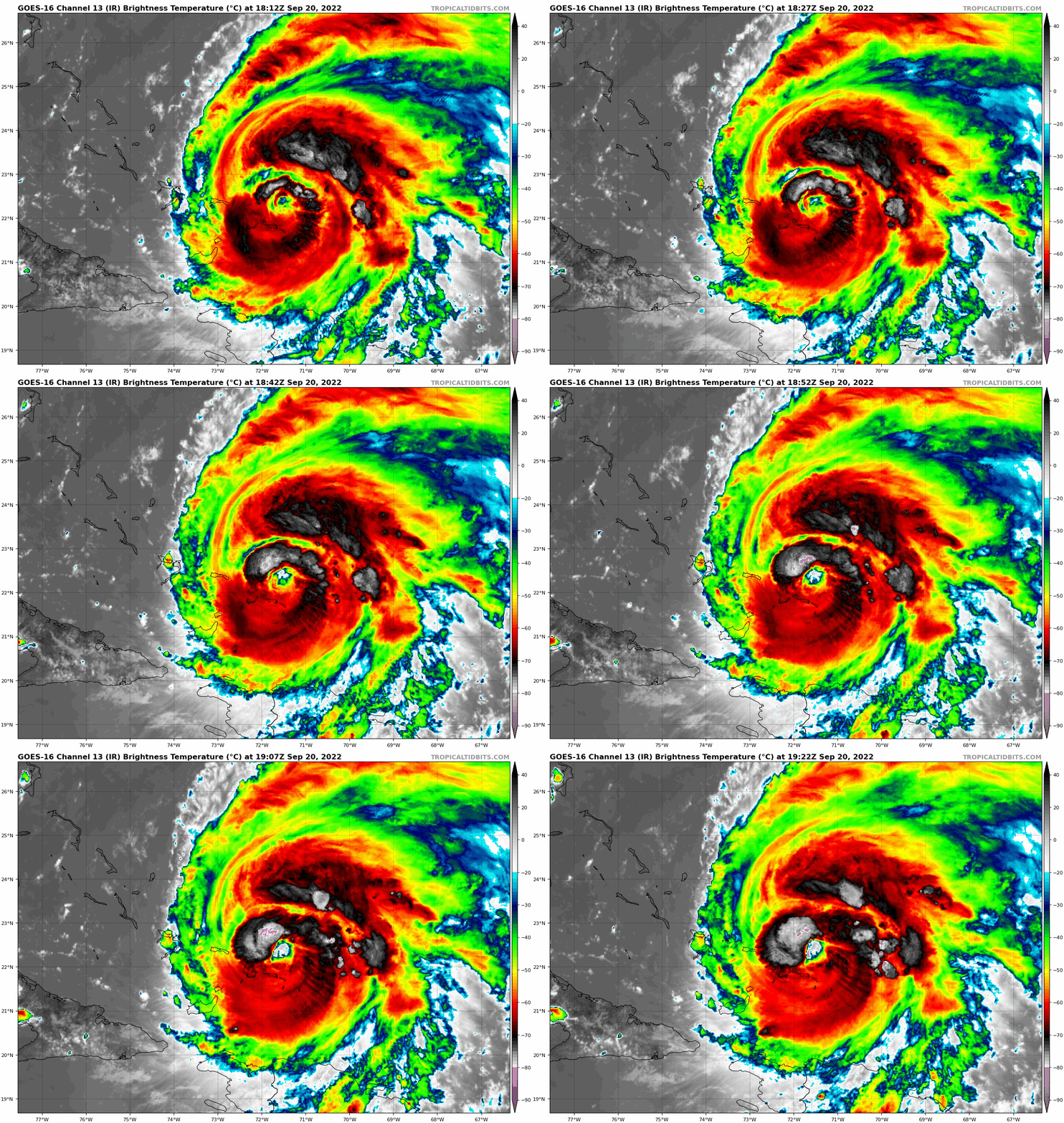
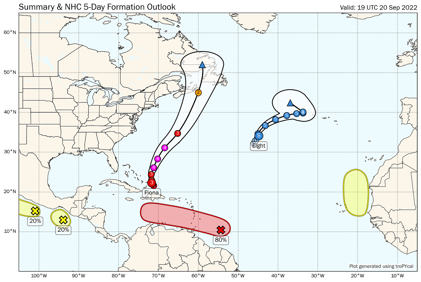
Hurricane Fiona: Fiona is traversing the Turks and Caicos this afternoon with sustained winds of 115 mph, making it the first Category 3 (major) hurricane of the 2022 season. As Fiona slowly lifts north from the islands, its eye is clearing out and convective symmetry is improving; look for continued intensification, likely to Category 4 status, over the next 24-48 while it accelerates out to sea. Fiona will pass just west of Bermuda on Thursday as a major hurricane, and move into Atlantic Canada this weekend as an extraordinarily powerful extratropical cyclone, with significant impacts expected there. U.S. impacts will be limited to large swells from the east along the U.S. East Coast.
Tropical Depression Eight/Tropical Storm Gaston: Tropical Depression 8 developed into morning in the open subtropical Atlantic. The 2 p.m. Best Track position estimate has TD 8 as a tropical storm already, so it will claim the name Gaston at 5 p.m. This one will strengthen a bit while meandering the open ocean over the next few days before merging with a front. No threat to anyone.
Other Disturbances in NHC outlook, with 2-/5-day NHC development odds:
Invest 98L east of the Lesser Antilles (60/80%): The primary focus for the U.S. today isn’t one of the named storms, but rather a tropical wave still about 500 miles east of the southern Windward Islands. While this wave is not well-organized at the surface, convection has increased in the last 24 hours near a weak low analyzed by the NHC near 10N, 55W.
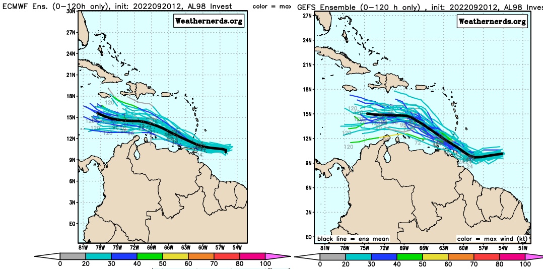
Invest 98L continues to look like potential trouble down the road. With very warm SSTs, ample mid-level moisture, and a ventilating upper-level wind pattern in place in the Caribbean, the development of a tropical depression in the next 2-3 days is likely, with ridging to the north steering 98L mostly west or west-northwest through the weekend. Its exact path is shorter term path (see below) is dependent on where a surface center consolidates and potential land interaction with South America.
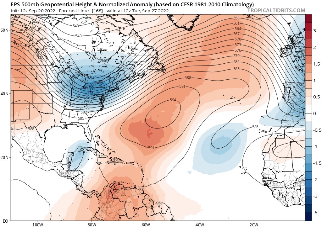
In the longer term, there is potential for 98L to turn north after reaching the western Caribbean due to a likely weakness in the subtropical ridging there (see below), possibly setting it on a path towards the Gulf in around a week’s time. This, coupled with a favorable environment for strengthening, means that all interests in Florida and along the entire Gulf Coast should watch 98L’s progress closely. However, nothing is certain: a faster/stronger 98L could turn north earlier, and a weaker/further south 98L might continue west into Central America. All these scenarios have some guidance support at this time. Much more on this one tomorrow.
Eastern Atlantic (0/20%): There is a slight chance of development near the West African coast in 3-6 days. Anything that forms would be short-lived, and not a threat to the U.S. or anyone else.
Elsewhere: That’s more than enough.
Next report: Weekly out tomorrow afternoon.


