Peak Performance: Hurricane Watch Weekly Column for September 7th
Two active hurricanes and a couple more waves to watch as the Atlantic passes the historical midpoint of the season this week.
If you are not already a supporter, please consider signing up for a paid subscription to WeatherTiger’s Hurricane Watch. You’ll get Florida-focused tropical briefings each weekday, plus weekly columns, coverage of every U.S. hurricane threat, our exclusive real-time seasonal forecast model, and the ability to comment and ask questions, for $7.99/mo. or $49.99/yr.
Like quality salsa, hurricane seasons are chunky. Long stretches of boredom commensurate with that of a seven-year-old at a Nike Factory Outlet often are punctuated by intense bursts of tropical activity. While the Atlantic showing signs of life this week after a soporific August is not unusual, the good news remains that there are no threats to Florida or the U.S. coastline today.
This uptick, led by Hurricanes Danielle and Earl, is timely as the next seven days are the historical peak of hurricane season, with 10-15% of total activity and historical U.S. landfalls crammed into the five-pound bag of the upcoming week. These two storms have produced around 20 units of Accumulated Cyclone Energy (ACE) since September 1st, and will rack up around 10 more through the weekend.
With 100 ACE units constituting an average season, Danielle and Earl’s contributions alone have lifted 2022 partway back from historical oblivion. While this was the second-quietest start to a year since 1950 a week ago, by the season’s midpoint, 2022 will have clawed its way to precedented levels of inactivity, or less ACE than about 2 out of 3 first halves of hurricane seasons. That also moves WeatherTiger’s seasonal forecast performance (thus far) from embarrassingly wrong to just plain wrong, all without any direct impacts on the U.S. Kudos to Danielle and Earl for the win-win.
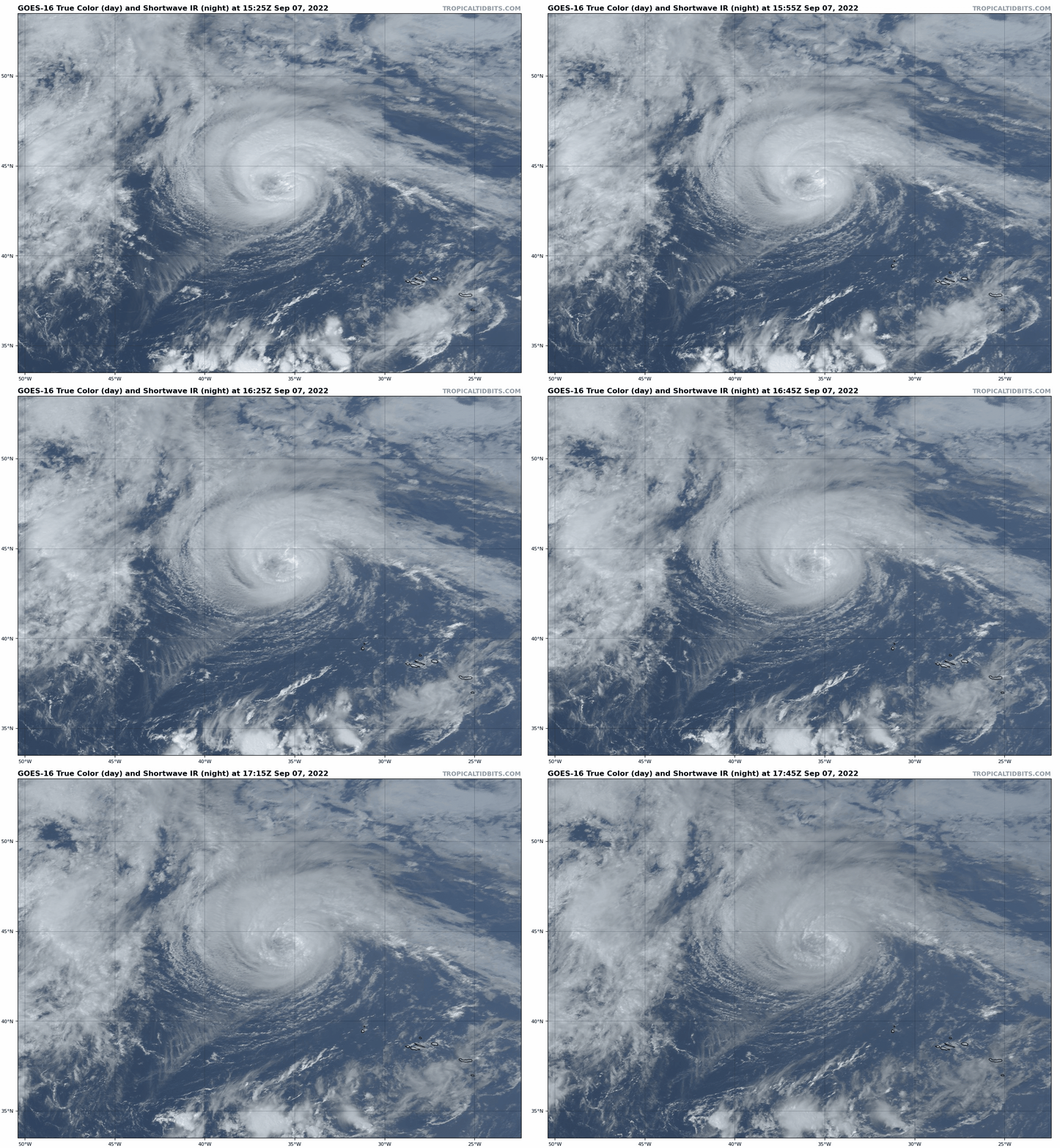
Still, there’s a lot of season to go—half, to be precise—and more development is possible in the week ahead. Currently, Hurricane Danielle is showing the tenacity of the cockroach as it clings to Category 1 status in the North Central Atlantic. Danielle has impressed for a hurricane that spent its entire life cycle at the latitude of Nova Scotia, but a northeast track into colder waters means a transition to a strong frontal low is imminent. Europe will get rain from the remnants of Danielle early next week.
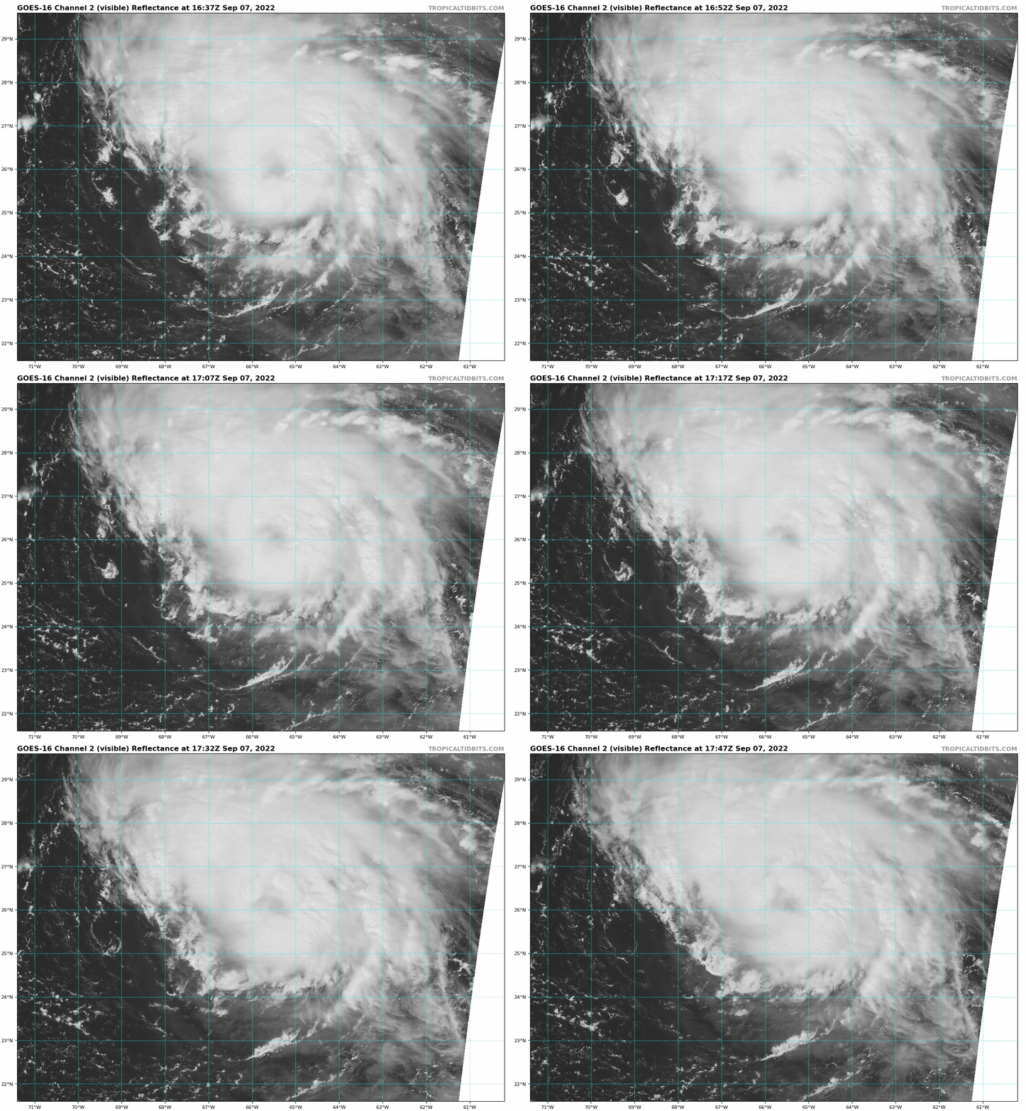
Hurricane Earl has also beaten the odds, claiming sustained winds of around 85 mph in the teeth of brisk wind shear halfway between Puerto Rico and Bermuda. Shear abates as Earl accelerates north over the next few days, and it is likely to become the year’s first major hurricane by Friday, passing a few hundred miles southeast of Bermuda. That merits Tropical Storm Warnings for the island, but don’t fear for the resilient people of Bermuda: their roofs are limestone ziggurats that collect rain and shrug off hurricane-force winds. Earl will be a nuisance as it passes on its way to the open Atlantic, and the only U.S. impacts will be long-period swells along the East Coast this weekend. Goodbye, Earl.
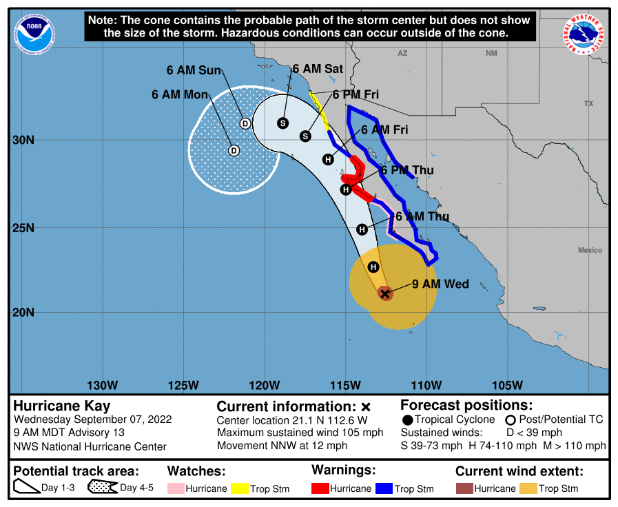
As a brief aside, internet rumors are being mongered that California is going to be hit by a hurricane this week. Before conjuring the grim spectacle of the Red Hot Chili Peppers fleeing (Flea-ing?) the wrath of a Category 5, note that the NHC forecast calls for the Eastern Pacific’s Hurricane Kay to weaken to a remnant low offshore northwestern Mexico, and for California to just receive needed rainfall from residual tropical moisture. Cool ocean temperatures make the landfall of a structurally healthy tropical cyclone on the West Coast as unlikely as a California orange producing a satisfying glass of juice.
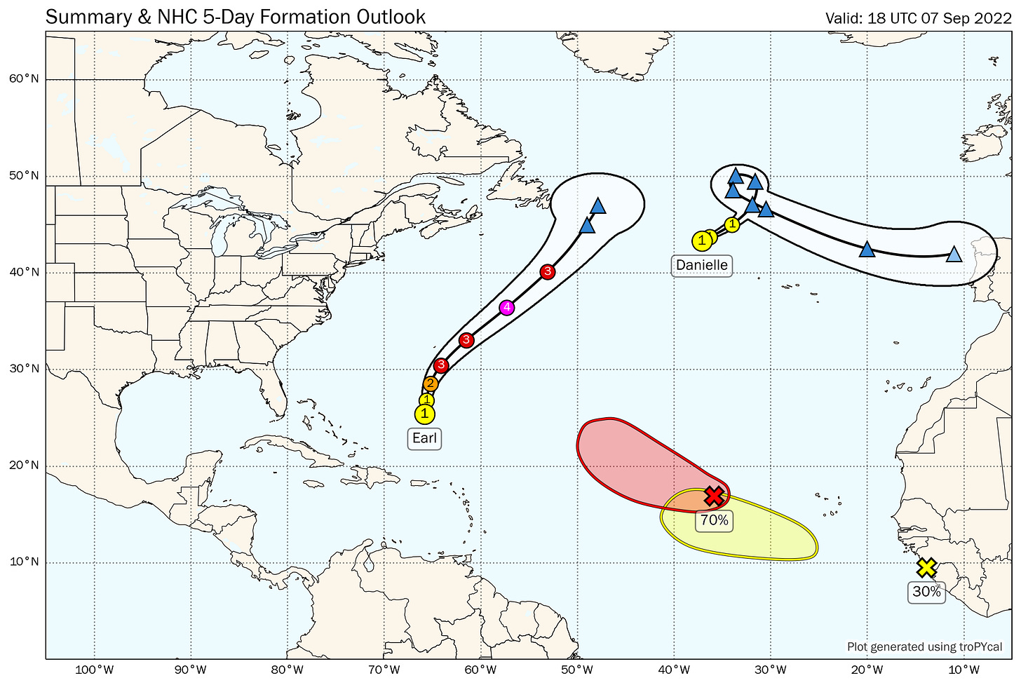
Back in the Atlantic, there are additional waves that have a shot at further organization this week, none especially alarming. A tropical wave west of the Cabo Verde Islands in the eastern Atlantic has a short window for development through Friday before it gets sheared out while turning north into open waters. A second wave emerging from West Africa presently is a little more interesting, as it is diving off the coast far enough south to initially dodge, duck and dip the drier airmasses to the north. This wave has an opportunity for development as it moves west-northwest at a leisurely pace into late next week, though it too may tangle with dry air down the road.
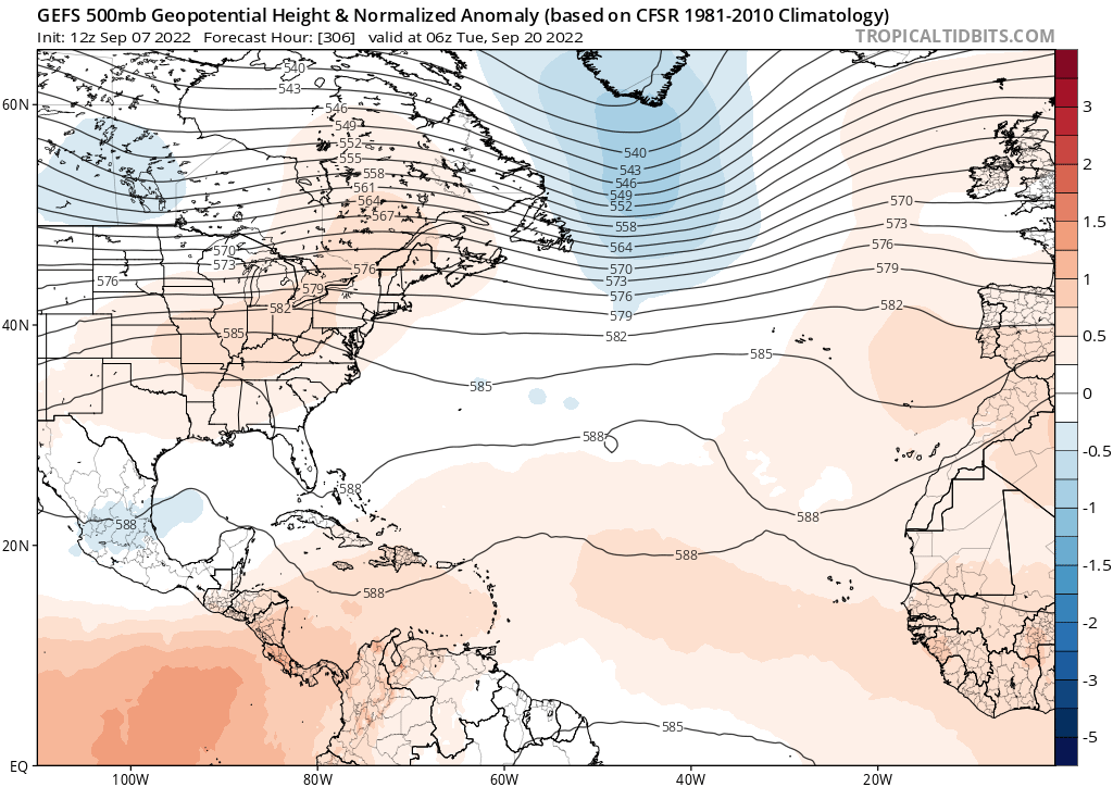
At longer range, there are hints of a ridge of high pressure possibly setting up over the Southeast U.S. heading into the back half of September, and all tropical waves will need to be watched closely should that steering pattern develop. Historically, the overlap of means—storms approaching from the east— and opportunity— a dangerous steering regime— for historical Florida East Coast hurricane threats becomes less common after around September 20th. Let’s hope we can get through a few more weeks without means and opportunity intersecting. (Motive doesn’t apply as hurricanes are not sentient, despite their chaotic neutral alignment.)
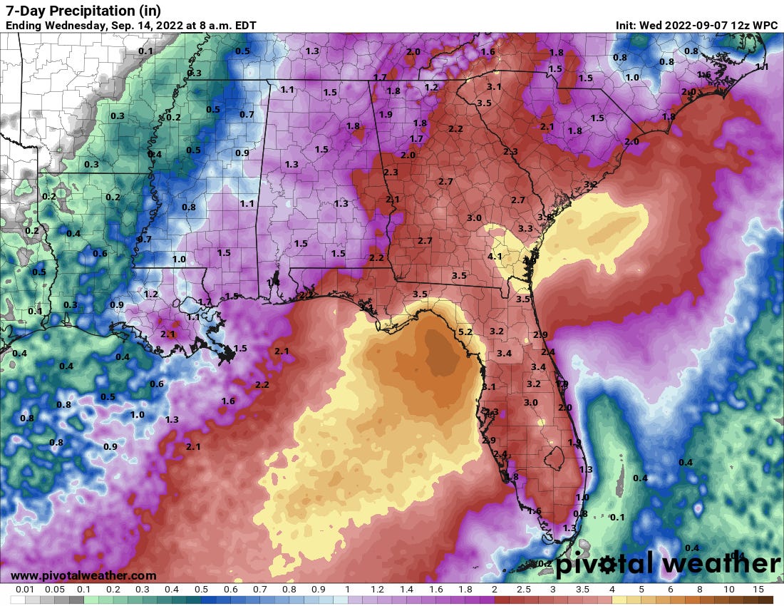
The bad news is that crummy weather need not be of tropical origin, and the weekend forecast for Florida looks like a dud. An upper-level low moving over the Central Gulf Coast this weekend will pull deep tropical moisture north over the state, catalyzing numerous showers and thunderstorms through Monday. Expect rainfall accumulations of 1.5-3” in Florida in the next 5 days, with local totals of 5” or more possible along the Gulf Coast. Due to the proximity of the upper low, this will not be an organized tropical system, but tell that to your outdoor plans.
Overall, the 2022 hurricane season looks more typical in the light of early September, though not yet in any way that is cause for concern. I’m rooting for more of that mild salsa flavor as the second half of hurricane season gets underway. Keep watching the skies.


