Odette, Won't You Spare Me Over?: WeatherTiger's Hurricane Watch for September 17th
A new tropical storm is moving away from the U.S. while risks diminish from an Atlantic wave.
This is the last daily tropical threat bulletin of our free trial. We hope you have enjoyed our coverage of a busy week in the Atlantic, as well as our fall hurricane season outlook. If you found it valuable, please consider upgrading to a paid subscription to continue to receive our daily reports, be comment and ask questions, and get subscriber extras. As always, thanks for reading the Watch, and feel free to get in touch at ryan@weathertiger.com with any questions.
Two-sentence Florida tropical threat synopsis: Enhanced rain chances over western Florida from the remnants of Nicholas will continue into the weekend, but there are no organized tropical risks to Florida over the next 10 days. TS Odette and an Atlantic wave are no longer potential concerns to the state.
Almanac: It’s Friday, September 17th… day 106 of the 2021 hurricane season, 77 days to go. By storm energy, the season is 58.9% complete as a whole, 68.0% complete for the continental U.S., and 58.2% complete for Florida.
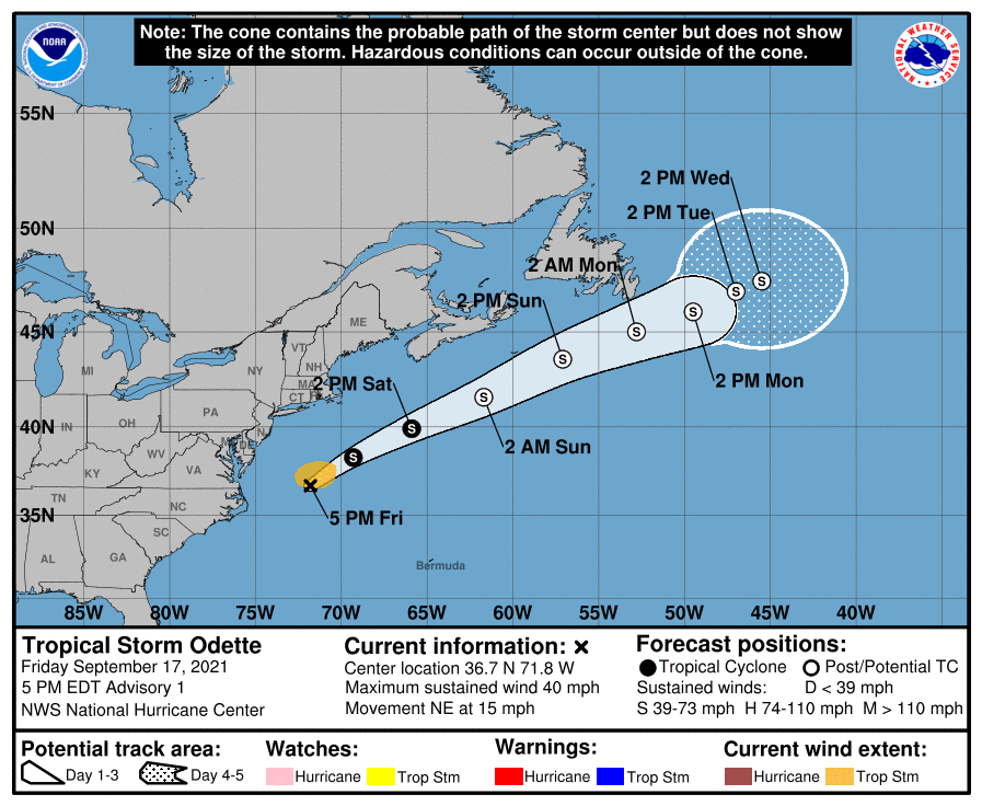
Active Storms: As of 5 p.m. Friday afternoon, Tropical Storm Odette has developed from a broad area of low pressure east of the mid-Atlantic. Odette may strengthen further as it accelerates northeast and away from land over the weekend, but it is not a threat to U.S. interests.
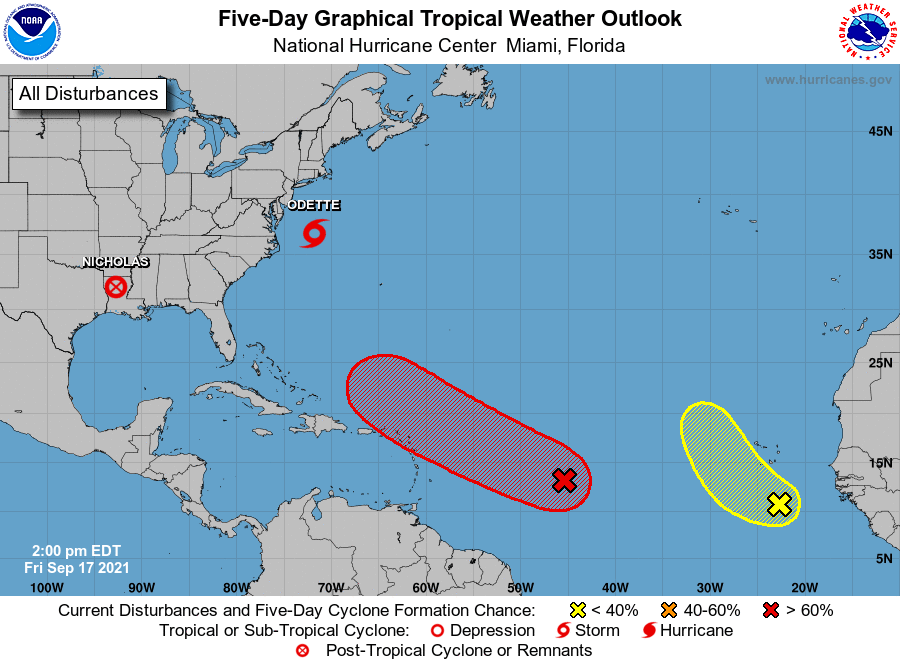
Current disturbances in NHC outlook, with 2-/5-day NHC development odds:
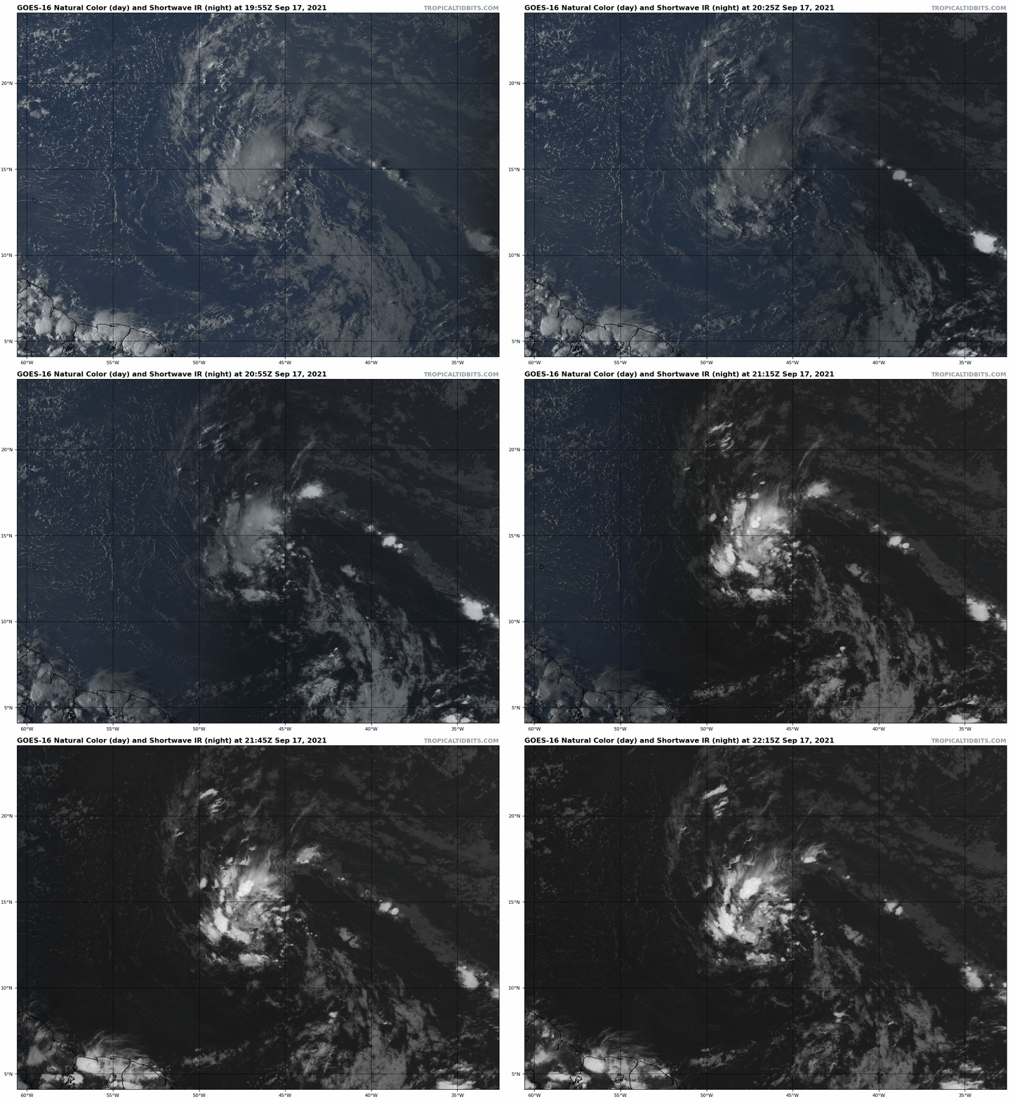
Invest 95L in the Eastern Atlantic (70/80%): A tropical wave in the central Atlantic is looking a little more organized today. This wave is expected to become a tropical depression over the weekend, taking advantage of slightly more favorable conditions on approach to the northern Lesser Antilles.
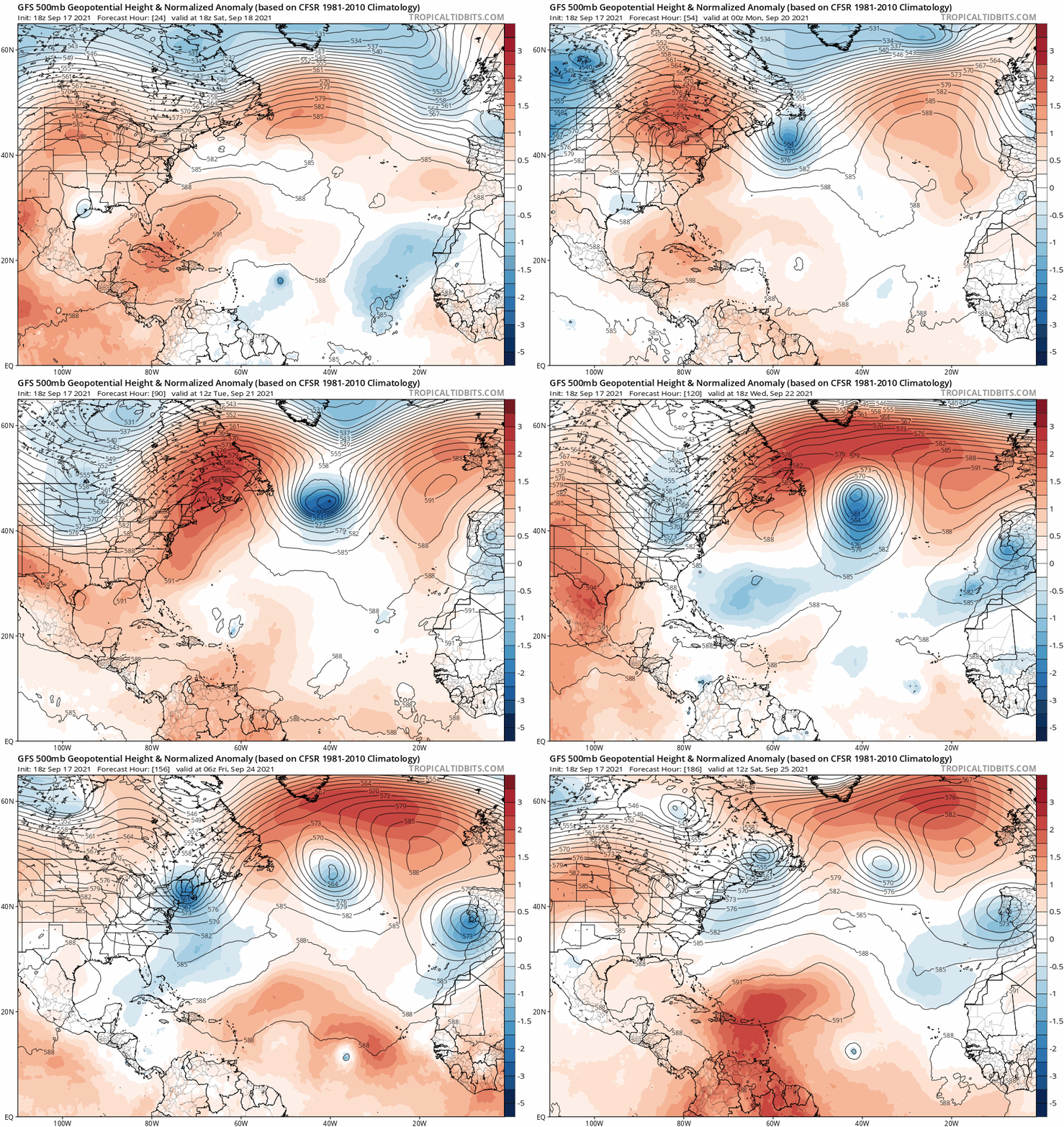
While 95L may brush Puerto Rico and the northern Windward Islands with some rain and breezy conditions Monday and Tuesday, the long-term fate of this system is increasingly clear. As seen below, a deep trough will move off the U.S. East Coast in 5-6 days, which will sweep 95L north in the general direction of Bermuda by late next week. There is some disagreement between models on how strong the system will be as it makes this turn, but a strong consensus for the turn itself.
Overall, while 95L may well become Tropical Storm Peter early next week, this system is no longer a potential threat to the U.S. coastline.
Far eastern Atlantic (20/30%): A tropical wave just off the African Coast is moving slowly west. There is some chance of development by early next week as the disturbance is turns north, but it is not a concern for the continental U.S.
Elsewhere: There are some indications that additional tropical waves in the eastern Atlantic have a chance of developing in the days 6-10 range, but none of these signals are particularly strong as of yet in the modeling.
Next report: Paid subscribers will receive a daily report on Monday, with the next column for free subscribers issued Thursday. Until then, keep watching the skies.


