Julia's Child: Hurricane Watch Weekly Column for October 12th
Tropical Storm Karl, a spinoff from Hurricane Julia, will remain safely confined to the southern Gulf of Mexico this week.
If you are a paid subscriber, thank you for your continued support of WeatherTiger.
If you are a free subscriber or new to WeatherTiger’s Hurricane Watch, please consider signing up for a paid subscription. You’ll get Florida-focused tropical briefings each weekday, plus weekly columns, full coverage of every hurricane threat, our exclusive real-time seasonal forecast model, and the ability to comment and ask questions, for $7.99/mo. or $49.99/yr.
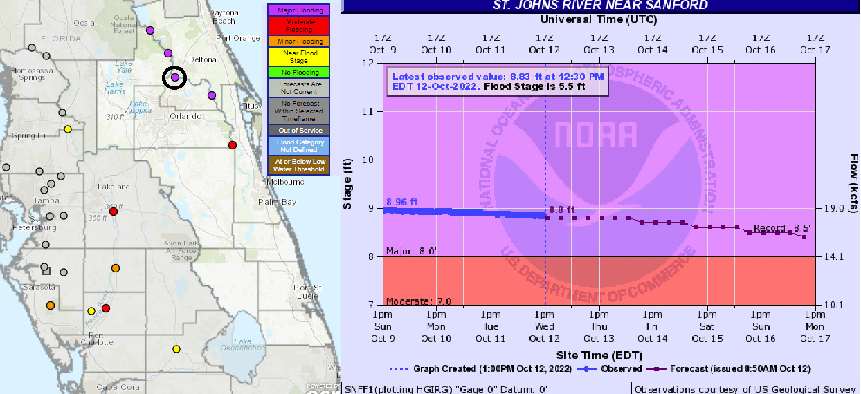
As if it knows it did something bad, Florida’s weather has been on its best behavior in the two weeks since Hurricane Ian. Mild, dry conditions won’t make the numerous rivers across Southwest and Central Florida still at flood stage decline any faster than our state’s languid topography and bathymetry will allow, but at least the minimal additional precipitation has not added insult to injury.
The jet stream pattern delivering this clement weather is the same one that initially swept Ian across Florida. I hope you have been enjoying this atypically fall-like fall, considering the circumstances, as that cold front cost around $100 billion.
Florida and the southeastern U.S. can expect the passage of another cold front between now and Friday, but this one is on the house. Not only will the upcoming front bring rainfall chances to portions of North Florida that have not seen accumulating precipitation in a month, but it will also safely confine this week’s tropical activity, Tropical Storm Karl, to the far southwestern Gulf of Mexico.
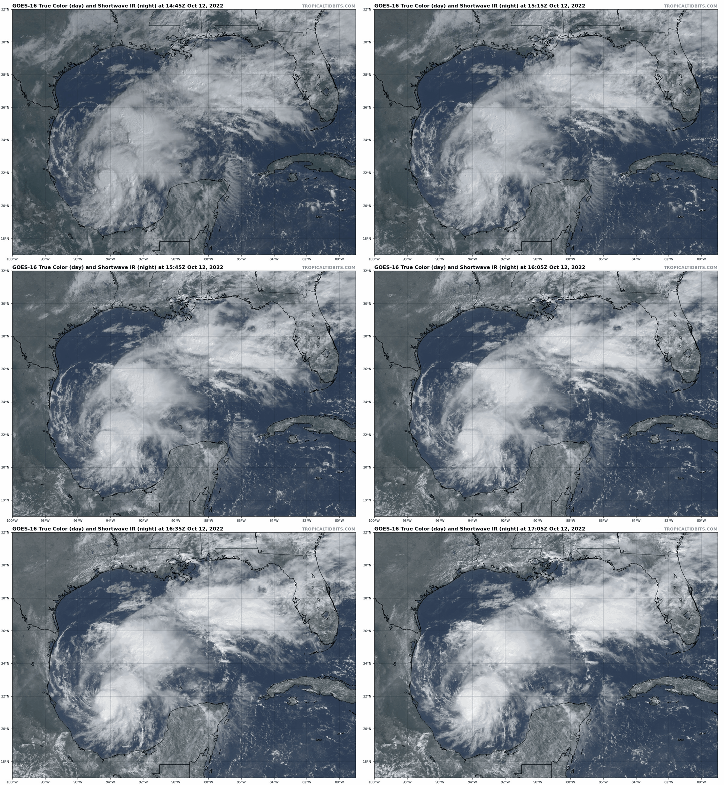
Karl developed in the Bay of Campeche on Tuesday from convection loosely associated with the erstwhile Hurricane Julia, which made landfall in Nicaragua on Sunday at Category 1 strength. While Julia itself continued westward into the eastern Pacific, an outer band of the storm arced north into the far southern Gulf and quickly spun back up into a new tropical cyclone.
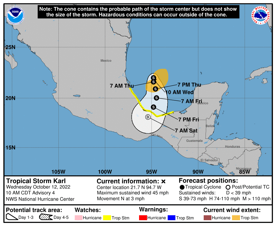
As of Wednesday afternoon, Julia’s child is simmering northeast of Veracruz, Mexico as a mid-range tropical storm with sustained winds of 50-60 mph, but the U.S. jet stream pattern will keep a lid on Karl. Historically, about one-third of October and November storms forming in this area later strike the U.S., but in Karl’s case, the eastern U.S. trough is too far north and east to yank the storm towards the northern Gulf Coast.
Instead, Karl will be under the influence of a Mexican ridge of high pressure, which will squash it back south into Central America by the weekend. Karl is not expected to intensify much prior to landfall, though its slow motion presents a flooding threat to southern Mexico. There will be no U.S. impacts.
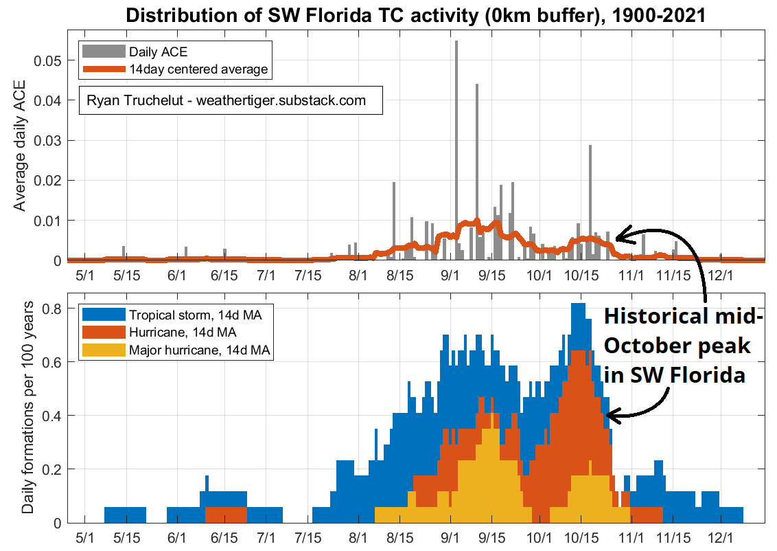
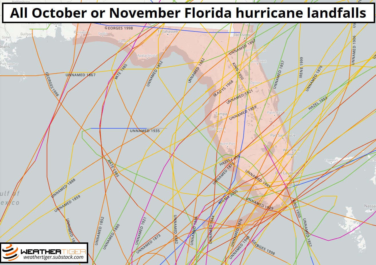
Other than its far southwest corner, the Atlantic Basin is so vast and empty of tropical disturbances that a Spirit Halloween superstore might move in at any moment. The threat of uncomfortably provocative Minions costumes notwithstanding, that means there are no hurricane risks to Florida or the U.S. coastline for at least the next week. This is great news, as there is a secondary peak in the climatological frequency of Florida hurricane landfalls between roughly October 10th and 25th, mostly associated with historical strikes in the Keys and Southwest Florida. Running clock now significantly increases the odds of getting through the rest of the year without another hurricane threat.
Additionally, upper-level troughing is likely to remain in place over the eastern U.S. for another 8 to 10 days. On the ground in Florida, that translates into continued optimal conditions for decorative gourds; aloft, the strong westerlies of the subtropical jet stream are farther south than normal and wind shear will prevent tropical storm formation in the Gulf or Caribbean through mid-October. There is a slight chance of brief development in the eastern Tropical Atlantic next week, but this would not be a concern for the U.S. or any landmass.
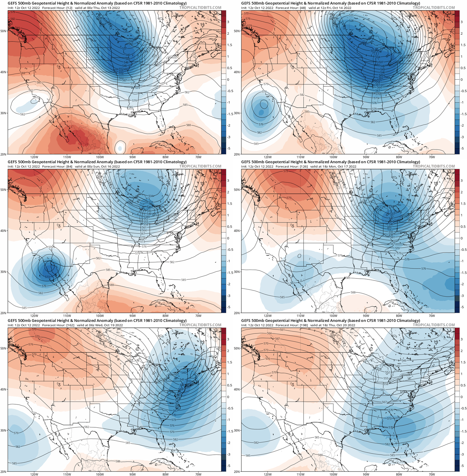
Some early signals hint that the eastern U.S. trough might weaken in the last 10 days of October, potentially offering a slightly more supportive environment for tropical development closer to home to end the month. I’ll keep an eye out for upper-level ridging developing north of a stalled front in the Gulf or western Caribbean, a common pathway for late-season tropical development, but there are certainly no concrete indications of anything to worry about at this time.
Overall, like a dog that just destroyed all your furniture, the weather now seems to want to be our best friend. Thankfully, innocuous conditions will persist for the foreseeable future, and there are no repeats of the $100 Billion Cold Front or new tropical threats on Florida’s horizon. History says not to call time on hurricane season just yet, but we’re getting through it. Keep watching the skies.


Up here in North Florida seems like Ian sucked all the water out to sea for a few days prior to landing and through today.
Never seen the soil here so suddenly dry and not returning. Is this common with storms this big? Farmer Anna wants to know!