Jackrabbit Start: WeatherTiger's Weekly Column for June 1st
A heavy rainmaker for South Florida may become the first named storm of 2022.
Welcome back to WeatherTiger’s Hurricane Watch! If you like what you read, please support us by signing up for our coverage of the 2022 hurricane season. Premium subscribers get Florida-focused daily tropical briefings each weekday, plus weekly columns, full coverage of U.S. hurricane threats, and our real-time seasonal forecast, all for $7.99 per month.
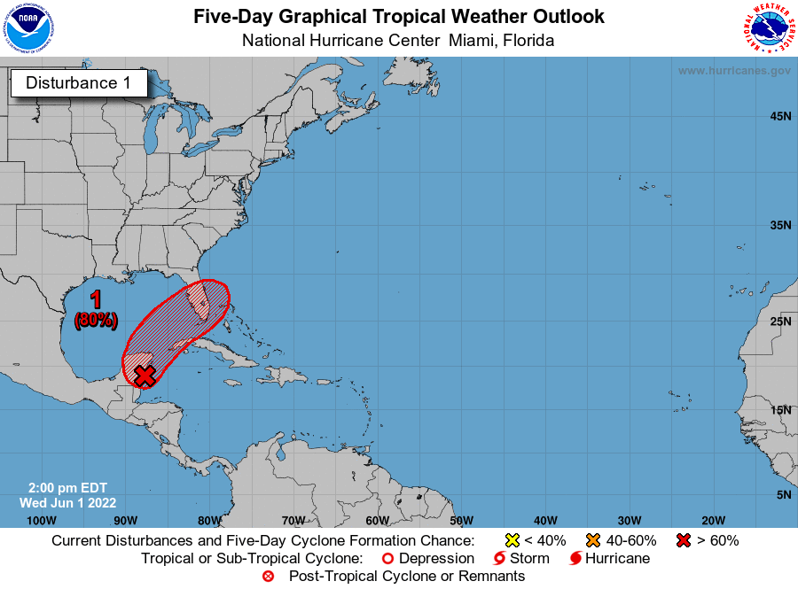
Hurricane Season 2022 is coming straight out of the blocks on day 1 with a tropical threat to Florida. As is the custom of early season storms, the potential landfall of a low-end tropical storm in the southern half of the peninsula early this weekend would have mostly rainfall impacts.
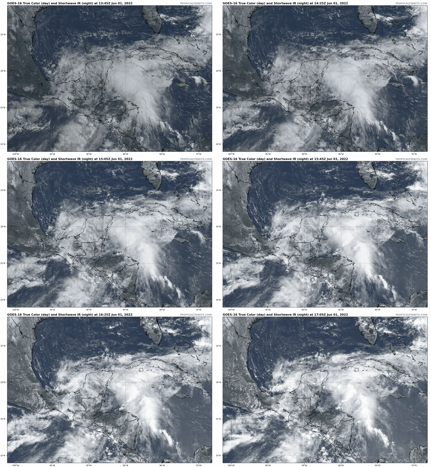
Currently, the disturbance of interest is a large area of low pressure across the southern Gulf of Mexico and northwest Caribbean Sea, centered along the eastern shore of the Yucatan peninsula. This system incorporates the remnants of the East Pacific’s Hurricane Agatha, which made landfall in southern Mexico as a strong Category 2 on Monday, as well as the broad low-level rotation associated with a Central American Gyre.
In the Tropics, success has many fathers, but only to a point. While ample moisture and upper-level divergence are likely to result in the formation of a tropical depression or weak tropical storm over the far southeastern Gulf by Friday, the convoluted preamble to development plus formidable westerly wind shear near Florida places a low ceiling on maximum intensity. This system will not be a damaging wind threat to Florida, even if it does become a tropical storm and claim the name Alex.
The track forecast is straightforward. A shortwave trough over the central Gulf and a dip in the Jet Stream over the eastern U.S. will cause the disturbance to begin hustling northeast on Friday, cross near or over the southern half of the Florida peninsula on Saturday, and accelerate away from the Southeast U.S. coast on Sunday. Track uncertainty is mostly linked to where and when a dominant center develops; slower and further south consolidation means the center might cross the Keys or southwest Florida, while faster or northward development could nudge the track closer to Tampa Bay.
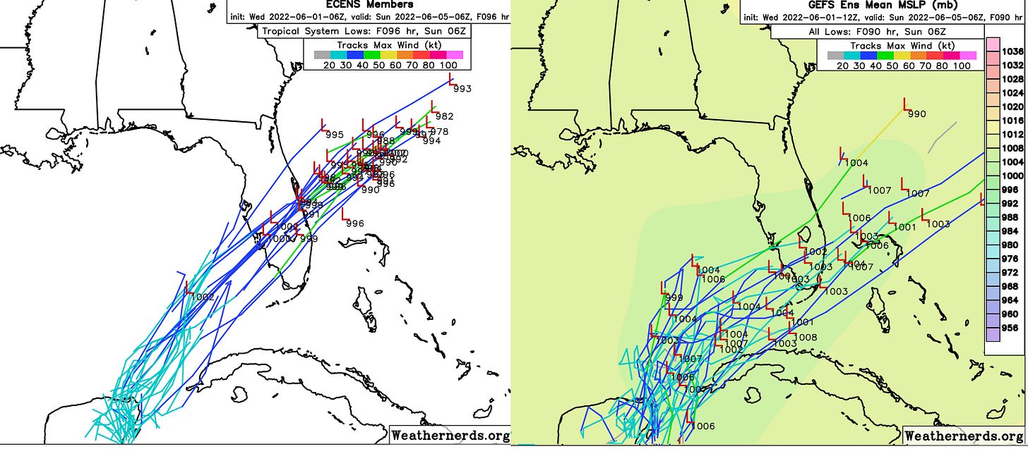
As always, precise forecasting of loosely organized tropical systems is a mug’s game, with impacts minimally dependent on the path of the circulation center. As is typical of early season tropical threats to Florida, wind concerns are expected to be negligible to nuisance-level, while rain impacts will be heavy and widespread. In the relatively more bullish intensity scenarios, coastal wind gusts for Southwest Florida, the Keys, and Southeast Florida top out in the low-end tropical-storm-force range. Gusty winds out of the south could result in coastal flooding in low-lying areas in that region.
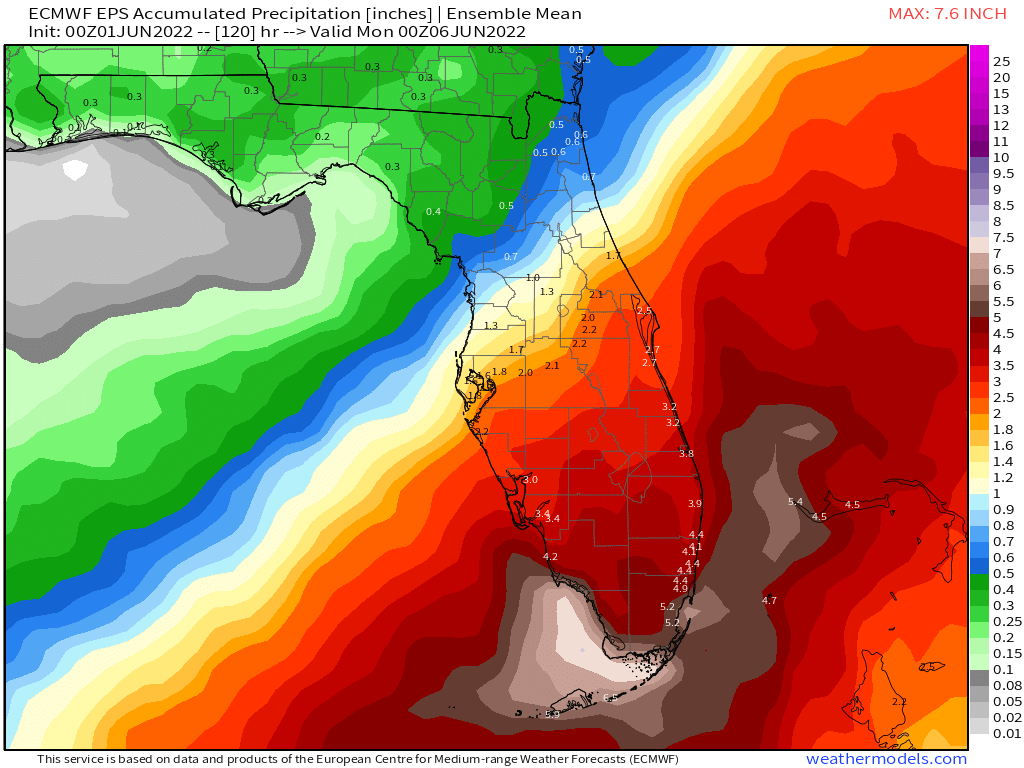
However, the biggest impact of this disturbance will be rainfall over the southern half of Florida. Because wind shear and dry air encroaching from the west will keep the storm lopsided, areas northwest of the center will see limited or no rainfall. West of a line from roughly Gainesville to Jacksonville, expect just a few scattered showers over the weekend and breezy conditions.
For Central Florida, your impacts are more uncertain, with possible outcomes ranging from minimal accumulations if the system zips through the Keys, to 1.5-3” of rain south and east if the low tracks further north. We should have a better read on which is more likely by tomorrow, so stay tuned.
The southern third of the peninsula is where tropical rainfall will be heaviest. South Florida is likely to see a 24-to-36-hour period of rain punctuated by intermittent squalls and downpours between Friday morning and Saturday afternoon, tapering to occasional showers overnight Saturday into Sunday. A weaker system likely would mean 1.5-3” accumulations for South Florida, with 4-6” general totals possible if the system is a little more organized.
While the brisk forward speed of the low will keep rainfall in check, there is potential for excessive precipitation causing localized urban flash flooding in the South Florida metro area on Friday and Saturday. Have a means of receiving emergency weather warnings on hand, particularly if you live in a coastal or flood-prone area. As always, turn around, don’t drown.
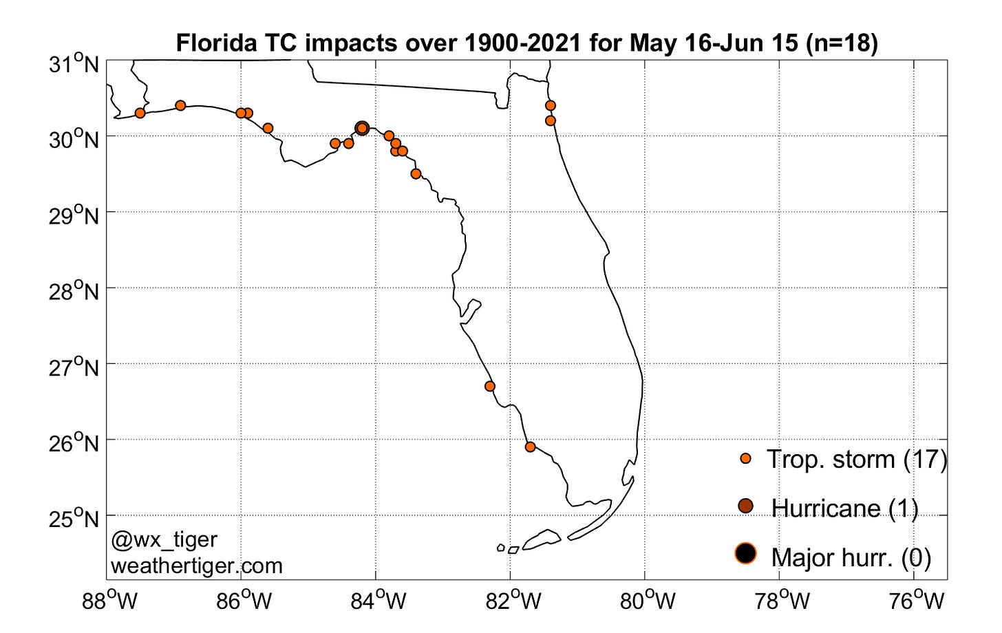
Climatologically, there’s nothing too out of the ordinary going on here. Florida has been struck by 17 tropical storms (and 1 hurricane) in late May or the first half of June since 1900; these systems were almost all sloppy, sheared rainmakers. While the more typical target for early June activity is the Steinhatchee region of the Big Bend, southwestern Florida landfalls are not unprecedented. The most recent reference point is Tropical Storm Barry in 2007. Those who remember Eckerd Drugs and Barnett Bank may also recall 1968’s Tropical Storm Abby.
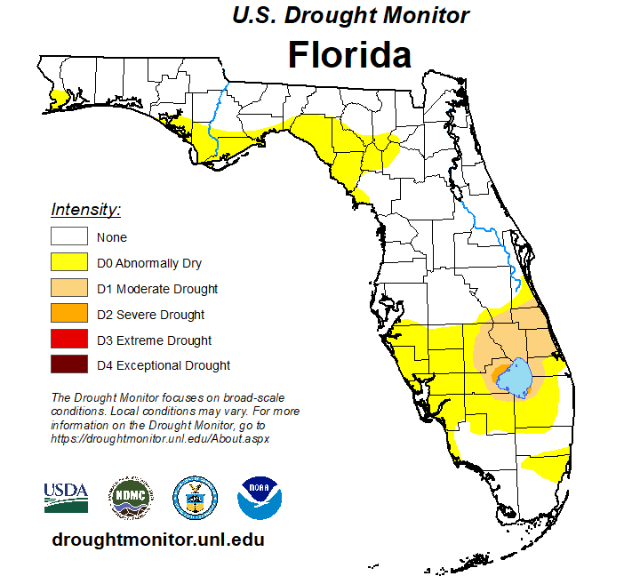
Overall, while the bad news is South Florida can expect a dreary first half of the weekend, the good news is heavy rainfall will contribute positively to mitigating an ongoing regional drought there. If nothing else, let this be a reminder to you that hurricane season is underway, and an ounce of preparation and planning is worth a pound of cure. Keep your wits about you in this tropical shot over the bow and keep watching the skies.


