Incoming: WeatherTiger's Hurricane Watch for June 18th
Soon-to-be Claudette resets the "days since U.S. landfall" sign from 218 to back to 0.
Each weekday WeatherTiger’s Hurricane Watch brings you a pithy tropical briefing with that day’s hurricane history and current tropical activity. Paid subscribers receive these daily briefings and are able to comment and ask questions, as well as get our seasonal outlooks, analysis columns, daily forecasts and video discussions during hurricane threats. Also included is live landfall coverage, like today’s video for Potential Tropical Cyclone 3. Free subscribers will receive our weekly forecast column and selected storm coverage.
As mentioned above, today’s preview of our daily briefing includes a live forecast video recorded around 1 p.m. Eastern on Friday afternoon concerning PTC 3 (future Claudette?). You can find that immediately below the fold.
Almanac: Today is Friday, June 18th… day 18 of the 2021 hurricane season, 166 days to go. By total storm energy, the season is 1.6% complete as a whole, 4.7% complete for the continental U.S., and 5.9% complete for Florida. The lone landfall on this date since 1851 is a tropical storm in 1959 that moved across Central Florida as a rainmaker, and several days later was responsible for one of the worst maritime disasters in Canadian history when it struck New Brunswick as a powerful non-tropical low.
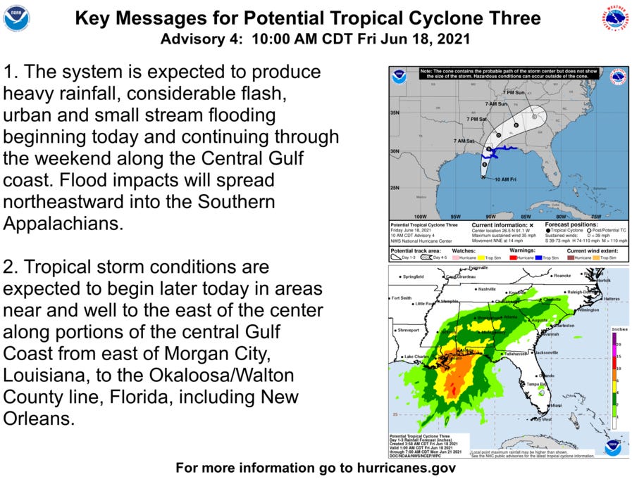
Active Storms: Potential Tropical Cyclone 3 is nearing the eastern Louisiana coast this afternoon, and is on the verge of finally becoming Subtropical or Tropical Storm Claudette over the next few hours. As of the 1 p.m. CT intermediate advisory from the NHC, maximum sustained winds have increased to 45 mph as the PTC continues north-northeast at 14 mph. On this track, the storm will come ashore south of New Orleans later this evening or very early tomorrow, pivoting northeast across southern Mississippi and central Alabama into early Sunday.
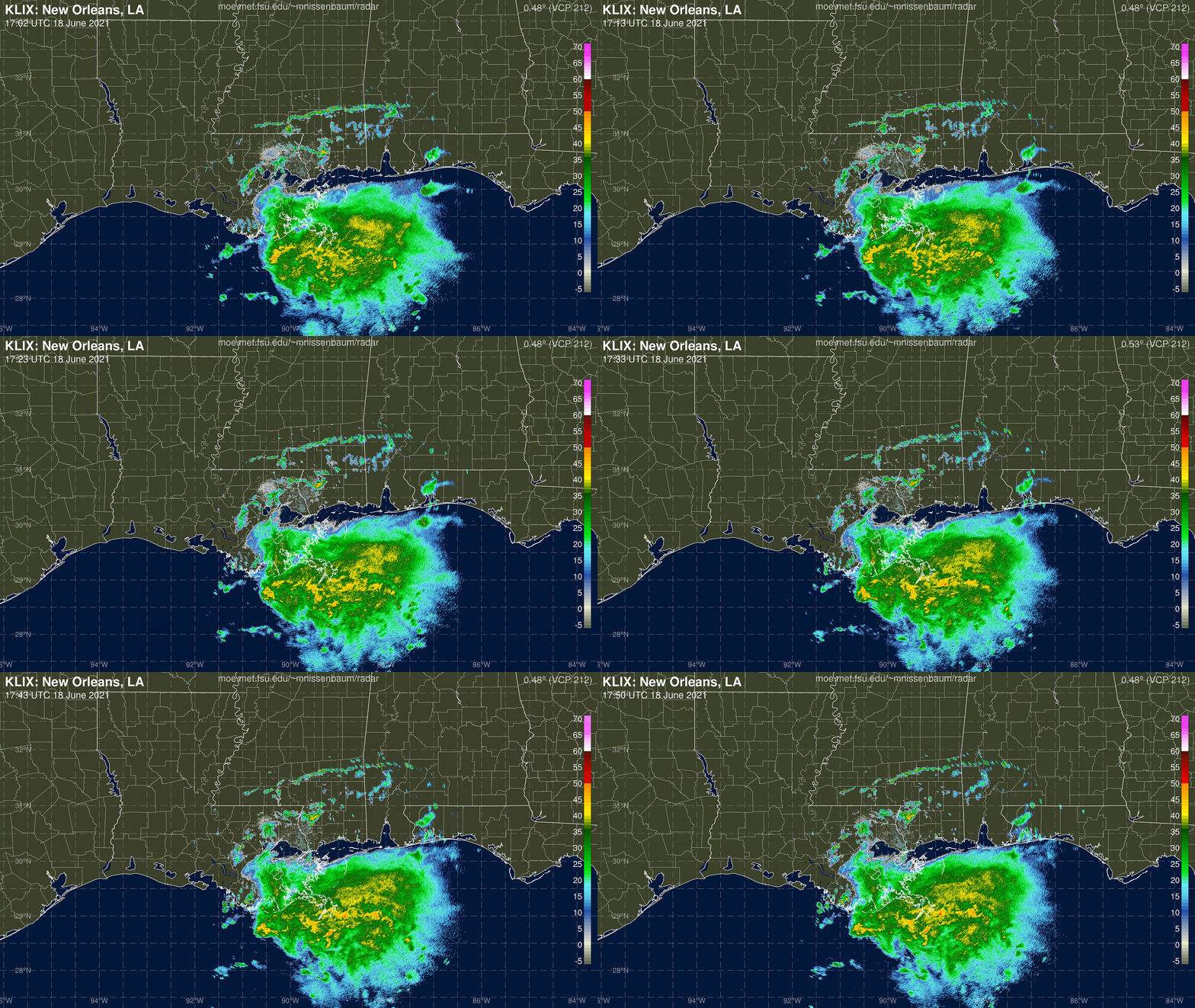
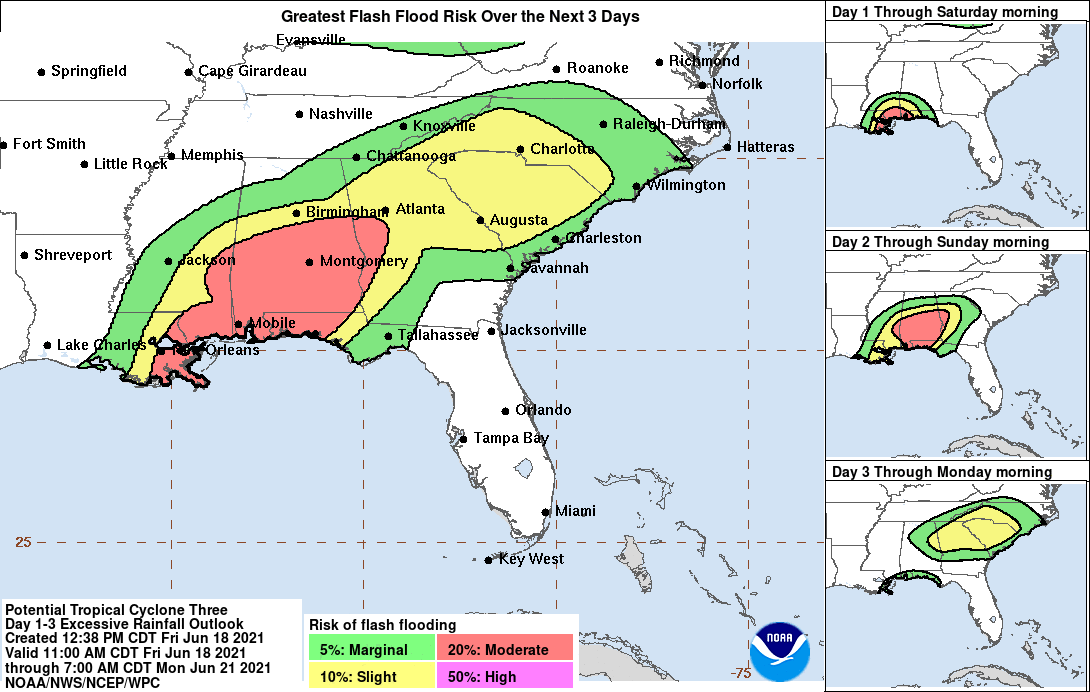
As expected, all the weather is near or east of the center, and heavy rainfall is already spreading ashore the southeastern Louisiana coastline. (For a full breakdown of current conditions and expected impacts today, please watch our live video at the top of this briefing.) There are few changes to the expected impacts of PTC3/Claudette from yesterday’s WeatherTiger forecast, other than a slight increase in forward speed that moves up the timing of rain arrival in eastern Louisiana, Mississippi, Alabama and western Florida to no later than early tomorrow morning. The region of flash flood potential has also crept further east out of central Louisiana and into the Florida Panhandle, but the heaviest rain totals will still remain west of Panama City.
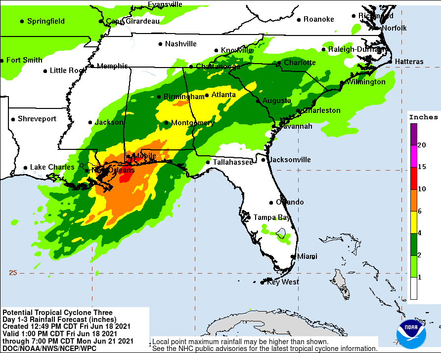
Flood potential remains the paramount threat from PTC 3/Claudette. General 4-8” totals remain a good bet from New Orleans east to Destin with local amounts to 10”, including the coastal counties of Mississippi and Alabama. Rain totals of 2-5” are expected inland over southern Mississippi, southern and south central Alabama, and western Georgia through Sunday. East of Destin, rainfall into Florida’s Big Bend and the Tallahassee area will be intermittent, but likely to total 1-2” through the weekend.
The wind threat from Claudette remains minimal, through Tropical Storm Warnings for the expectation of onshore gusts to around 40 mph are up from Morgan City, LA east to Destin, FL. The primary danger from winds comes from unsafe beach conditions along the Gulf Coast extending east into Apalachee Bay, particularly the threat of strong rip currents in the areas highlighted above, as well as 2-3’ of surge.
Overall, the first tropical storm landfall of 2021 is likely in the next 12 hours, forcing Louisiana to reset their “Days Since Tropical Storm or Hurricane Landfall” sign from 233 days back to 0 days. The dominant threat remains the potential for flash flooding in the areas highlighted in red below, so stay weather aware and have a means of receiving localized warnings this weekend in this region in particular.
Current disturbances in NHC outlook: None.
Elsewhere: Nothing of note. A low passing north of Bermuda is non-tropical.
Next report: If there is a significant change to the forecast for PTC 3/Claudette, a quick update may be issued early tomorrow. Otherwise, the next daily briefing will be issued by 3 p.m. Monday.


