Hurricane Helene Morning Briefing for September 26th
Helene is crossing the east-central Gulf and remains a catastrophic threat, though there are some slightly positive trends to report this morning.
I will be liveblogging Helene beginning a little after noon and continuing through landfall. That link will be sent to all subscribers when it is live.
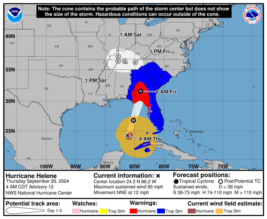
Hurricane Helene has intensified modestly overnight as it sets its sights on Florida, and its expected path has jogged a little eastward overnight. Helene will make landfall somewhere in Apalachee Bay this evening or very early on Friday. As of the 8 a.m. NHC advisory, Hurricane Helene is located about 300 miles southwest of Tampa Bay and 350 miles south of Apalachicola, moving north-northeast at about 12 mph.
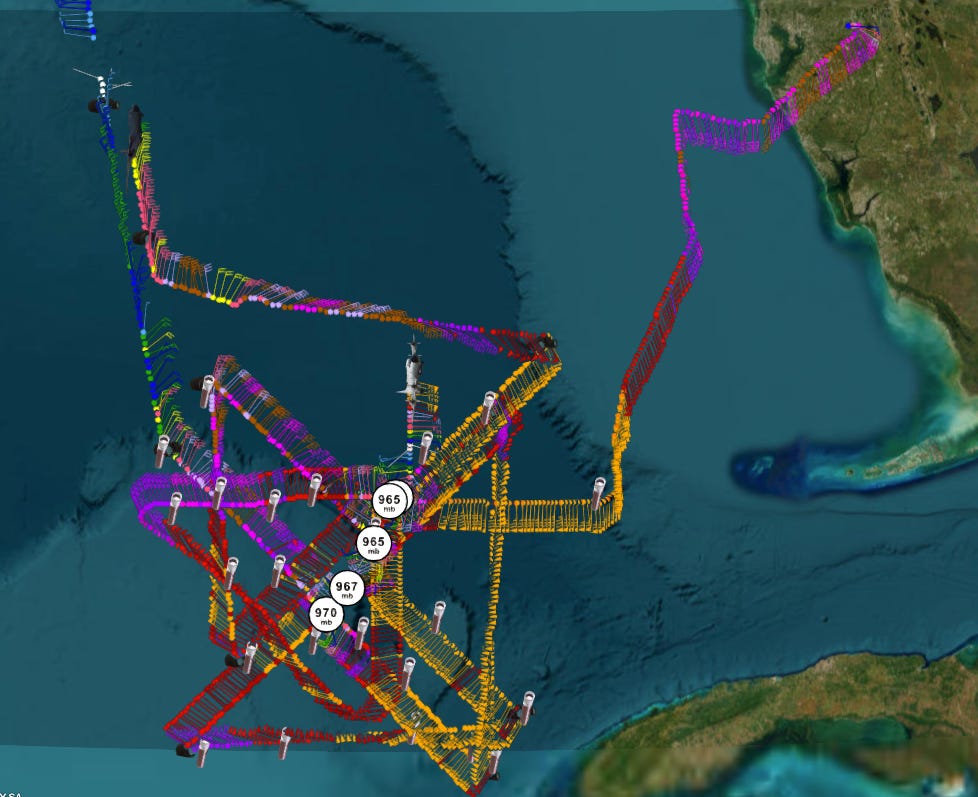
Maximum sustained winds per this advisory are 100 mph, which is up about 15 mph from 12 hours ago. That makes Helene a Category 2 hurricane, but it’s still less intensification than was forecast for the overnight hours, likely as a consequence of the storm having an inner and outer eyewall fighting for dominance. A Hurricane Hunter plane in the storm is finding data showing winds have strengthened notably in the last couple of hours, with pressures also falling. This means intensification is kicking off in earnest, and Helene’s peak intensity today is still expected to be in the Category 3 or 4 range.
Still, the fact that rapid intensification has been delayed is helpful in shaving a bit of the high-end potential off the hurricane’s core of destructive winds tonight. Recon data also shows Helene has nudged a few miles east of the 5 a.m. NHC track centerline, but not further. I’ll be watching carefully to see if that persists, as every tick east counts towards increasing the potential for Tallahassee staying on the weaker, western half of the storm. Make no mistake: in Tallahassee, your rooting interest is that the center of Helene passes to our east.
Morning recon data also shows just how large Helene is, as expected. Sustained tropical-storm-force winds extend up to 325 miles to the southeast of the center into the Keys, with sustained hurricane-force winds reaching nearly 60 miles to the east of the center. This is not a change to the forecast, rather a validation of earlier NHC and model forecasts for widespread wind and surge impacts across Florida on Thursday.
With the NHC track shifting east by about 20 miles between 11 p.m. and 5 a.m., peak surge projections are unchanged overnight at a stunning 15-20 feet in Apalachee Bay into early tomorrow, with 5-8’ likely in the Tampa Bay region this evening, and 3-5’ feet across the rest of Southwest Florida this afternoon, where water levels are already 2-3’ above normal tides. I want to emphasize again that 15-20’ in Apalachee Bay, especially central and eastern sections, is taller than many two-story buildings, and will roll miles inland in some areas. It is not too late to leave the coastal Big Bend and go just far enough inland to a shelter location safe from the surge, as dangerous weather won’t arrive in North Florida until late afternoon.
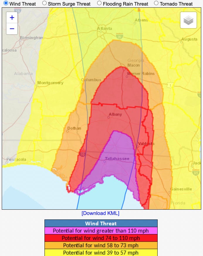
The primary inland threat from Helene continues to be destructive winds associated with the core or eyewall of the hurricane during and after landfall. (There is no change in the expectation of the rest of the Florida peninsula seeing wind gusts in the 40s and 50s today, with coastal gusts into the 60s along much of the Florida Gulf Coast ramping up towards mid-day.) There is some uncertainty in exactly how strong the wind gusts Helene will be packing tonight will be, but as shown above, NWS wind threat product continues to nicely illustrate the region of highest potential for 110 mph+ gusts capable of causing structural damage as extending across the Apalachee Bay coast and inland through the eastern Panhandle to Tallahassee and Thomasville, GA. Because of Helene’s expected ~25 mph forward speed at landfall, hurricane-force gust potential through the overnight hours into early Friday covers most of SW Georgia as well.
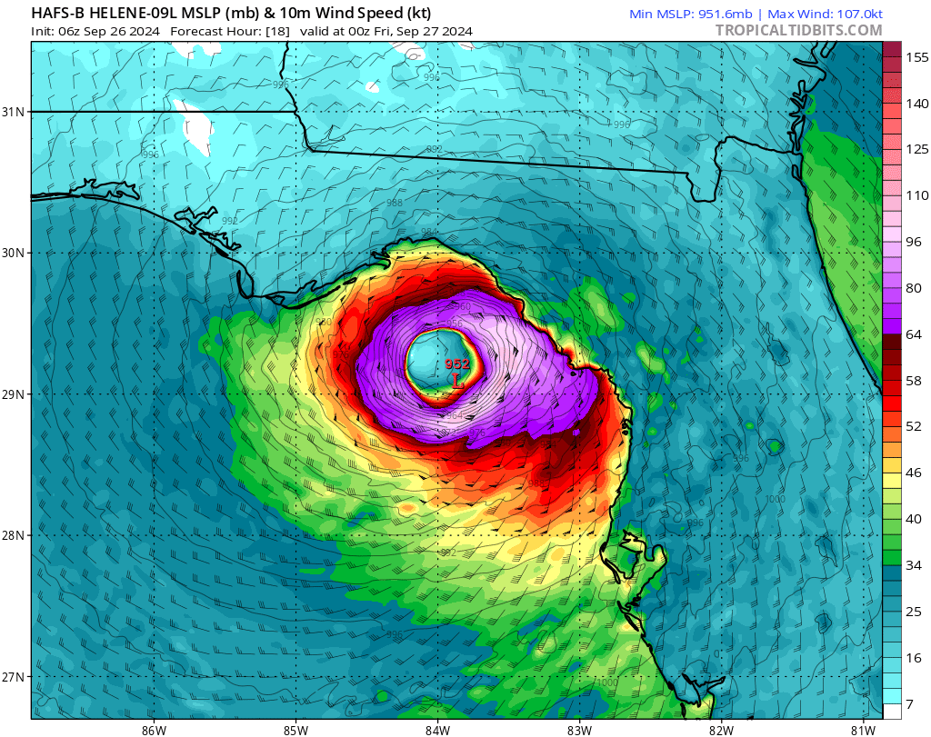
How big the core of the storm is and where exactly it tracks are key questions in the Panhandle and Big Bend, and still not completely resolved. One hopeful sign is that the morning HAFS runs are backing off a little on Helene’s intensity at landfall, aiming more towards the Category 3 range and a slightly smaller (though still 60-80 miles wide) core of destructive hurricane-force winds (see above). Taking the 06z HAFS-B scenario verbatim, that probably translates to 75-95 mph wind gusts in the northwest eyewall and 95-115+ mph gusts in the eastern and northeastern eyewall for inland portions of the eastern Panhandle and Big Bend. Exactly who gets what is still a jump ball, but if Helene makes landfall between St. Marks and Perry as the ensemble mean supports, that would keep Tallahassee in the relatively weaker, but still quite bad northwestern outer eyewall. I’ll be updating those odds tick by tick in the liveblog.
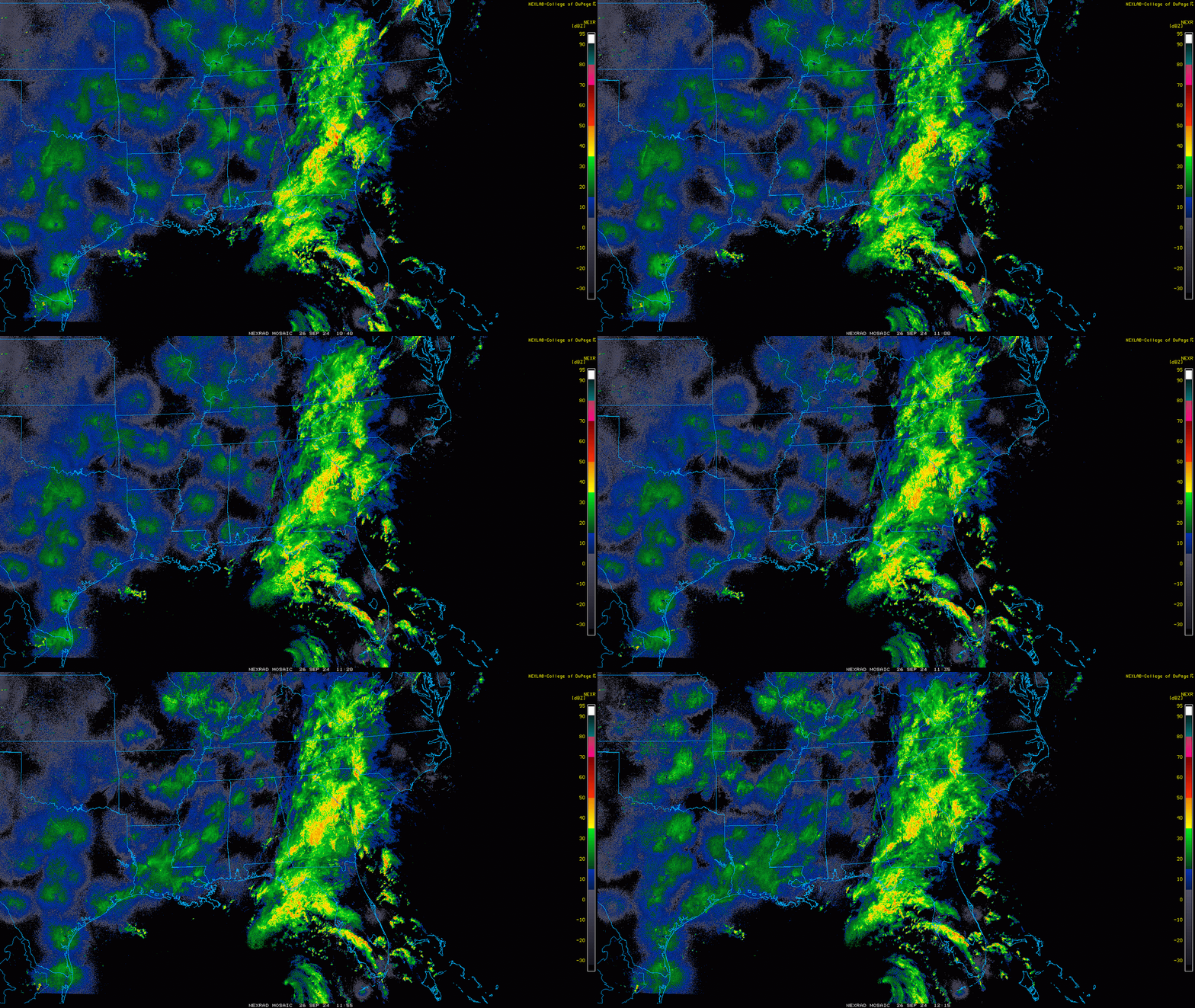
Finally, no change to the widespread rainfall impacts across Florida and the Southeastern U.S. over the next 2-3 days. Storm totals of 5-10” on saturated ground mean a high risk of flash flooding in the eastern Panhandle. Ongoing flood issues will also continue in north Georgia and western North Carolina into Saturday, where local storm totals may exceed 12”. Steady rains continue this morning from North Florida into the Appalachians, as periodic strong bands move across the peninsular Florida Gulf Coast this morning. This will situation will continue through the early afternoon, with heavier wind and rain pushing into North Florida in the late afternoon.
I will be back later today with a Helene live blog that should start a bit after noon, which I plan on continuing until the end of the extreme surge and wind threat to North Florida and South Georgia. Realistically, I’ll post until I can’t post any more. My house is 20 miles from the Gulf on high ground, so while I’m confident in my physical safety and that of my family, I’m not confident that power and my comms redundancies won’t all be down in the evening hours depending on where that core goes and how strong it is. I will do what I can.
Stay safe and keep watching the skies.


![[Image of cumulative wind history] [Image of cumulative wind history]](https://substackcdn.com/image/fetch/w_1456,c_limit,f_auto,q_auto:good,fl_progressive:steep/https%3A%2F%2Fsubstack-post-media.s3.amazonaws.com%2Fpublic%2Fimages%2Fde8d8439-9330-4966-a988-c3cdc84e4e3c_897x736.png)
![[Image of WPC Flash Flooding/Excessive Rainfall Outlook] [Image of WPC Flash Flooding/Excessive Rainfall Outlook]](https://substackcdn.com/image/fetch/w_1456,c_limit,f_auto,q_auto:good,fl_lossy/https%3A%2F%2Fsubstack-post-media.s3.amazonaws.com%2Fpublic%2Fimages%2F2349d808-fed2-448b-a7d8-e80a35cf624a_1090x692.gif)
Stay safe, appreciate all you do. FYI, I am in Nokomis, had a wind gust of 38 mph, about .77 inches of rain so far. Currently blue sky and clouds.
I'd loan you my big Honda generator but don't think there is anyway to get it to you in time. Stay safe.