Got Cows?: Hurricane Watch Weekly Column for July 24th
Exploring the link between hurricanes and tornadoes as quiet conditions continue for another week in the Atlantic.
WeatherTiger’s Hurricane Watch is a reader-supported publication. Paid subscribers get Florida-focused daily tropical briefings, plus weekly columns, full coverage of every hurricane threat, our exclusive real-time seasonal forecast model, and the ability to comment and ask questions for $49.99 per year.
A few months ago, while my son exchanged viruses with his fellow patrons at a suburban trampoline bounce zone, I contemplated a wind tunnel booth luridly titled, “RIDE THE HURRICANE: CAN YOU SURVIVE?”
Underneath this sign was a large picture of a tornado, flanked for good measure on either side by the word “HURRICANE.”
It was then that I realized that there may be some misconceptions out there regarding hurricanes, tornadoes, and whether tornadoes can turn into hurricanes (they cannot), and made a mental note to correct the record during a quiet moment in the season.
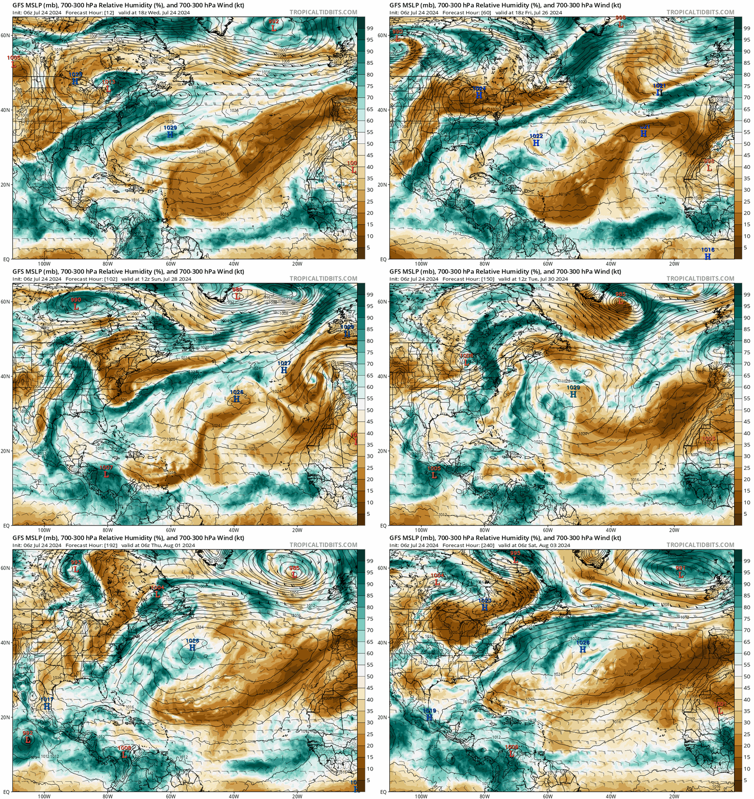
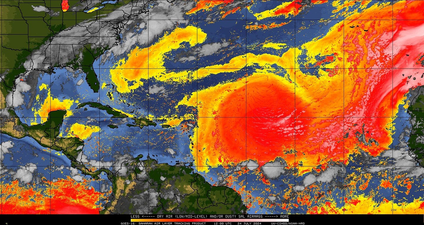
Fortunately, we continue to find ourselves in just such a moment entering the final week of July. As 2wisterz: ¡TornaDOS! sweeps into theaters nationwide, the Atlantic, Caribbean, and Gulf of Mexico are being scoured by elevated wind shear and dry, dusty airmasses. That means there are no tropical disturbances with a meaningful shot at development for the upcoming seven days.
A lonesome tropical wave just emerging from Africa will be plowing westward through the dust this week; that system may be worth watching in the southwestern Atlantic or Gulf starting at end of next week, if anything is left after its trek. I’ll keep an eye on things in case it finds a more favorable pocket of moisture and outflow well down the road, but risks remain low. Sustained Atlantic tropical activity remains as improbable as Glen Powell turning down a role in a legacy sequel prior to the anticipated return of deep tropical moisture sometime in mid-August.
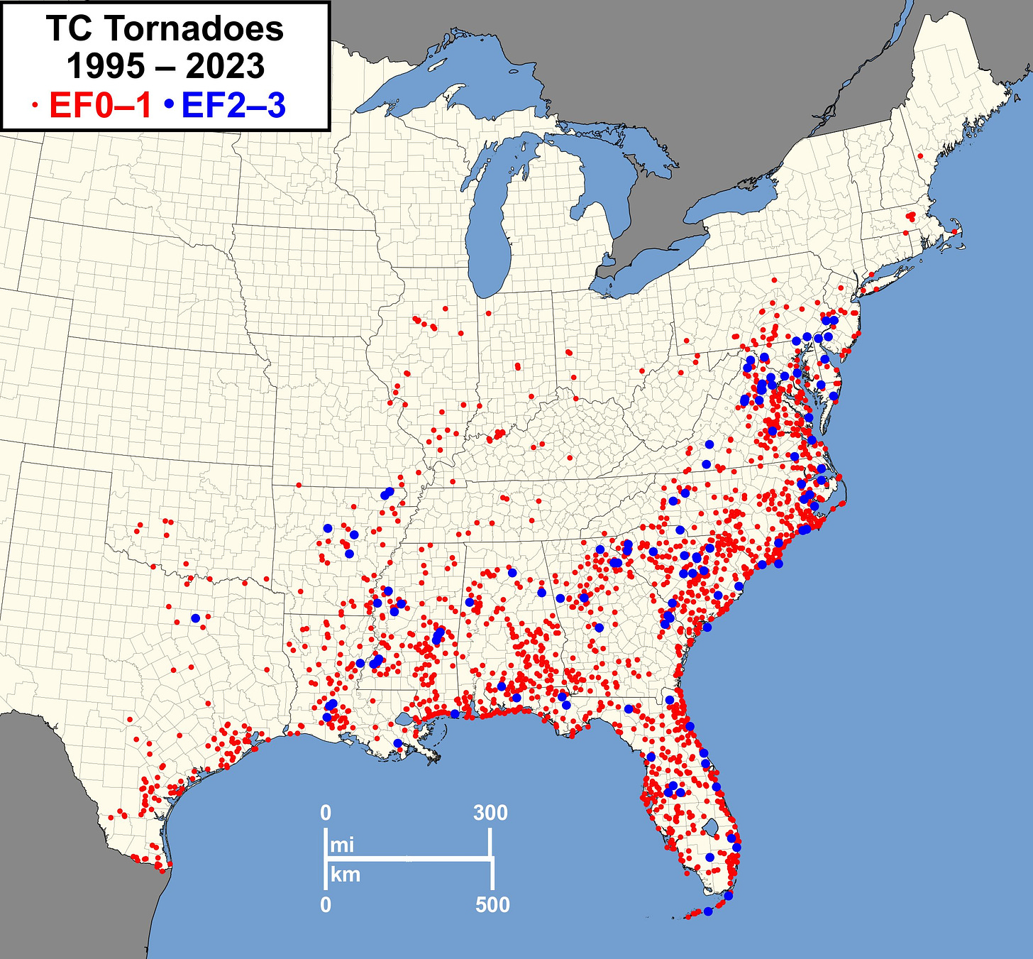
Of course, July 2024 has nothing to prove after Hurricane Beryl, which single-handedly produced more Accumulated Cyclone Energy (ACE) than the 1991, 1994, or 2013 hurricane seasons, and over five times the ACE of an average July. Beryl also set a torrid pace in terms of tornado production, with the hurricane and its post-tropical remnants responsible for at least 65 confirmed tornadoes from Texas to New York, fifth-most on record.
Tornadoes— which along with surge, wind, rain, are one of the primary hurricane threats and impacts— account for the least damage and fewest casualties of those four horsemen during tropical cyclone landfalls. Still, as Beryl demonstrates, tornadoes are an unpredictable hazard, capable of occurring hundreds of miles away or many states inland from the strike point.
For those of you whose meteorological education occurred mainly in America’s amusement centers and mall food courts, hurricanes and tornadoes are both capable of producing damaging cyclonic winds, but have little else in common. Size is one key difference. Most tornado circulations are tens to hundreds of meters wide and spawn from a single thunderstorm, while tropical cyclones span hundreds of kilometers and consist of many individual cells of convection.
Another distinction is energy source. A typical tornado triggered by a mid-latitude front forms in the region of overlap between convective potential energy (a.k.a. CAPE, driven by solar heating) and strong wind shear, a changing of the speed or direction of winds with height often caused by nearby jet streams. Shear and CAPE are the Stevie Nicks and Lindsey Buckingham of thunderstorms; individually, they can produce impressive work, but when they come together, the results may be truly explosive. Side note: Nicks and Buckingham have a duet on original Twister soundtrack in which they wish tornadic death on each other, which I obviously recommend.
In contrast, the heat and moisture sources for hurricanes are warm oceans, and wind shear is a negative for tropical cyclone development. The catch is that hurricanes, especially when making landfall, can sometimes create favorable conditions for tornado formation on the periphery of the storm. This is because land friction slows down a hurricane’s winds close to the surface more than the winds higher off the ground, creating a localized type of vertical wind shear that can set individual storm cells in outer bands spinning like a top. This is particularly common on the right side of a hurricane relative to its direction of forward motion during and after landfall.
Hurricane-induced tornadoes are far from the classic cow-lofting ropes and wedges visible across miles of open Plains. Rather, tropical tornadoes are sheathed in heavy rainfall, short-lived, and chaotic, often with brief lead times for warnings. They can’t be chased, not even by The Extreme himself. (RIP Bill Paxton, whose untimely passing ended both the possibility of a proper Twister sequel and a my personal dream of a Bill Pullman-Bill Paxton presidential ticket.)
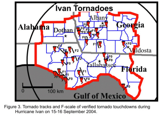
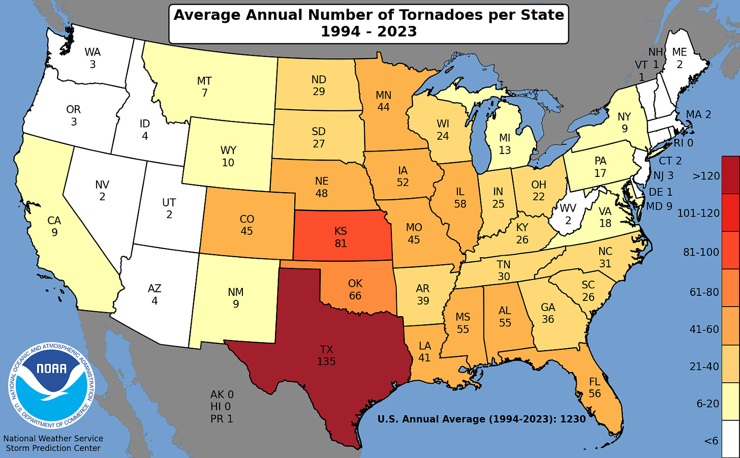
What hurricane-induced tornadoes lack in aesthetics, they can make up for in quantity. Due to Florida’s size and frequency of tropical impacts, we are a top 5 state for average annual tornado count, putting up comparable numbers to Iowa or Illinois even without counting touchdowns at Universal Studios’ erstwhile Twister: The Ride. However, compared to the Midwest, a disproportionate number of Florida tornadoes are relatively weak and transient EF-0s or EF-1s. The most widespread hurricane-induced tornado outbreak on record was triggered by Ivan in 2004, which produced 18 tornadoes in Florida and 115 overall, killing 7.
So, as the moviegoing masses create favorable conditions for the eventual formation of Twist3r, remember that hurricanes are not only not the same thing as tornadoes, but contain the tornado within their threat multitude. And if you are doing graphic design for a weather-themed novelty, please think of the children and shoot me an email for a complimentary fact check. Keep watching the skies.


Your readers of my generation appreciate the Fleetwood Mac analogy—great description! BTW, did you get on that hurricane ride??