Fiona Begins: The Hurricane Watch for September 15th
Tropical Storm Fiona is en route to the Northeast Caribbean this weekend, with anuncertain forecast for next week.
If you are not already a supporter, please consider signing up for a paid subscription to WeatherTiger’s Hurricane Watch. You’ll get Florida-focused tropical briefings each weekday, plus weekly columns, coverage of every U.S. hurricane threat, our exclusive real-time seasonal forecast model, and the ability to comment and ask questions, for $7.99/mo. or $49.99/yr.
Florida tropical threat synopsis: No tropical threats to Florida in the next 5-6 days. Tropical Storm Fiona presents some risk to the Florida peninsula in 7-11 days.
Almanac: It’s Thursday, September 15th… day 107 of the 2022 hurricane season, 78 days to go. By total storm energy, the season is 55.1%, 64.7%, and 54.9% complete for the Atlantic, continental U.S., and Florida, respectively.
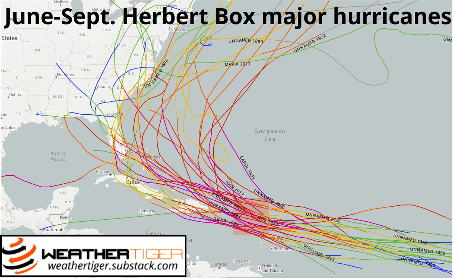
With TS Fiona moving towards the Islands, some have noted that Fiona will cross the "Hebert Box #1" indicating a possible eventual threat to Florida. However, the Hebert "rule" only applies to tropical cyclones that are major hurricanes while in the box. Even using that definition, only 12 of the 30 major hurricanes to move across the box in July-September eventually struck Florida, as seen above. There are no magic bullets (or boxes) in forecasting.
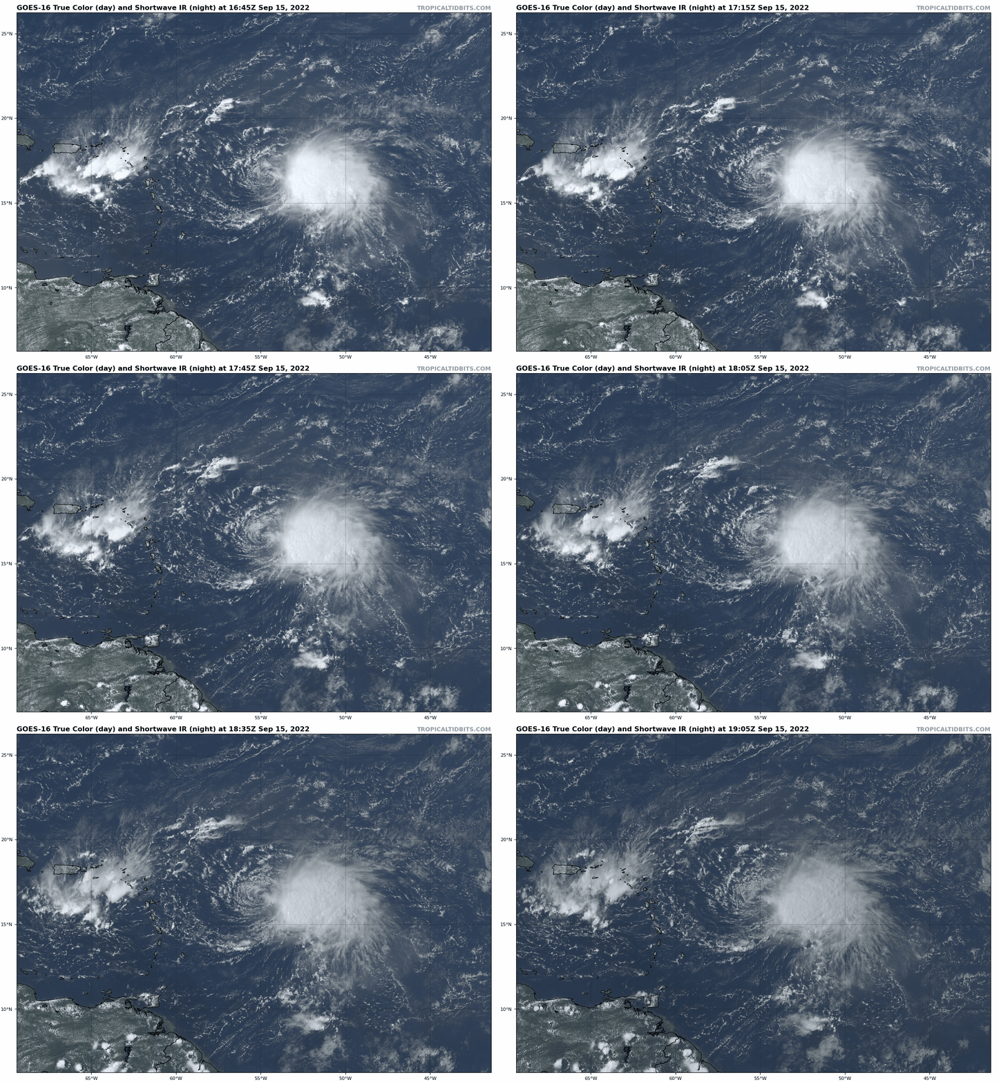
Active Storms: Tropical Storm Fiona developed overnight from Tropical Depression Seven. Maximum sustained winds are around 60 mph, though only well east of the center of circulation.
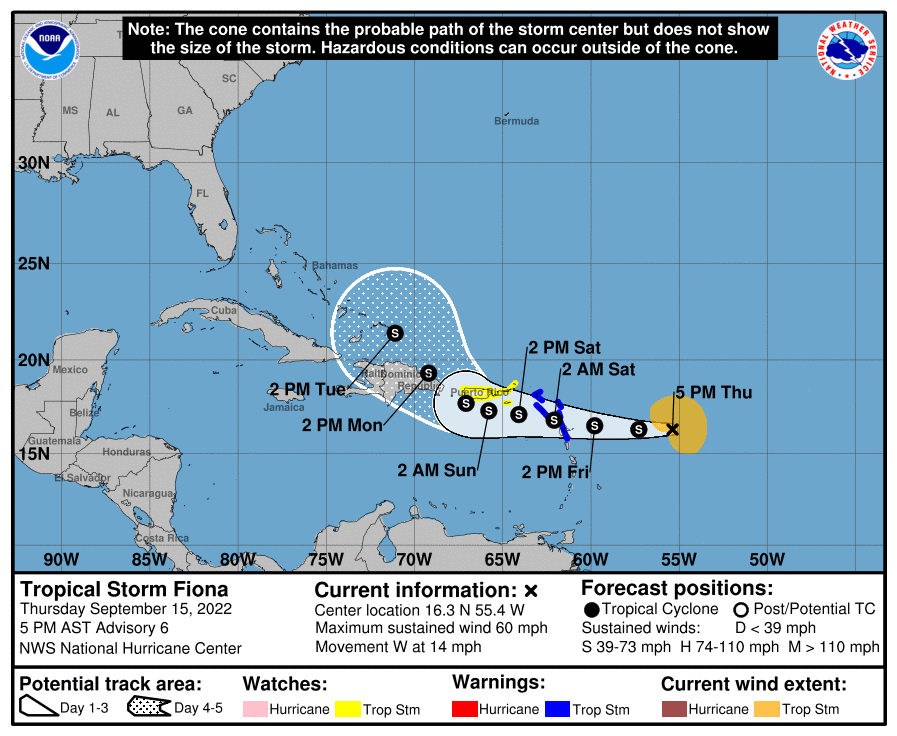
Other than Fiona strengthening a bit more quickly than anticipated, yesterday’s forecast expectations for the storm have not changed. As seen above, Fiona is not well-organized, with westerly wind shear and dry air joining forces to displace the storms’s intense convection over 100 miles east of the low-level center. Over the next couple of days, Fiona is expected to keep rolling west at a 15-20 mph clip, with convection pulsing and fading but little overall change in structure or intensity. Tropical Storm Warnings are in effect for the northern Lesser Antilles, and Puerto Rico will pick up 4-8” of rainfall over the weekend as Fiona passes near or over the island.
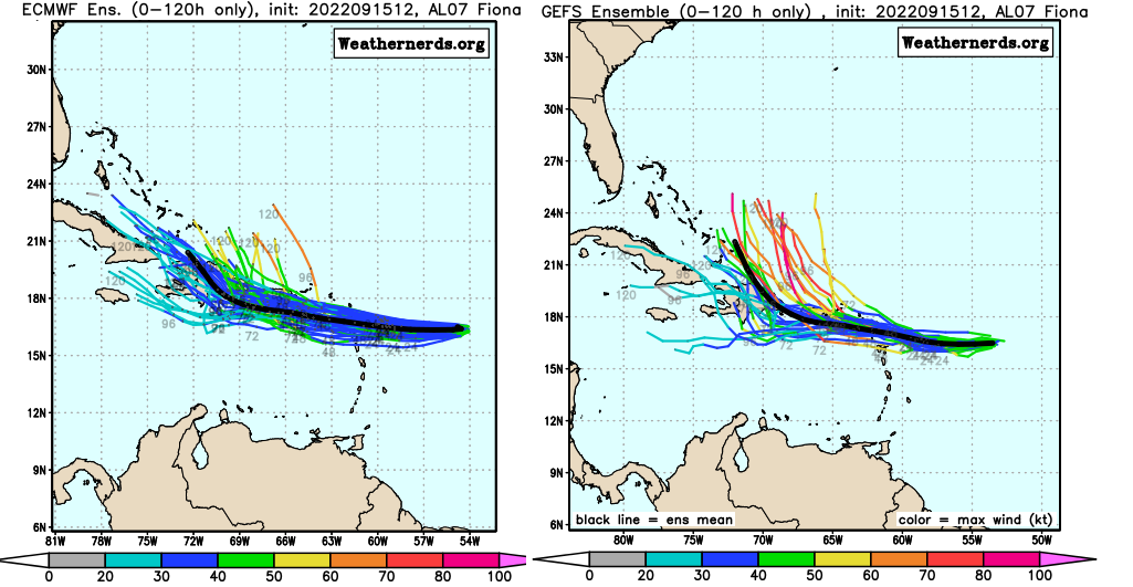
The forecast continues to be murky at best past Monday. Environmental conditions may improve in 3-4 days as Fiona transits the northeastern Caribbean. However, terrain interaction with Puerto Rico and Hispaniola could prevent the storm from taking advantage of those conditions. Fiona’s track on days 5-7 is dependent on how much it intensifies between Saturday and Monday: the weaker storm shown on the 12z Euro/Canadian proceeds further west into the Bahamas, while the GFS, HWRF, and HMON show earlier strengthening and a path east of the Bahamas. The UKMET and the NHC track are between the two model clusters.
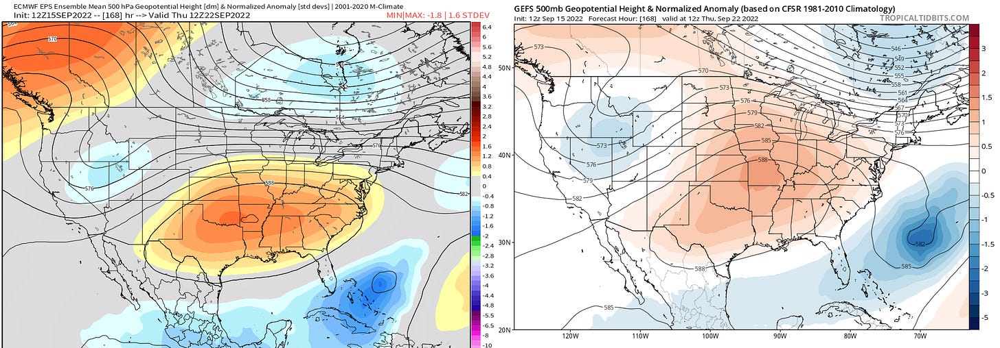
If Fiona stays weak and slips farther west, that could ultimately mean a higher chance of some U.S. impact in 7-10 days. Ensembles have trended a little stronger with east-central U.S. ridging late next week, meaning there is some chance of Fiona missing the initial trough over the western Atlantic on days 7-8 if it is far enough south and west. With a very complex U.S. jet stream pattern on days 7-10 and uncertainties regarding Fiona’s structure, it remains very unclear how it will play out. More data and time will help, but for now, Fiona does remain a risk to Florida and the U.S. East Coast in 7-10 days. Stay tuned.
Other Disturbances in NHC outlook, with 2-/5-day NHC development odds: None.
Elsewhere: Nothing doing. Fiona is the only game in town.
Next report: Daily update out tomorrow afternoon.


Dr. Ryan is correct - I prefer boredom to terror...
Watching, reading a world class meteorologist scientist like you go through the deep lonely chasms of boredom land in this odd but end-loaded hurricane season is like watching Beethoven being shown chopsticks for the first time….