


Category Slow: The Hurricane Watch for September 19th
Hurricane Fiona's slow speed is triggering a flood disaster in Puerto Rico and the Dominican Republic; the continental U.S. will not see direct impacts.

If you are not already a supporter, please consider signing up for a free or paid subscription to WeatherTiger’s Hurricane Watch. Paid subscribers get Florida-focused tropical briefings each weekday, plus weekly columns, coverage of every U.S. hurricane threat, our exclusive real-time seasonal forecast model, and the ability to comment and ask questions, for $7.99/mo. or $49.99/yr. Free subscribers receive our weekly columns and storm coverage in your inbox.
Florida tropical threat synopsis: No tropical threats to Florida in the next 7 days. There are hints of a possible threat from the south starting in around 10 days.
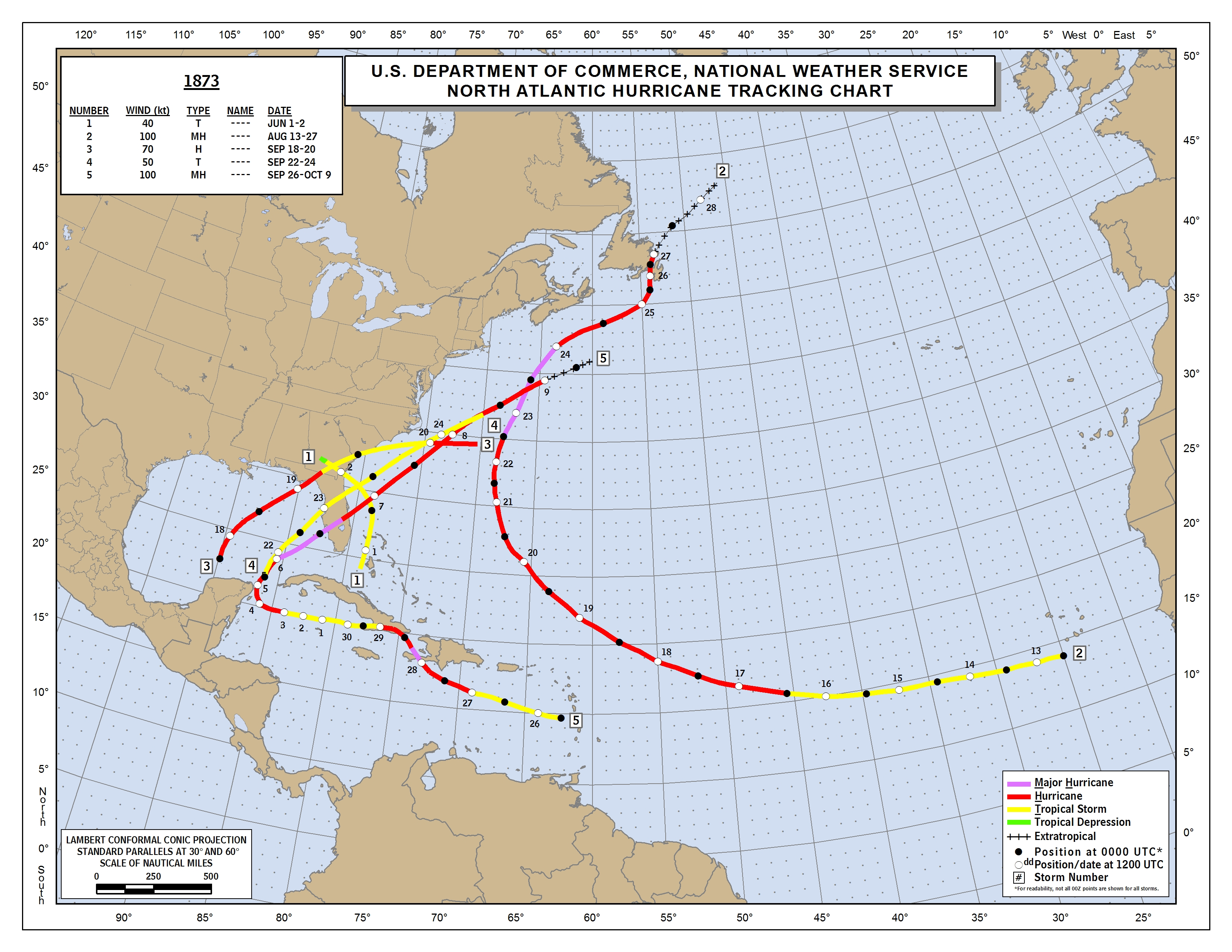
Almanac: It’s Monday, September 19th… day 111 of the 2022 hurricane season, 72 days to go. By total storm energy, the season is 62.2%, 71.4%, and 62.6% complete for the Atlantic, continental U.S., and Florida, respectively. On this date in 1873, a Category 1 hurricane followed a track similar to 2016’s Hermine into Apalachee Bay to a landfall at St. Marks— one of just 12 historical storms to cross the Bay at hurricane intensity.
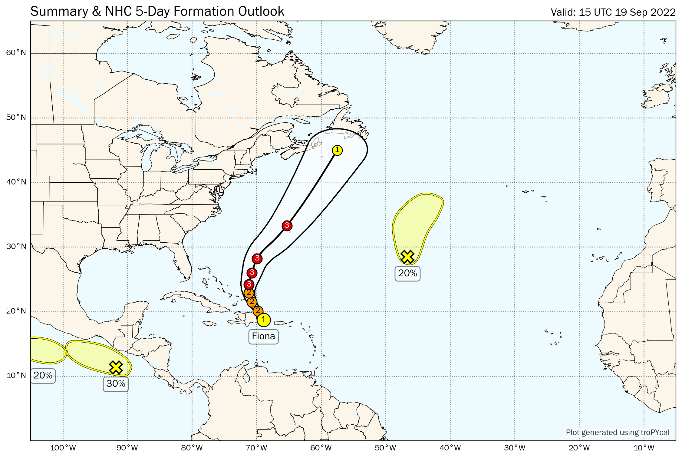
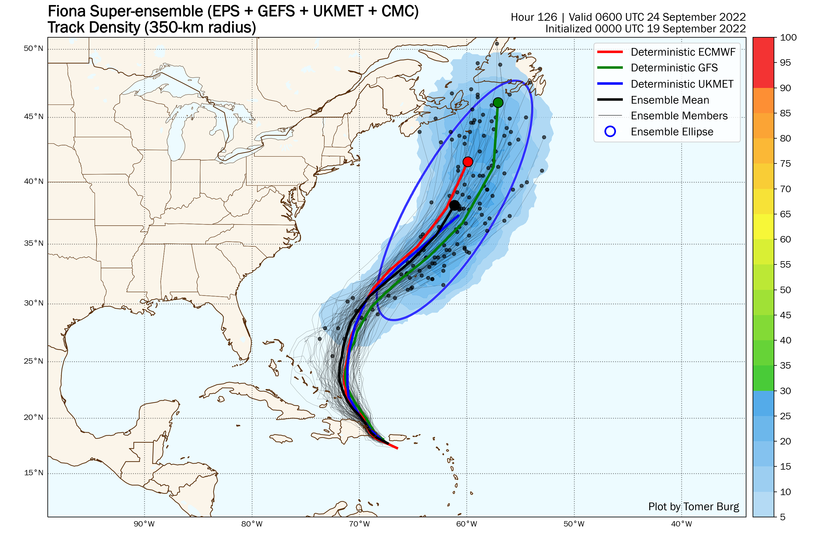
Active Storms: Hurricane Fiona is clearing the northern coast of the eastern Dominican Republic this afternoon, with sustained winds only dropping slightly to 85 mph during its overnight transit. Fiona is tracking northwest at an agonizing 8 mph, and a continued lethargic northwest to north movement is expected over the next 24-36 hours.
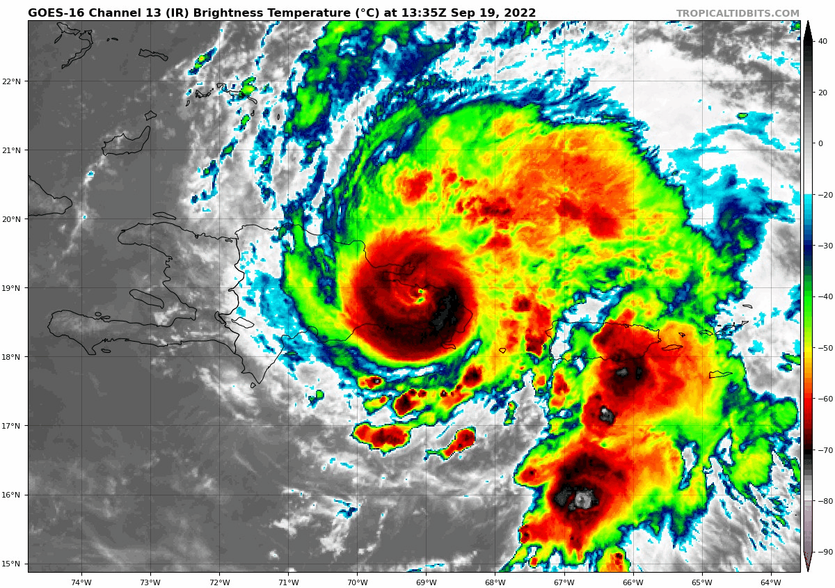
This, coupled with a core structure that is only modestly disrupted by its land passage, will unfortunately keep soaking bands rainfall in place over the Dominican Republic and Puerto Rico through at least tomorrow. This precip will only exacerbate an ongoing catastrophe across Puerto Rico, where southern and eastern sections of the island picked up 8-16” of rainfall as Fiona scraped along the southern coast yesterday, with local totals of up to 25”. While Fiona’s Category 1 winds did some damage, its slow movement massively amplified the flash flooding and landslide destruction. Rainfall is starting to wane over Puerto Rico this afternoon, but an additional 2-4” is certainly possible. A heartbreaking situation for an island still reeling from Category 4 Hurricane Maria in 2017.

Fiona’s intensification is allowing it to feel a developing weakness in subtropical ridging to the north, and a north and eventually NE/NNE movement is basically certain in the week ahead, though significant model variance in how fast this movement will be remains. While the only impacts on the continental U.S. will be large swells from the east, Bermuda and Atlantic Canada should brace for a formidable Fiona over the next 3-6 days, as the hurricane is expected to keep strengthening and reach Category 3 or 4 intensity this week.
Other Disturbances in NHC outlook, with 2-/5-day NHC development odds:
Invest 97L/Central subtropical Atlantic (20/20%): A small low, Invest 97L, is moving north across the open Central Atlantic, well away from any landmass. This low is generating a modest amount of deep convection near an apparent closed circulation center. There is a window for 97L to briefly grab a name over the next 2-3 days as it moves north and northeast, before shear increases.
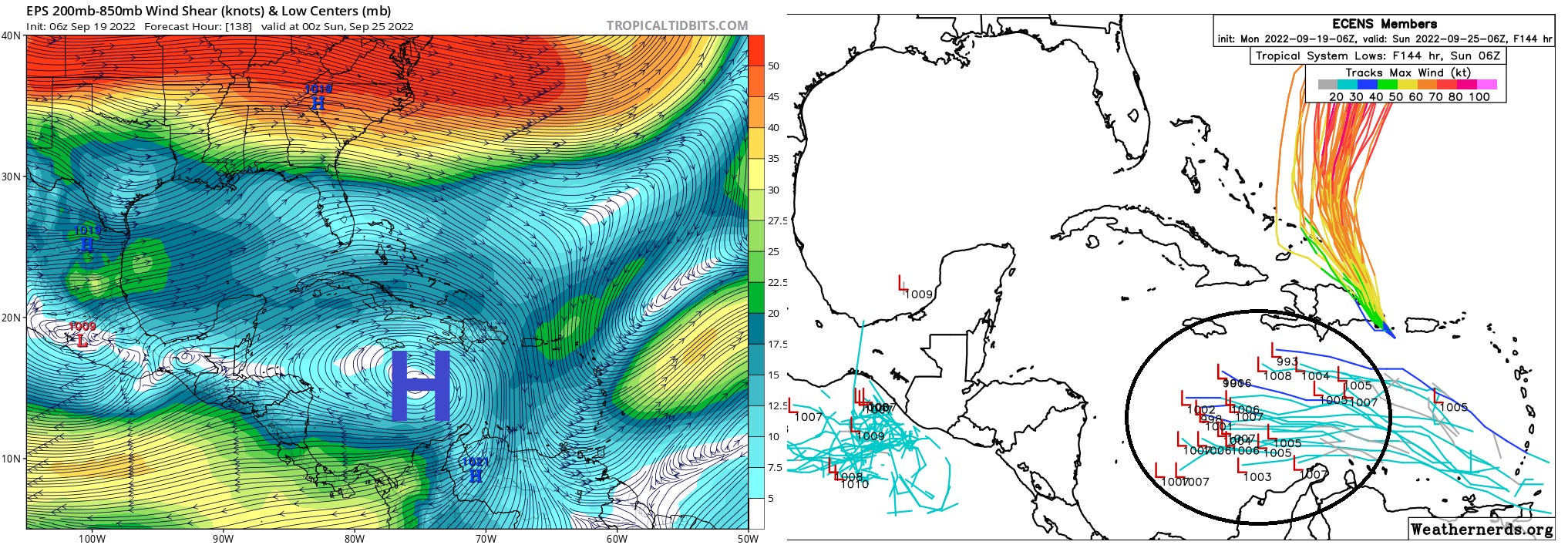
Elsewhere: The next potential threat is coming into focus in association with an unassuming tropical wave near 10N, 48W. While initially impeded by Fiona’s outflow as it continues west-northwest, it is likely to enter a more favorable environment in the east-central Caribbean in 3-4 days. Ensemble guidance suggests a stout upper-level anticyclone aloft in the central and western Caribbean over the weekend and into early next week, offering favorable ventilation to anything that develops underneath. It is early, but the pieces appear to be coming together to support possible development, as indicated by the 12z GFS and other guidance.
The western Caribbean is a traditional breeding ground for U.S. hurricane threats entering the latter third of the season. Given climatology and the potential for a lingering weakness in steering flow next week over the western Atlantic or eastern U.S., this wave is certainly one to watch.
Next report: Daily update out tomorrow afternoon.