Bears Watching: WeatherTiger's Hurricane Watch for June 30th
A tropical depression is likely to form soon, and Florida should take note.
WeatherTiger’s Hurricane Watch daily briefings are released each weekday afternoon during hurricane season. Click below to subscribe to receive these forecasts by e-mail:
Almanac: Today is Tuesday, June 30th… day 30 of the 2021 hurricane season, 154 days to go. By total storm energy, the season is 2.4% complete as a whole, 7.9% complete for the continental U.S., and 7.5% complete for Florida as month #1 of the season ends.
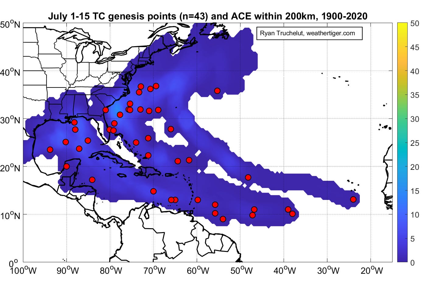
On this date, the final of three (!) Category 2 hurricanes to strike the Gulf Coast in June 1886 made landfall near Apalachicola. You can read more about that storm and June 1886 here. More generally, storm development in the Main Development Region become less uncommon in the first half of July than June, though still rare. And yet…
Active Storms: None.
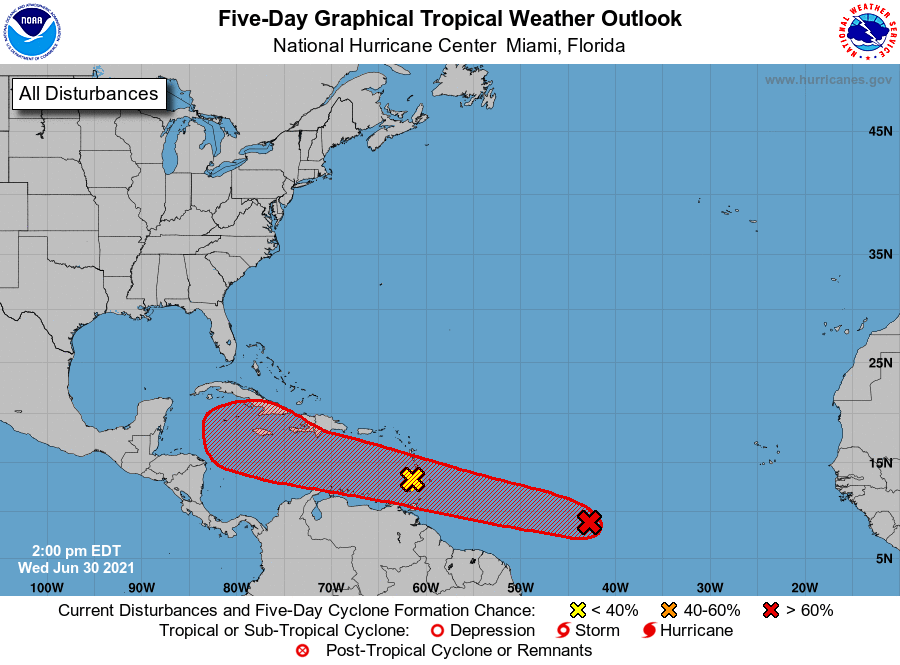
Current disturbances in NHC outlook:
Invest 95L/Lesser Antilles (2-/5-day odds: 0/0%). The western of the two Atlantic tropical waves is still generating showers as it crosses the Lesser Antilles, but is badly sheared and no development of this wave is expected as it continues west.
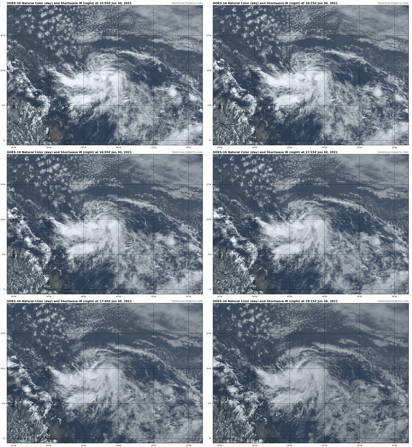
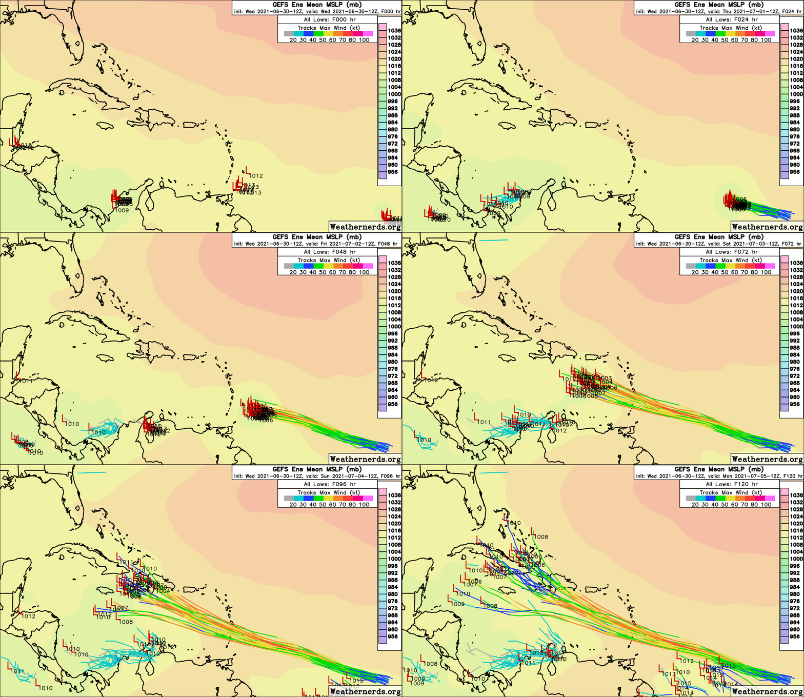
Invest 97L/Tropical Atlantic along 45W (2-/5-day odds: 70/90%). The tropical wave embedded in the monsoon trough halfway between Africa and the Lesser Antilles has continued to organize in the last 24 hours as predicted. While the low-level circulation is still a little elongated, convection is abundant south of 10N, and 97L is quite likely to become a tropical depression or minimal tropical storm over the next 12-36 hours. Potential Tropical Cyclone advisories are expected to be initiated by the NHC soon ahead of this in order to issue tropical storm watches or warnings for the Lesser Antilles.
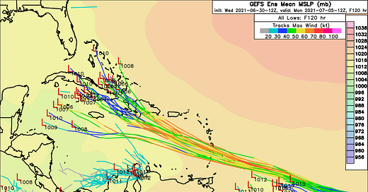
Given favorable shear and moisture environmental conditions and passable SSTs, the uniform bullishness of models and ensemble members on 97L over the next three days is not unrealistic. The system (possibly “Elsa”) will pass through the Windward Islands as a strong tropical storm or even a hurricane on Friday, and pass several hundred miles south of Puerto Rico early on Saturday, bringing squally, gusty weather there.
In the second half of the weekend, effective shear is likely to increase over 97L in the central Caribbean as the storm accelerates west-northwest, and land interaction with Hispaniola, Cuba, or Jamaica is also a strong possibility. This may act to limit or weaken 97L, or even dissipate it entirely as shown on the 12z Euro. Should the storm survive, it is likely to turn north into the general vicinity of Florida or the southern Gulf in 5-6 days. It is too early to speculate on particular scenarios, other than to say that 97L does bear watching for Florida.
How many bears, you ask? On a scale of one to five bears: two bears watching. Stay tuned.
Elsewhere: Nothing currently, but the African wave train may need to be watched for the next week to the east of 97L until conditions turn less favorable for development.
Next report: A long-form column on 97L/PTC 5/TD 5/Tropical Storm Elsa will be sent tomorrow afternoon by 3 p.m.

