August and Everything After: Hurricane Watch Weekly Column for August 9th
An eastern Atlantic tropical wave is something to watch next week, plus how Debby slots into August hurricane history.
WeatherTiger’s Hurricane Watch is a reader-supported publication. Paid subscribers get daily tropical briefings, plus weekly columns, full coverage of every hurricane threat, our exclusive real-time seasonal forecast model, and the ability to comment and ask questions.
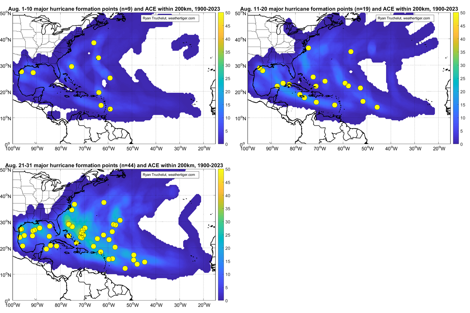
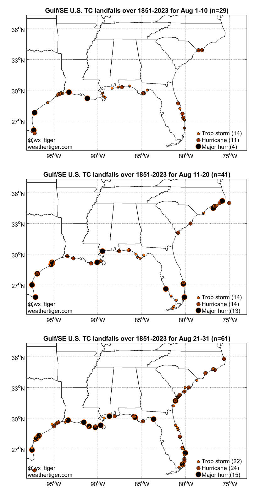
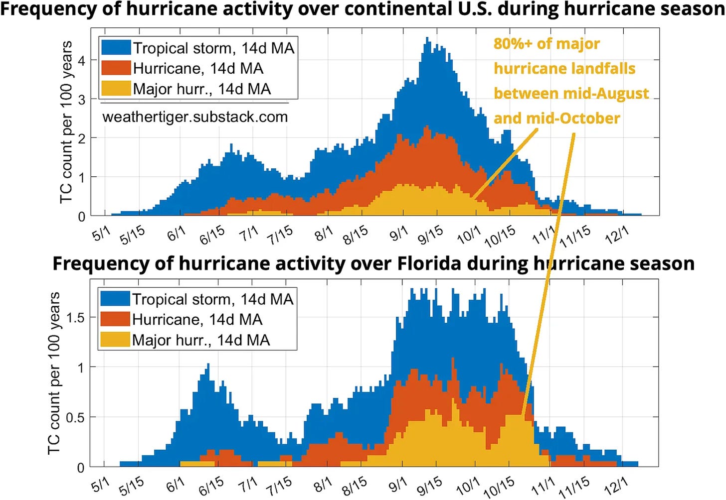
Like a ramp into troubled water, August marks the transition between the tropical skirmishing of the first third of the season, and the peak two months of severe hurricane risks between mid-August and mid-October. Though the 2024 season is already two U.S. hurricane landfalls deep, well over 90% of historical Category 3, 4, and 5 landfalls have occurred after this week. Welcome to August, the worst month of the year.
This August got off to a particularly August-like start, with Hurricane Debby touching off a scramble for storm supplies on a week better-known for a scramble for school supplies enroute to bringing wind and surge impacts to west-central and northern Florida and submerging the coastal Southeast with heavy precip. The remnants of Debby are located inland over the northern mid-Atlantic and will spread another 2-4” of rainfall this weekend focused on the northern Appalachians and the Adirondacks. Flash flooding risks will accompany these heavy rains, which will clear the Northeast U.S. by Saturday afternoon.
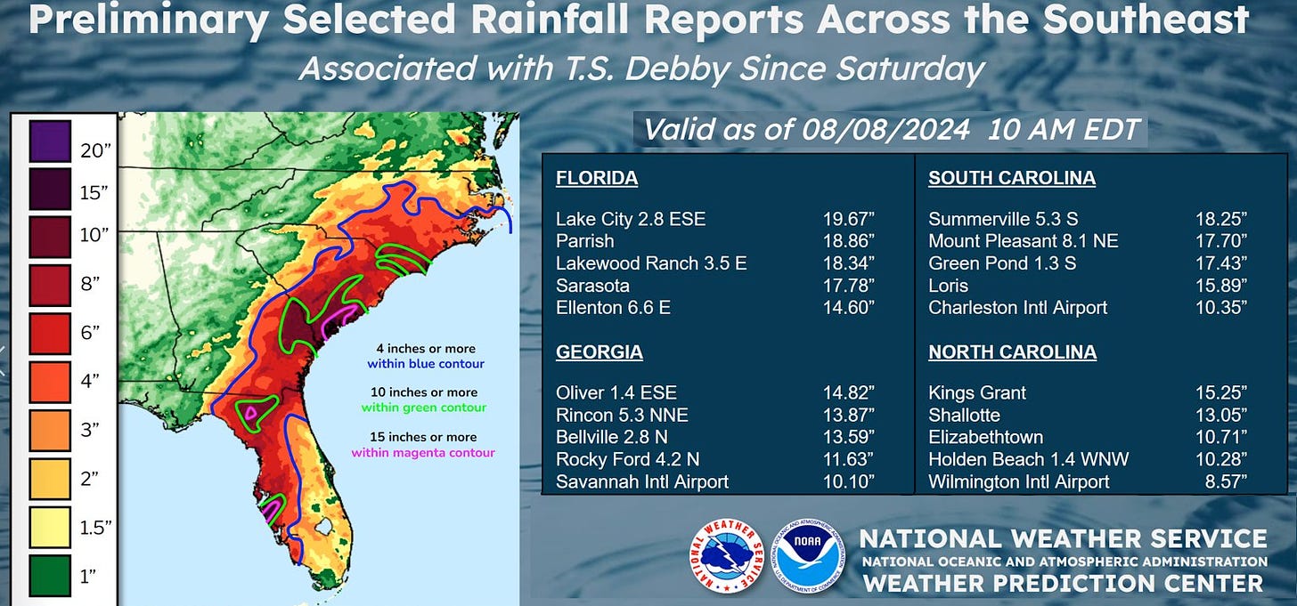
Debby was a little unusual in that early August landfalls aren’t all that common on the eastern Gulf Coast, but as typical of early season storms, its primary impact was flash flooding. Several spots, including near Sarasota, Lake City, and Charleston, saw 15-20” rainfall totals from Debby. Much broader areas of west-central and northern Florida, eastern Georgia, and the central and eastern Carolinas tallied around 10” or more, causing widespread flooding.
The true extent of the wind impacts is a little unclear as there aren’t many weather stations in the Suwannee River Valley where Debby struck, but top gust observations include 70 mph at Mayo, 66 mph at Cedar Key, 62 mph in Madison, and a surprising 64 mph in Sarasota. The Tallahassee Airport saw a peak gust of 48 mph. Overall, Debby was a bumpy descent into the heart of hurricane season, combining the track of Idalia with the structure and intensity of Hermine, hybridized with the name and flooding rainfall of 2012’s Tropical Storm Debby.
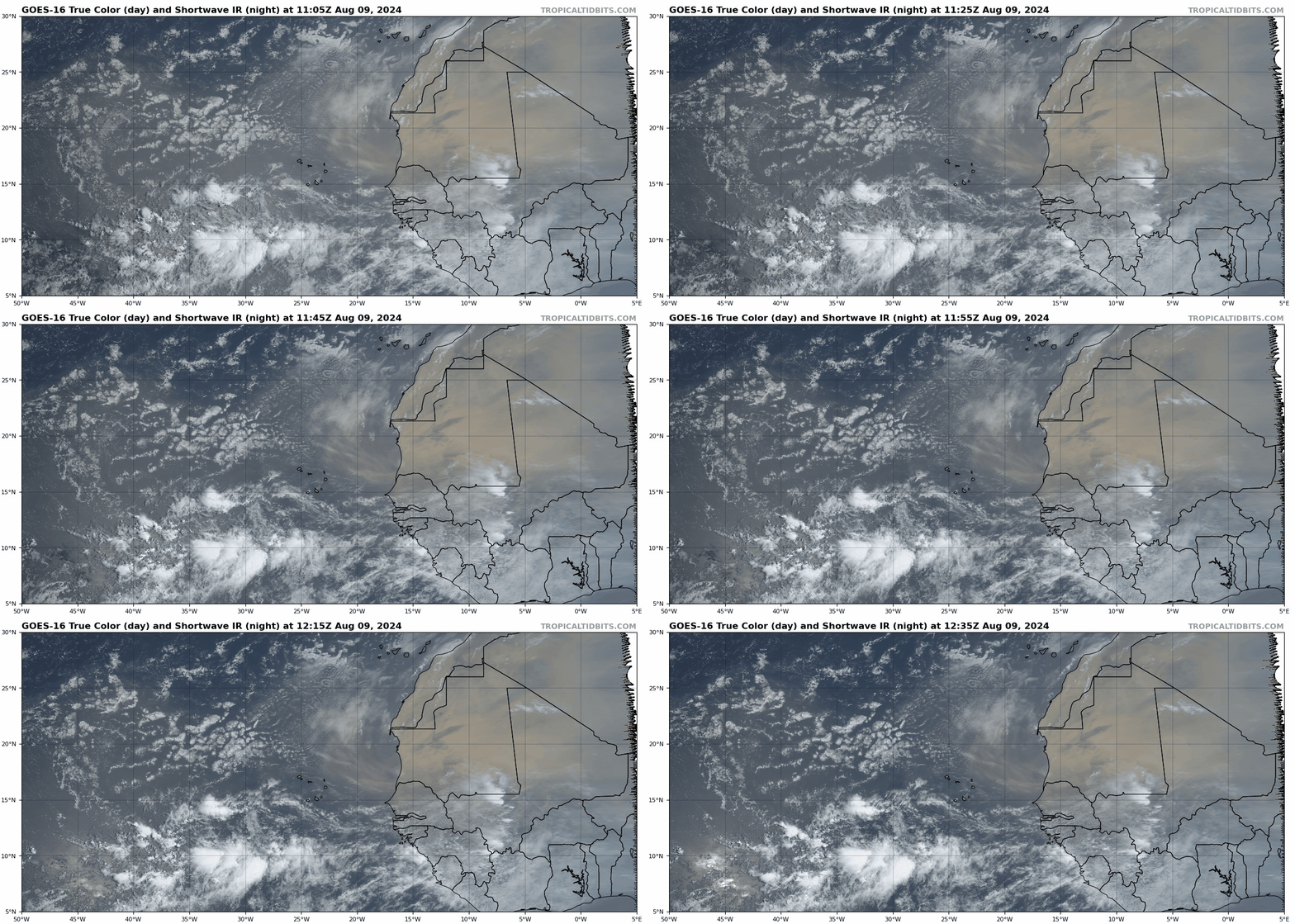
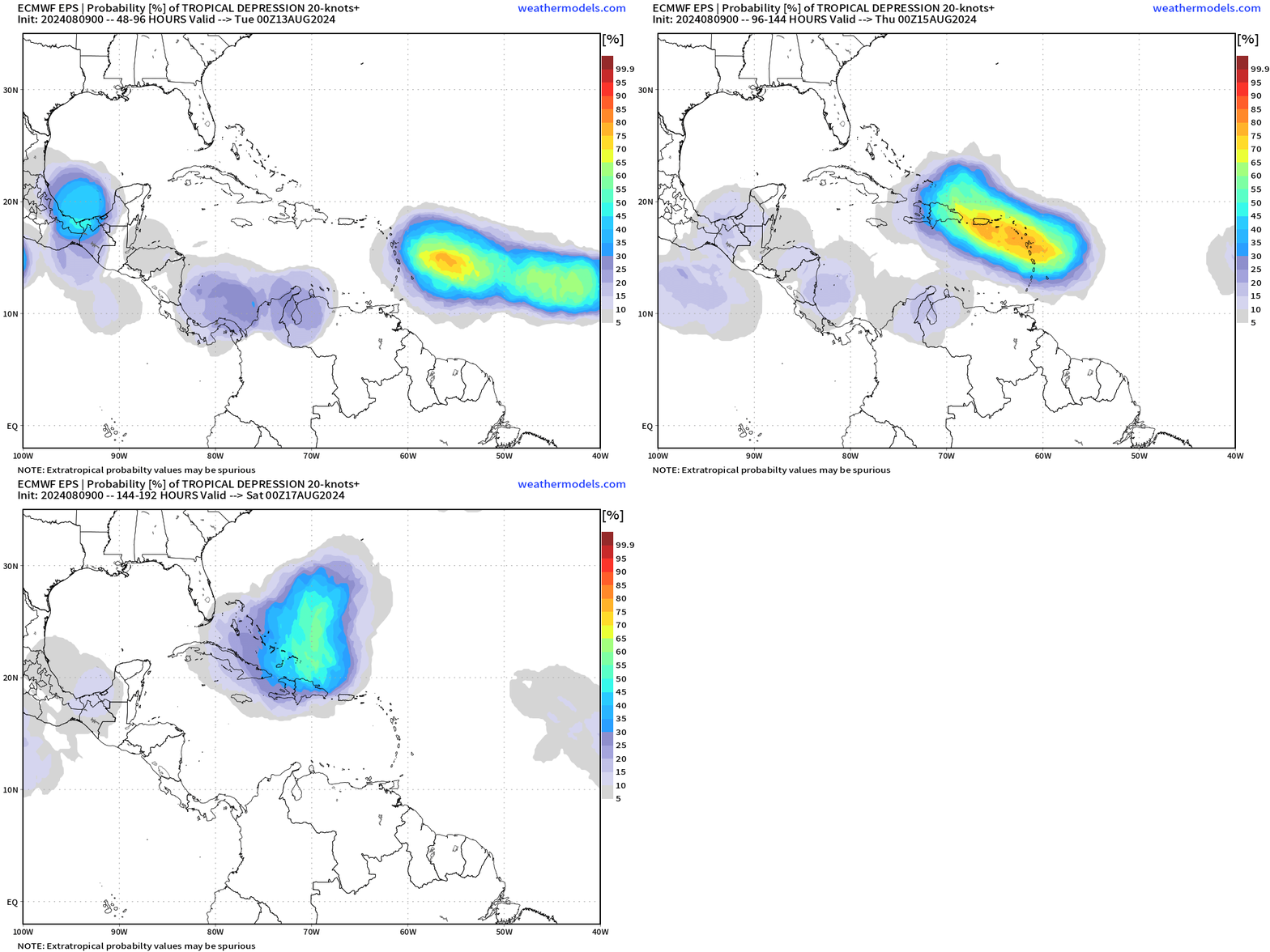
There are no other named storms today in the Atlantic. Don’t expect that to be true for long, however, as a tropical wave currently in the eastern Atlantic is likely to develop into a depression by early next week east of the Lesser Antilles. Dry air will keep the wave's initial chances of development in check into the weekend, but a favorable outflow regime and better moisture availability as the wave nears the Leeward Islands make this system a good bet to organize by Monday.
The risks to the islands depend on how fast the system can come together. With the potential greatest impacts in Puerto Rico and Hispaniola Tuesday and Wednesday, a mid-week hurricane threat is on the table there if the wave becomes a depression on Sunday or early Monday. The Leeward Islands and eastern Greater Antilles are at least likely to see heavy rain early next week.
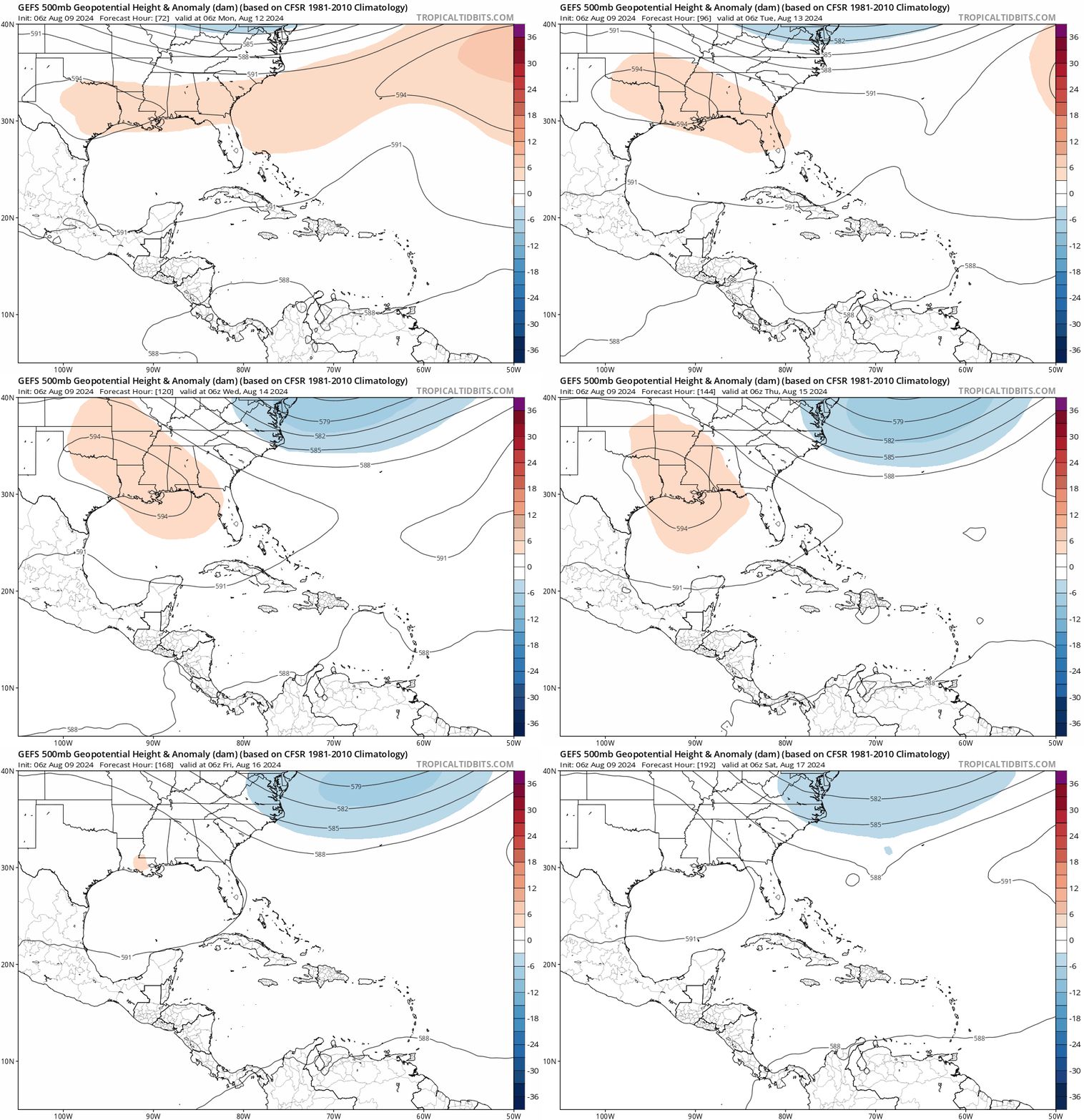
The wave’s longer-term fate is unclear. The system should start to angle more northward beyond Hispaniola in response to a persistent dip in the jet stream east of the U.S. East Coast, but steering currents late next week may be complicated by a potential attempt of ridging along the western Gulf Coast and in the western Atlantic to link up and keep the wave heading somewhat westward. How sharp that north turn occurs is also dependent on how quickly and where an actual circulation forms along the wave axis. The bottom line is that an eventual threat to the U.S. East Coast in about 10 days isn’t the most likely outcome, but can’t be ruled out yet.
I’ve been pointing in this column to mid-August as the timeframe for a more sustained uptick in tropical activity, and unfortunately that appears likely to come to fruition. With environmental conditions becoming quite favorable in the Atlantic’s Main Development Region and sea surface temperatures a couple of degrees above normal, almost every tropical wave rolling off Africa has some eventual chance of development going forward. I’ll discuss more about how steering currents might be shaping up for late August and September and go over WeatherTiger’s updated seasonal forecast next week, provided the wave isn’t menacing the continental U.S.
Overall, there are probably a couple more potential U.S. hurricane threats to go before August slips away like a moment in time, especially as the rate of U.S. major hurricane landfalls more than triples between the first and last ten days of August. As we turn our attention back to securing the 5 small-batch protractors, 53 non-toxic glue sticks, and 197 artisanal colored pencils our precious children need to learn, don’t forget to keep watching the skies.


![[Image of WPC Flash Flooding/Excessive Rainfall Outlook] [Image of WPC Flash Flooding/Excessive Rainfall Outlook]](https://substackcdn.com/image/fetch/w_1456,c_limit,f_auto,q_auto:good,fl_lossy/https%3A%2F%2Fsubstack-post-media.s3.amazonaws.com%2Fpublic%2Fimages%2F37798b93-4841-480e-9f63-d0ea8e08c410_892x716.gif)
