Augtober: Hurricane Watch for October 2nd
A sprawling Gulf disturbance will bring heavy rain to Florida next week as the Tropical Atlantic lights up.
This free sample of WeatherTiger’s daily bulletin may be shared freely.
Florida and continental U.S. tropical threat synopsis: A broad area of low pressure, which may or may not become a tropical system, will likely develop in the Gulf over the weekend. Regardless of name, this low may have heavy rain impacts on the Florida peninsula starting around Sunday and extending into next week.
Almanac: It’s Tuesday, October 2nd… day 124 of the 2024 hurricane season, 59 days to go. By total storm energy, the season is 77.9%, 84.4%, and 75.5% complete for the Atlantic, continental U.S., and Florida, respectively.
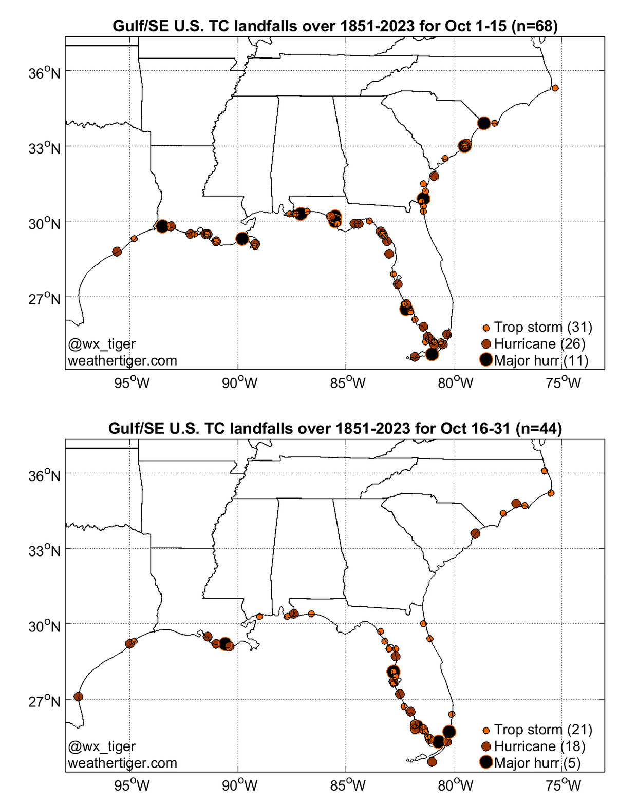
Looking at landfall climatology for the month ahead, there are numerous northern Gulf Coast hurricane landfalls in the first half of October. These thin out as historical risks shift to a focus on west-central and southwest Florida in the second half of the month. A U.S. hurricane landfall occurs in October about one out of every three years.
Active storms:
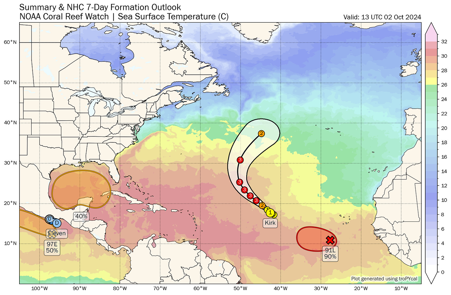
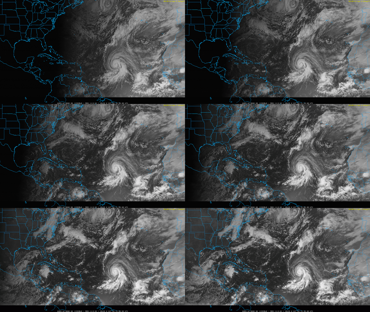
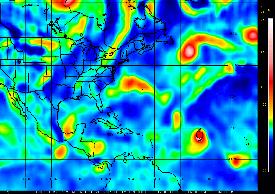
Hurricane Kirk is intensifying in the eastern Tropical Atlantic, taking on the “cinnamon roll” look of a system with healthy banding and a solid inflow of deep moisture. Sustained winds are up to 85 mph, and Kirk should set phasers to intensify as it moves northwest over the next few days. There’s no real change in the longer-term forecast since yesterday, with Kirk expected to become a major hurricane in the next few days and safely passing around 1,000 miles east of Bermuda over the weekend. No threat to land other than eventual rough surf next week on Atlantic beaches.
Newly-designated Tropical Depression 13 has formed this morning, because apparently the Cape Verde portion of hurricane season is now in July and October in this topsy-turvy world of ours. TD 13 is hundreds of miles southeast of Kirk and likely to strengthen to a hurricane over the next 5 days as it gets away from Kirk’s outflow and moves steadily west-northwest. This one too may well become a strong storm and rack up open-ocean Accumulated Cyclone Energy units, but TD 13 is unlikely to have direct land impacts.
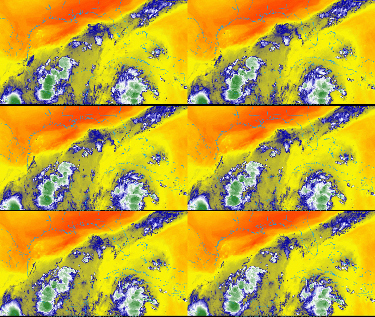
Disturbances in the NHC tropical weather outlook: NHC continues to give a broad area of convection and low pressure extending from the southern Gulf of Mexico into a northwest Caribbean Sea a 40% chance of development between Friday and next Wednesday. In the past day, there has been an increase in the amount, though not the organization of the thunderstorm activity associated with the next round of Central American Gyre (CAG) activity; as of early Wednesday afternoon, there are two main areas of convection, one focused in the Bay of Campeche and the other to the south of Cuba. Water vapor imagery shows plenty of moisture across the southern Gulf and northern Caribbean as well as increasingly favorable upper-level winds, with a much drier airmass in the northern Gulf of Mexico.
With two pockets of rotation nested within the larger CAG, tropical development is not imminent, and it’ll take several days at least to consolidate the pieces into a single disturbance. Both areas are expected to lift north into the general vicinity of south-central Gulf by the weekend, by which time they may combine into a single, broad circulation. The resulting area of low pressure is expected to be large, but due to increasing shear, likely will lack any kind of intense core. Rather, a large area of rainfall is likely to spread out to the east and northeast of the low’s broad center. This rainfall will probably reach the immediate northern Gulf Coast and the Florida peninsula by late in the weekend.
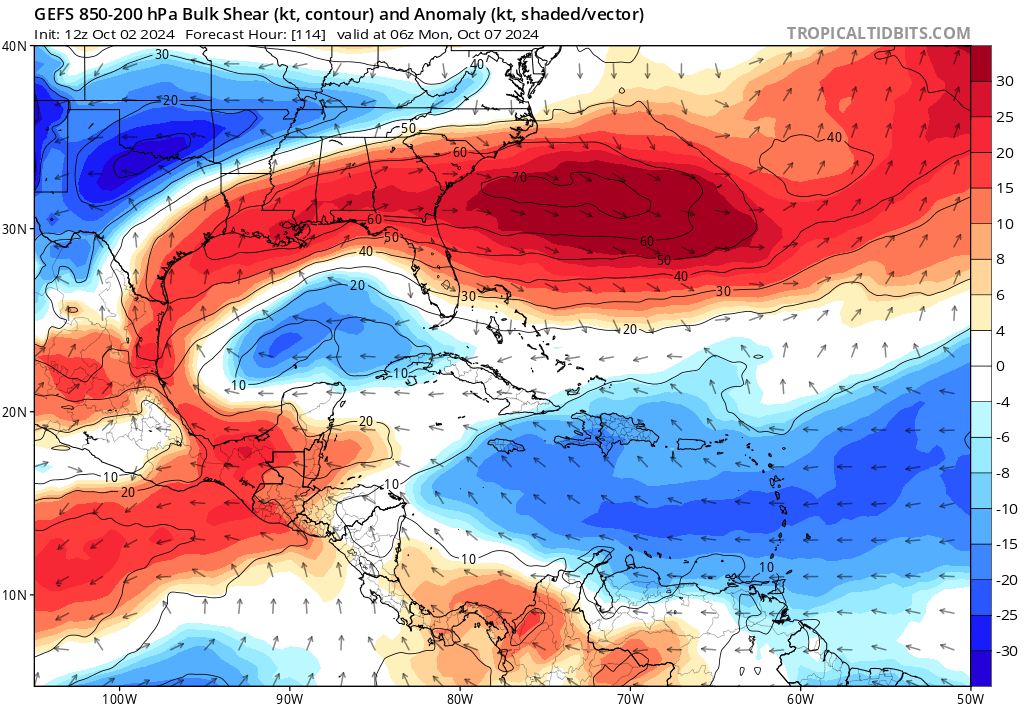
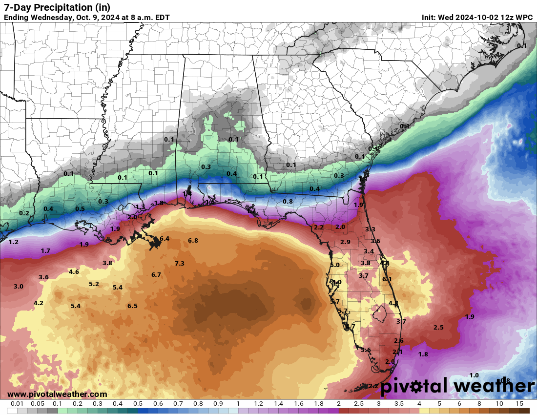
With a fair amount of wind shear over the Gulf, nearby dry air to its west, and several fronts likely to be in its vicinity, it is unclear whether the resulting disturbance will actually meet the definition of tropical cyclone, or be more of a hybrid or frontal low. That makes a difference for whether the system ever receives a name, but it doesn’t make much of a difference in the system’s eventual impacts. Exactly how fast the low will move east-northeast across the eastern Gulf ahead of an approaching dip in the jet stream early next week is to be determined, but South and Central Florida are likely to tally 3” or more of rainfall between Sunday and Tuesday, with the potential for widespread higher totals if the storm lingers through the mid-week or beyond.
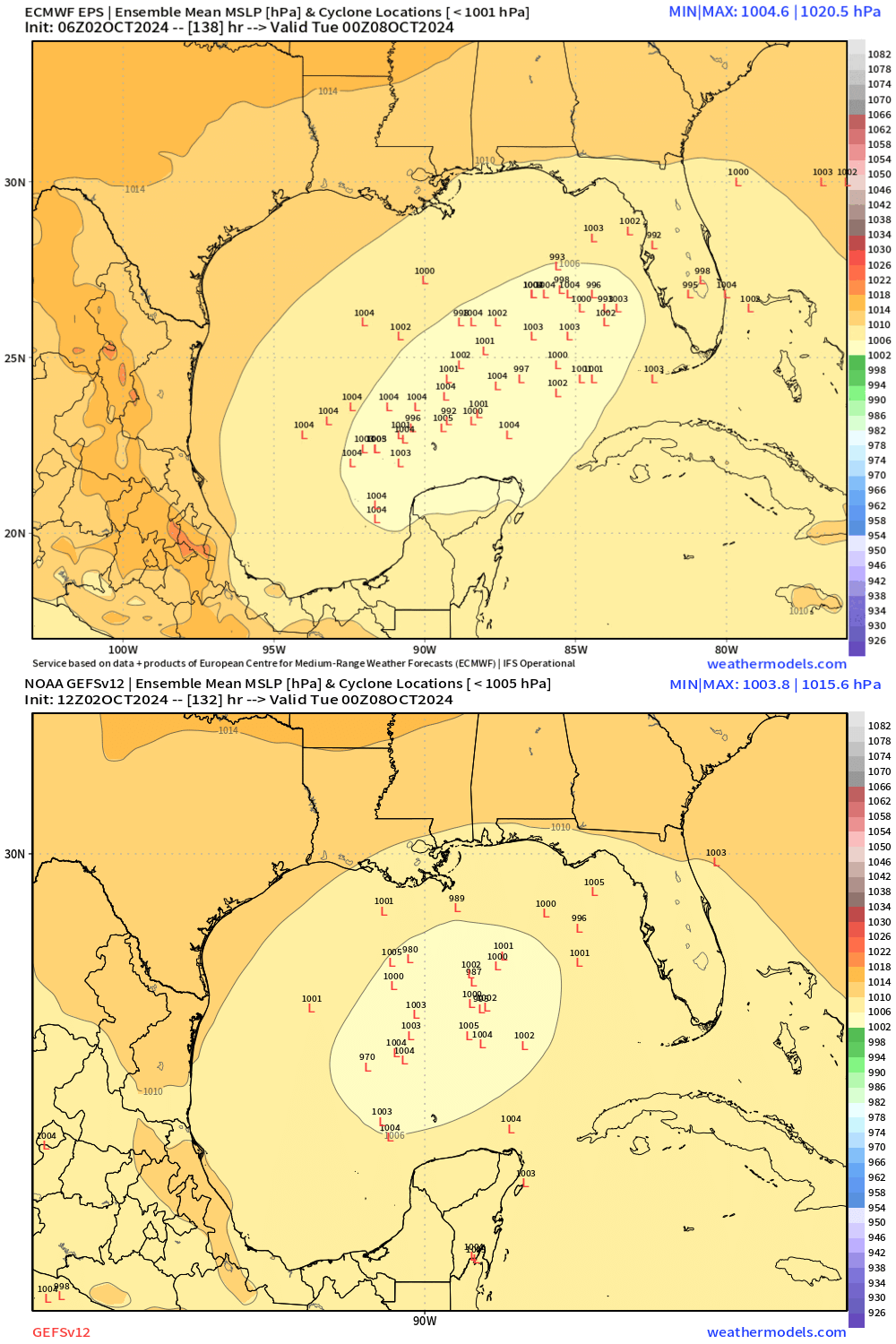
Again, while something is likely to form over the Gulf by the weekend, what develops is not likely to be a tight, well-organized hurricane, and may well not even technically be a tropical storm or depression either. However, the label, or lack thereof, doesn’t mean that there won’t be impacts: tropical or not, the eventual rainfall accumulations are likely to be heavy in Central and South Florida. That certainly isn’t helpful for recovery efforts along the Florida Gulf Coast, nor are the potential for some gusty winds or rough seas early next week across the eastern Gulf, either.
Farther north, the fact that the jet stream is likely to be oriented from west-to-east across the Southeastern U.S. means tropical moisture from this system is likely not going to be pulled into north Georgia or the Carolinas, where thankfully little rain is expected over the next 10 days. North Florida may or may not see significant rainfall from this, but rains are not likely to last as long over the Panhandle as peninsular Florida. I know it’s stress-inducing to have a tropical pain in the liver just short of jaundice hanging out over the Gulf, but we should have a better answer for how this rainmaker may play out in a few days.
Elsewhere: No other areas of interest. I taped a podcast earlier today hosted by the National Tropical Weather Conference and also featuring Mark Sudduth of Hurricane Track discussing our experiences in Hurricane Helene and what it means for the future of forecasting, which you can listen to here.
Next update: Daily bulletin tomorrow afternoon.


🤣”I know it’s stress-inducing to have a tropical pain in the liver just short of jaundice…” these nuggets of humor are worth the price of admission
Enjoyed seeing you on PBS! I can see you becoming the Sanjay Gupta of climate change and severe weather events 👍