


Whoa-oh, We're Halfway There: WeatherTiger's Hurricane Watch for August 31st
Busy Atlantic, but no sign of any Florida threats on the horizon as the peak nears.

WeatherTiger’s Hurricane Watch is a quick, easy-to-understand newsletter focused on predicting and understanding Florida hurricane threats. Sign up free below to get our weekly column and storm coverage straight in your inbox, or go premium to receive daily updates.
Two-sentence Florida tropical threat synopsis: No immediate threats as the remnants of Ida will continue to enhance heavy rain chances in northern Florida today and central Florida tomorrow. Otherwise, ongoing tropical activity in the eastern and central Atlantic is not a threat to Florida, and development chances in the Caribbean or southern Gulf have declined a little since yesterday, at least for the next week.

Almanac: It’s Tuesday, August 31st… day 92 of the 2021 hurricane season, 91 days to go—halfway there by the calendar, though not quite in terms of overall activity. By storm energy, the season is 26.6% complete as a whole, 41.0% complete for the continental U.S., and 26.6% complete for Florida.
So far, as shown above, 2021 is the 2nd most-active first half of a hurricane season since 1900 in Accumulated Cyclone Energy over the continental U.S. Over 9 total units of U.S. ACE have occurred in Claudette, Danny, Elsa, Fred, Henri, and Ida, more than double the median U.S. ACE for the whole hurricane season, considering the 1900 through 2020 season.
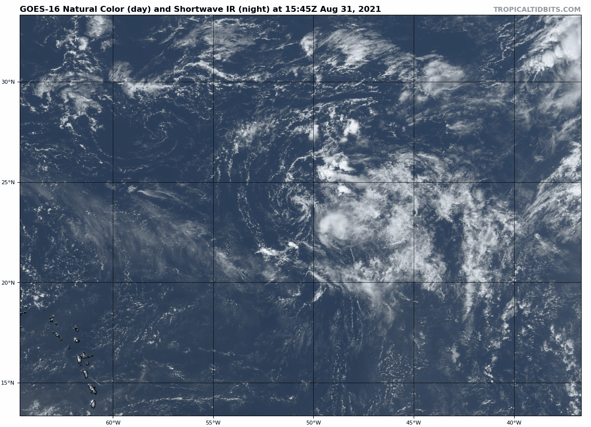
Active Storms: Kate continues to ride the struggle bus in the lonely open Atlantic today, now downgraded to a tropical depression as shear takes what little convection it ever had. Dissipation appears probable over the next 24 hours, but in any case, Kate is no concern to anyone.
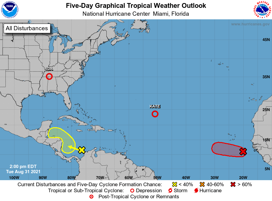
Current disturbances in NHC outlook, with 2-/5-day NHC development odds:
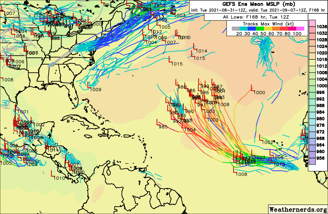
Invest 90L (90/90%): A vigorous wave in the far eastern Atlantic is wrapping up this afternoon, and will likely become Tropical Depression 12 by the end of the day today. Conditions in the Main Development Region are conducive for continued strengthening over the next 5-7 days, and most ensemble guidance suggests 90L becomes a major hurricane over the weekend or early next week.

With U.S. East Coast and western Atlantic troughing in place on days 6-12, potential Larry remains highly favored to turn north into the open Atlantic well to the east of Florida. We’ll keep an eye on it, but there is no more evidence today than yesterday to suggest this storm is any threat to Florida.
Southern Caribbean (10/20%): Good news here as a disorganized area of showers and storms east of Nicaragua is increasingly likely to move inland over Central America in 2-3 days. There is still a slight chance of some development before then, but the already slim odds of this system slipping north into the Gulf have diminished further since yesterday.
Elsewhere: No other active disturbances. Additional development in the east Atlantic is probable in 6-10 days, which always should be watched at this historically dangerous time of the hurricane season. The southern Gulf may also bear watching in 7-10 days if the trough axis can ever more back over water.
Next report: Next daily update tomorrow afternoon.