When September Ends: Hurricane Watch for September 30th
Possible Gulf threat stays on the back burner, while the east Atlantic finally goes off.
This free sample of WeatherTiger’s daily bulletin has been sent to all subscribers. You may share it freely.
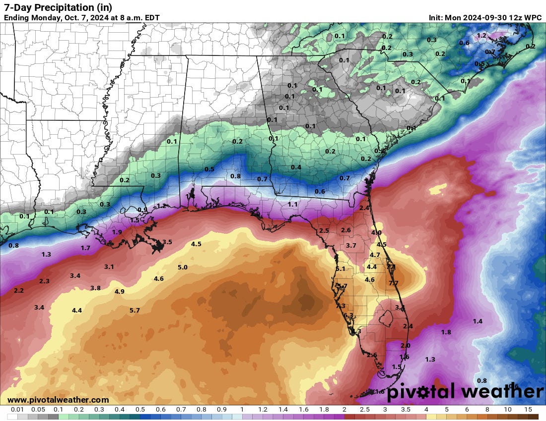
Florida and continental U.S. tropical threat synopsis: A disturbance in the western Caribbean poses an eventual risk of a tropical storm reaching the Gulf in the next week, and is likely to be a Florida rainmaker at least. Bears continued monitoring.
Almanac: It’s Monday, September 30th… day 122 of the 2024 hurricane season, 61 days to go. By total storm energy, the season is 75.8%, 83.5%, and 75% complete for the Atlantic, continental U.S., and Florida, respectively.
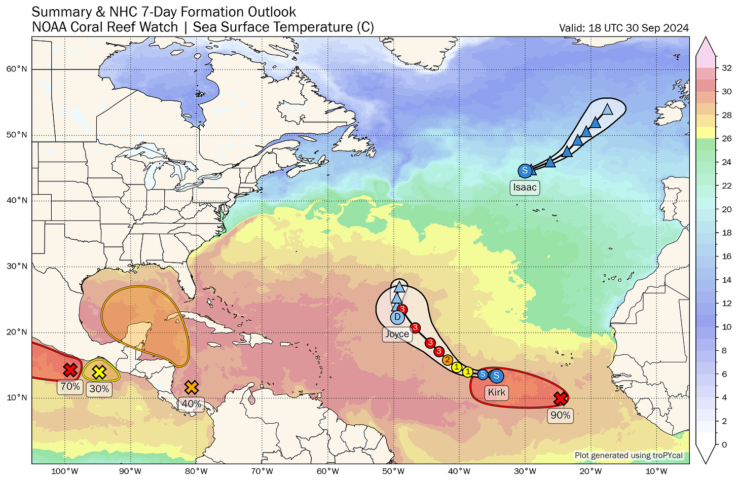
Active storms: Plenty. Leaning into the obvious reference, the Tropical Atlantic has finally awakened as September ends. In additional to Helene’s post-tropical remnants still spinning over the mid-South (though thankfully not triggering much precip), there are several named storms to cover, though no threats to land. To wit:
Post-tropical cyclone Isaac has merged with a front and is no longer a tropical storm, after peaking as a Category 2 hurricane in the North Atlantic over the weekend. Will contribute some moisture to western Europe.
Tropical Depression Joyce is being heavily sheared in the central Tropical Atlantic, after peaking as a modest tropical storm over the weekend. Joyce should weaken further to a remnant low in the next day, with no land impacts.
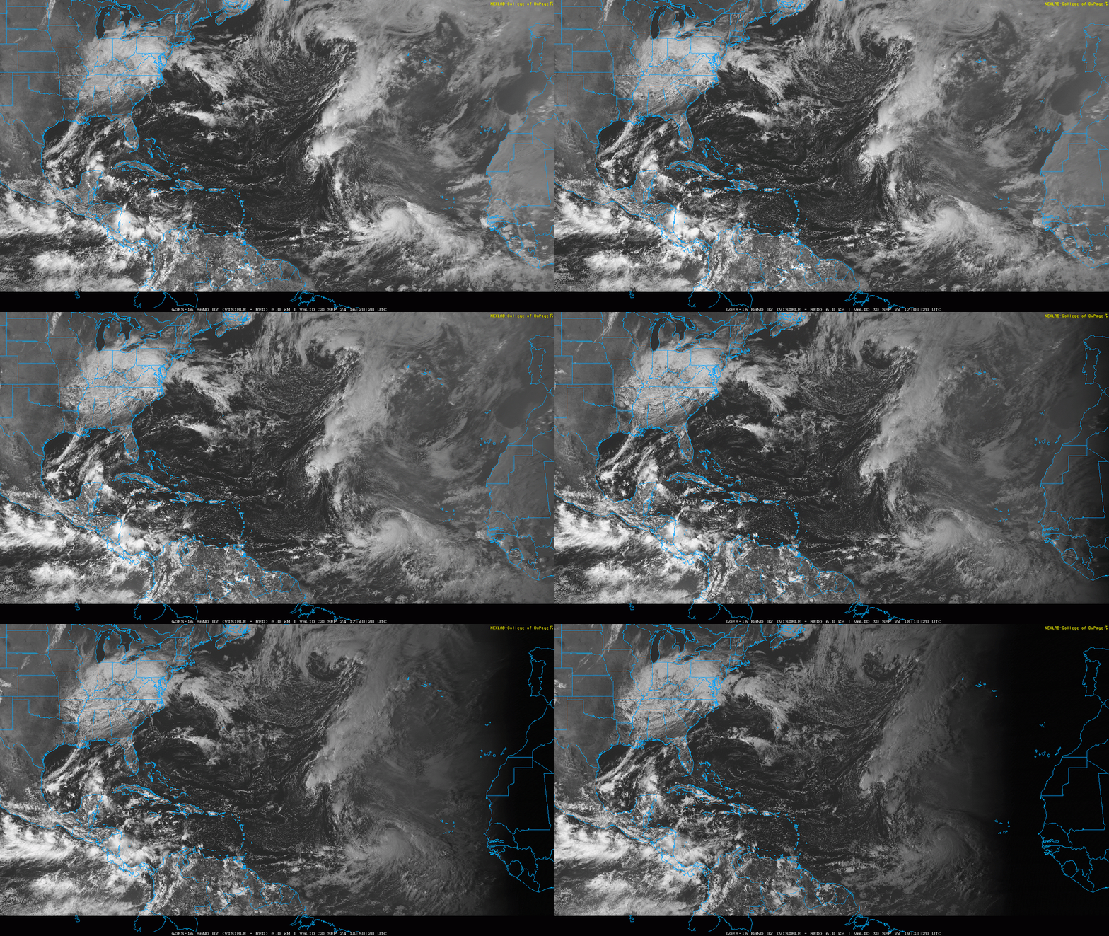
Tropical Storm Kirk is finally going to be the kind of Cape Verde-originating major hurricane that I’ve been expecting since August, only it’ll happen in early October. Kirk is wrapping up in a pristine environment today, with maximum winds up to 60 mph at 5 p.m. Continued strengthening is expected as Kirk curls northwest into open waters, and it may well peak out at Category 4 intensity next weekend as it turns northeast.
Kirk will create high seas that may eventually cause dangerous surf conditions on the U.S. East Coast next week, but is otherwise only a threat to shipping lanes.
Disturbances in the NHC tropical weather outlook:
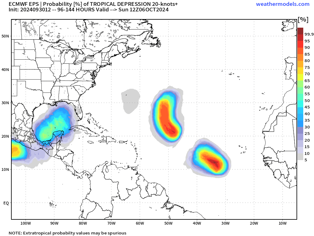
The primary focus in the Tropics remains a disturbance rotating around a re-developing Central American Gyre, which the NHC is giving a 10% of development through Wednesday and 40% chance over the next week. Some convection has developed in the southern Caribbean, so there is an area to watch, although this convection is being sheared by an upper low for now. Note that the NHC development odds are down a skosh since Sunday, when they were 50%.
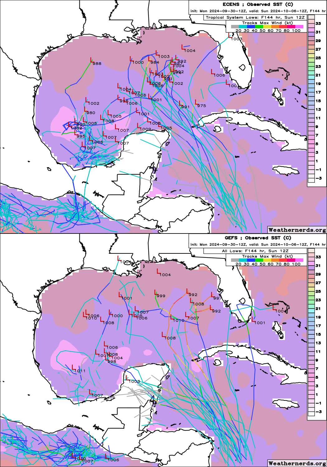
12z GFS and Euro ensemble member low positions on Sunday morning with SSTs. Image via weathernerds.org. Once this upper low moves to the disturbance’s west and weakens, the environment later in the week may allow some further organization to occur as it lifts northwest around the periphery of a western Atlantic ridge and moves towards the Gulf of Mexico. There continues to be disagreement between the models on whether a circulation is more likely to consolidate in the southwestern or central Gulf, though I would lean towards the east.
The more quickly and more eastward a circulation develops, the better the chances of a somewhat stronger system arising are. However, I do not see the kind of high-end potential out of this disturbance as was clear preceding Helene; while fast-moving Helene hardly put a dent in sea-surface temperatures, the subtropical jet will shift south in the first week of October, imparting more shear on anything that tries to develop. This may not be enough shear to stop something from forming entirely by early next week, but the most likely outcomes here are broader, weaker, messier systems, not tightly organized strong hurricanes. That would indicate that the dominant impacts of any storm would be primarily rain for the eastern half of the Gulf Coast, especially peninsular Florida.
It’s still very early, and we should watch the Gulf closely for the upcoming week or more. But I am not seeing this as another Gulf major in the works.
And finally, Invest 91L is a tropical wave in the far eastern Atlantic, which the NHC is giving a 50% chance of development in the next two days, and 90% in the next seven. There’s not much to look at right now, but once this wave gains a little more separation from Kirk, it too is likely to develop under an MJO-driven favorable outflow regime, aided by (finally) ample moisture in the region. This system is overwhelmingly likely to never threaten any land, which is true of almost all October Cape Verde storms, but given the pattern there is perhaps a slight chance of it reaching the Lesser Antilles sometime next week.
Elsewhere: Nothing else on the horizon.
Next update: Daily bulletin tomorrow mid-afternoon as we attempt to regain some sense of normalcy around here this week.


I have some thoughts I want to share about Helene but will wait till things calm down. While not trained in your science, as the GM of the private Siesta Key Utilities from 1985-2006 I do have some storm experience. Not counting surviving Betsy in Baton Rouge in 1965. No response required.