We've Got Potential: Hurricane Watch for September 21st
Potential Tropical Cyclone 16 will reach eastern North Carolina on Saturday; an eastern Atlantic wave should develop but risks to the Antilles are easing a bit.
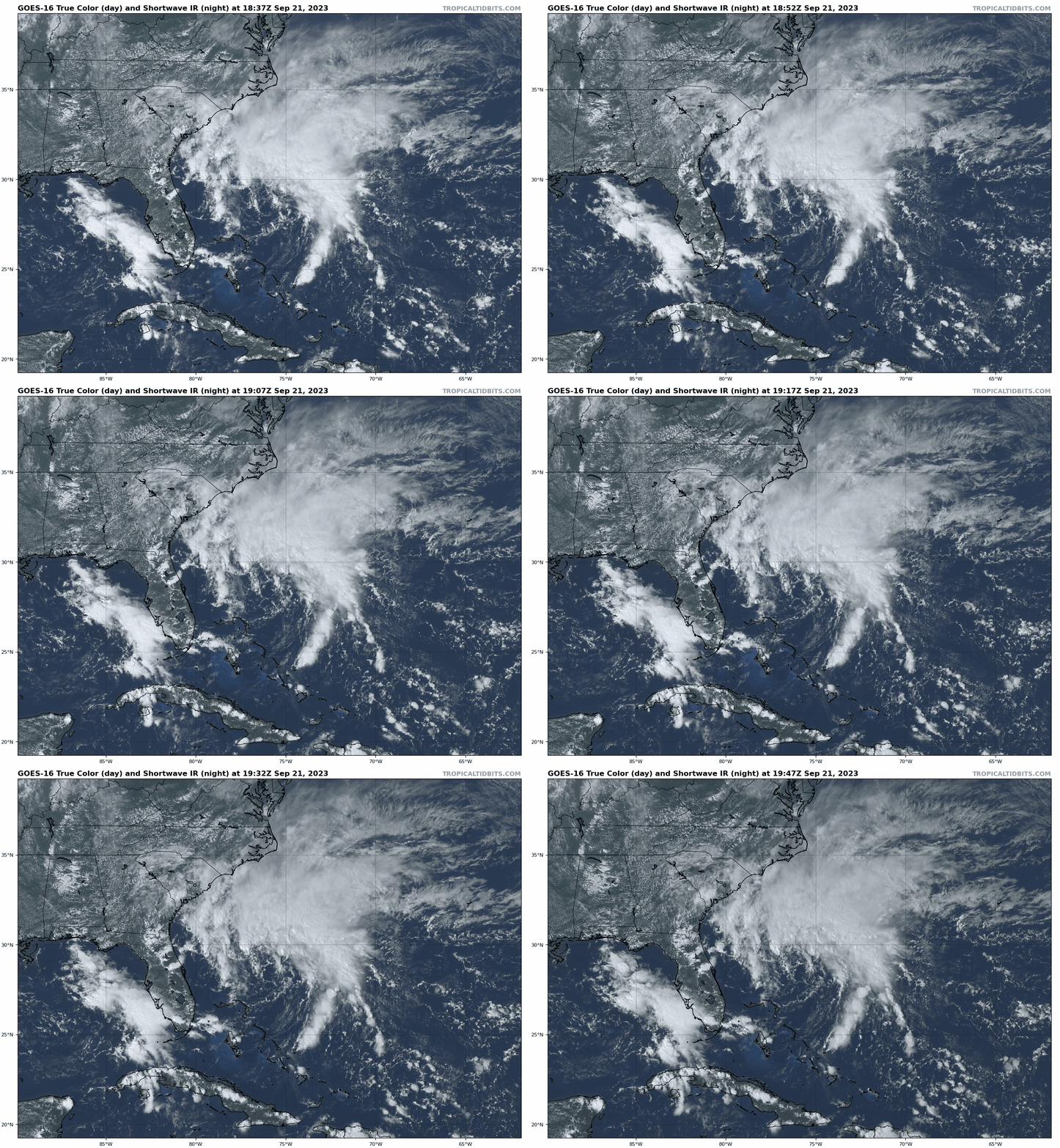
Florida tropical threat synopsis: Potential Tropical Cyclone 16 is 300 miles east of Florida and will move north towards the Carolinas over the next 2 days. A few showers and breezy conditions are expected in northeast Florida through tomorrow due to PTC 16. Otherwise, no tropical threats to Florida for at least the next week.
Almanac: It’s Thursday, September 21st… day 112 of the 2023 hurricane season, 71 days to go. By total storm energy, the season is 64.5%, 73.7%, and 63% complete for the Atlantic, continental U.S., and Florida, respectively.
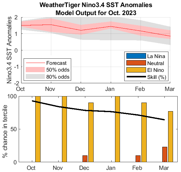
The monthly in-house ENSO model run is smokin’ hot off the WeatherTiger supercomputer this afternoon. No surprises here— the ongoing El Nino remains likely to poke around the low end of “strong” Nino territory (+1.5C) for the rest of hurricane season, with a weakening of warm anomalies thereafter. With current weekly Nino3.4 anomalies of +1.6C, this means steady state for the near future, but indications are far from clear that this will translate into a quiet late season.
Active Storms:
Category 1 Hurricane Nigel is still out there in the north Atlantic, but won’t hold on to tropical status much longer as it traverses cooler waters. Nigel will become extratropical by early tomorrow on its way to northwestern Europe.
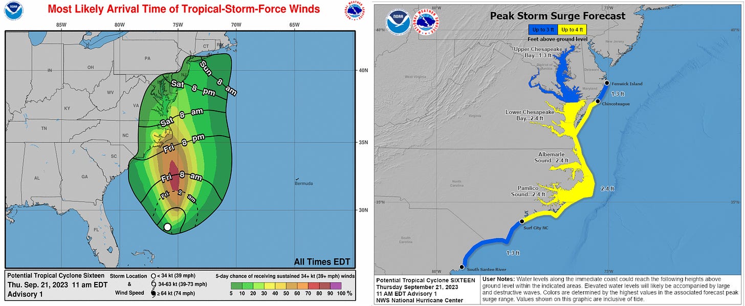
The NHC has initiated advisories on Potential Tropical Cyclone 16 today, located about 300 miles east of Cape Canaveral. Currently, PTC 16 is a loosely organized frontal low, generating thunderstorms and 35 mph sustained winds north and east of the center. However, with PTC 16 likely to tighten up as it rolls north over the next 48 hours, the NHC is giving it a 60% chance of eventually becoming a subtropical or tropical storm before reaching eastern North Carolina on Saturday. Tropical Storm Warnings and Storm Surge Watches are in effect for the Outer Banks north into Chesapeake Bay.
These areas will likely see wind gusts of anywhere from 40 to 60 mph and storm surge of 2-4’ starting late Friday into Saturday from 16’s broad windfield, and there will be little significant difference in impacts whether or not PTC 16 receives a name. The low and associated front will also bring extensive moisture north into the eastern mid-Atlantic and southern New England with it, and 2-5” general rain totals with local accumulations in eastern NC up to 8” are likely.
Other disturbances in NHC outlook, with 2-/7-day NHC development odds: A wave nearing 30W (Invest 90L) in the eastern Tropical Atlantic now has NHC development chances of 40% over the next 2 days and 80% in the next 7 days. With this wave already showing signs of healthy outflow and less opportunity for interaction with another disturbance to its southeast, there is a better model consensus today that development is probable within 2-4 days as the wave rolls west. Development farther east and faster increases the odds that 90L will eventually turn northwest into a weakness in the subtropical ridging slated to develop along 60W in 5-7 days. Invest 90L should still be monitored as a potential threat to the northern Lesser Antilles, U.S. Virgin Islands, and Puerto Rico, but the chances of direct impacts are lower today than yesterday.
Elsewhere: No other areas of note in the Atlantic today.
Next report: Daily bulletin out tomorrow afternoon.


![[Image of WPC QPF U.S. rainfall potential] [Image of WPC QPF U.S. rainfall potential]](https://substackcdn.com/image/fetch/w_1456,c_limit,f_auto,q_auto:good,fl_lossy/https%3A%2F%2Fsubstack-post-media.s3.amazonaws.com%2Fpublic%2Fimages%2Fdab72748-8491-40ec-a8b0-4212ee97f59c_892x716.gif)
