

WeatherTiger's Tropical Storm Elsa Analysis for July 4th
WeatherTiger's Tropical Storm Elsa Analysis for July 4th
Elsa struggles south of Cuba, as a mid-week Florida tropical storm hit is likely.

WeatherTiger’s Hurricane Watch will be issuing daily (or more) forecasts for Elsa for the duration of the threat to Florida. If you enjoy our work and are not already a supporter, please considering signing up for our paid subscription service to receive a daily threat briefing each weekday, or sharing this blog with your friends and family.

Tropical Storm Elsa is still struggling into the second half of the holiday weekend. Center reformations and the influence of land continue to favor a scenario in which Elsa’s primary impacts are a wet midweek for the western half of the Florida peninsula, with rain chances starting to nudge higher in the Panhandle as well.
The National Hurricane Center’s 2 p.m. Sunday advisory has Tropical Storm Elsa sandwiched between Jamaica and eastern Cuba, with maximum sustained winds down to 60 mph. Elsa’s forward motion has slowed in the last 24 hours, and the storm is now moving west-northwest at a reasonable 13 mph.
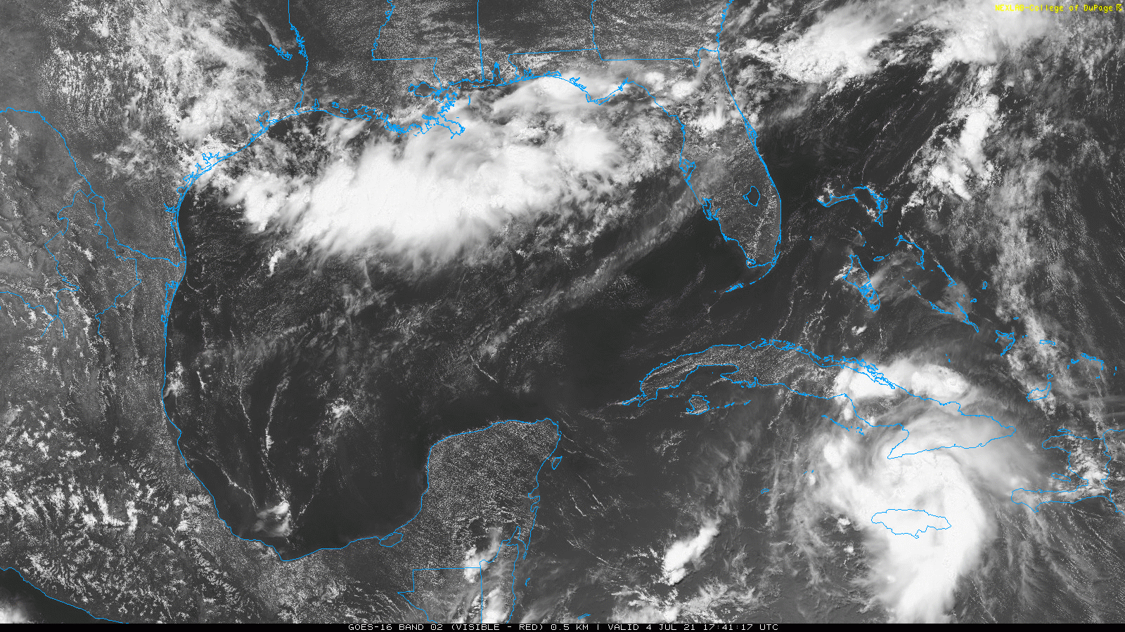
On this track, Elsa will cross central Cuba starting Monday morning, and turn northwest into the southeastern Gulf of Mexico Monday evening. Tropical Storm Watches and Warnings are in effect for much of Southwest Florida and the Keys, as rainbands with embedded gusty winds move in from south to north over the course of the day.
The key development with Elsa in the last 24 hours is its lack of development. While Elsa’s center has managed to not move directly over any of the Greater Antilles so far, the proximity of mountainous terrain nevertheless teamed with moderate shear to disrupt and broaden the storm’s low-level circulation late Saturday and early Sunday. This disruption has caused a new low-level center to develop a little south of the previous center, along with a rise in minimum pressure and decrease in windspeeds.
As of Sunday afternoon, Elsa is re-entering a slightly more favorable environment just south of Cuba, where water temperatures are in the mid and upper 80s. The tropical storm is still producing quite a bit of convection, but radar and aircraft data show this storm activity is disorganized. As such, only a little strengthening is likely before Elsa crosses Cuba on Monday.
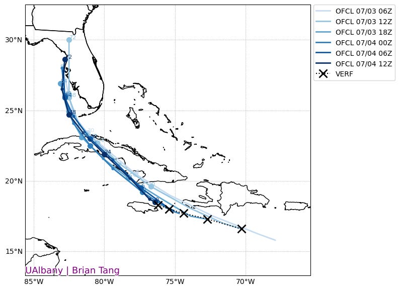
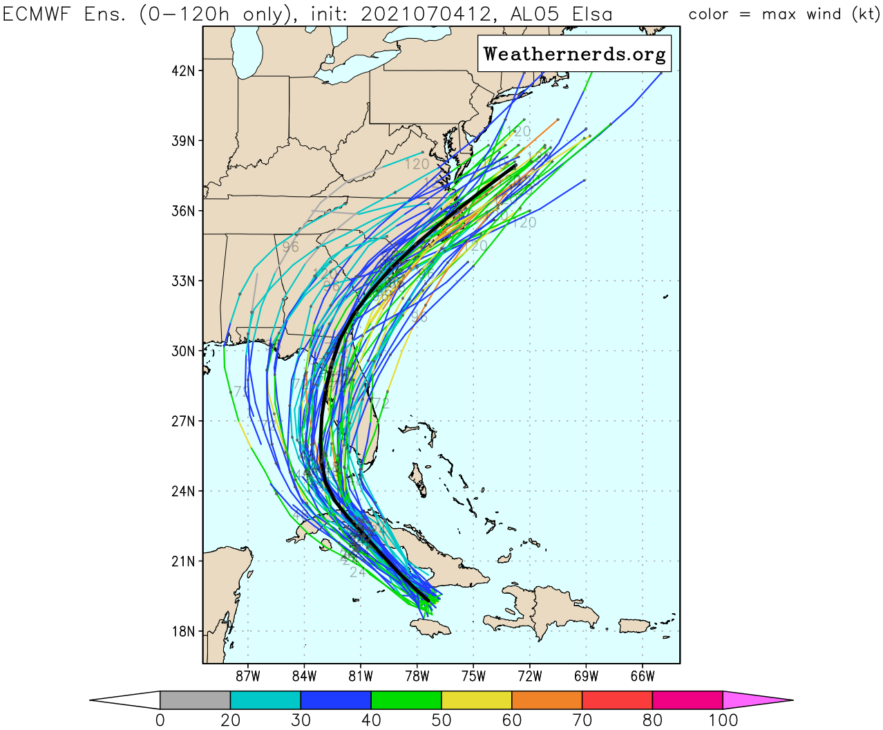
The relocation of the center has nudged the NHC track forecast and consensus of computer model guidance a little farther west into the eastern Gulf since yesterday. The general idea of Elsa turning northwest on Monday, north on Tuesday, and north-northeast into Florida on Wednesday as it curves around the western end of steering mid-level high pressure is unchanged, however.
While these incremental track changes favor Elsa spending more time over water in the eastern Gulf into mid-week, a marginal wind shear environment is likely to make any re-intensification slow. This means that Elsa is expected to remain a tropical storm until landfall, with only a few ensemble members supporting a return to hurricane intensity.
Elsa will be tracking parallel to the Florida Gulf Coast on Monday and Tuesday, meaning final landfall is could occur anywhere between Southwest Florida and the central Panhandle. However, because Elsa is unlikely to have a tight, well-organized core, its precise track is less important. Southwesterly shear means heavy rainfall is likely to extend well east of the center; the western half of the Florida peninsula is in for a 2-4” soaking between late Monday and early Wednesday. Along the immediate Gulf coast, these rains will be accompanied by the potential for tropical storm force winds and several feet of surge.
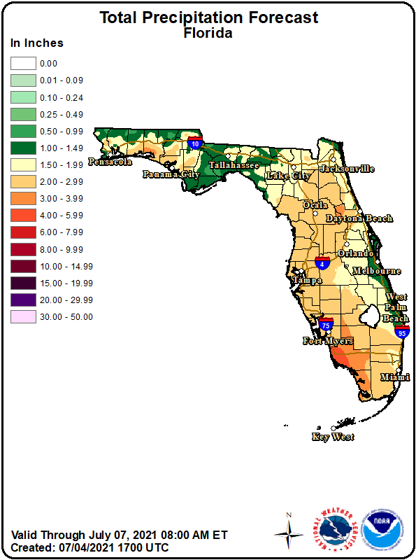
For the eastern half of the peninsula, including Southeast Florida, intermittent gusty rainbands are still expected, but the shift west in Elsa’s track has lessened expected accumulations a touch since yesterday—a slightly better outlook for ongoing recovery efforts in Surfside. For the Panhandle, the tick west means just the opposite, with chances of a tropical storm pulling north into Apalachee Bay on Wednesday rising a bit since yesterday. While this increases the odds of heavy rainfall in north Florida, particularly in the Big Bend, there is likely to be a sharp precipitation cutoff west of Elsa’s center that makes the “your backyard” forecast for the Panhandle highly uncertain and subject to change.
Overall, Elsa’s primary threat remains heavy rainfall and coastal flooding along the Florida Gulf Coast. Given the storm’s current disorganization, Elsa is likely to remain a tropical storm until landfall, with the forecast for local impacts coming into better focus after Elsa clears Cuba on Monday. In the meantime, keep watching the skies.
Next update: Our daily forecast analysis will be issued around 4 p.m. tomorrow. Forecast videos for Elsa are likely to start either tomorrow or Tuesday.