WeatherTiger's Tropical Depression Fred Analysis Column for August 12th
Fred is barely hanging on, but still will impact Florida's weather this weekend.
WeatherTiger’s Hurricane Watch will be issuing daily forecasts for Tropical Storm Fred for the duration of the threat to Florida. If you enjoy our work and are not already a supporter, please consider signing up for our paid subscription service to receive a daily threat briefing each weekday, or sharing this blog with your friends and family.
Tropical Depression Fred is hanging on by a thread after taking a path over the highest and craggiest mountains of Hispaniola, but remains expected to have primarily rainfall impacts on South Florida, the Florida Gulf Coast, and the Panhandle between Saturday and Monday.
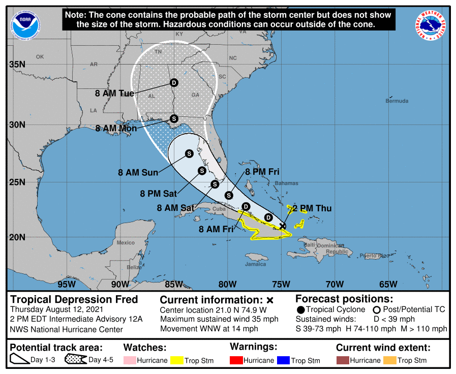
The National Hurricane Center’s 2 p.m. Thursday advisory locates Tropical Depression Fred’s broad center of circulation just north of eastern Cuba, with maximum sustained winds down to 35 mph. Fred’s forward motion is west-northwest at around 15 mph. Little change in heading or intensity is expected through mid-day Friday, as Fred continues to parallel the north coast of Cuba.
Fred’s strenuous hike has left the depression with structural damage that will require at least a couple of days to mend and may never be repaired. The mountainous terrain displaced Fred’s mid-level rotation from its low-level vortex, leaving a shallow and weak circulation almost completely devoid of deep convection. Minimum pressure as tracked by Air Force Reconnaissance is quite high even for a depression and has not fallen through the day on Thursday.
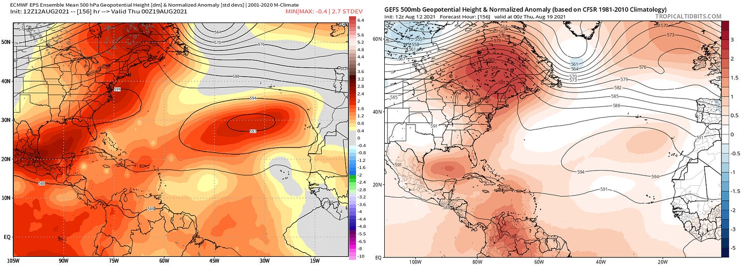
There is a chance that Fred reverts to being a tropical wave in the next 36 hours, while the center is technically back over water but southern inflow into the circulation is impeded by Cuba’s mountains. Assuming Fred survives the next couple of days, on Saturday it will curve around the periphery of a ridge of western Atlantic high pressure and turn northwest toward the Florida Keys and southeastern Gulf of Mexico.
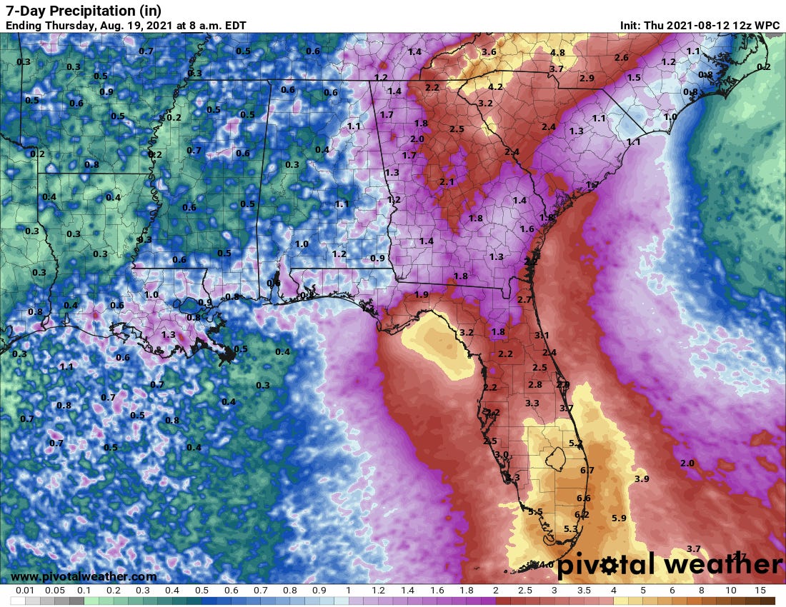
Given Fred’s loose organization and the potential for center reformation, it is not clear whether the center of circulation (if one exists) will move north-northwest over the eastern Gulf this weekend, or ride inland up the western Florida peninsula. If the latter, look for 2-4” of rain with locally higher amounts for the peninsula to be the only impact of Fred.
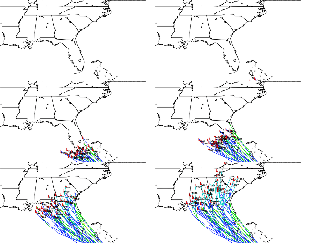
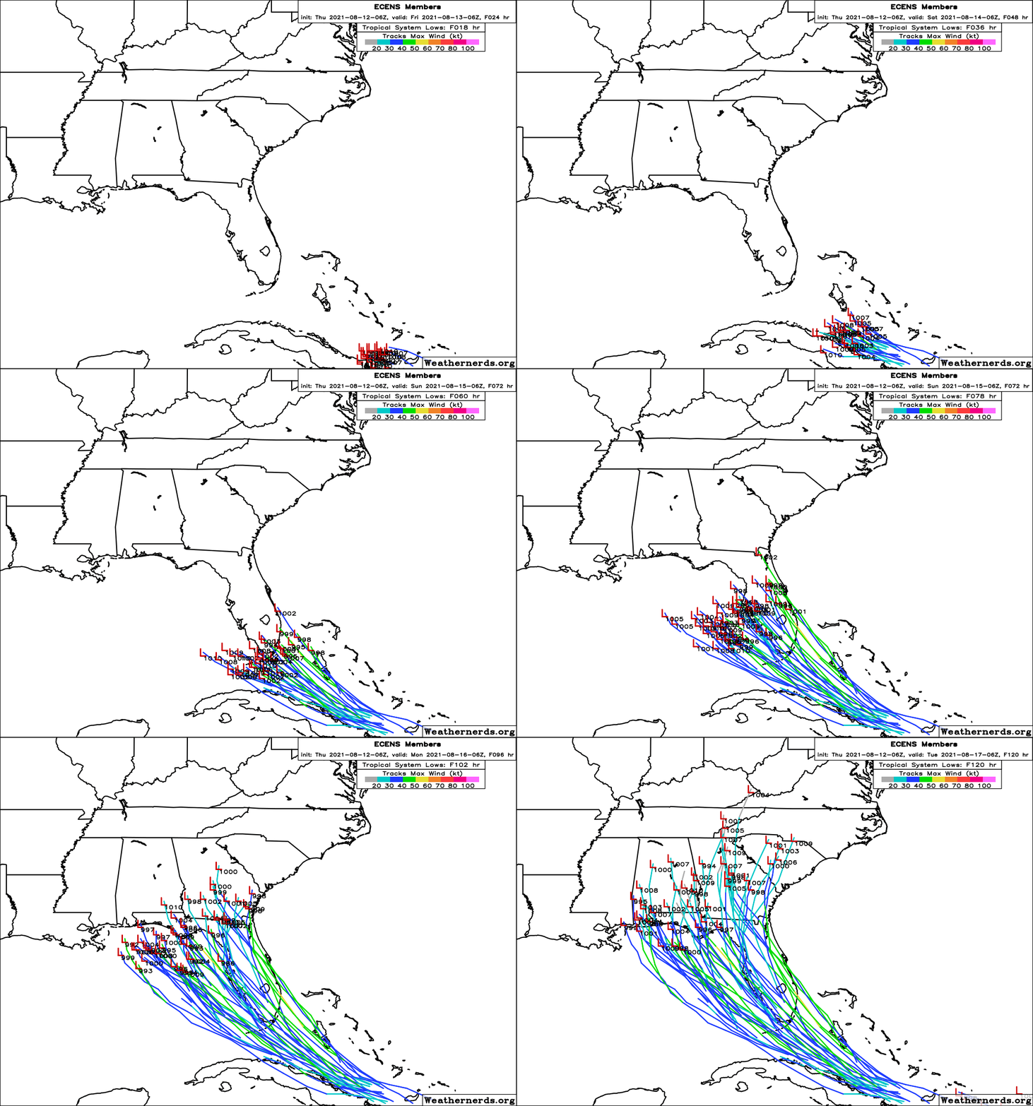
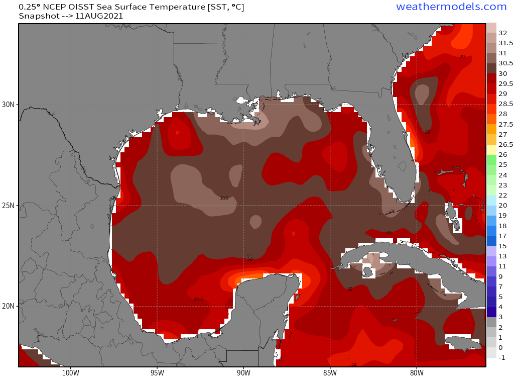
Should Fred both not dissipate in the next two days and avoid a track over the Florida peninsula, as shown by a slight majority of Euro ensemble members (above), it remains possible that some re-strengthening could occur between Saturday and early Monday in the eastern Gulf. Shear is projected to subside into the manageable 15-20 knot range, mid-level moisture will be moderately favorable, and sea surface temperatures are a smoldering 85 to 88 degrees along Fred’s potential path.
That likely lands Fred in a regime where its intensity may increase on the whole over the weekend, but like Elsa pulses up and down with the vagaries of convective bursts. Given how disheveled the depression is currently, reaching high-end tropical storm status prior to reaching the Panhandle is a possibility, but a mid-range tropical storm (50 to 60 mph maximum sustained winds) is more likely. There is no model support for Fred reaching hurricane status after the beating it took in the islands.
Assuming Fred remains offshore, it will track roughly parallel to the Florida Gulf Coast. Fred is highly unlikely to have a tight, well-organized core, so its precise track is less important. A couple inches of rain and some brisk coastal winds are expected in southwest Florida and west central Florida over the weekend, with overall impacts generally less than Elsa.
In the Panhandle, impacts from Fred would be in the Sunday and Monday timeframe. Fred will probably track somewhat further west than Elsa, potentially opening up more of the Panhandle to 1-3” rainfall than with that storm. However, given significant ongoing flooding in eastern portions of the Big Bend, any additional precipitation is unwanted along the northern Nature Coast.
If Fred can get its act together, there is some chance of tropical storm force winds and dangerous surge in the Panhandle, with highest chances in Apalachee Bay. However, for that to happen, Fred has to not dissipate, not move over the Florida peninsula, and follow a narrow angle of approach to North Florida. For now, we’ll put that outcome in the range of the possible, not the expected.
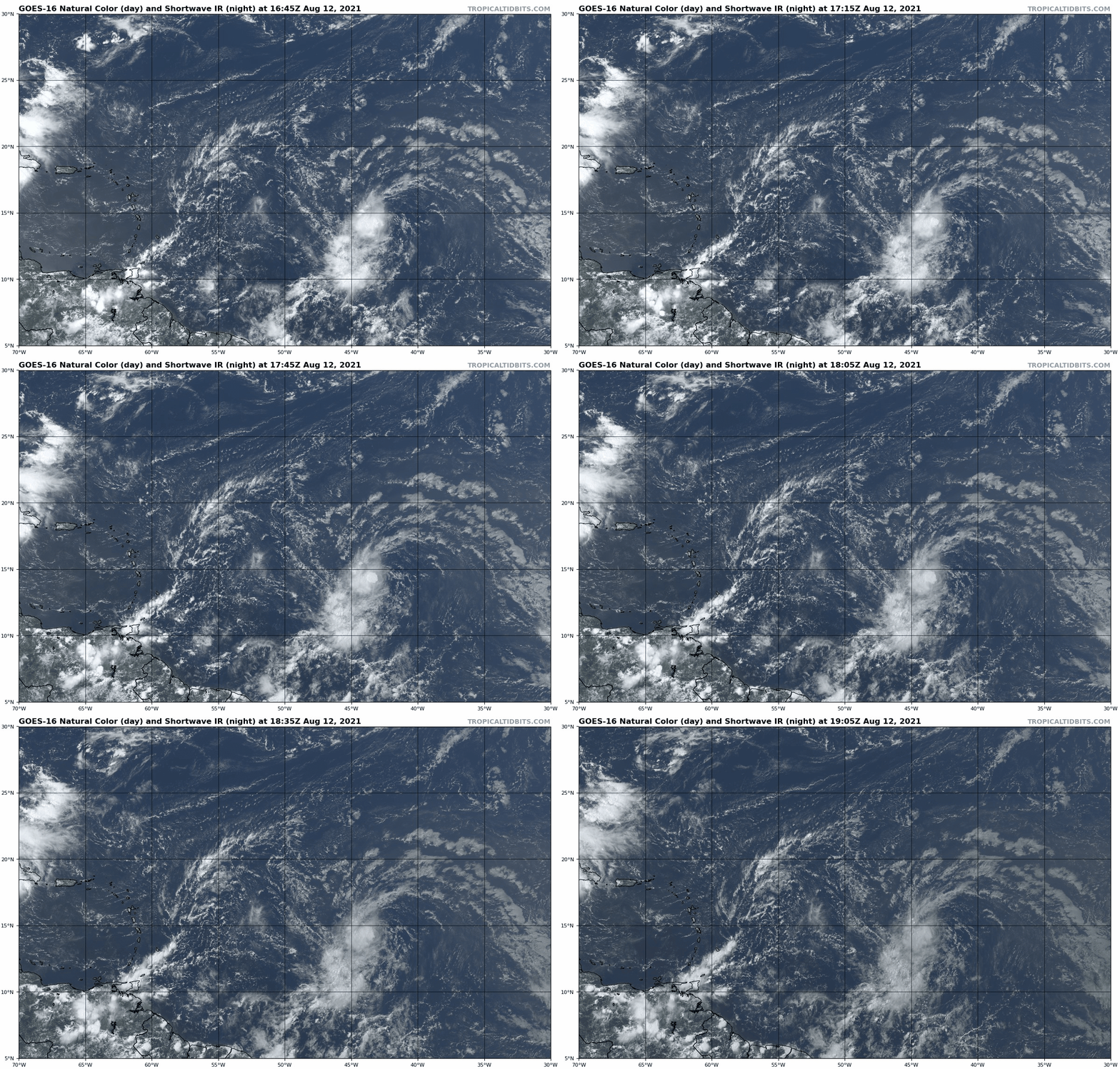
Elsewhere, a tropical wave over the Central Atlantic also needs to be monitored over the next week. Convection is increasingly around a surface circulation today, and development of a tropical depression is likely by the end of the weekend. This system will be steered generally west on a similar path to Fred, potentially landing somewhere between Jamaica and the Bahamas in around five days. With western Atlantic ridging remaining in place, the resulting east-to-west steering flow is such that any storm in that general location would certainly be of concern to Florida or the Gulf Coast. Something else to watch to be sure.
Overall, while there is potential for some eventual strengthening, given Fred’s current disorganization only intermittent bands of heavy rainfall across much of Florida between Saturday and Monday is a likely impact at this point. All else remains up in the proverbial air, so keep watching the skies.
Next report: Tomorrow afternoon.

