WeatherTiger's Hurricane Watch for November 1st
Keeping an eye on the possibility of a Caribbean disturbance sneaking into the Gulf next week.
WeatherTiger’s Hurricane Watch is a reader-supported publication. Paid subscribers get Florida-focused daily tropical briefings, plus coverage of every U.S. hurricane threat, our exclusive real-time seasonal forecast model, and the ability to comment and ask questions.
Florida and continental U.S. tropical threat synopsis: No tropical threat to Florida or the continental U.S. for the next 5 days. Some impacts from a Caribbean disturbance are possible in Florida late next week or later, but remain less likely than not.
In continental U.S. landfall terms, November is the quietest (and final) month of the hurricane season. With just fourteen historical tropical storm or hurricane strikes since 1851, November has only recorded a few more U.S. landfalls than May, a month that is not even officially part of the season.
But in classic 2024 style, far be it from anything to not agitate and inflame our last nerve, especially the Tropics. A disturbance in the southern Caribbean will more likely than not become a tropical depression by early next week, and has a chance of pushing into the southern Gulf of Mexico in the second half of next week. While I remain bearish on the chances of damaging U.S. impacts down the road with this system, they also cannot yet be ruled out.
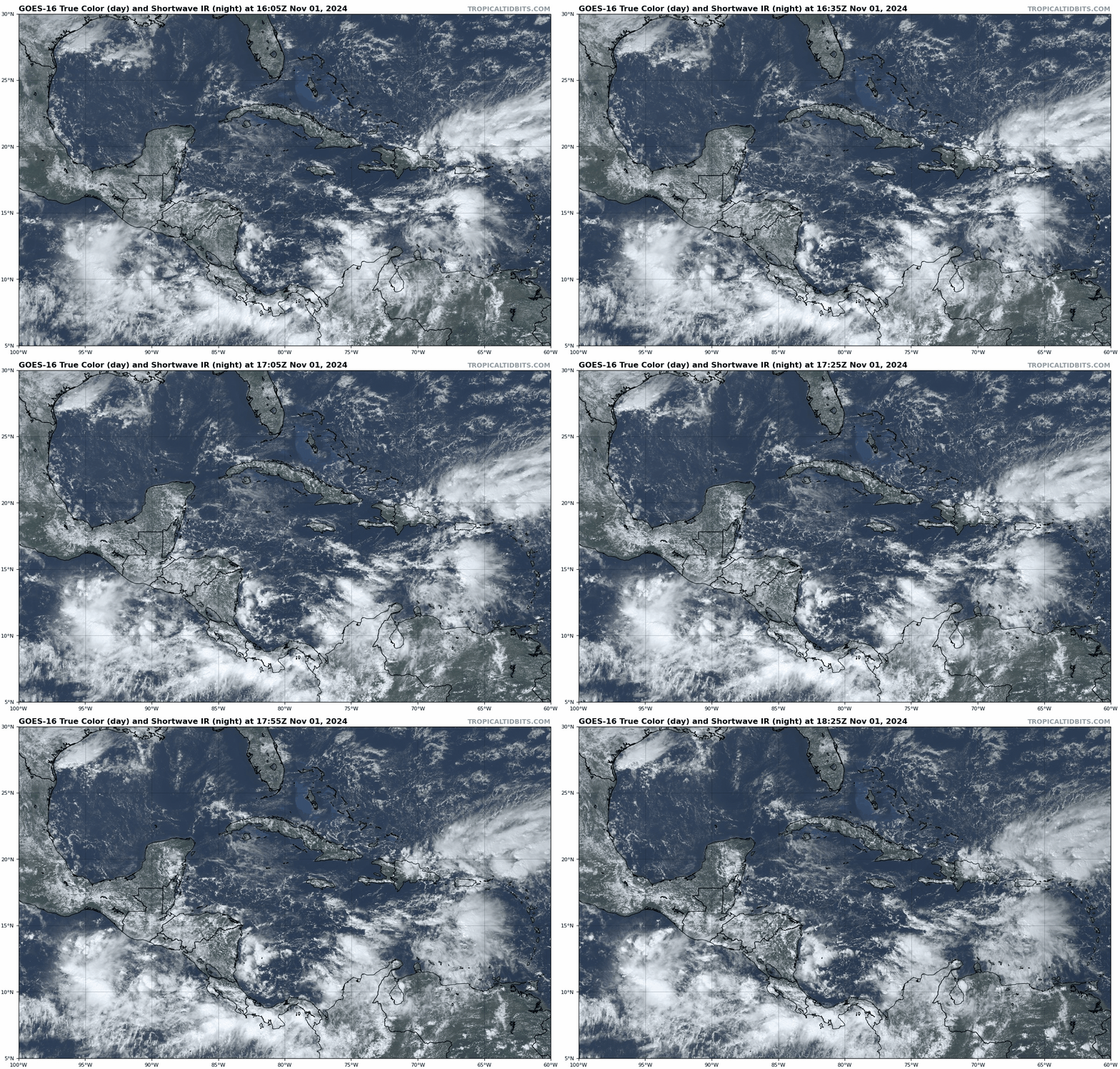
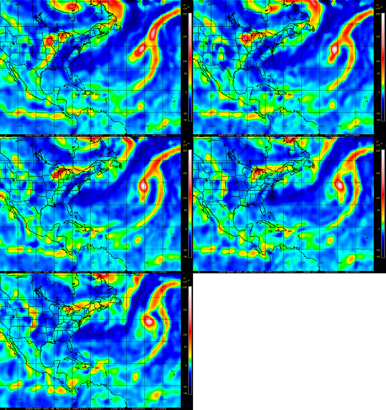
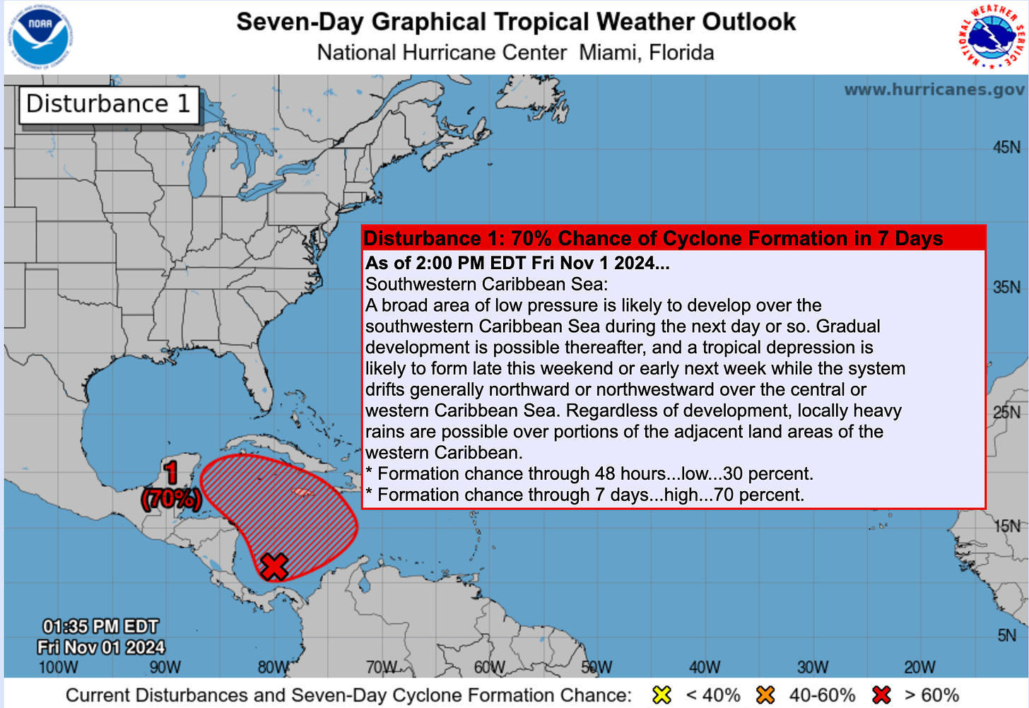
I’m going to keep it pithy today as you probably don’t want to be reading this any more than I want to be writing it. The general situation is that an area of intermittent thunderstorm activity in the south-central Caribbean has been festering for the last several days, upticking as we entered the October 30 through November 10 favored window for tropical development that I laid out two weeks ago. Convection is coming and going, but low-level turning is gradually becoming more concentrated east of Central America, and wind shear is steadily decreasing in the Caribbean. For these reasons, the NHC is predicting a high chance of development over the next 7 days.
In the medium term, exactly when and where an organized system will emerge from the primordial ooze of yet another Central American Gyre is not clear. The Caribbean rotation is interacting with a knot of thunderstorm activity along a dissipating front near Hispaniola and Puerto Rico, which will be folded into the Caribbean disturbance by Monday or Tuesday. (That’s why we don’t need to worry about the Hispaniola thunderstorms developing into a tropical system on their own.) Based on the upper-level wind pattern and consensus of model guidance, a tropical depression forming south of Jamaica between Sunday and Tuesday seems reasonable to me.
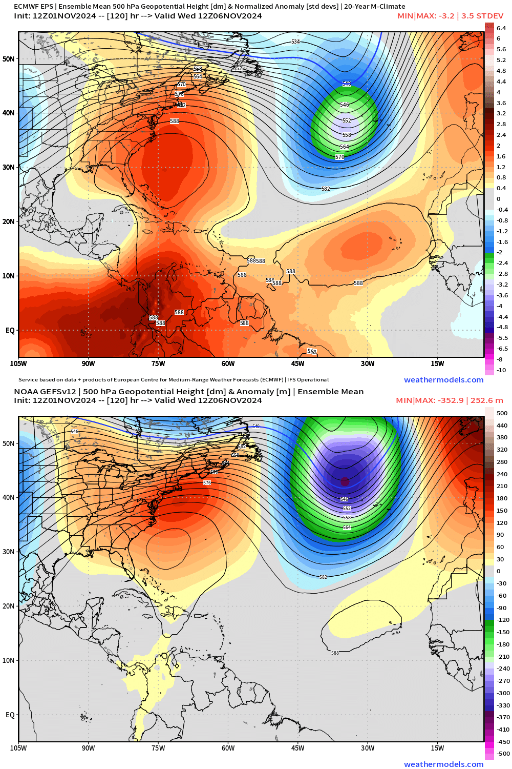
A strong area of high pressure aloft will be centered over the Southeastern U.S. and western Atlantic this weekend through the middle of next week, which will steer the developing system west-northwest, in the direction of western Cuba, the Yucatan Channel, or the Yucatan peninsula. As it does so, it’ll be moving over northwestern Caribbean waters still in the mid-80s, and under a favorable outflow regime. If the disturbance can get its act together at the surface on the faster side of possibilities, there certainly is a chance it could develop into a hurricane in the mid- or late week.
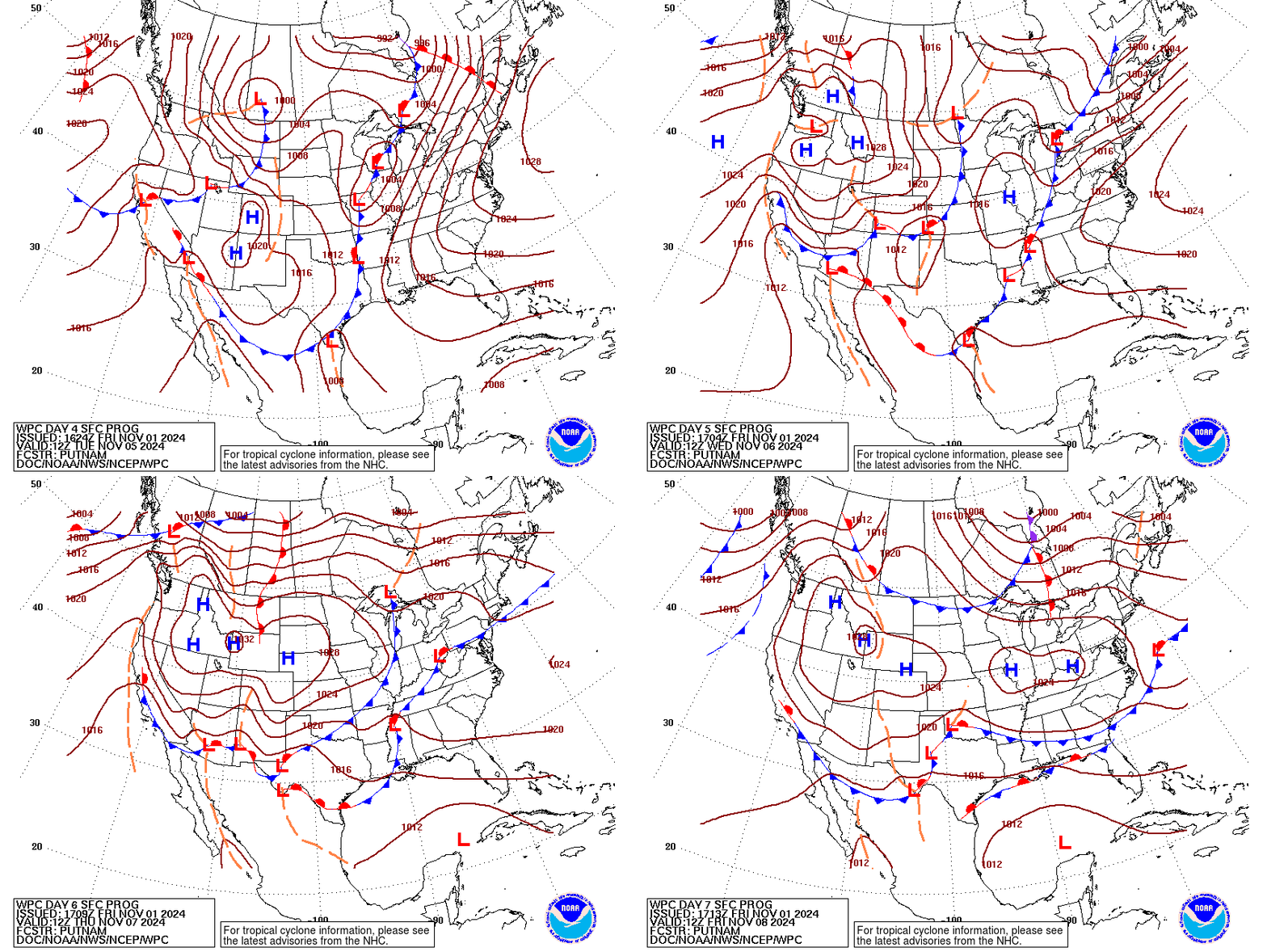
Towards the end of next week, the Southeastern ridge may start to slide east as a front drops south out of the Midwest, though models differ quite a bit on how far south that front will get. This front could be approaching as the disturbance enters the far southern Gulf around Thursday. From there, what happens depends on whether the front or the Southeastern ridge are the dominant influence on steering winds in the Gulf. Most reliable guidance suggests that western flank of that steering high pressure will still extend over the Gulf, keeping a potential storm moving west- or northwest-ward into the southwestern Gulf of Mexico. A minority of model ensemble members have a faster, stronger frontal passage, in which case a storm theoretically near the Yucatan or Cuba might turn northeast towards Florida towards the end of next week or over the following weekend.
While I can’t rule out a Florida threat at this point, I’m by default skeptical of it for several reasons. First, rare events are rare for a reason. There aren’t many landfalls in November because the waters surrounding the U.S. coast are tepid, upper-level winds are harsh, and dry continental airmasses reach deep into the Tropics, all of which are factors in play in this case.
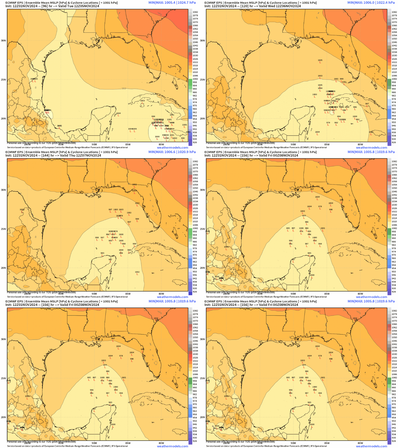
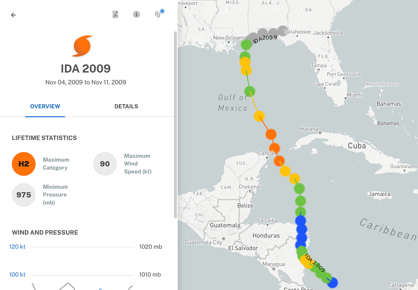
That means a November hurricane has to develop in the Caribbean, then move quickly across the Gulf so as not to fall apart in hostile territory. In this case, while steering winds may bring an organized tropical system into the southern Gulf next week, they do not appear primed to make that system then race north or northeast with haste. Rather, weaker steering currents appear likely, which would give dry air and shear an extended crack at weakening any storm, as shown on the European model. Time plus Gulf in August, September, or October is bad mix, but time is on our side very late in the season. For example, in November 2009, Hurricane Ida peaked out as a Category 2 in the southern Gulf, but weakened dramatically and lost tropical characteristics before passing near Mobile and Pensacola just 36 hours later. The scenario in which a stronger storm enters the Gulf, then weakens to the point where which its impacts are not a big deal before approaching land is very much on the table.
Overall, raging (and understandable) communal hurricane apprehension aside, U.S. landfall risks from the disturbance currently in the southern Caribbean remain low. Things we don’t want to see are quicker or farther north development through early next week, mid-week rapid strengthening, or a trend faster and sharper with late next week’s front; if those start to fall into place, a more significant landfall threat to Florida becomes realistic. For now, it’s a bank shot, not something to be worrying about at this time. With a little luck, we can get past this particular source of crippling anxiety in the week ahead. I’ll be watching it closely, so keep watching the skies.


Well they got our big pile of tree junk from Milton so why not another one.
what you get the Big Bucks for...wink, wink, nod, nod