WeatherTiger's Hurricane Watch for October 31st
Chances are increasing for a depression to form in the Caribbean by early next week.
Florida and continental U.S. tropical threat synopsis: No tropical threats to Florida or the continental U.S. for at least the next 5 days. Some fringe effects from a Caribbean tropical disturbance may start being felt in South Florida in the second half of next week.
Almanac: It’s Thursday, October 31st… day 151 of the 2024 hurricane season, 32 days to go. By total storm energy, the season is 94.2%, 98.4%, 96.9% complete for the Atlantic, continental U.S., and Florida, respectively.
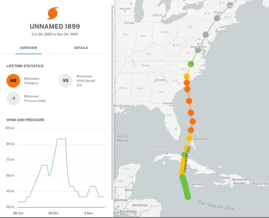
While Hurricane Zeta’s Louisiana landfall on October 28th, 2020 is the latest-in-the-year continental U.S. major hurricane strike on record, that statistic is also a bit misleading. The only Halloween hurricane landfall on record occurred in 1899 near Myrtle Beach, South Carolina estimated at 95-knot Category 2, just incrementally below Category 3 intensity. The hurricane continued into North Carolina after landfall, spreading significant wind damage well inland, and also brought at least 8’ of storm surge between Myrtle Beach and Wilmington.
Active storms: None.
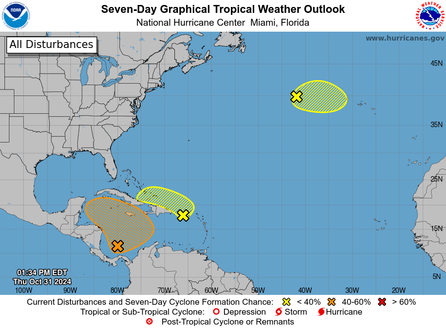
Disturbances in the NHC tropical weather outlook:
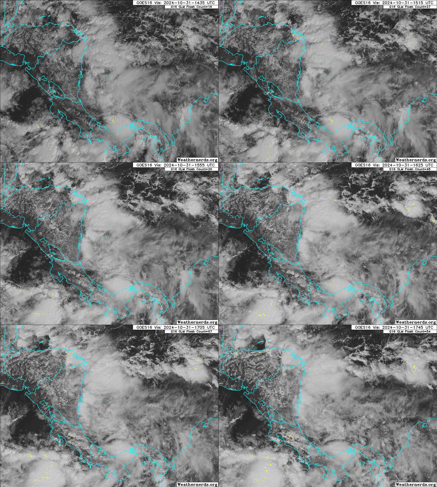
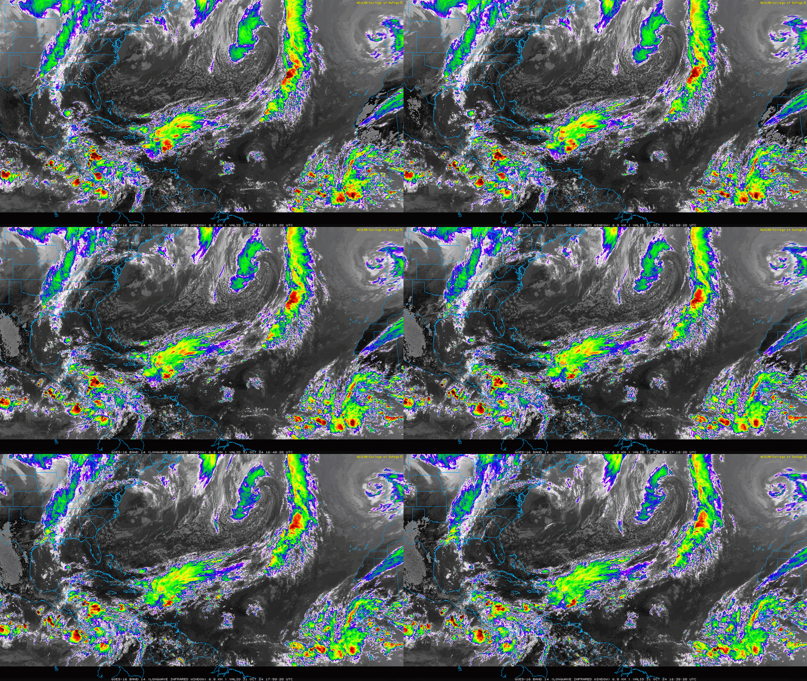
Convection in the south-central Caribbean is more concentrated today east of Nicaragua, and the NHC has increased development probabilities to 10% over the next 2 days and 60% over the next 7 days. Low-level turning has increased since yesterday, though the disturbance is elongated east-west at the surface. Upper-level winds are still unfavorable, but look to become more conducive to sustained and organized convection over the weekend.
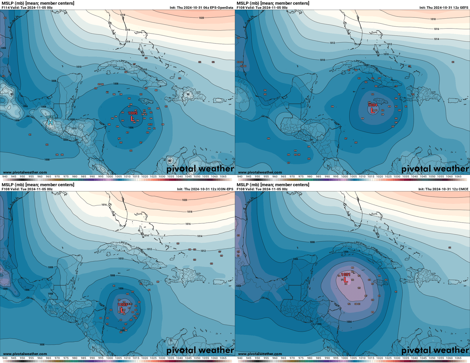
With a more coherent disturbance starting to emerge from the primordial soup of a developing Central American Gyre, the timeline for likely organization of a tropical depression in the west-central Caribbean is starting to narrow down to more likely than not late this weekend or early next week. Models continue to show a range of possibilities on the location of development, but a general consensus on something forming south of Jamaica in three to five days is taking shape. Given the favorable environmental conditions driven by the incoming MJO pulse, this seems reasonable to me.
With strong ridging in place over the Southeastern U.S. and western Atlantic for the next 5-7 days, after an initial drift north the system is likely to turn west or northwest next week. (A faster movement to the north as shown on the GFS is unlikely, as that model is overcooking potential interaction with another disturbance near Hispaniola.) At the same time, there is likely to be a window for intensification in the middle of next week in the northwestern Caribbean, especially if the disturbance gets organized on the faster side of the range of possibilities.
While more of today’s ensemble members eventually bring a storm into the southern Gulf by the end of next week, unfavorable upper-level winds and cooler sea surface temperatures also lurk there; thus, U.S. risks down the road are still low, though higher than yesterday as development chances increase. Any conditional U.S. threat is predicated on the system developing quickly (say, by early Sunday), and even in that case, a track into Central America or the Yucatan is more likely than a clean passage into the southern Gulf. I’m watching the area closely, but remain bearish on the U.S. threat.
Relatedly, the 2 p.m. Tropical Weather Outlook throws a 10% chance of development through late Saturday on some ongoing northeastern Caribbean convection, located near Puerto Rico. Only the GFS is attempting to amplify this disturbance into a short-lived storm, which feels very unlikely. This area is expected to fold into the larger western Caribbean circulation by early next week.
Finally, there a 20% chance within the next two days of a non-tropical low briefly acquiring subtropical characteristics in the northeastern Atlantic, in the vicinity of the Azores. That’s much closer to Europe than North America, so this is obviously not of any concern.
Elsewhere: Nothing else of note.
Next update: Next bulletin out tomorrow.


