WeatherTiger's Hurricane Elsa Forecast Analysis for July 2nd
Elsa strengthens in the eastern Caribbean. Florida should take note.
WeatherTiger’s Hurricane Watch will be issuing daily (or more) forecasts for Hurricane Elsa for the duration of the threat to Florida. If you enjoy our work and are not already a supporter, please considering signing up for our paid subscription service to receive a daily threat briefing each weekday, or sharing this blog with your friends and family.
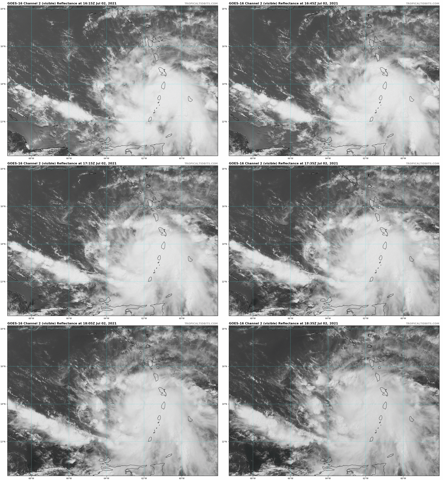
Elsa is sprinting through the eastern Caribbean after becoming 2021’s first hurricane on Friday, and continues to pose a threat to Florida and the eastern Gulf Coast early next week.
The National Hurricane Center’s 2 p.m. Friday advisory has Hurricane Elsa just west of the Windward Island chain, with maximum sustained winds of 85 mph. Barbados recorded a wind gust of 86 mph as Elsa’s incipient eyewall passed just south early Friday. Elsa continues to race west-northwest at over 25 mph, a ludicrous speed not typically associated with strengthening. Yet, here we are.
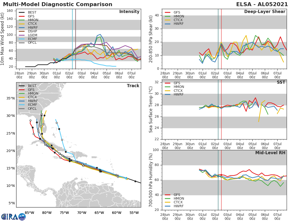
More intensification could occur Saturday, as Elsa’s movement slows a bit, and reaching Category 2 or even Category 3 status is possible this weekend. The hurricane will pass several hundred miles south of Puerto Rico early Saturday morning and be near southern Hispaniola on Sunday morning.
As was true in yesterday’s forecast, confidence in Elsa’s evolution deteriorates beyond that point. The NHC forecast scrapes Elsa along the mountainous southern coast of Haiti and eastern Cuba on the 4th, then angles a land-weakened Elsa up the Florida Gulf Coast early next week. However, NHC forecast discussions acknowledge that this is a low-confidence forecast.
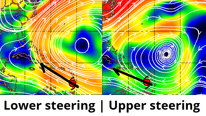
The primary source of uncertainty is how Elsa’s transit of the Greater Antilles will play out. If Elsa ticks a bit further north than expected, the 6,000’ to 8,000’ peaks of Haiti and the eastern third of Cuba will significantly disrupt its circulation. With shallower steering currents oriented more south to north, a weaker Elsa might turn north to the east of Florida or proceed up the peninsula, as persistently suggested by the European model.
However, Elsa has outstripped model forecasts of forward speed and intensity for the last few days, and continues to do so on Friday. With deeper steering winds oriented more east to west, a track that cleanly shoots the gap between eastern Cuba and Jamaica comes into focus. Central and western Cuba are less mountainous than eastern Cuba, so the core of the hurricane would be more temporarily disrupted in this scenario, and potentially able to reconstitute itself in the Gulf early next week.
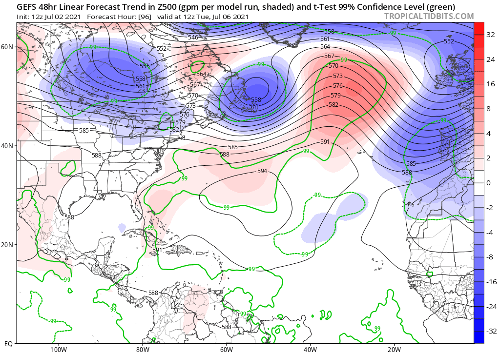
By late Monday, Elsa is likely to be turning north as it reaches the western edge of subtropical high pressure. Forecast guidance also continues to trend stronger with this ridge over time, which is a classic bias of modeling also indicating that Elsa could trend farther west, resulting in more time over water.
As Elsa potentially arrives in the Gulf, an upper-level low to its northwest may induce some shear over the top of the hurricane. Exactly how much shear and whether Elsa’s core is intact entering the Gulf is critical here. In the same way that a strong wind would blow out a candle, but ventilate and spread a forest fire, the 20 knots of wind shear that are an unfavorable environment for a weaker storm can serve as conducive outflow a stronger hurricane.
There have been several cases in recent years in which Gulf hurricanes have intensified leading up to landfall while interacting with an upper-level trough over the Southeast, in ways that were surprising to models and forecasters alike. I am not predicting that will occur with Elsa, but recognizing this pattern does point to upside intensity potential in the Gulf, as some hurricane-specific models are suggesting.
It is important to understand that NHC predictions are the median point within a broad range of disparate possibilities, including a formidable hurricane in the eastern Gulf and dramatic weakening over Haiti or Cuba. Therefore, sizeable changes in the official track and intensity forecast are possible. Moral: do not check out on Elsa as you sip citrus-infused adult seltzers this weekend. If you do, you may have severe forecast whiplash come Monday.
Overall, the risks from Elsa have nudged a little higher than yesterday given its strengthening trends in the last 24 hours. The Florida peninsula as well as the eastern half of the U.S. Gulf Coast should be on alert over the weekend, and ready to put a hurricane plan into action early next week if necessary. Keep watching the skies.

